
Incident Media Photographs
Could not determine your location.
 Wildfire
 Prescribed Fire
 Burned Area
Response
Burned Area
Response Other
Other
Photographs Gallery
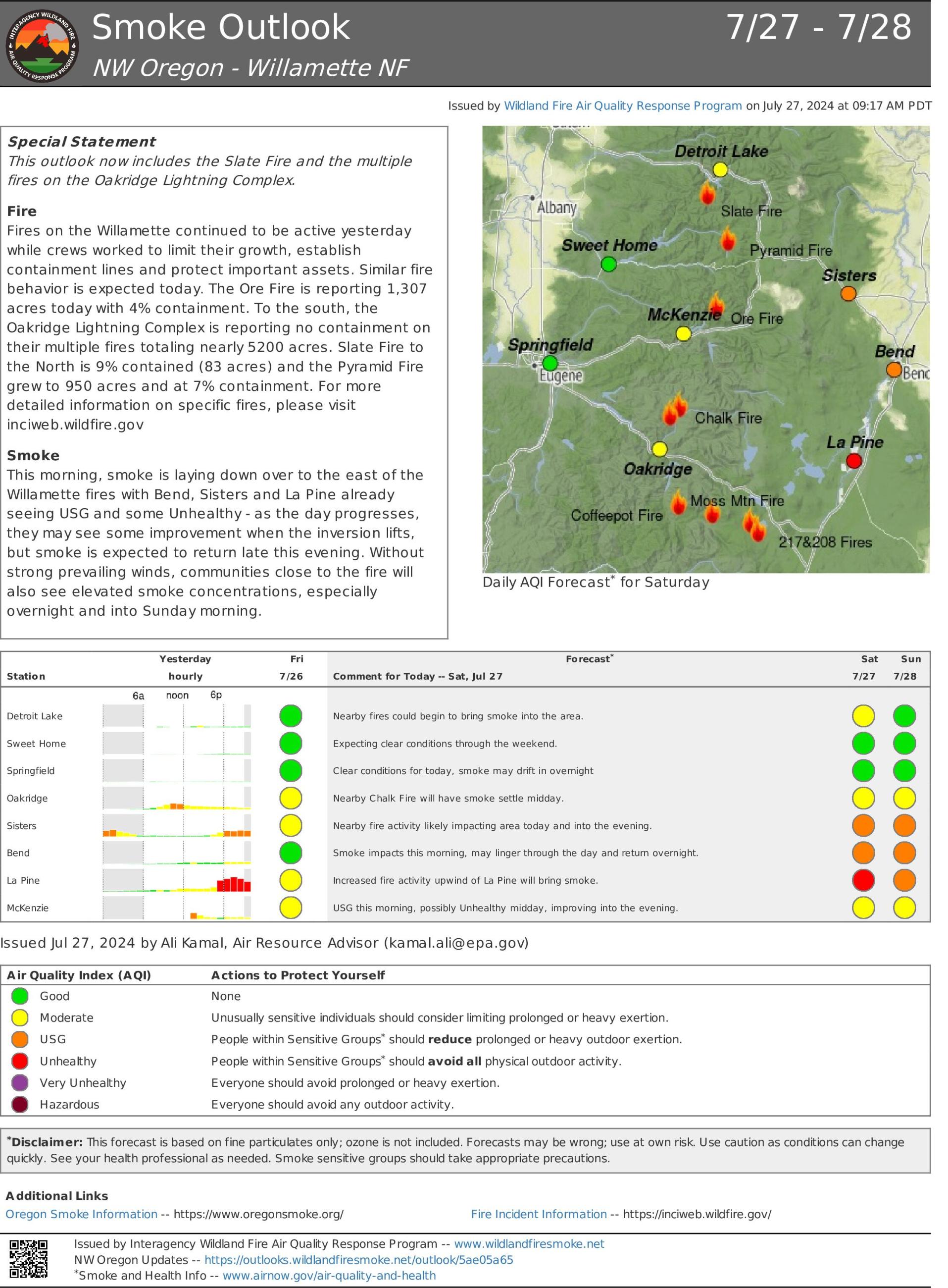
Ore Fire Smoke Outlook July 27 2024
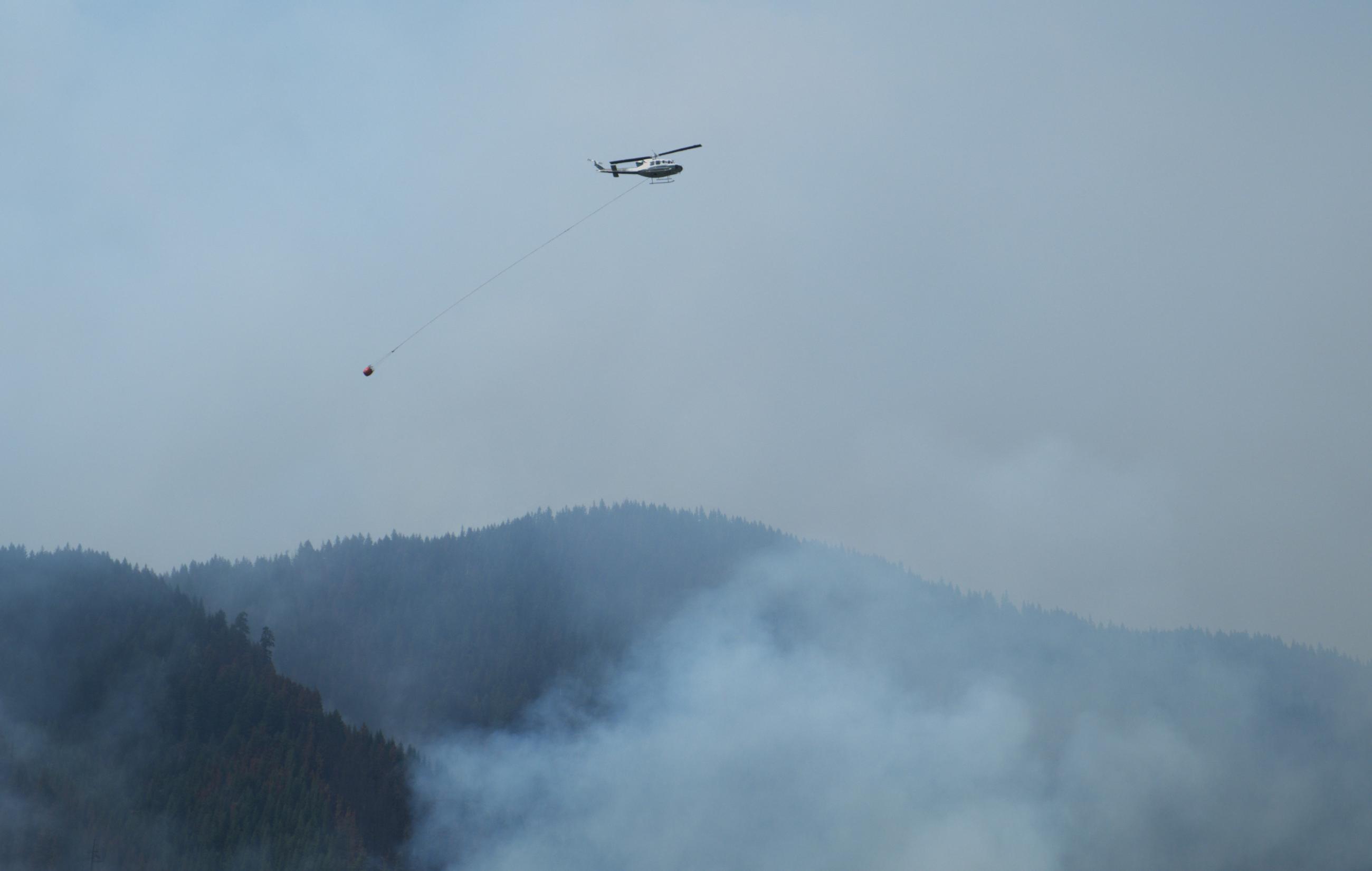
Aviation Resources drop buckets on the Ore Fire.
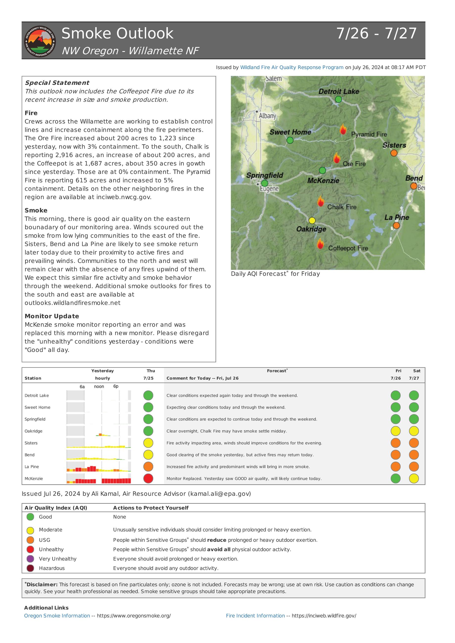
A map showing air quality based on air quality monitors around the Ore Fire
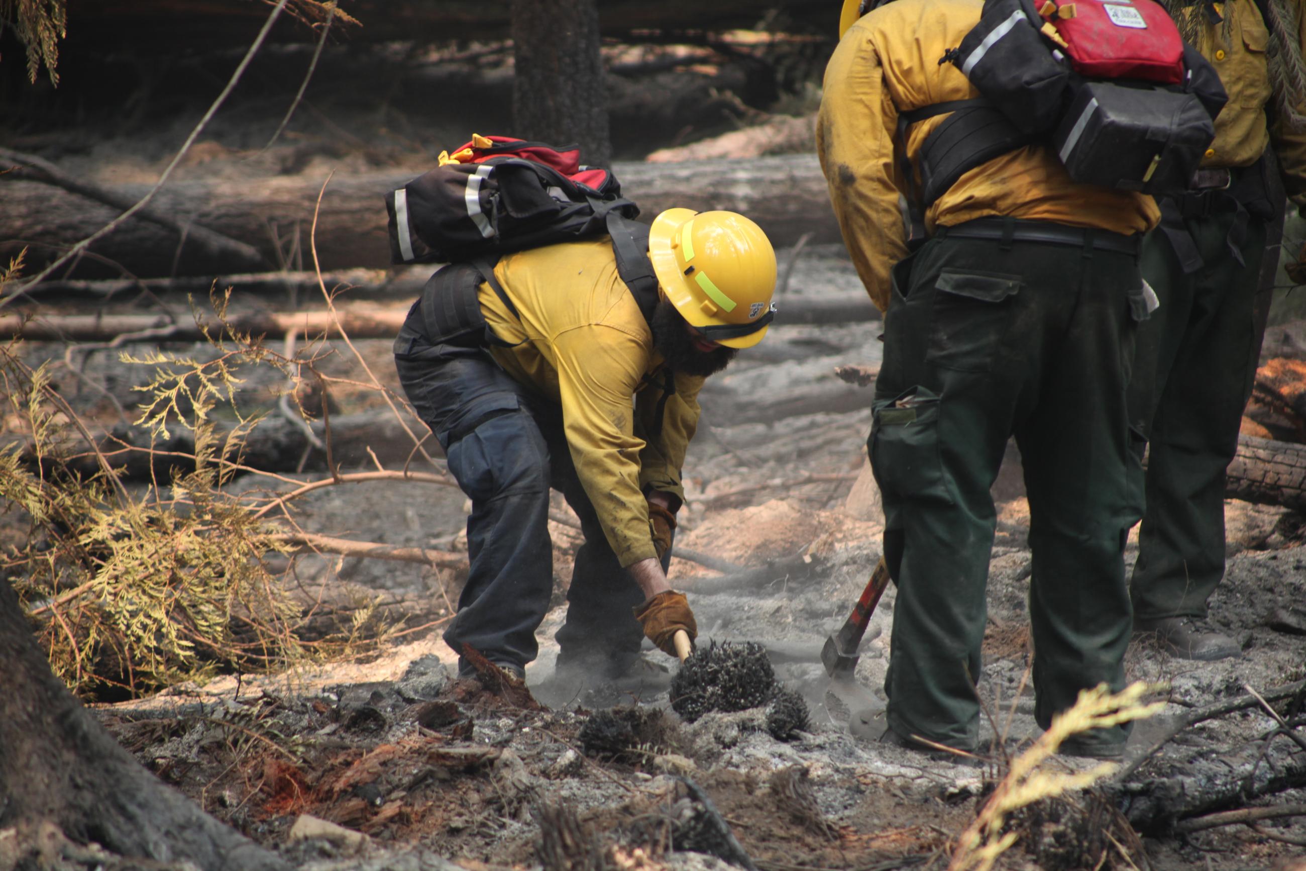
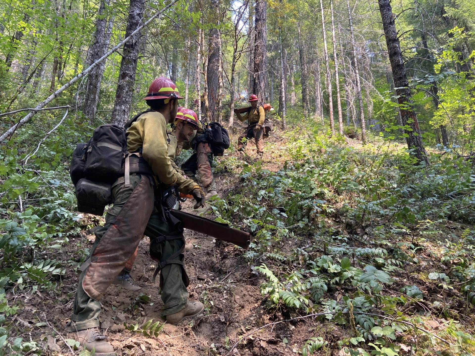
Firefighters' mop-up hotspots along the fire's edge against the control line to reduce heat along the fire line.
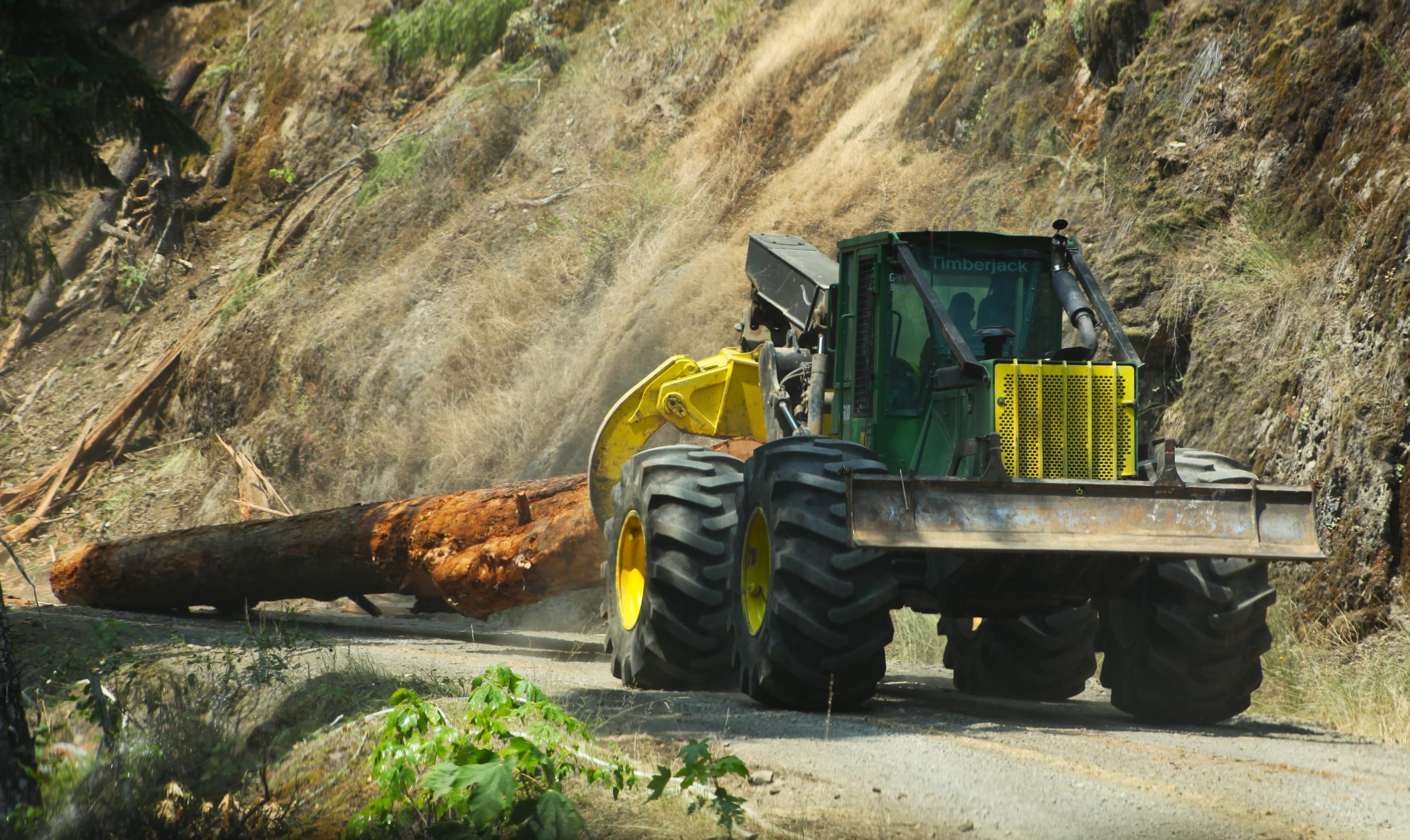
Heavy equipment moves fallen debris off the 1509 Road
Pre-treating green side of the line will lessen receptiveness of the vegetation to fire.
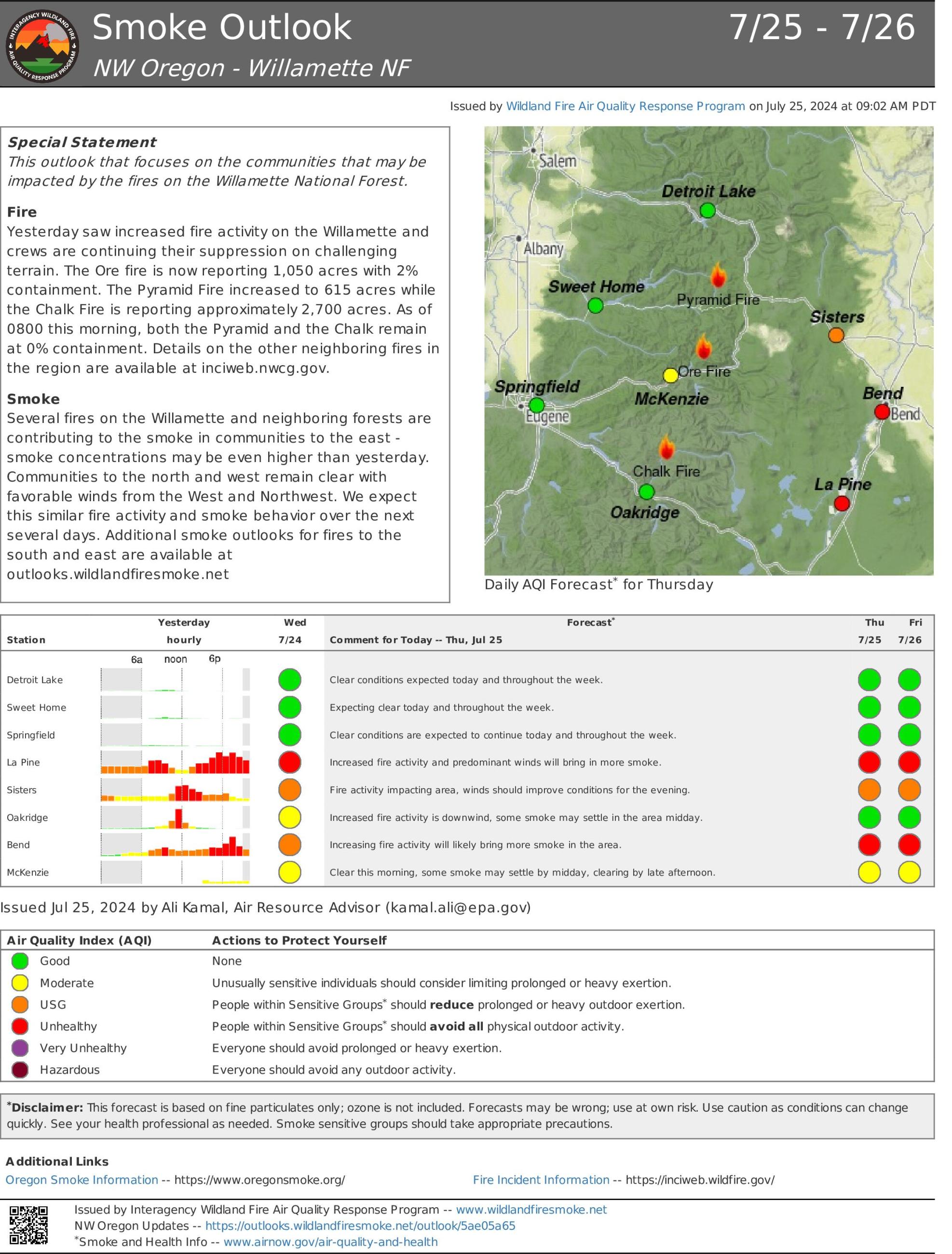
A map showing air quality levels in the surrounding communities of the Ore Fire.
A map showing the footprint of the Ore Fire, northeast of Blue River Reservoir
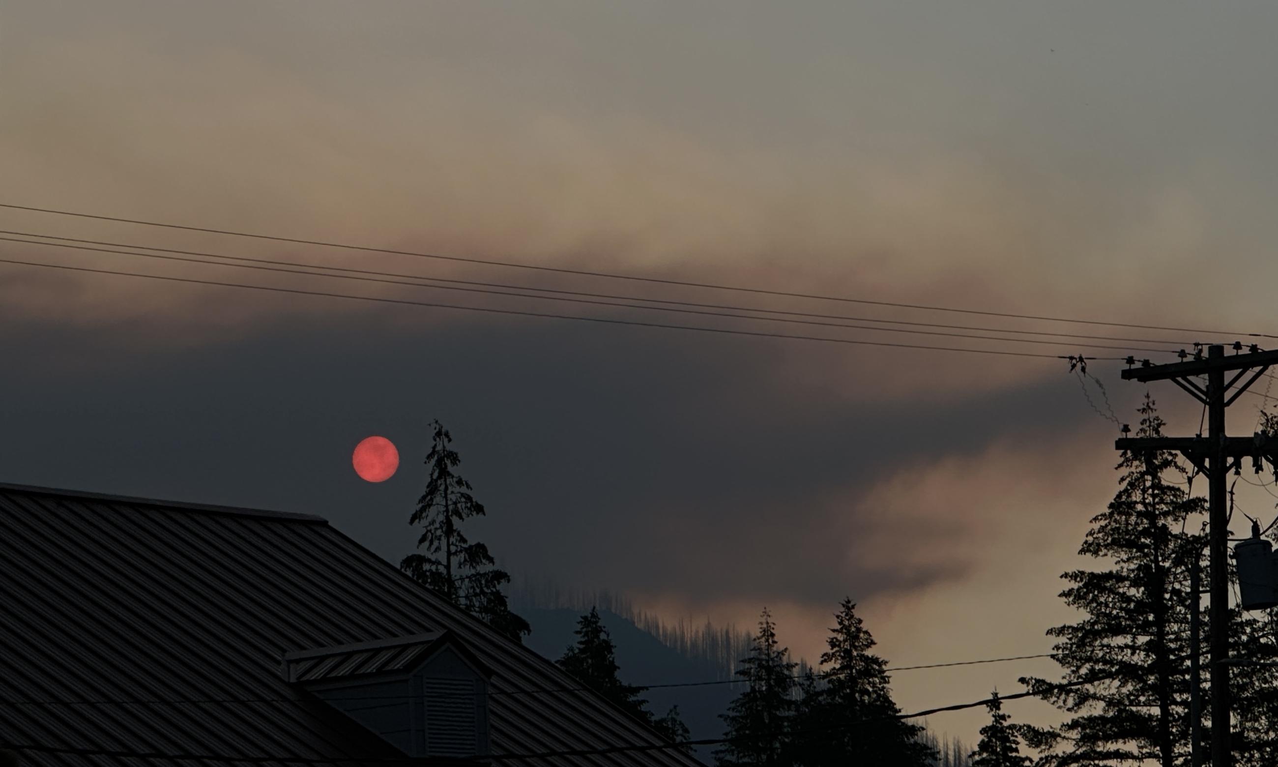
Smoke obscures the sun on July 23 2024. For more information on smoke please visit https://wildlandfiresmoke.net
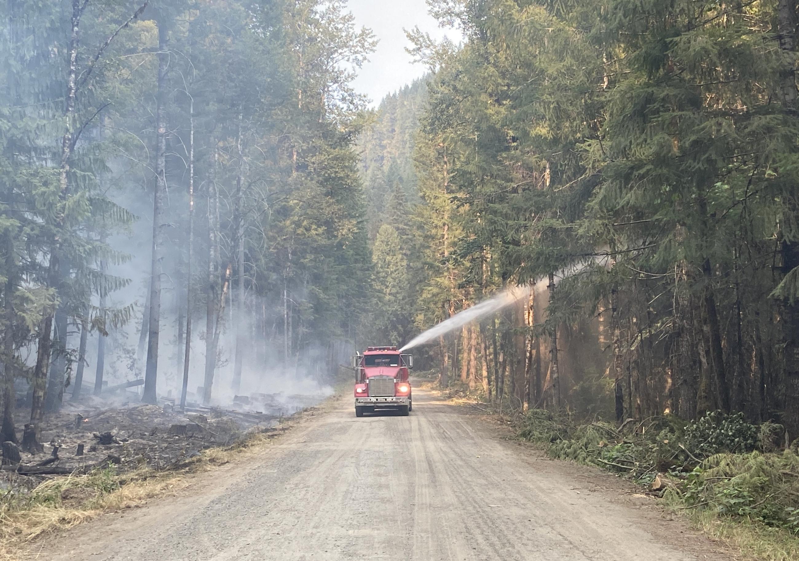
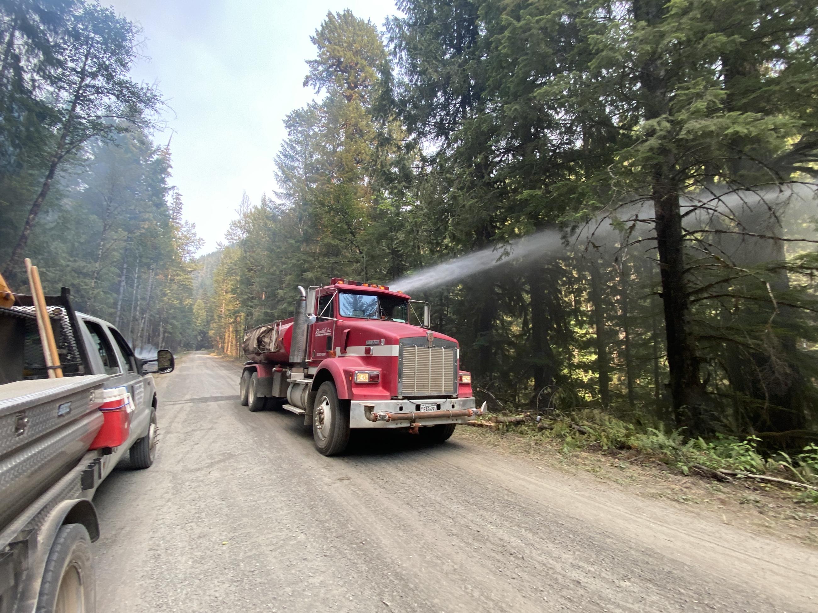
An engine sprays water (pre-treating) onto the green side of the line in Division Zulu along the FS 15 Road.
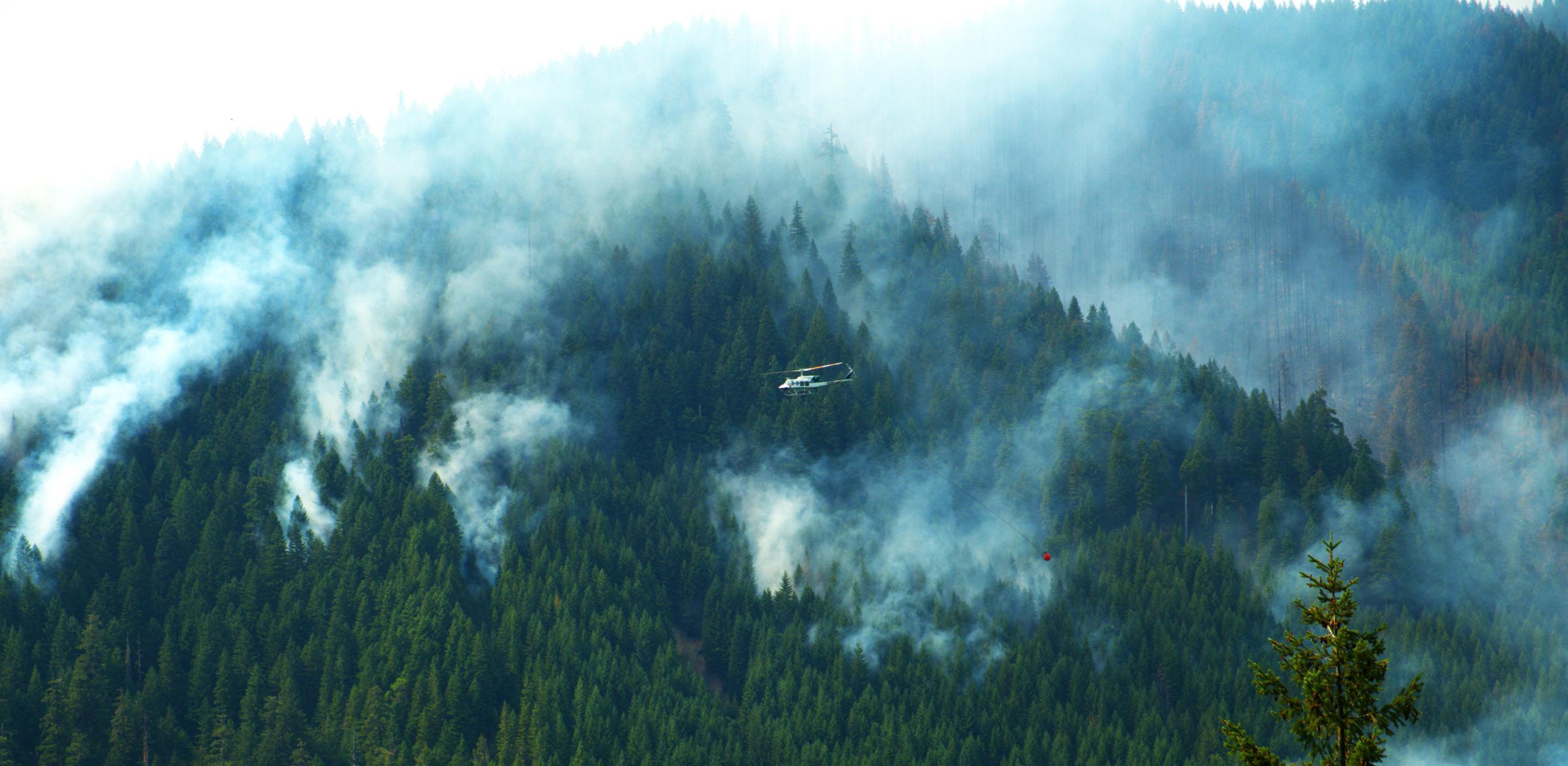
A bucket-equipped helicopter flies over the southern edge of steep and thickly-forested southern edge of the Ore Fire.