
Incident Media Photographs
Could not determine your location.
 Wildfire
 Prescribed Fire
 Burned Area
Response
Burned Area
Response Other
Other
Bedrock Fire
Unit Information
Incident Contacts
- Bedrock Fire InformationEmail:Phone:541-215-6735Hours:8:00 a.m. - 8:00 p.m.
Photographs Gallery
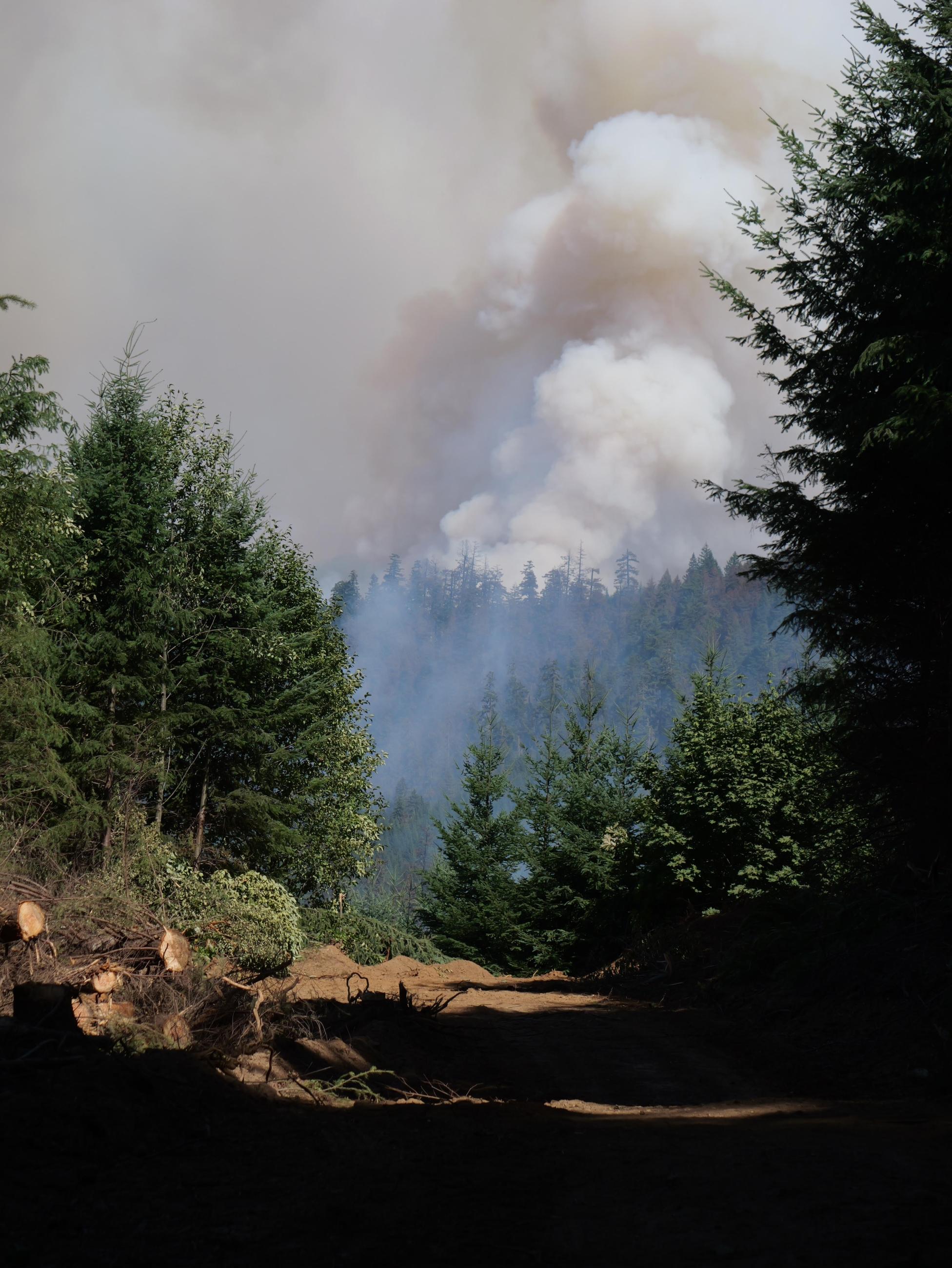
With clear air and sunshine on Tuesday, fire activity picked up on the northwest corner of the Bedrock Fire.
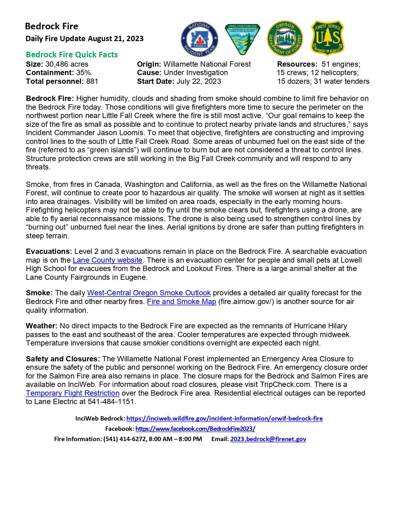
Bedrock Fire Quick Facts
Size: 30,486 acres Origin: Willamette National Forest Resources: 51 engines; 15 crews; 12 helicopters; 15 dozers; 31 water tenders
Containment: 35% Cause: Under Investigation Total personnel: 881 Start Date: July 22, 2023
Bedrock Fire: Higher humidity, clouds and shading from smoke should combine to limit fire behavior on the Bedrock Fire today. Those conditions will give firefighters more time to secure the perimeter on the northwest portion near Little Fall Creek where the fire is still most active. “Our goal remains to keep the size of the fire as small as possible and to continue to protect nearby private lands and structures,” says Incident Commander Jason Loomis. To meet that objective, firefighters are constructing and improving control lines to the south of Little Fall Creek Road. Some areas of unburned fuel on the east side of the fire (referred to as “green islands”) will continue to burn but are not considered a threat to control lines. Structure protection crews are still working in the Big Fall Creek community and will respond to any threats.
Smoke, from fires in Canada, Washington and California, as well as the fires on the Willamette National Forest, will continue to create poor to hazardous air quality. The smoke will worsen at night as it settles into area drainages. Visibility will be limited on area roads, especially in the early morning hours. Firefighting helicopters may not be able to fly until the smoke clears but, firefighters using a drone, are able to fly aerial reconnaissance missions. The drone is also being used to strengthen control lines by “burning out” unburned fuel near the lines. Aerial ignitions by drone are safer than putting firefighters in steep terrain.
Evacuations: Level 2 and 3 evacuations remain in place on the Bedrock Fire. A searchable evacuation map is on the Lane County website. There is an evacuation center for people and small pets at Lowell High School for evacuees from the Bedrock and Lookout Fires. There is a large animal shelter at the Lane County Fairgrounds in Eugene.
Smoke: The daily West-Central Oregon Smoke Outlook provides a detailed air quality forecast for the Bedrock Fire and other nearby fires. Fire and Smoke Map (fire.airnow.gov/) is another source for air quality information.
Weather: No direct impacts to the Bedrock Fire are expected as the remnants of Hurricane Hilary passes to the east and southeast of the area. Cooler temperatures are expected through midweek. Temperature inversions that cause smokier conditions overnight are expected each night.
Safety and Closures: The Willamette National Forest implemented an Emergency Area Closure to ensure the safety of the public and personnel working on the Bedrock Fire. An emergency closure order for the Salmon Fire area also remains in place. The closure maps for the Bedrock and Salmon Fires are available on InciWeb. For information about road closures, please visit TripCheck.com. There is a Temporary Flight Restriction over the Bedrock Fire area. Residential electrical outages can be reported to Lane Electric at 541-484-1151.
InciWeb Bedrock: https://inciweb.wildfire.gov/incident-information/orwif-bedrock-fire
Facebook: https://www.facebook.com/BedrockFire2023/
Fire Information: (541) 414-6272, 8:00 AM – 8:00 PM
Email: 2023.bedrock@firenet.gov
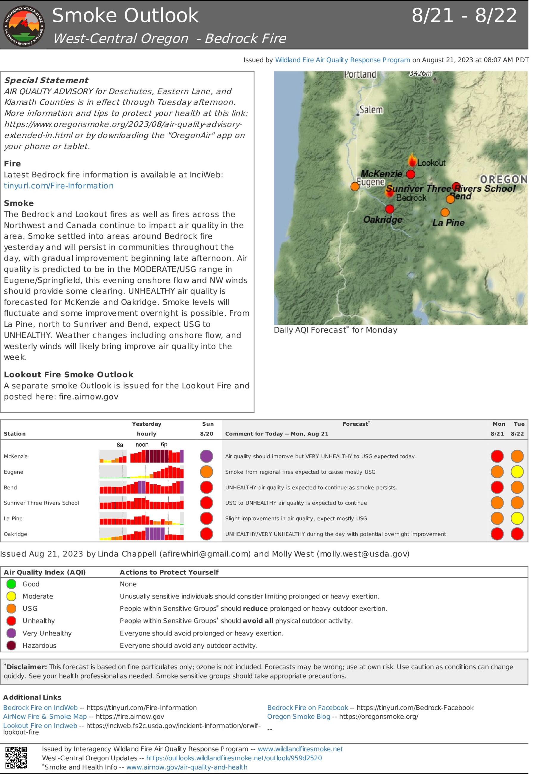
The Bedrock and Lookout fires as well as fires across the Northwest and Canada continue to impact air quality in the area. Smoke settled into areas around Bedrock fire yesterday and will persist in communities throughout the day, with gradual improvement beginning late afternoon. Air quality is predicted to be in the MODERATE/USG range in Eugene/Springfield, this evening onshore flow and NW winds should provide some clearing. UNHEALTHY air quality is forecasted for McKenzie and Oakridge. Smoke levels will fluctuate and some improvement overnight is possible. From La Pine, north to Sunriver and Bend, expect USG to UNHEALTHY. Weather changes including onshore flow, and westerly winds will likely bring improve air quality into the week.
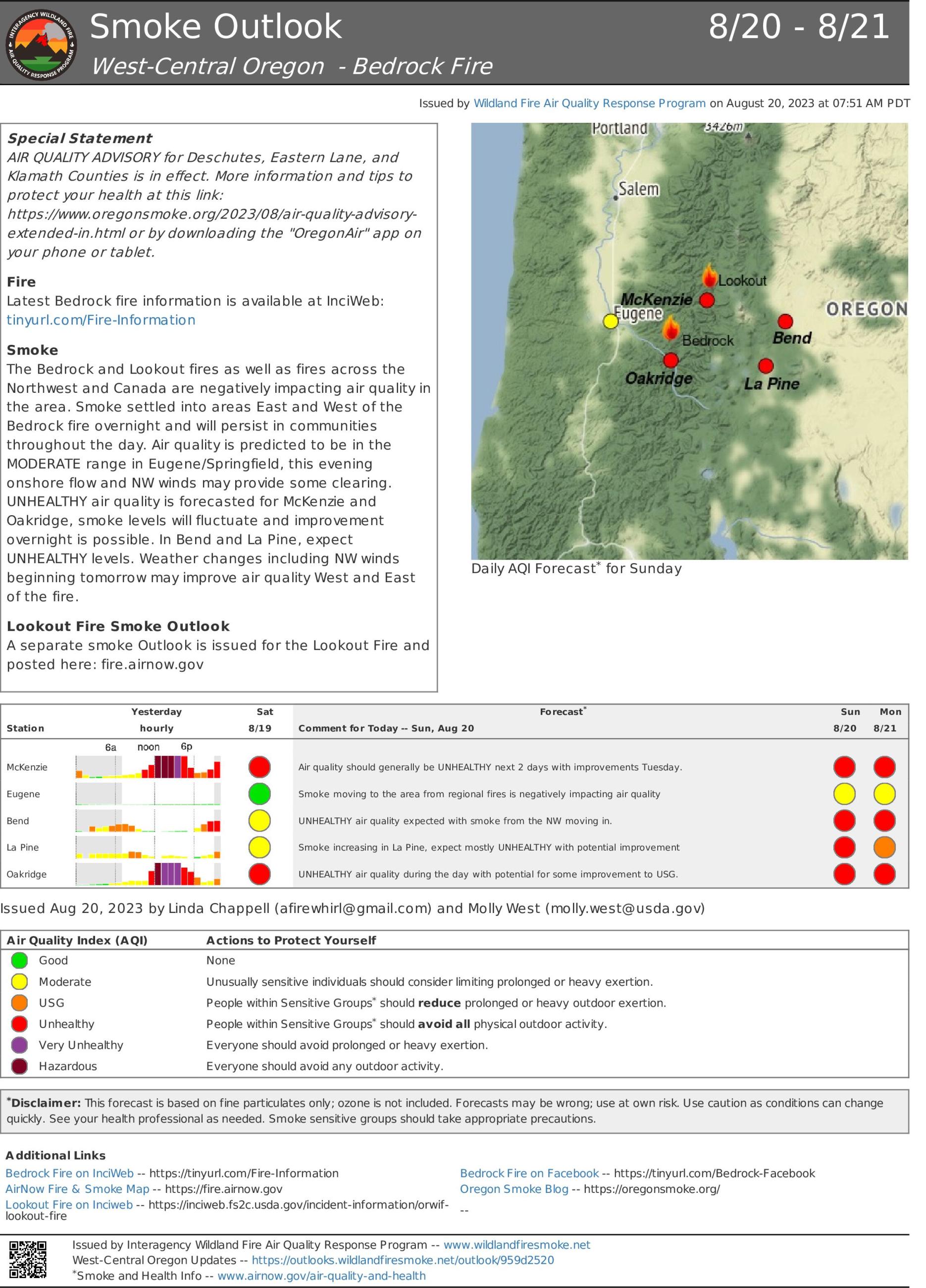
The Bedrock and Lookout fires as well as fires across the Northwest and Canada are negatively impacting air quality in the area. Smoke settled into areas East and West of the Bedrock fire overnight and will persist in communities throughout the day. Air quality is predicted to be in the MODERATE range in Eugene/Springfield, this evening onshore flow and NW winds may provide some clearing. UNHEALTHY air quality is forecasted for McKenzie and Oakridge, smoke levels will fluctuate and improvement overnight is possible. In Bend and La Pine, expect UNHEALTHY levels. Weather changes including NW winds beginning tomorrow may improve air quality West and East of the fire.
Pacific Northwest Team 2, under Incident Commander Jason Loomis, took command of the Bedrock Fire at 6 am this morning. This will be the last update for the Salmon Fire as fire activity has remained consistent and management has transferred back to the local unit. Last night favorable weather conditions allowed for an infrared flight, which provided more accurate fire perimeter and acreage of the Bedrock Fire.
Bedrock Fire: On the northwest side of the fire, crews are securing previous firing operations and will conduct more firing operations as needed when conditions are favorable. Crews will continue to look for direct and indirect line options. On the northeast side of the fire, lines are being held and cleaned up and interior unburned islands are being monitored. The southwest corner continues to be the most challenging for firefighters, but Crane Valley Hotshots were able to tie off the corner and connect it to the “boot” on the southern edge. Crews located hot spots in this area and were able to extinguish them. There will continue to be scouting done for contingency line options north of Winberry Creek.
Salmon Fire: Firefighters continue to patrol and monitor around the fire perimeter. There is currently minimal fire behavior.
Evacuations: Level 2 and 3 evacuations remain in place on the Bedrock fire. A searchable evacuation map with fire perimeters is on the Lane County website. There is an evacuation center for people and small pets at Lowell High School for evacuees from the Bedrock and Lookout Fires. There is a large animal shelter at the Lane County Fairgrounds in Eugene.
Smoke: The daily West-Central Oregon Smoke Outlook provides a detailed air quality forecast for the Bedrock and Salmon Fires, as well as other nearby fires. Communities will continue to be affected by smoke from Bedrock Fire, Lookout Fire, and other fires in the region.
Weather: Maximum temperatures will remain consistent at 80-90 degrees. Winds are expected to be around 10 mph, with gusts reaching 15 mph. There will be a cooling trend for the beginning of the week, with Hurricane Hilary providing moisture to the region, though Bedrock Fire area will likely receive no significant precipitation.
Safety and Closures: The Willamette National Forest implemented the Bedrock Fire Emergency Area Closure to ensure the safety of the public and personnel working on the fire. An emergency closure order for the Salmon Fire area also remains in place. The closure maps for the Bedrock and Salmon Fires are available on InciWeb. For information about road closures, please visit TripCheck.com. There is a Temporary Flight Restriction over the Bedrock Fire area. Residential electrical outages can be reported to Lane Electric at 541-484-1151.
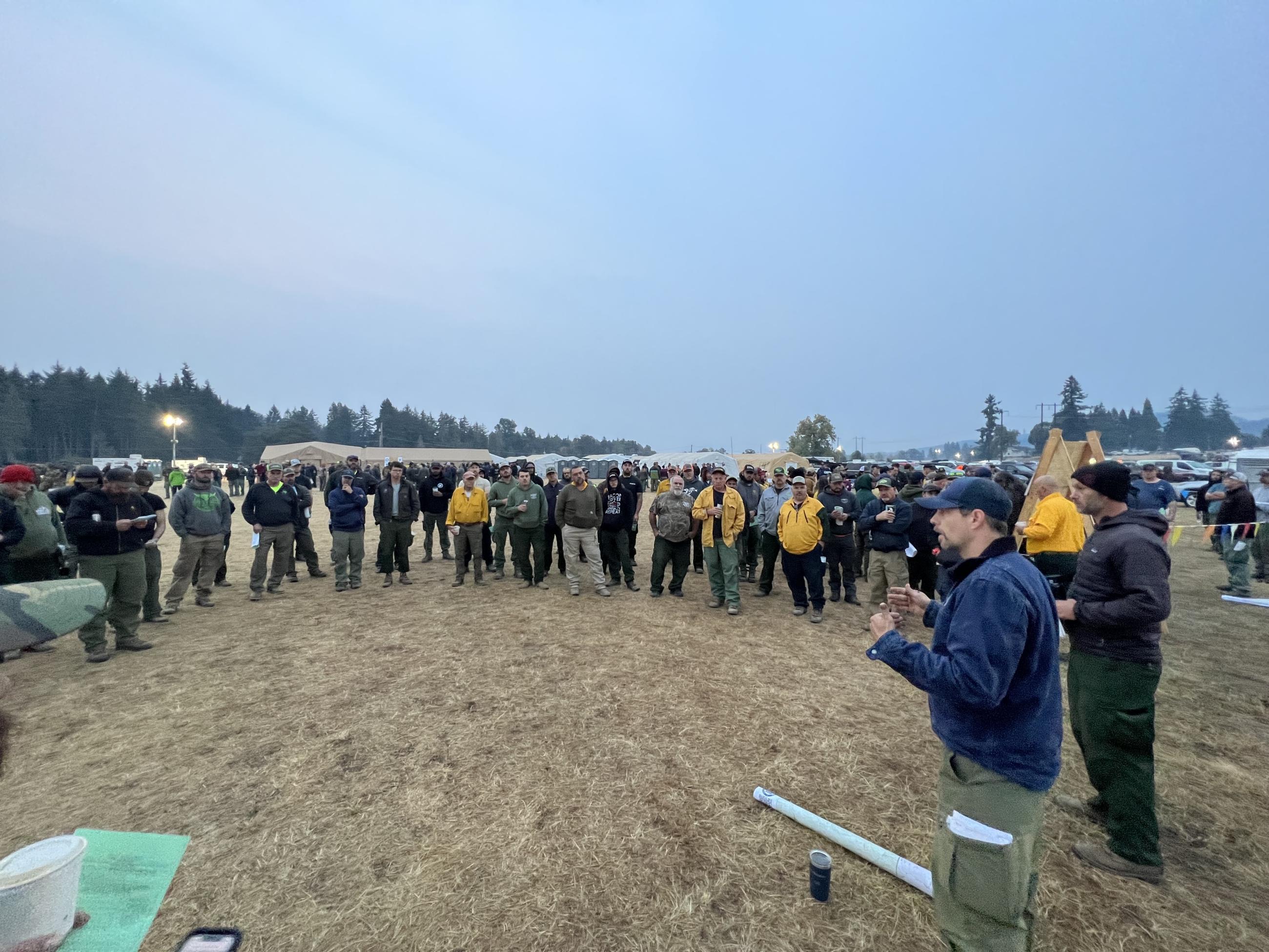
Division group supervisor Cam Chambers conducts a meeting with some of the firefighters assigned to his area of the fire. After the main morning meeting, the different division supervisors hold more detailed meetings with their resources to talk about the plan for the day.
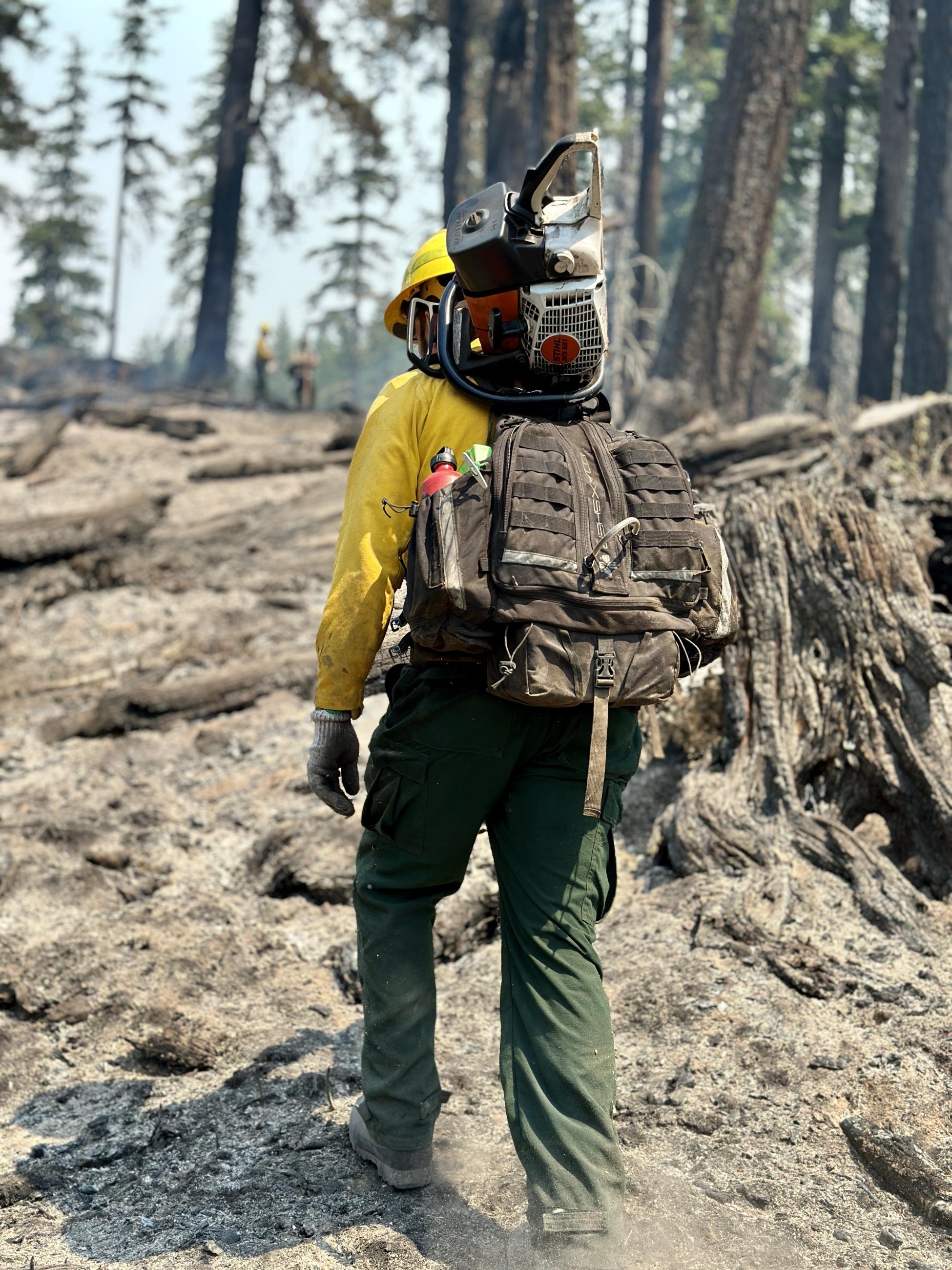
Firefighter carrying a chainsaw through a burned area
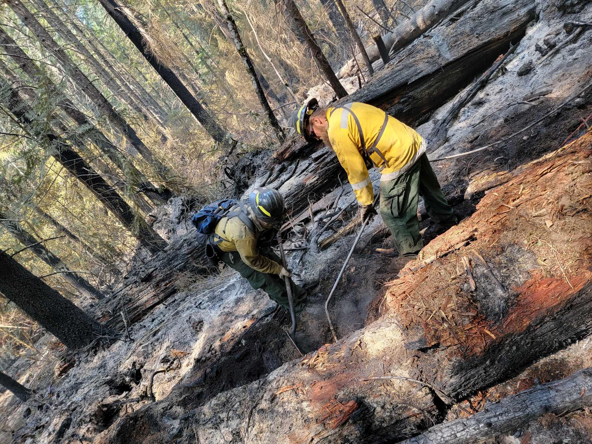
Firefighters mop up residual hot spots on Division Y near the 196 road. They are digging out burning roots from a large stump. Burning roots can smolder for weeks or months unless they are dug out and extinguished.
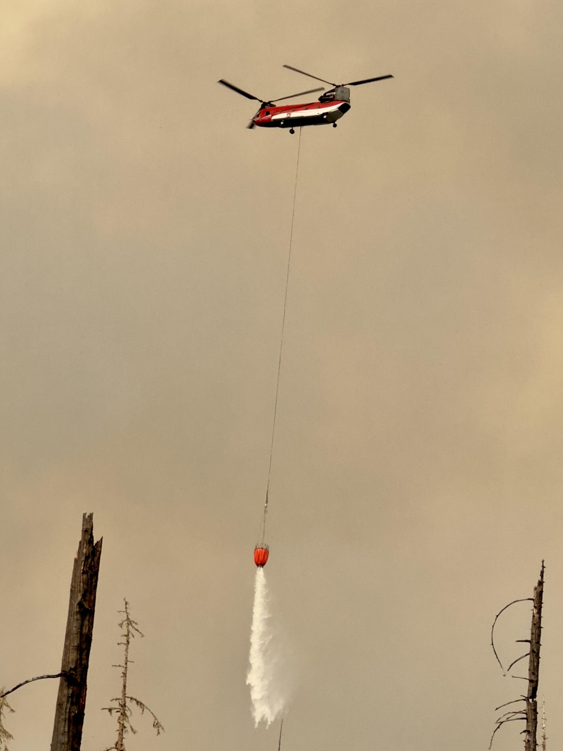
A Chinook helicopter flies below smoky skies with a water bucket that's dumping water.
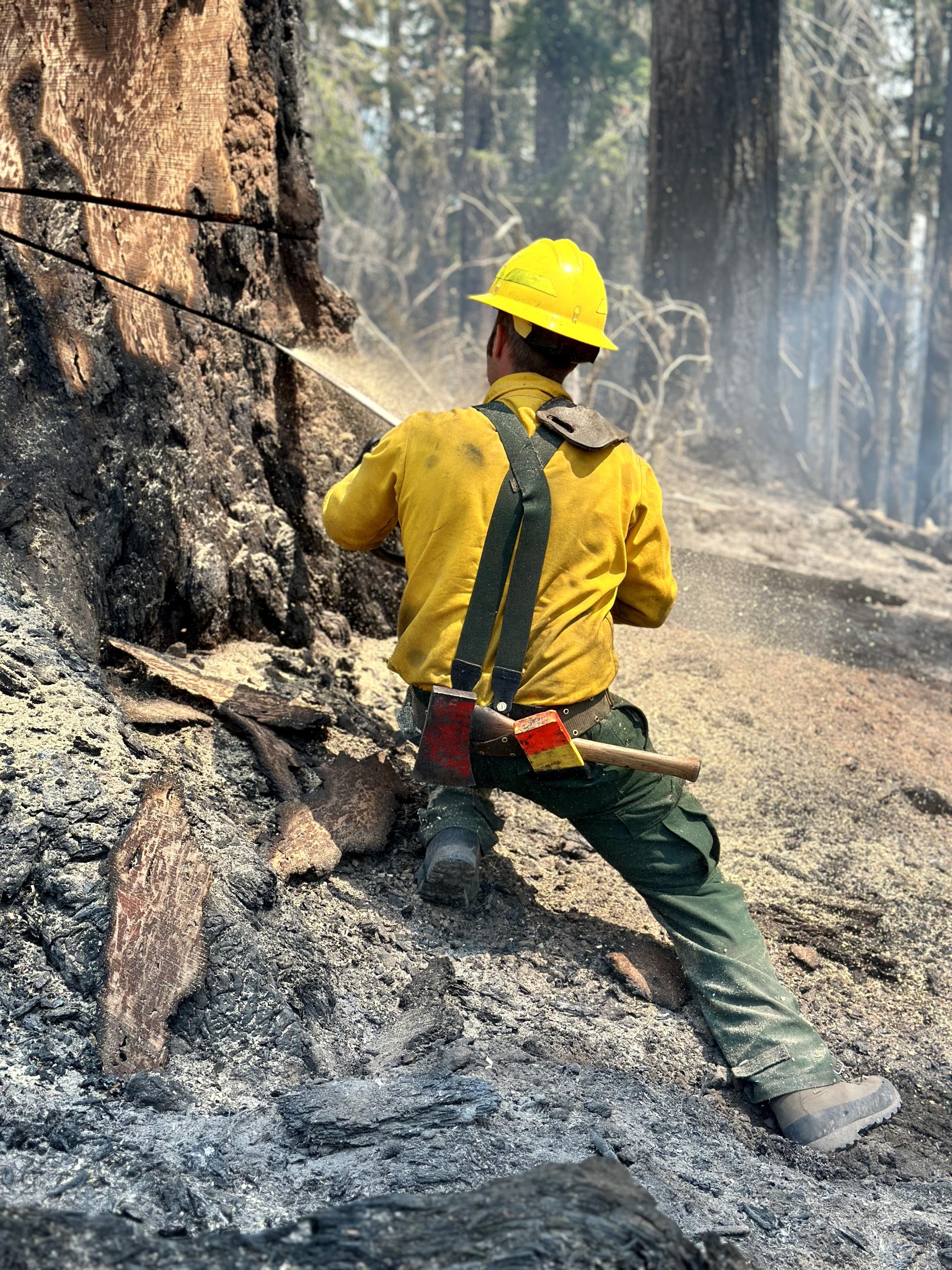
A tree feller cuts the "pie" in a tree.
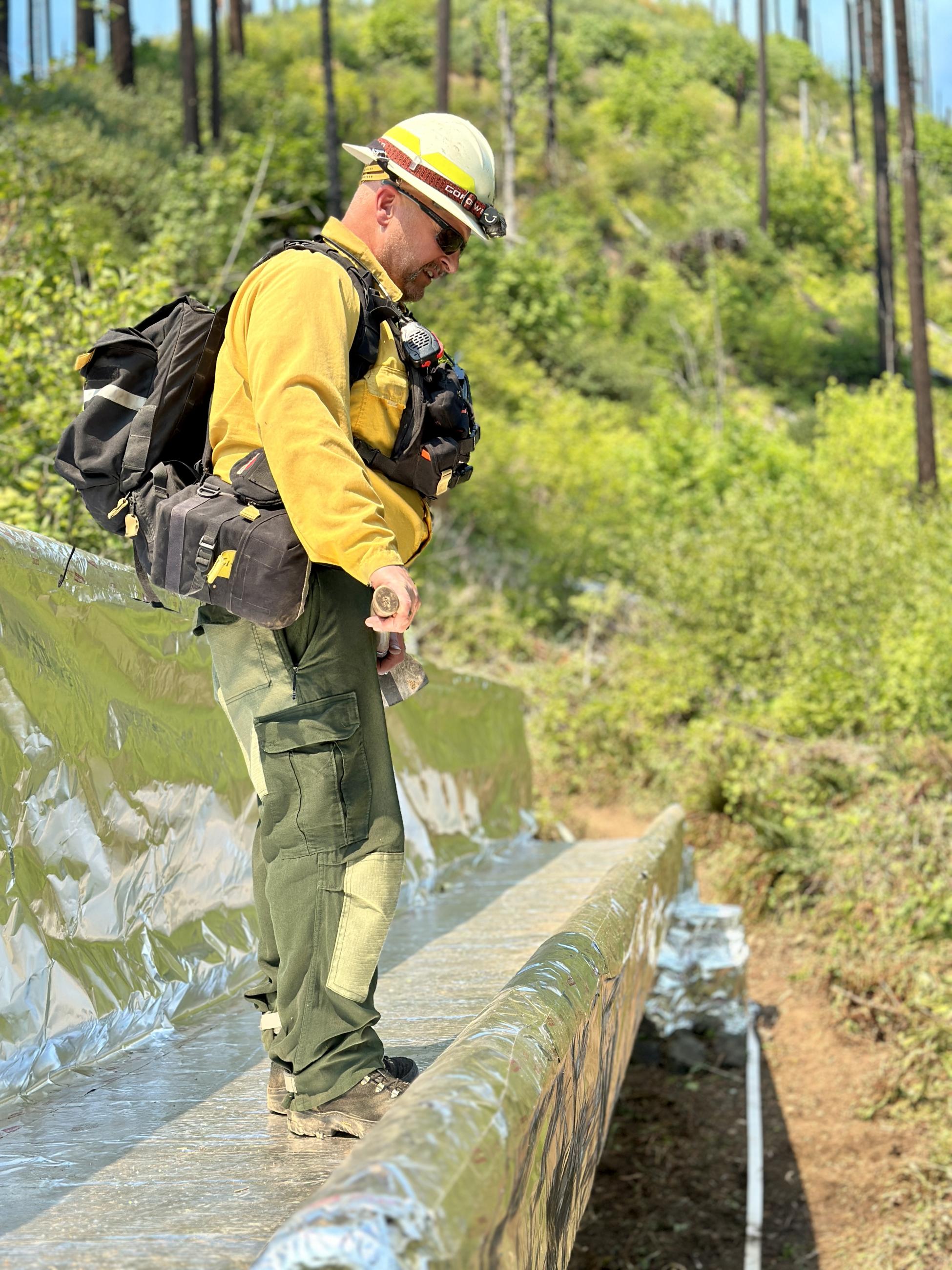
The Sierra/Yankee Division Supervisor inspects a bridge protected by aluminized structure wrap at Bedrock Campground.