Incident Media Photographs
Could not determine your location.
Photographs Gallery
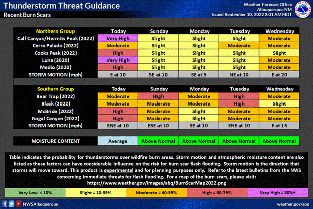
![Thunderstorm Probability for Sept. 10 Image showing NWS thunderstorm forecast for recent burn scars in New Mexico](https://inciweb-prod-media-bucket.s3.us-gov-west-1.amazonaws.com/s3fs-public/styles/max_2600x2600/public/2022-10/2022_09_10-11.35.11.928-CDT.gif?VersionId=WDROru1PDp2UiKU.8yFX.Co865_9aHXk&itok=G5Y2vQfD)
National Weather Service forecast for thunderstorm probability in recent burn scars
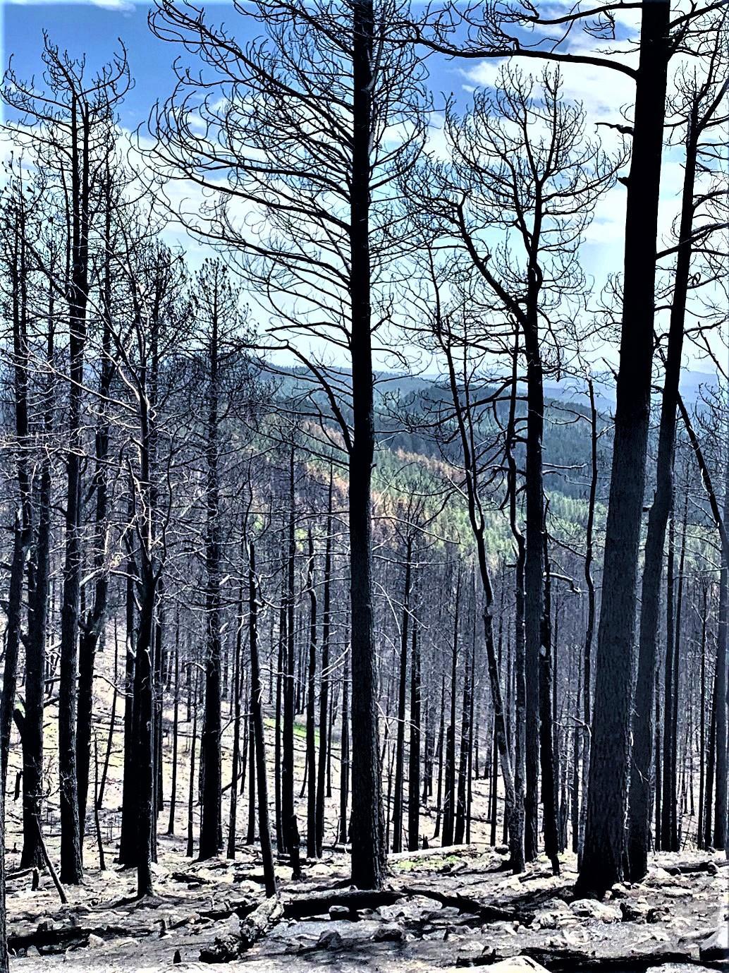
![Cerro Pelado Burned Area Assessed by BAER Image showing the Cerro Pelado Burned Area that was assessed by BAER Scientists and Specialists](https://inciweb-prod-media-bucket.s3.us-gov-west-1.amazonaws.com/s3fs-public/styles/max_2600x2600/public/2022-10/2022_07_16-13.34.31.377-CDT.jpeg?VersionId=f32md89ca6WV0Cl9fIf.JNsePxz7ct02&itok=x4flnnkN)
Cerro Pelado Burned Area Assessed by BAER Specialists and Scientists
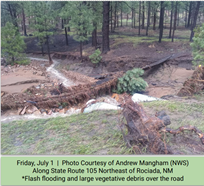
![Flash Flooding & Large Vegetative Debris Over Road Image showing Flash Flooding & Large Vegetative Debris Over Road on 7-1-22 taken by NWS Andrew Mangham](https://inciweb-prod-media-bucket.s3.us-gov-west-1.amazonaws.com/s3fs-public/styles/max_2600x2600/public/2022-10/2022_07_16-14.48.35.782-CDT.png?VersionId=XwLiKCF2CC0D7XbaQ0Lcq2VCJki3pFbz&itok=9ZWjLVHz)
Flash Flooding & Large Vegetative Debris Over Road on 7-1-22 taken by NWS Andrew Mangham
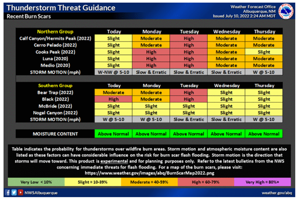
![NM Burn Scar Thunderstorm NWS Forecast Table Image showing NM Burn Scar Thunderstorm NWS Forecast Table](https://inciweb-prod-media-bucket.s3.us-gov-west-1.amazonaws.com/s3fs-public/styles/max_2600x2600/public/2022-10/2022_07_10-16.24.59.607-CDT.png?VersionId=bGqRswmikMhhssnnIRlSlLRSbhooSDs4&itok=vTh9wGbA)
NM Burn Scar Thunderstorm NWS Forecast Table
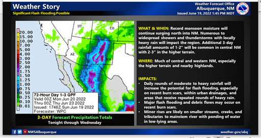
![NWS ABQ --Flash Flood Weather Notice Image showing National Weather Service ABQ--Flash Flood Weather Notice](https://inciweb-prod-media-bucket.s3.us-gov-west-1.amazonaws.com/s3fs-public/styles/max_2600x2600/public/2022-10/2022_06_20-13.30.48.614-CDT.png?VersionId=oCSxXhFceivRpaWDrYSA4Rlr.qn9i7QY&itok=-esVyPd-)
National Weather Service ABQ--Flash Flood Weather Notice
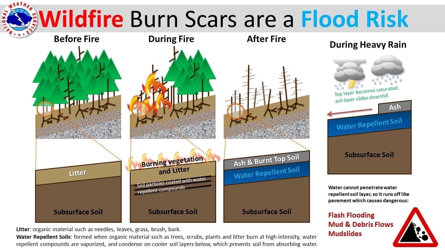
![NWS Wildfire Burn Scars are a Flood Risk Image showing National Weather Service Reminder that Wildfire Burn Scars are a Flood Risk](https://inciweb-prod-media-bucket.s3.us-gov-west-1.amazonaws.com/s3fs-public/styles/max_2600x2600/public/2022-10/2022_06_16-11.24.12.835-CDT.jpeg?VersionId=UO75sXJEIL05fNYtUC8k1vIdkv3udlgF&itok=d5yrpVtt)
National Weather Service Reminder that Wildfire Burn Scars are a Flood Risk
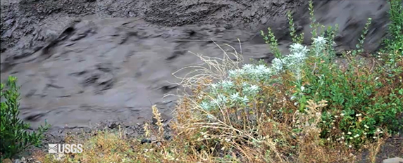
![Ash and Debris Flow Image showing an ash and debris flow](https://inciweb-prod-media-bucket.s3.us-gov-west-1.amazonaws.com/s3fs-public/styles/max_2600x2600/public/2022-10/2022_06_08-16.47.25.335-CDT.png?VersionId=Iqaw36r2L2EALUJVkHZsNdik9ZYp5jeC&itok=od60tZQj)
Ash and Debris Flow
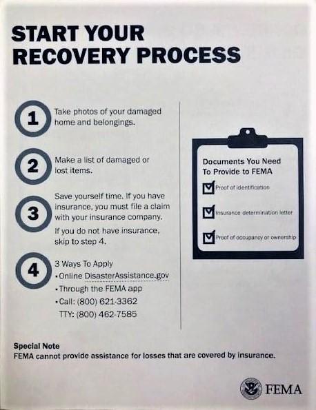
![FEMA FLYER--Start Your Recovery Process Image of a Federal Emergency Management Agency (FEMA) about starting the process for recovery following a national declared disaster](https://inciweb-prod-media-bucket.s3.us-gov-west-1.amazonaws.com/s3fs-public/styles/max_2600x2600/public/2022-10/2022_06_03-20.39.22.151-CDT.jpeg?VersionId=SSyKffEWtlcFobnLNrfEsdbc4caLTAxa&itok=D-bQdeB5)
FEMA FLYER--Start Your Recovery Process
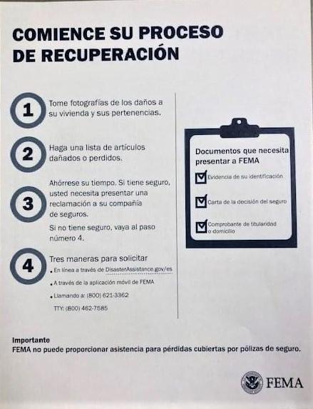
![FEMA FLYER--Comience Su Proceso de Recuperacio'n Image of a Federal Emergency Management Agency (FEMA) flyer in Spanish: Comience Su Proceso de Recuperasio'n](https://inciweb-prod-media-bucket.s3.us-gov-west-1.amazonaws.com/s3fs-public/styles/max_2600x2600/public/2022-10/2022_06_03-20.44.45.123-CDT.jpeg?VersionId=LcFE8Kr1FtXAr56NM.Yu25oyfQUsdxTV&itok=bJIoJUk5)
FEMA FLYER--Comience Su Proceso de Recuperacio'n
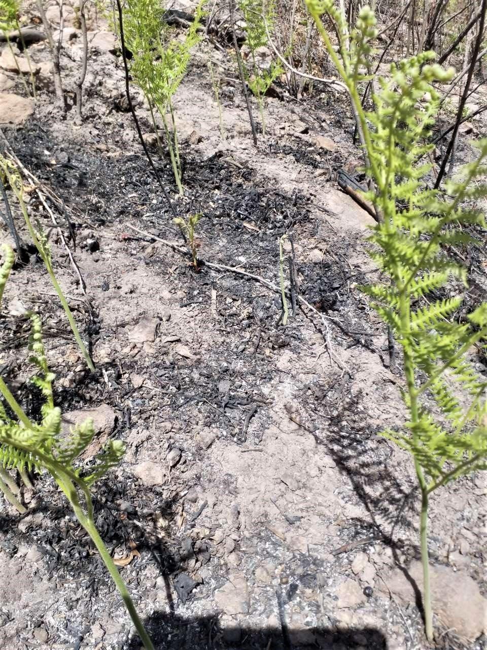
![SoilScientist TomGiambra Finds Vegetation ReGrowth Image showing Vegetation Regrowth in Canon de Norte in the northern part of the Cerro Pelado burn area found by BAER Soil Scientist Tom Giambra](https://inciweb-prod-media-bucket.s3.us-gov-west-1.amazonaws.com/s3fs-public/styles/max_2600x2600/public/2022-10/2022_05_30-21.51.35.371-CDT.jpeg?VersionId=MyQdTLUPXzZp9YPIncxNDChzguJQ43yf&itok=yoFhSGri)
BAER Soil Scientist finds Vegetation Regrowth in Canon de Norte in the northern part of the Cerro Pelado burn area
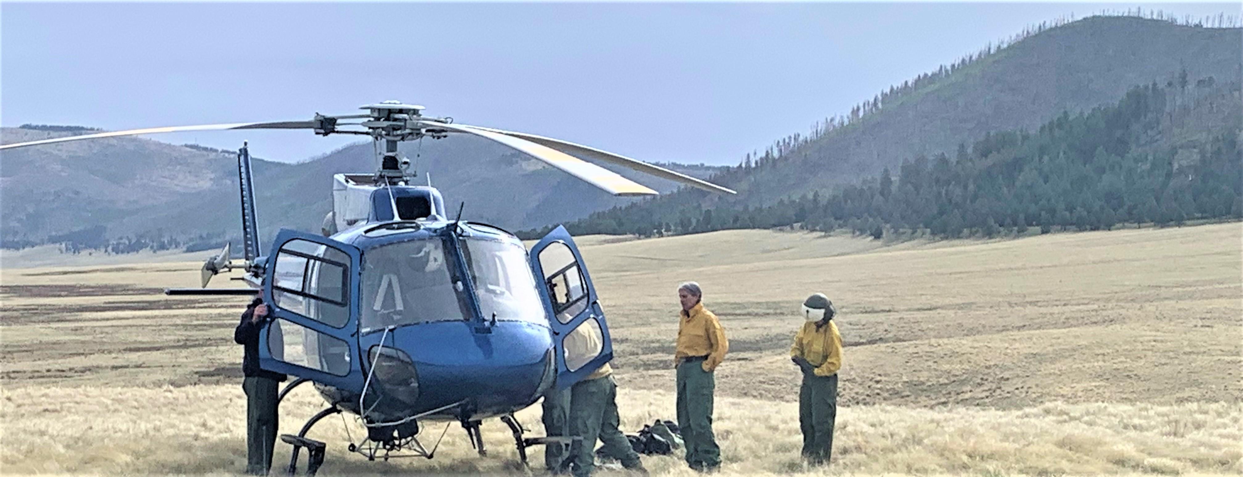
![Aerial Reconnaissance by BAER Specialists Image showing BAER Soil Scientist Nori Koehler & BAER Hydrologist Kelly Mott Lacroix Prepare for Recon Flight of the Cerro Pelado Burned Area](https://inciweb-prod-media-bucket.s3.us-gov-west-1.amazonaws.com/s3fs-public/styles/max_2600x2600/public/2022-10/2022_05_30-21.58.10.900-CDT.jpeg?VersionId=wEEEKor_ZKfueVQs1hAr_2_faDkIGqRD&itok=3bq_UNhc)
BAER Soil Scientist Nori Koehler & BAER Hydrologist Kelly Mott Lacroix Prepare for Recon Flight of the Cerro Pelado Burned Area
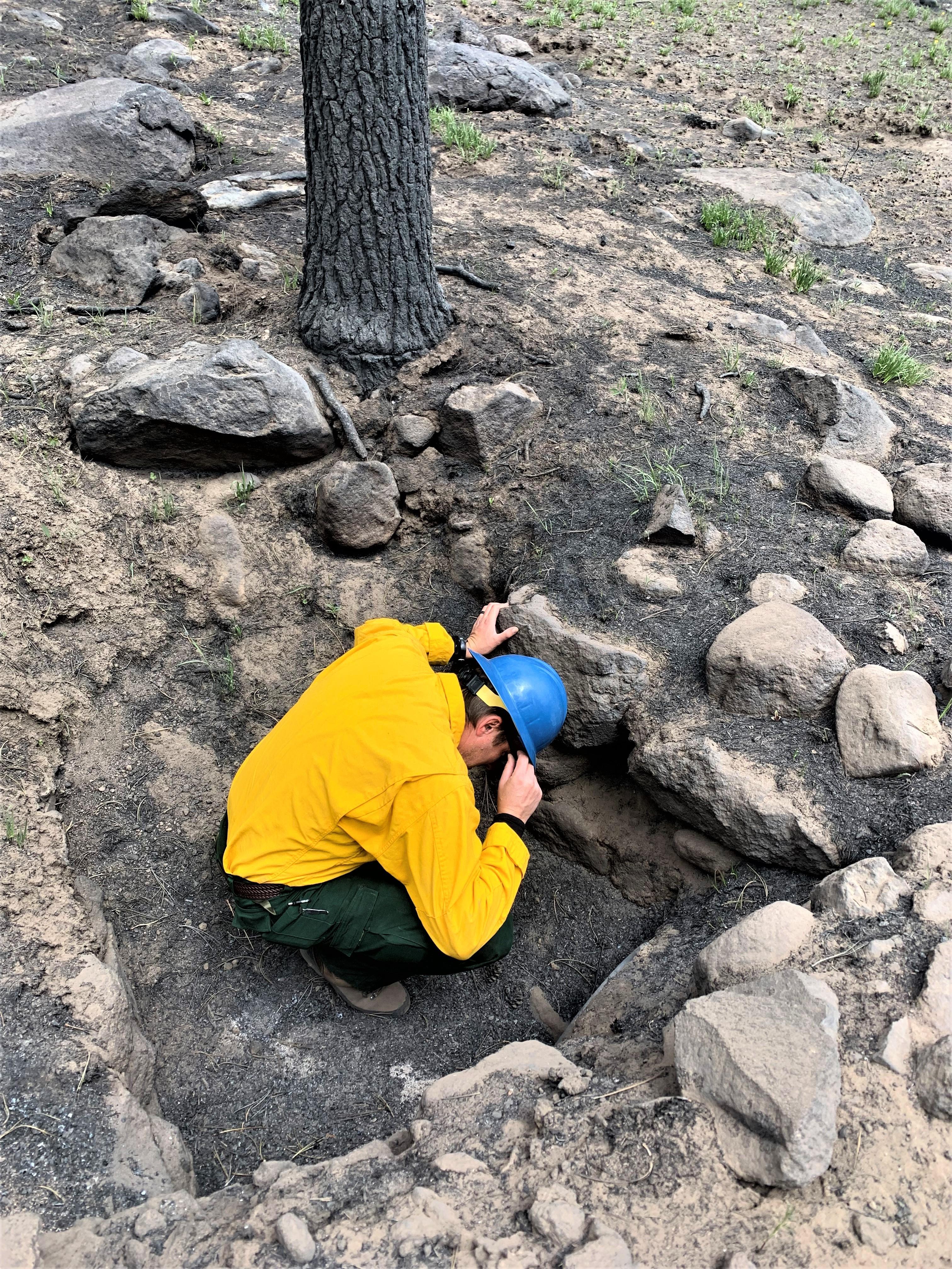
![BAER Assessing Cerro Pelado Burned Area Image showing BAER Hydrologist Kyle Paffett checking a culvert on Forest Service Road FSR270 in the Cerro Pelado Burned Area](https://inciweb-prod-media-bucket.s3.us-gov-west-1.amazonaws.com/s3fs-public/styles/max_2600x2600/public/2022-10/2022_05_23-22.48.44.848-CDT.jpeg?VersionId=PRtMyCznuLPklcFIWWU3pYgDeeqMvsAS&itok=dm0r3bFS)
BAER Hydrologist Kyle Paffett checking a culvert on Forest Service Road FSR270 in the Cerro Pelado Burned Area