
Incident Media Photographs
Could not determine your location.
 Wildfire
 Prescribed Fire
 Burned Area
Response
Burned Area
Response Other
Other
Photographs Gallery

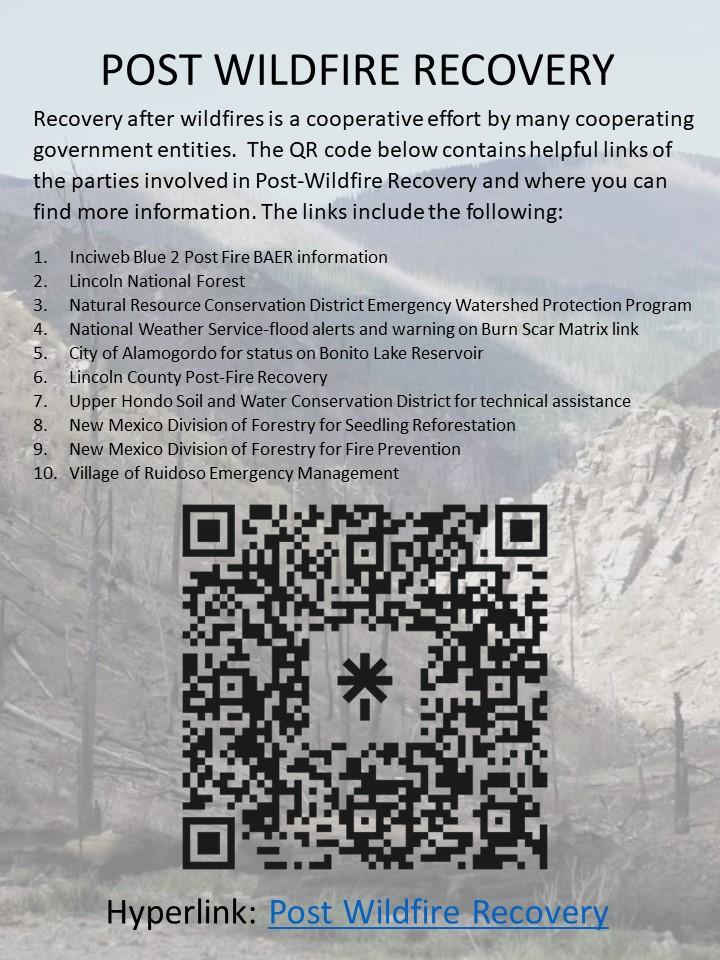
Recovery after wildfires is a cooperative effort by many cooperating government entities. The QR code below contains helpful links of the parties involved in Post-Wildfire Recovery and where you can find more information.
- Inciweb Blue 2 Post Fire BAER information
- Lincoln National Forest
- City of Alamogordo for status on Bonito Lake Reservoir
- Lincoln County Post-Fire Recovery
- New Mexico Department of Homeland Security and Emergency Management
- Natural Resource Conservation District Emergency Watershed Protection Program
- National Weather Service-flood alerts and warning on Burn Scar Matrix link
- Upper Hondo Soil and Water Conservation District for technical assistance
- New Mexico Division of Forestry for Seedling Reforestation
- New Mexico Division of Forestry for Fire Prevention
- Village of Ruidoso Emergency Management
Hyperlink: Post-Fire Recovery
Recovery after wildfires is a cooperative effort by many cooperating government entities. The QR code below contains helpful links of the parties involved in Post-Wildfire Recovery and where you can find more information.
- Inciweb Blue 2 Post Fire BAER information
- Lincoln National Forest
- Natural Resource Conservation District Emergency Watershed Protection Program
- National Weather Service-flood alerts and warning on Burn Scar Matrix link
- City of Alamogordo for status on Bonito Lake Reservoir
- Lincoln County Post-Fire Recovery
- Upper Hondo Soil and Water Conservation District for technical assistance
- New Mexico Division of Forestry for Seedling Reforestation
- New Mexico Division of Forestry for Fire Prevention
- Village of Ruidoso Emergency Management
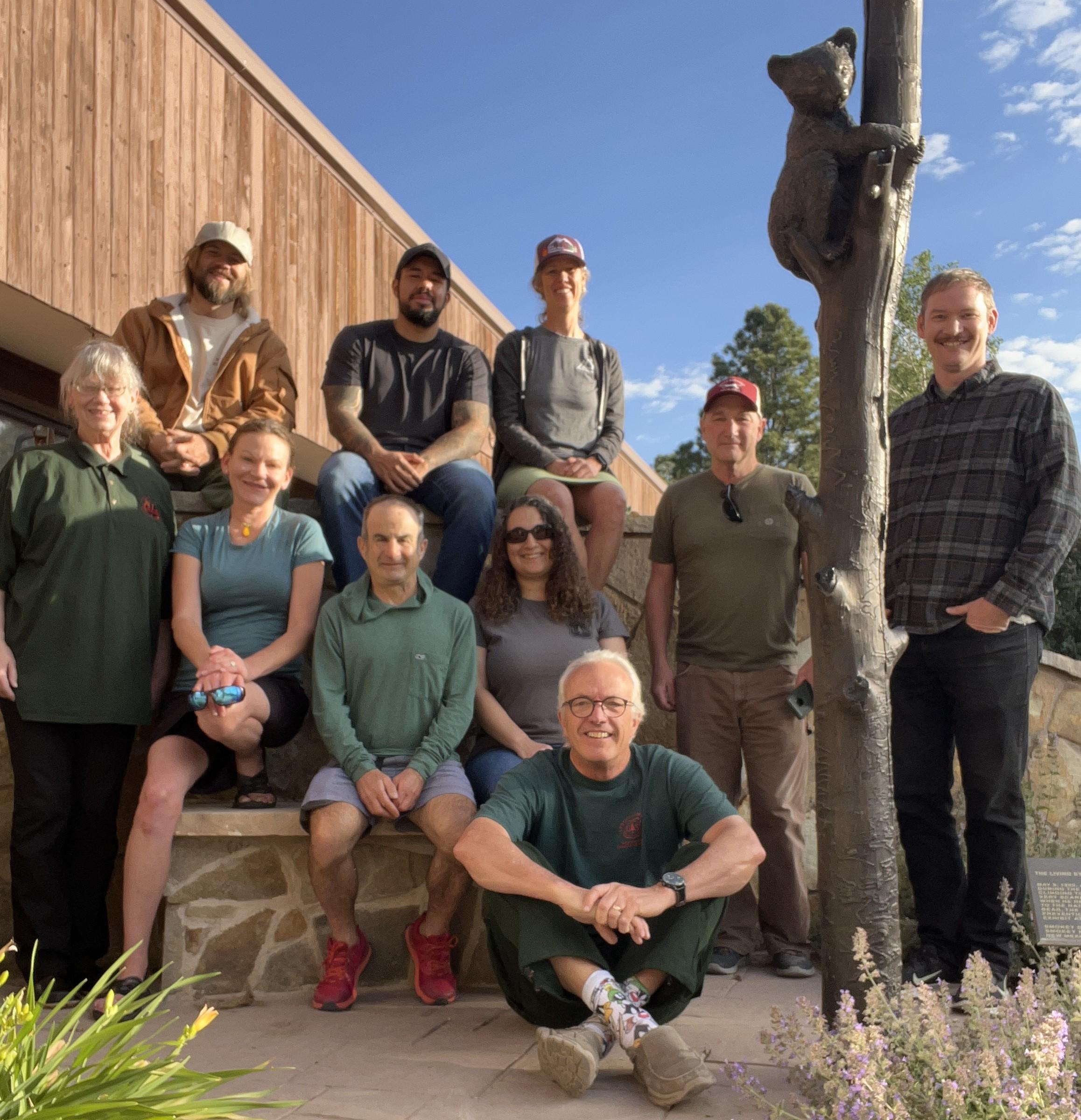
Blue 2 Burned Area Emergency Response Team (BAER) June 13, 2024. Top row from left to right: Dave Hall-archaeology, Edgar Martinez co-team leader, Jamie Krezelok-hydrologist, Smokey Bear. Middle row from left to right: Rhonda Stewart-Lincoln National Forest BEAR coordinator, Danelle Scott-hydrologist, Andrew Breibart-hydrologist, Maureen Yonovitz-soil scientist, Terry Hardy co-team leader, Henry Glover-soil scientist. Third row Dick Fleishman-PIO.
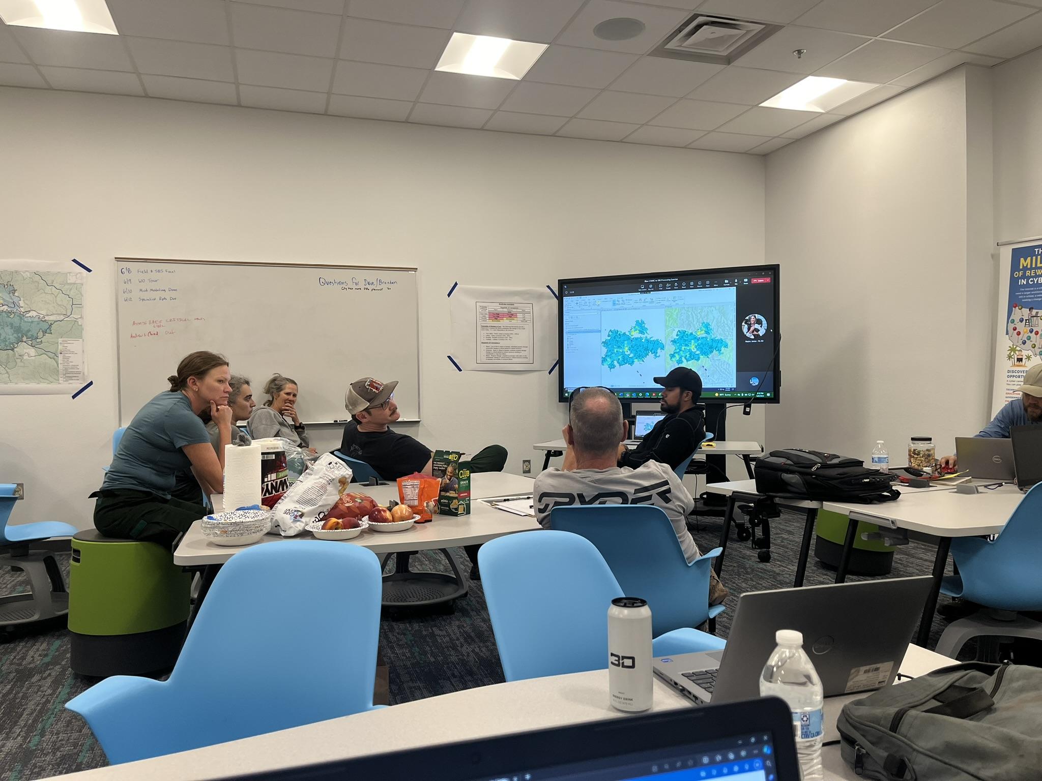
BAER Team hydrologist and soil scientist work through the process finalizing the Soil Burn Severity map for the Blue 2 Fire on June 8, 2024.
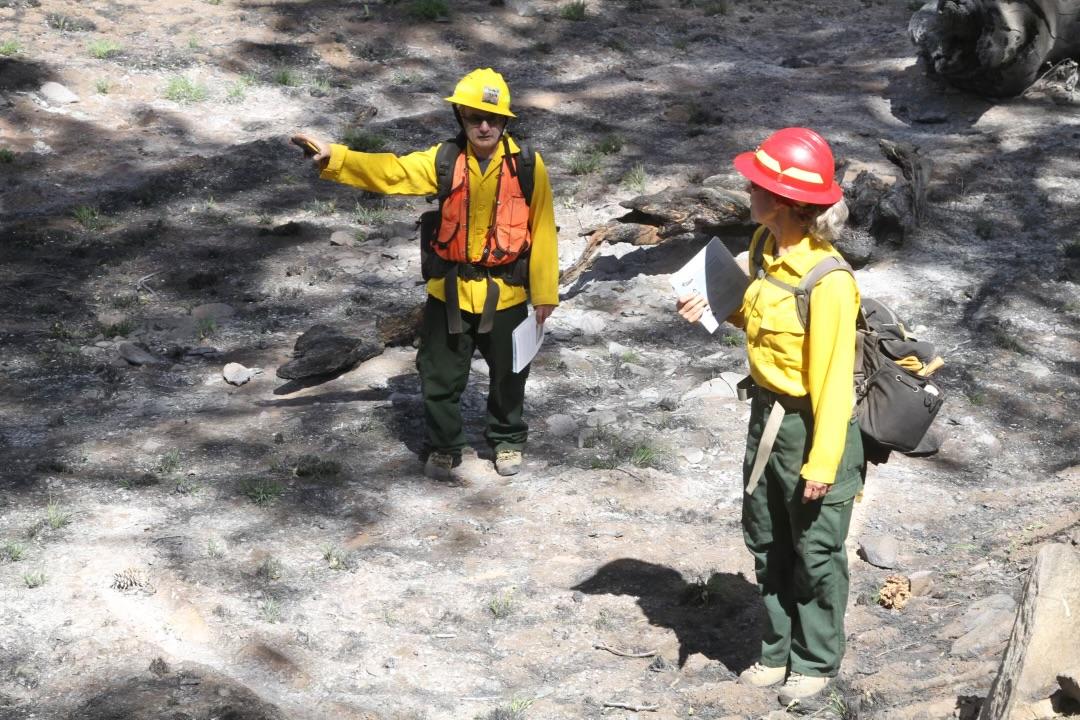
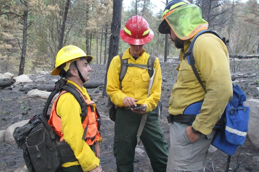
Hydrologists Andrew Breibart and Jamie Krezelok from the Blue 2 BAER Team discuss soil burn severity on the Blue 2 Fire, June 7. 2024.
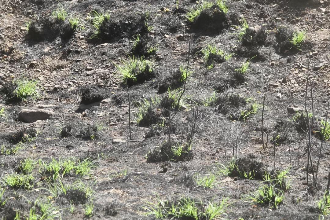
Grass sprouting post-fire within the Blue 2 Fire near South Fork Campground.
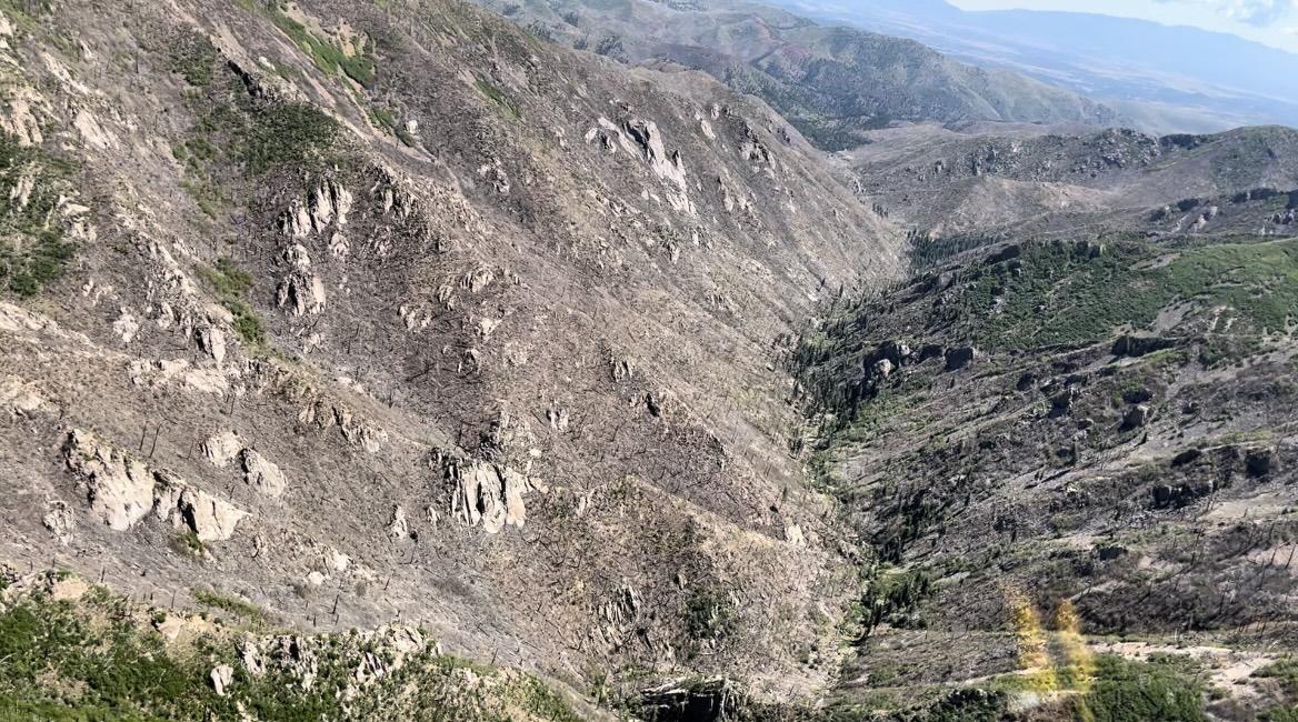
Burn in South Fork of Bonito Creek from Burned Area Emergency Response (BAER) recon flight June 5, 2024
BAER team members (from left to right) Andrew Briebart, Jamie Krezelok and Edgar Martinez consult their digital map before moving to the next sample point. BAER Team members will take multiple sample points to validate soil burn severity across the Blue 2 Fire that will inform the creation of a Soil Burn Severity map.
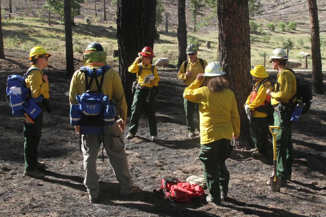
BAER Team members begin with safety briefing before doing field plots to validate the soil burn severity on the Blue 2 Fire on Thursday, June 6, 2024.
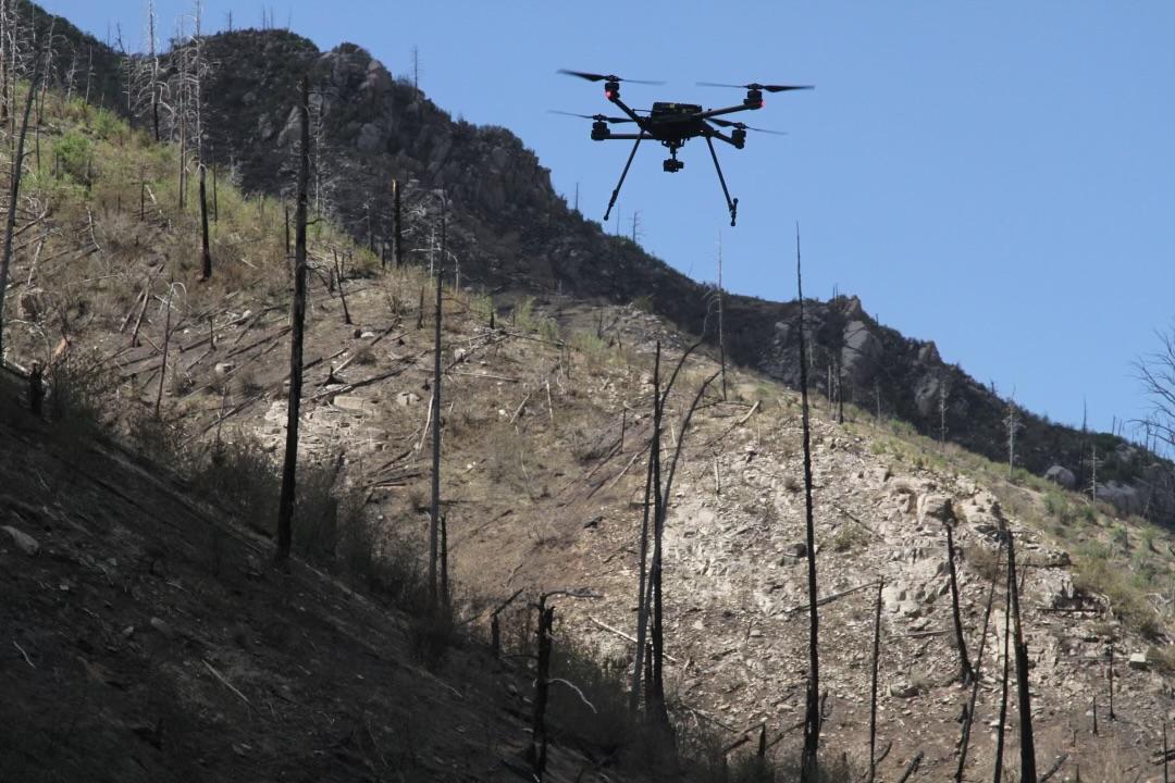
The BAER Team utilized a UAS today to gather data on trail conditions across the Blue 2 fire that will be used within the BAER Teams assessment of trail values at risk.

BAER team member is assessing how well water infiltrates on a burned soil sample. How well twater infiltrates, or does not infiltrate, is one indicator of the dame to the soil taht was caused by the Blue 2 Fire.