Incident Media Maps
Settings - change map background and toggle additional layers
Filter - control incident types displayed on map.
Zoom to your location
Reset map zoom and position
Could not determine your location.
Show Legend
 Wildfire
 Prescribed Fire
 Burned Area
Response
Burned Area
Response Other
Other
Elk Fire 2024
Unit Information
Incident Contacts
- Bighorn National Forest Type 4Phone:307-674-2600Hours:8 a.m. - 4:30 p.m.
Maps Gallery


[
PDF
]
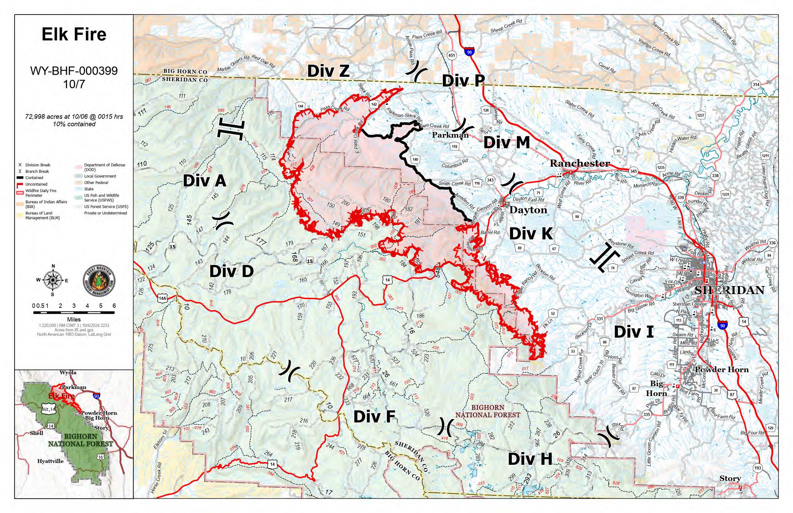
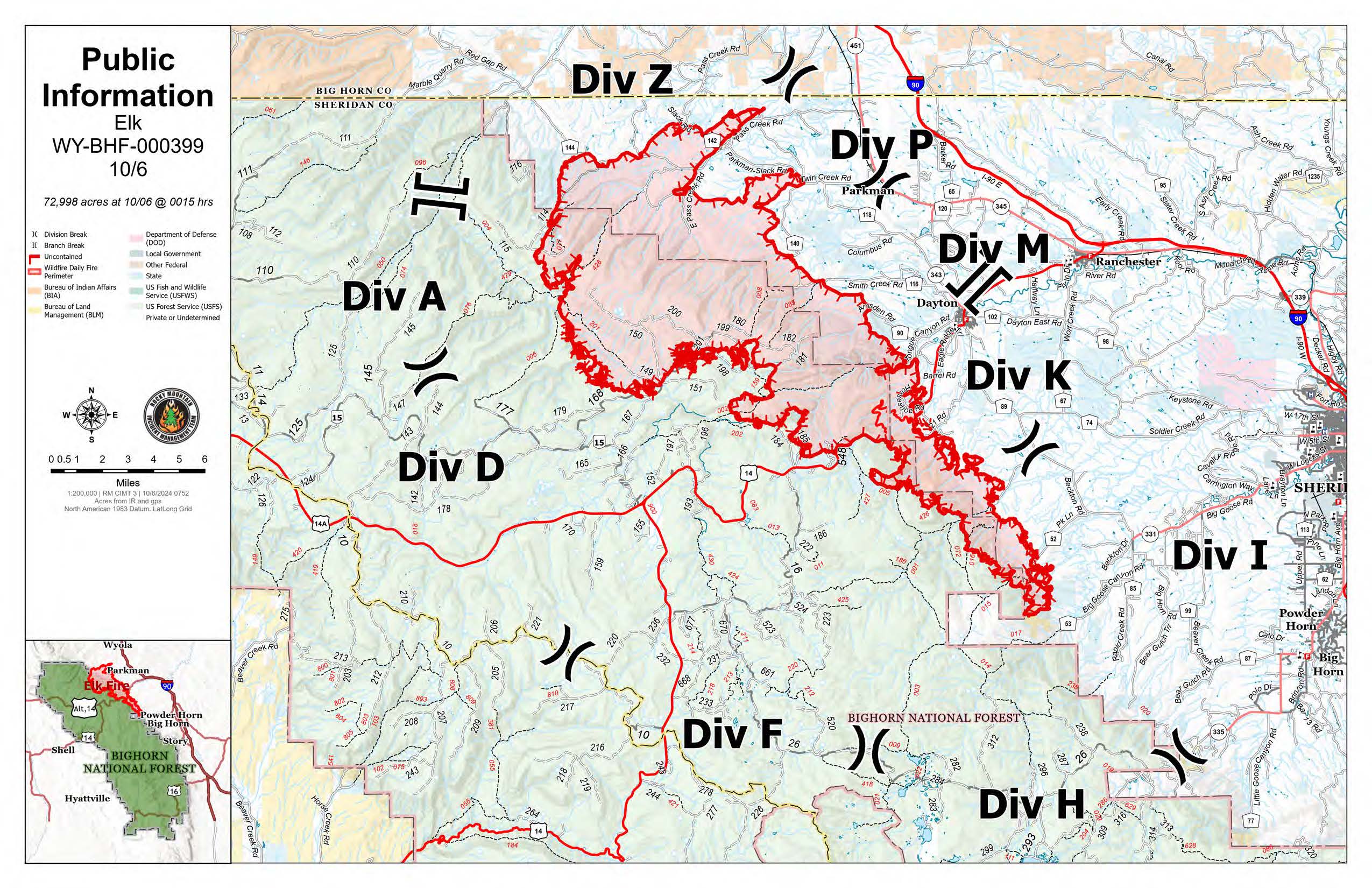
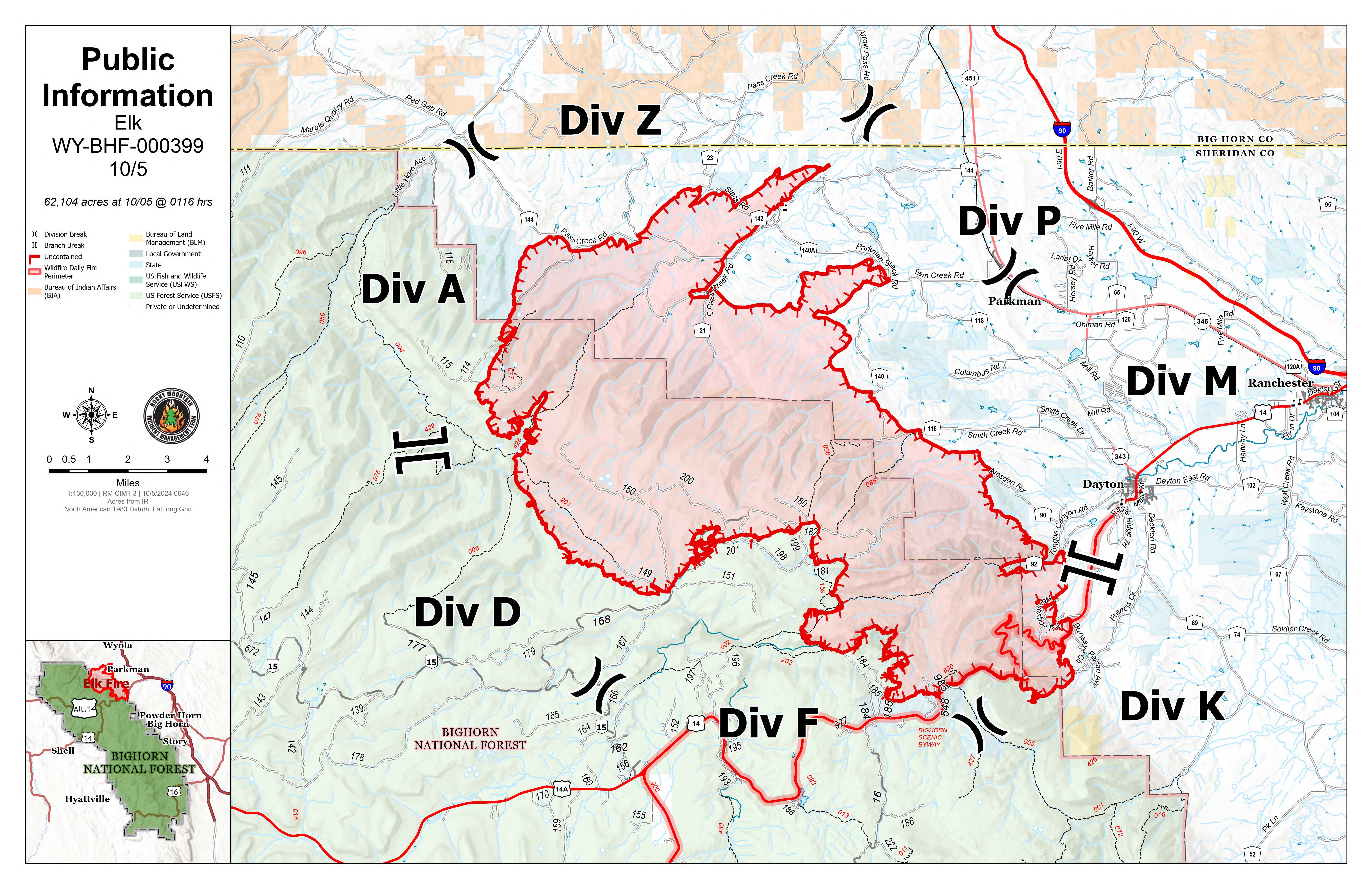
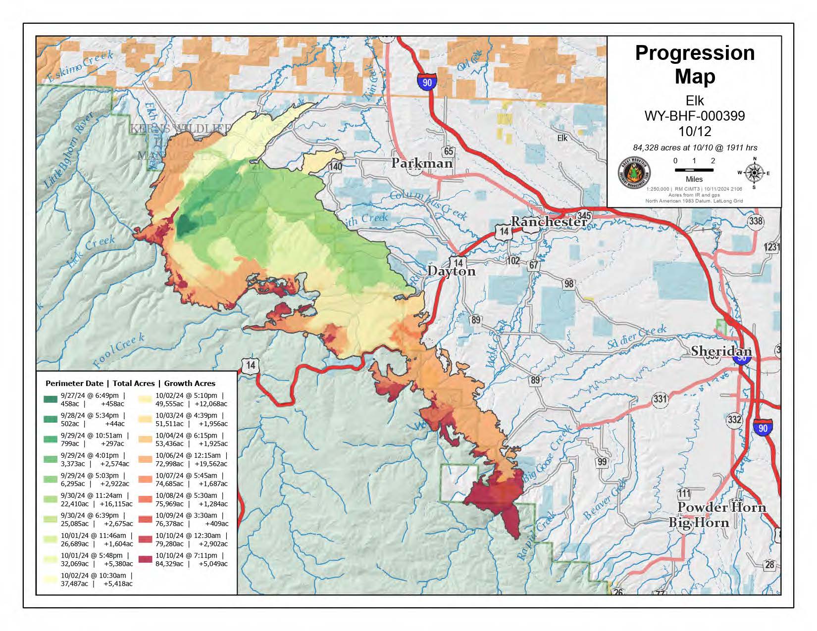
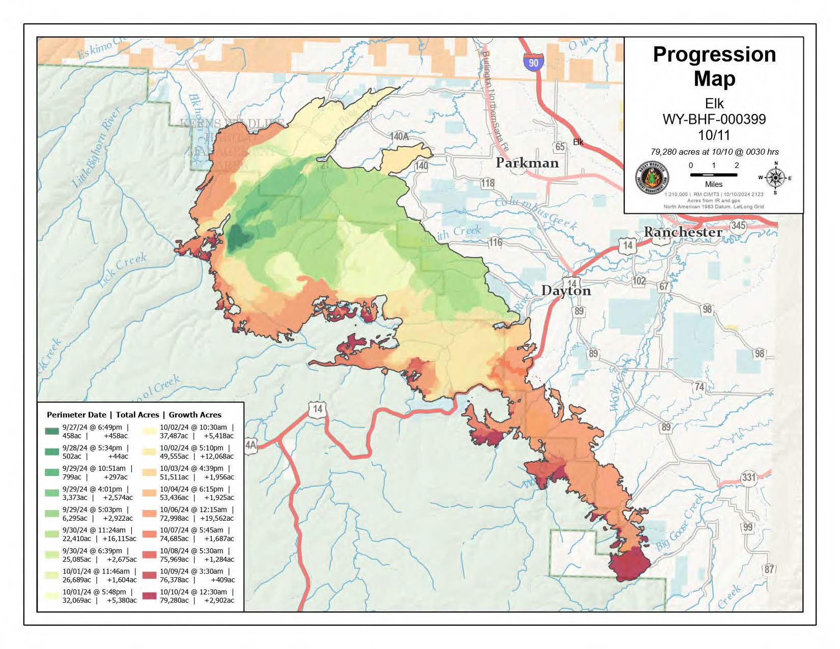
This map shows the Elk Fire in red, with the contained portions of the perimeter in black and uncontained portions of the perimeter in red. The Sheridan County Closure area is shown in blue crosshatching with a blue perimeter. Elk Hunt Areas 37 and 38 are outlined in brown, The Forest Service Closure Area is shown in purple crosshatching with a purple perimeter.