U.S. flag

An official website of the United States government

Here's how you know

Incident Media Maps

Zoom to your location
Reset map zoom and position

Could not determine your location.

Storage Fire

Unit Information

Texas 
College Station, 
Texas 
77845 
Texas 
College Station, 
Texas 
77845 

Incident Contacts

  • Adam Turner
    Email:
    adam.turner@tfs.tamu.edu
    Phone:
    940-328-9158
  • Information Officer
    Email:
    information@tfs.tamu.edu
    Phone:
    979-255-0591

Maps Gallery

Image options: [ Full Size ] - [ PDF ]

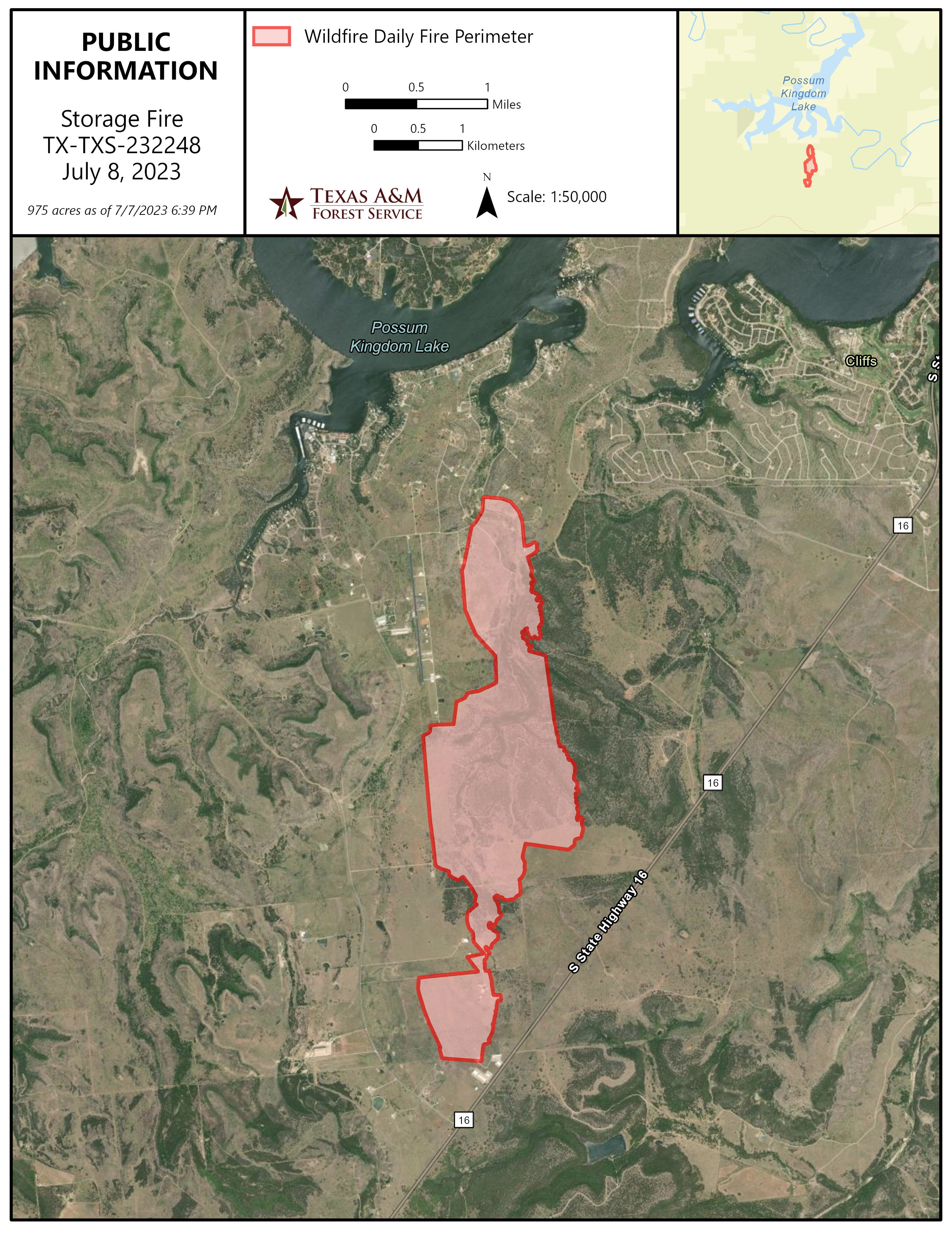
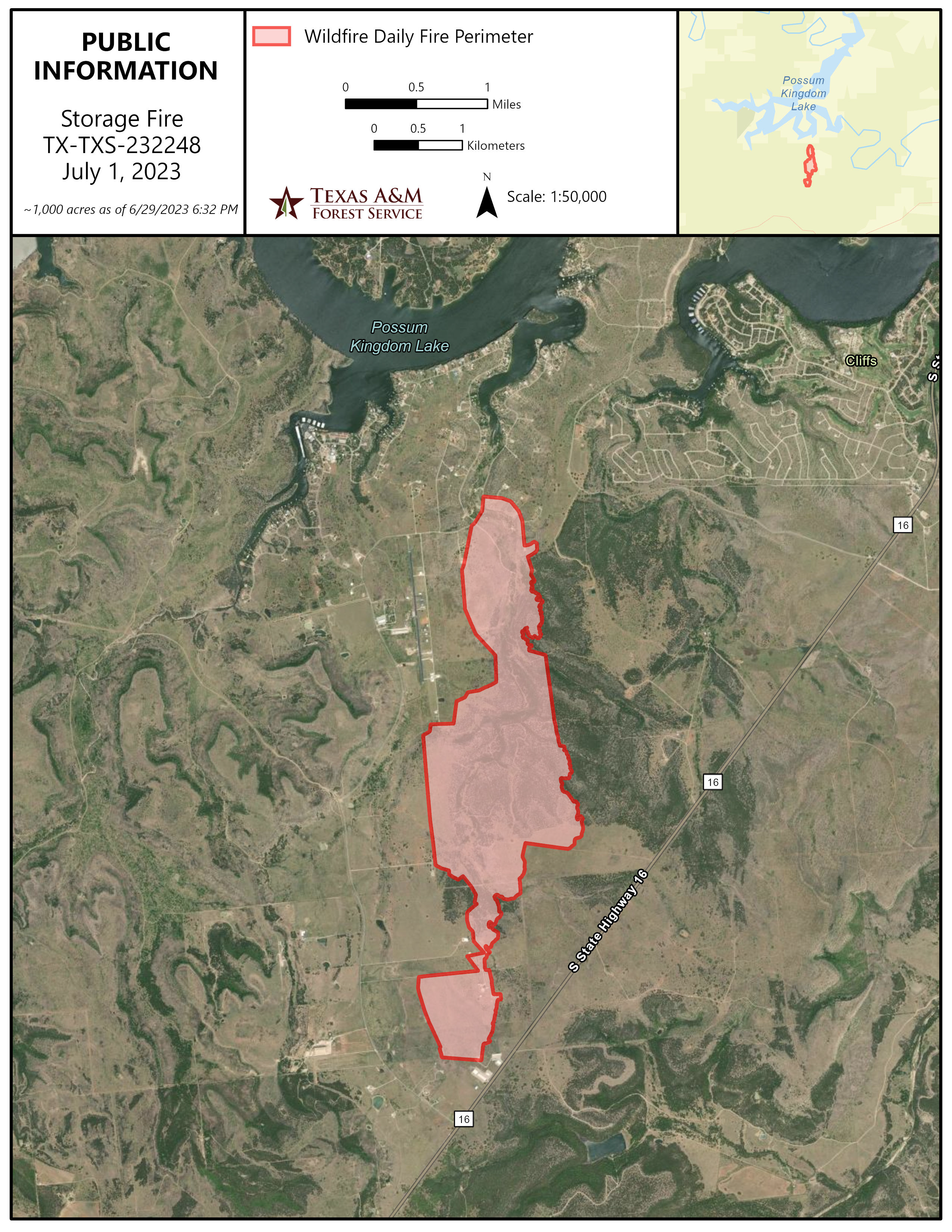
The additional acres burned on the east flank, or the right side of this map. The area will be monitored throughout the day.

Image options: [ Full Size ] - [ PDF ]

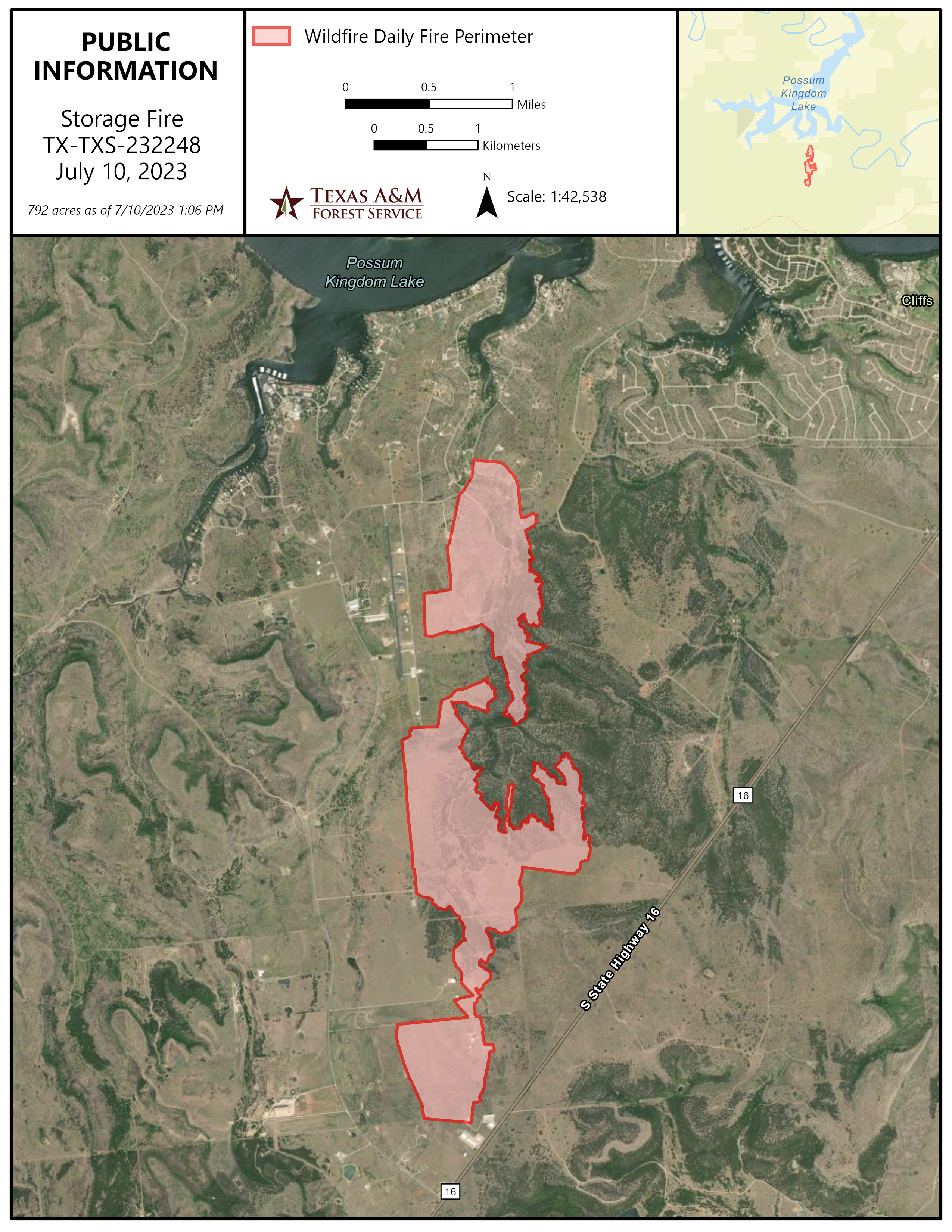
An Information map of the burned area of the Storage Fire. The decreased acreage is due to a more accurate mapping of the fire perimeter by hiking the perimeter of the burned areas in the daylight. 

Image options: [ Full Size ] - [ PDF ]

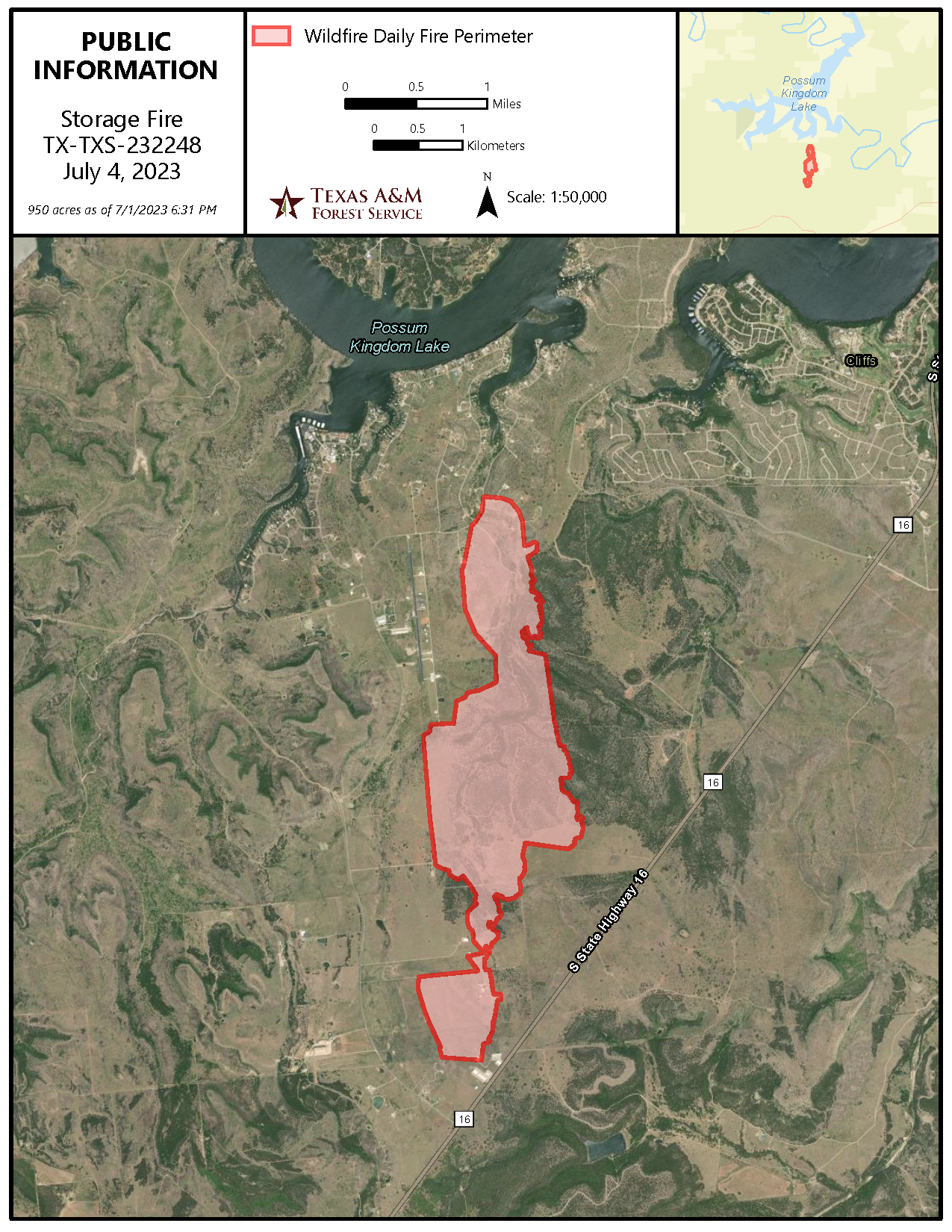
An Information Map for July 4, 2023 showing where the fire has burned.

Image options: [ Full Size ] - [ PDF ]

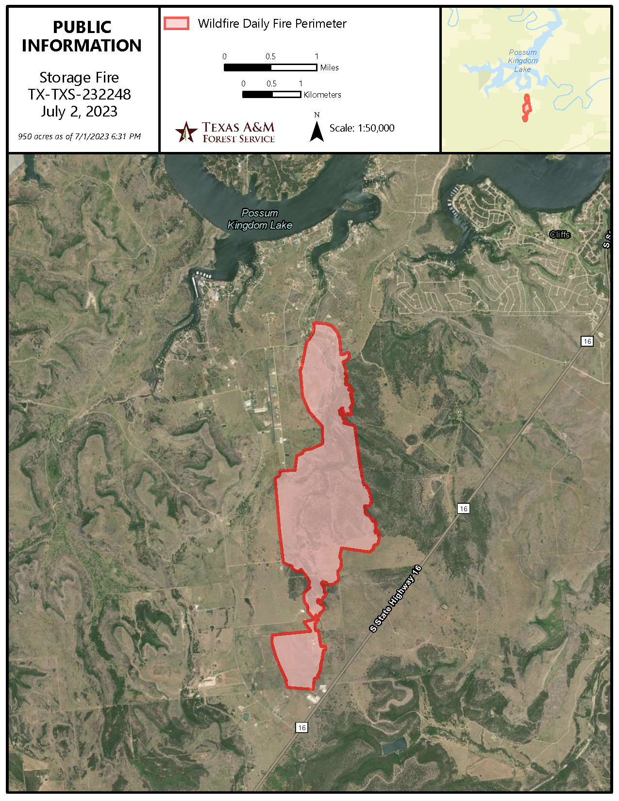
The area the fire burned is shown by a red area over satellite imagery of the area in its in.

Image options: [ Full Size ] - [ PDF ]


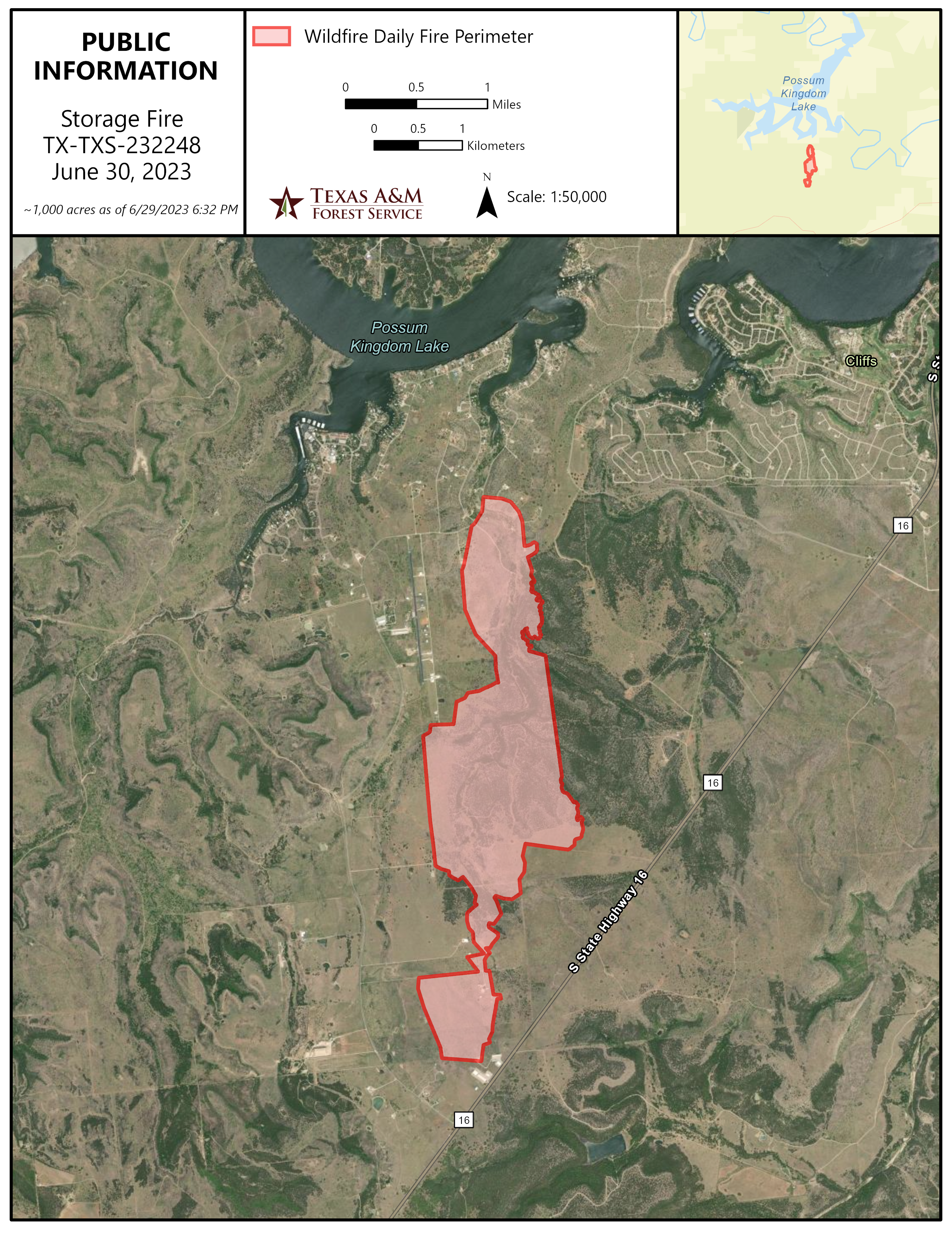
A map showing where the fire is currently located over satellite imagery. No significant growth occurred yesterday.

Image options: [ Full Size ] - [ PDF ]

A map showing where the fire is currently located over satellite imagery. The new growth yesterday, pushed to the north from the initial lines. 

Image options: [ Full Size ] - [ PDF ]

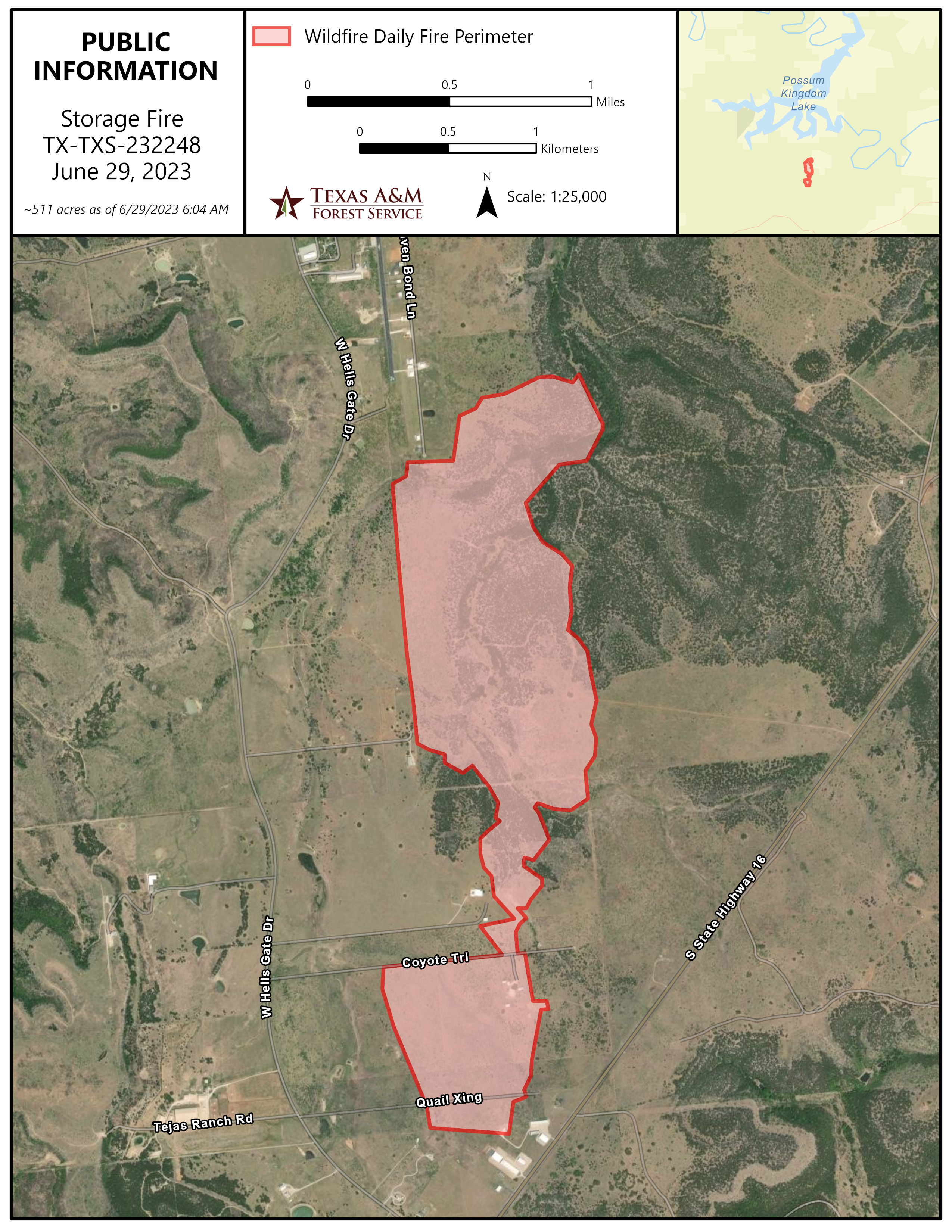
Public Information Map as of June 29, 2023, for the Storage Fire burning in Palo Pinto County.