Incident Media Maps
Settings - change map background and toggle additional layers
Filter - control incident types displayed on map.
Zoom to your location
Reset map zoom and position
Could not determine your location.
Show Legend
 Wildfire
 Prescribed Fire
 Burned Area
Response
Burned Area
Response Other
Other
Maps Gallery
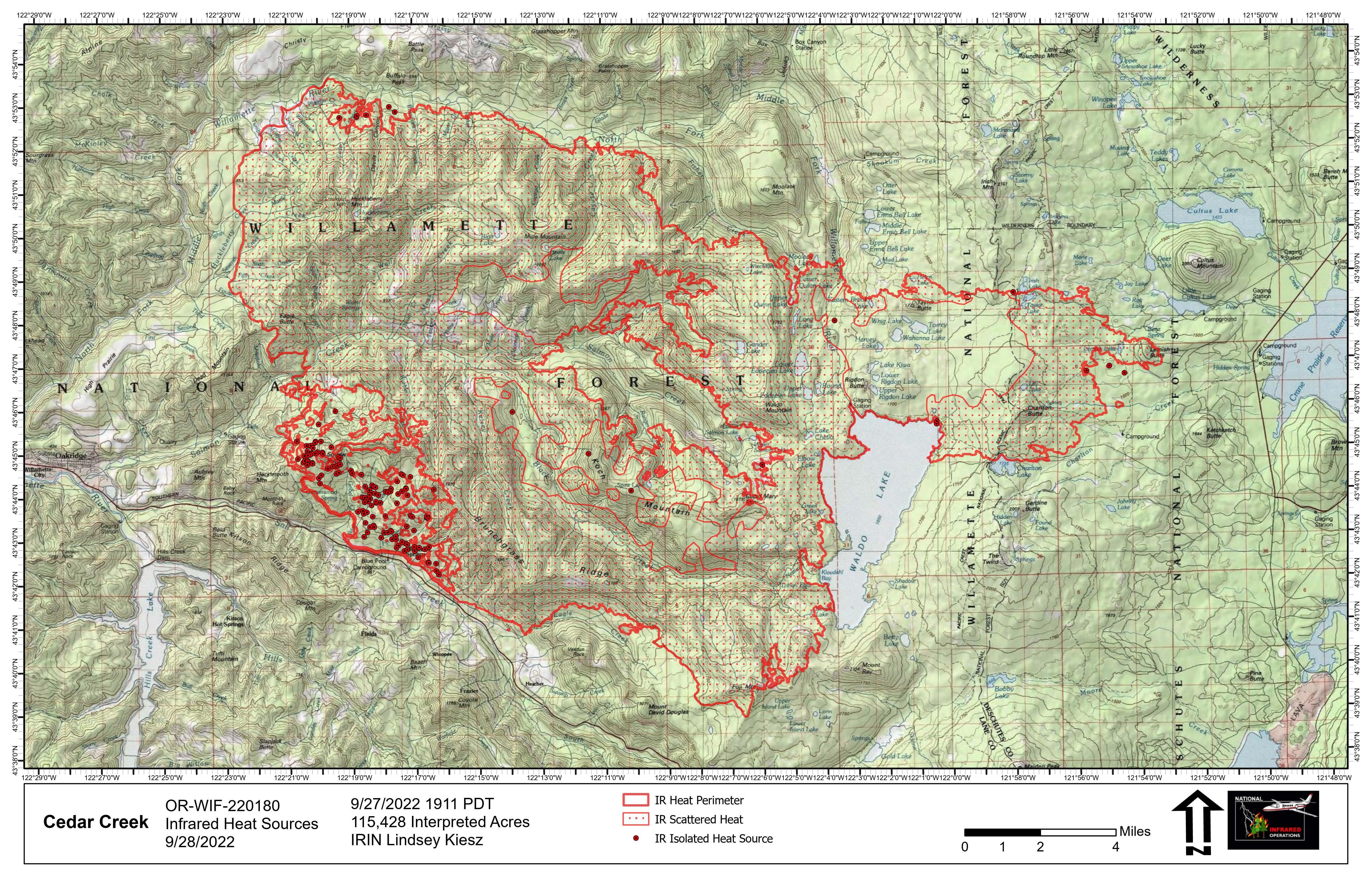
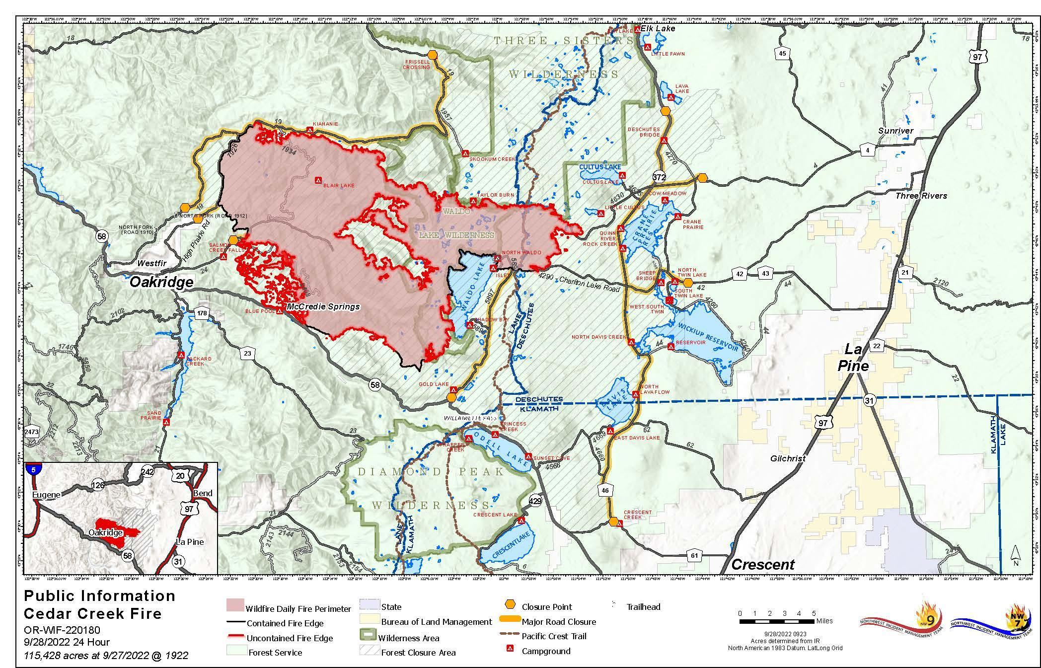
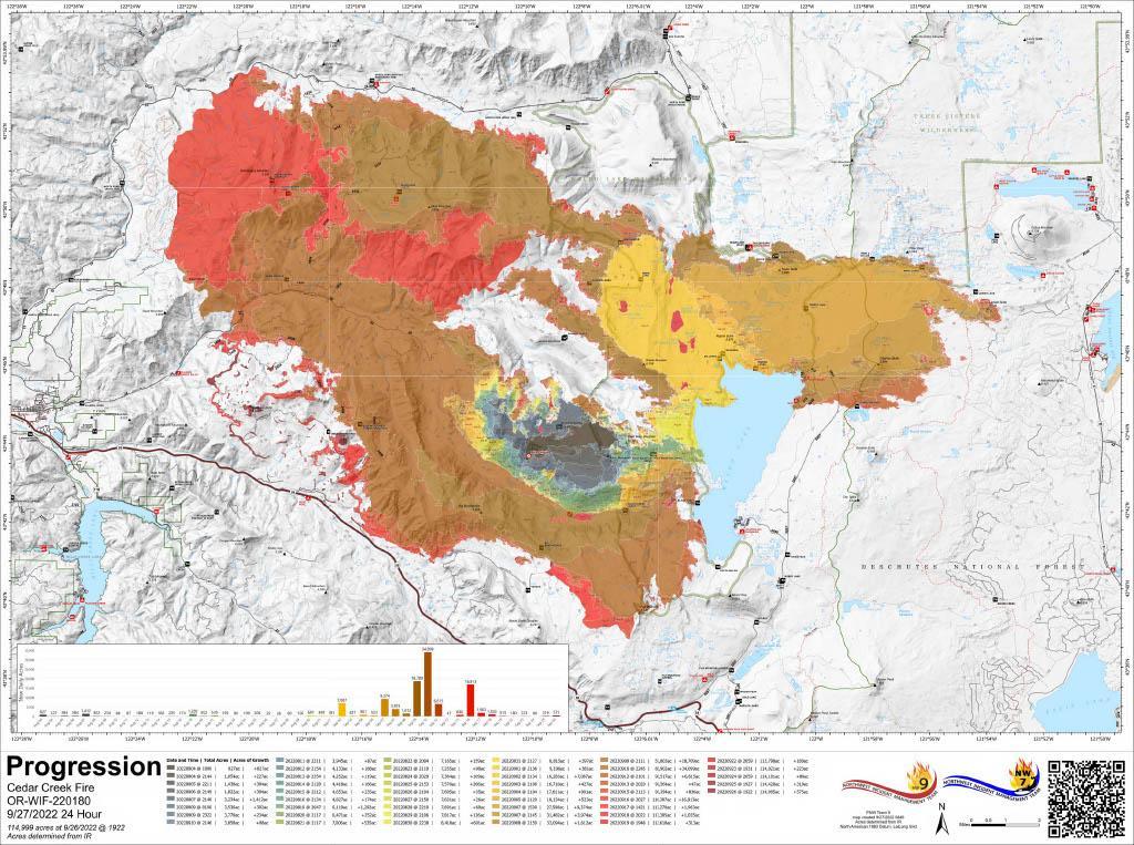
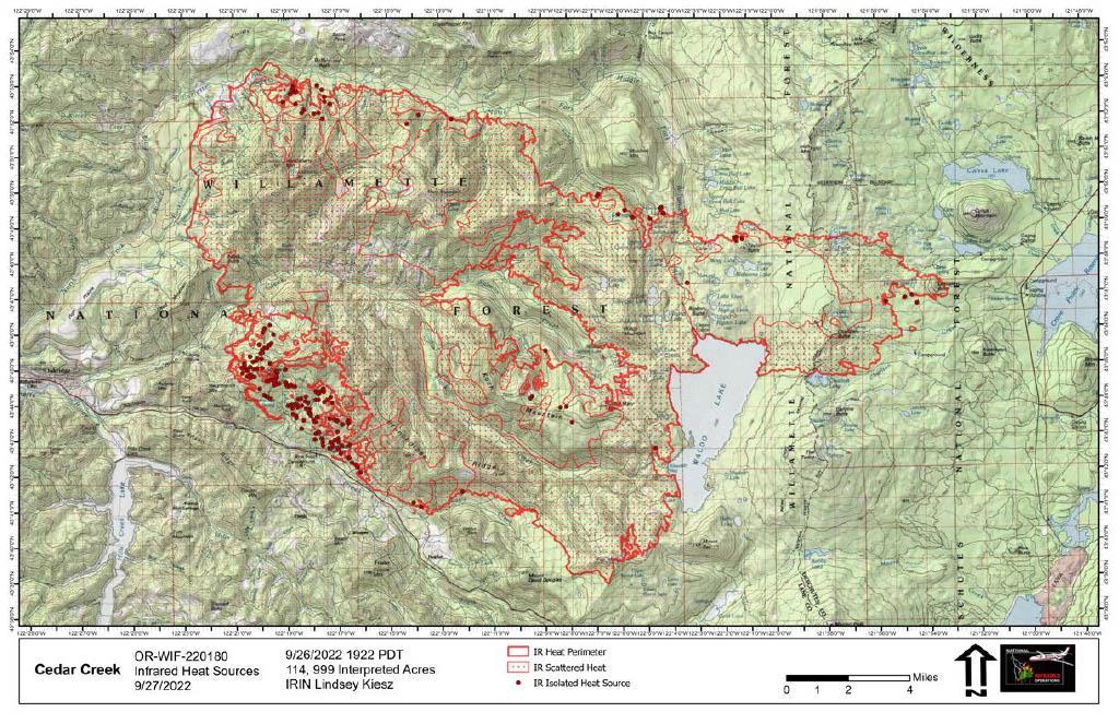
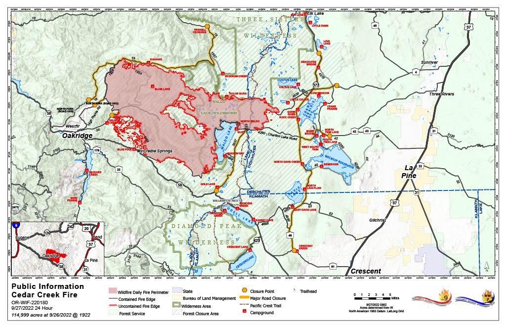
Image options: [ Full Size ] -
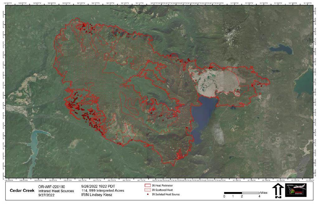
Cedar Creek Fire Infrared on Aerial Photography Map for Tuesday, Sept 27, 2022.
Image options: [ Full Size ] -
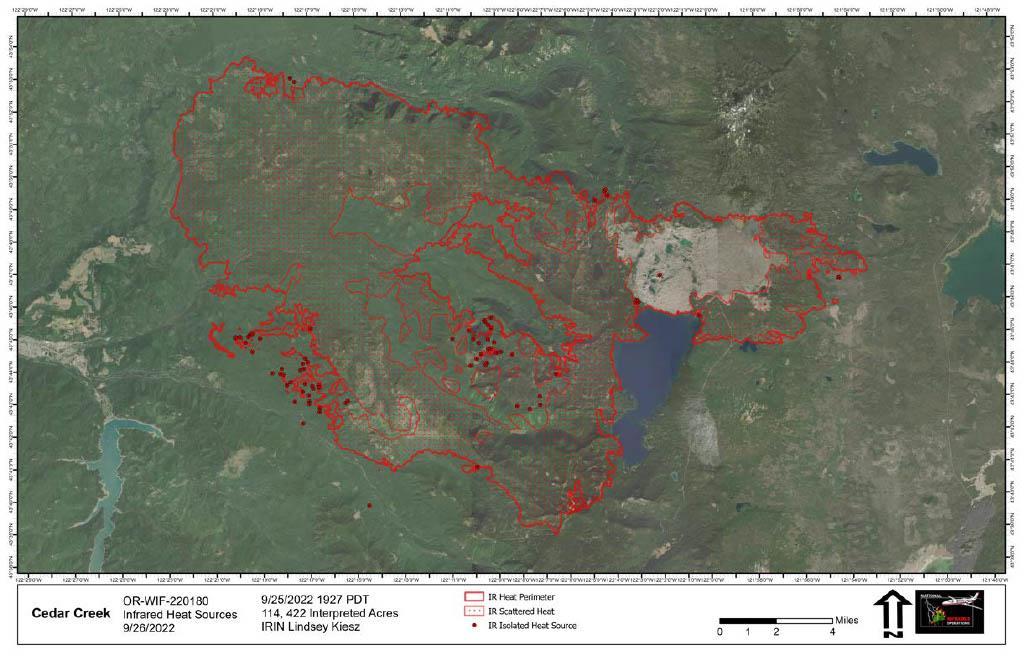
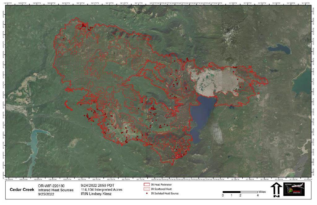
Cedar Creek Fire Infrared on Aerial Photography Map for Monday, Sept 26, 2022.
Image options: [ Full Size ] -
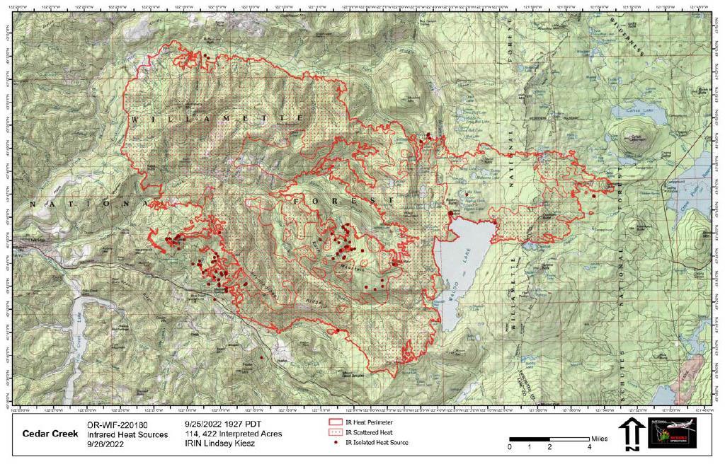
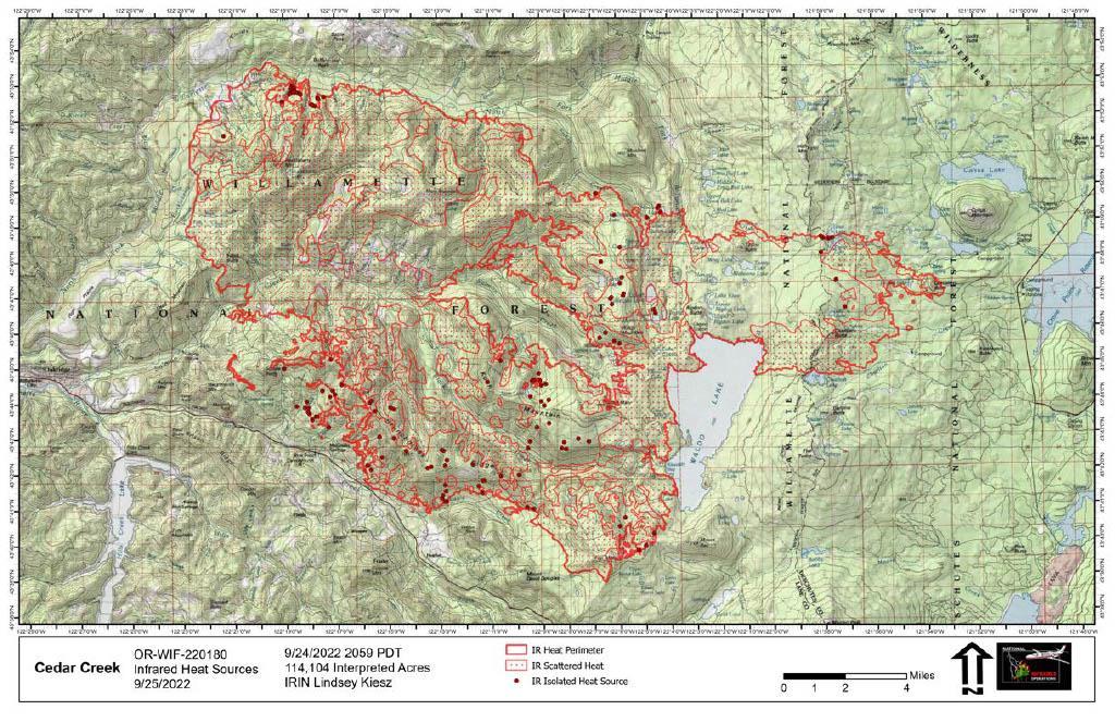
Cedar Creek Fire Infrared on Topography Map for Monday, Sept 26, 2022.