U.S. flag

An official website of the United States government

Here's how you know

Incident Media Maps

Zoom to your location
Reset map zoom and position

Could not determine your location.

Crockets Knob Fire

Share this incident

Unit Information

431 Patterson Bridge Rd 
John Day, 
Oregon 
97845 
431 Patterson Bridge Rd 
John Day, 
Oregon 
97845 

Incident Contacts

  • Phone:
    541-575-3000

Maps Gallery

Image options: [ Full Size ] -
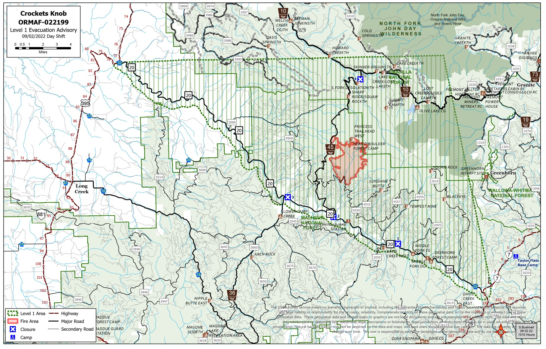
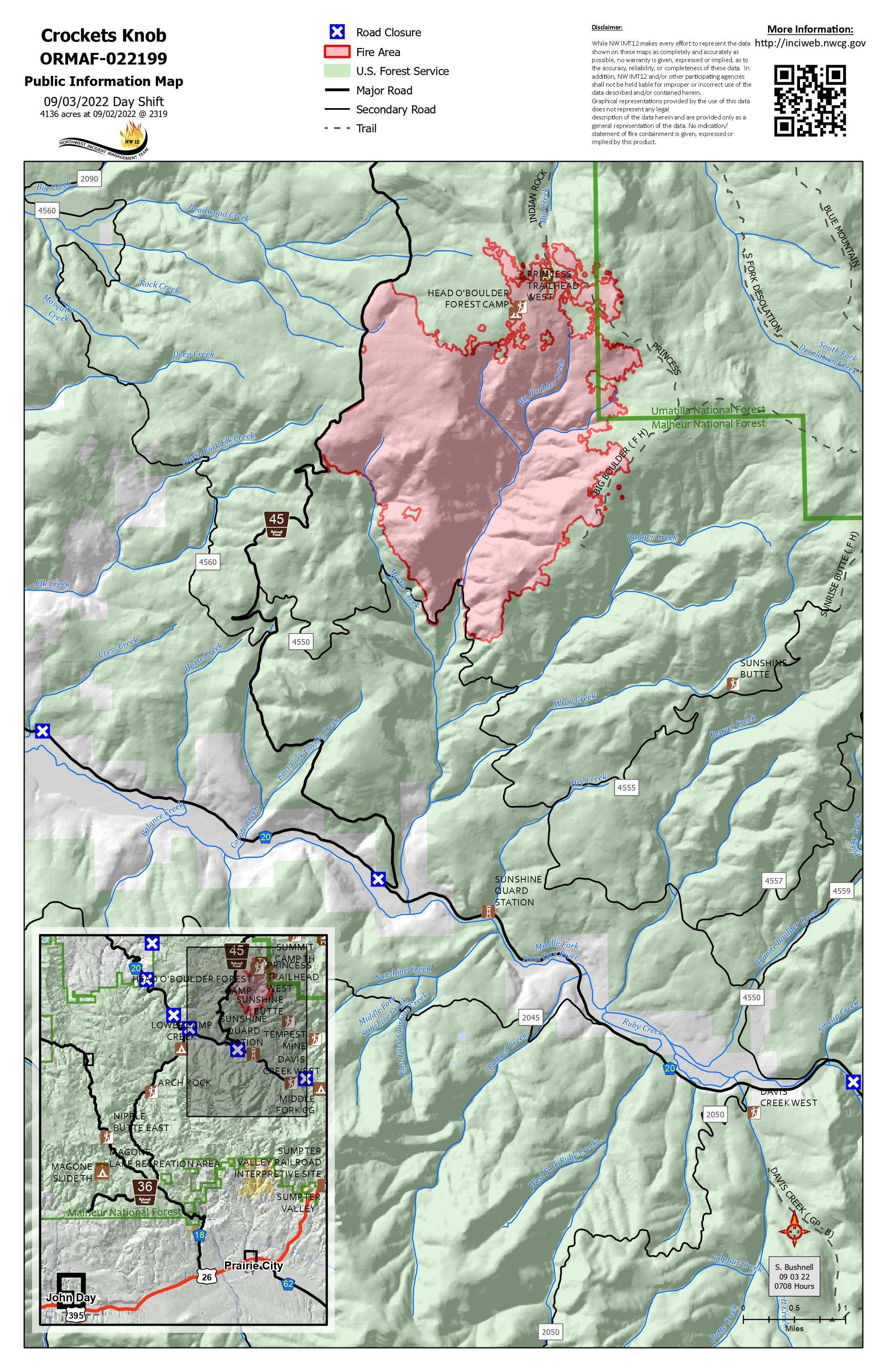
Crockets Knob Fire Map 9/3/2022

Image options: [ Full Size ] -

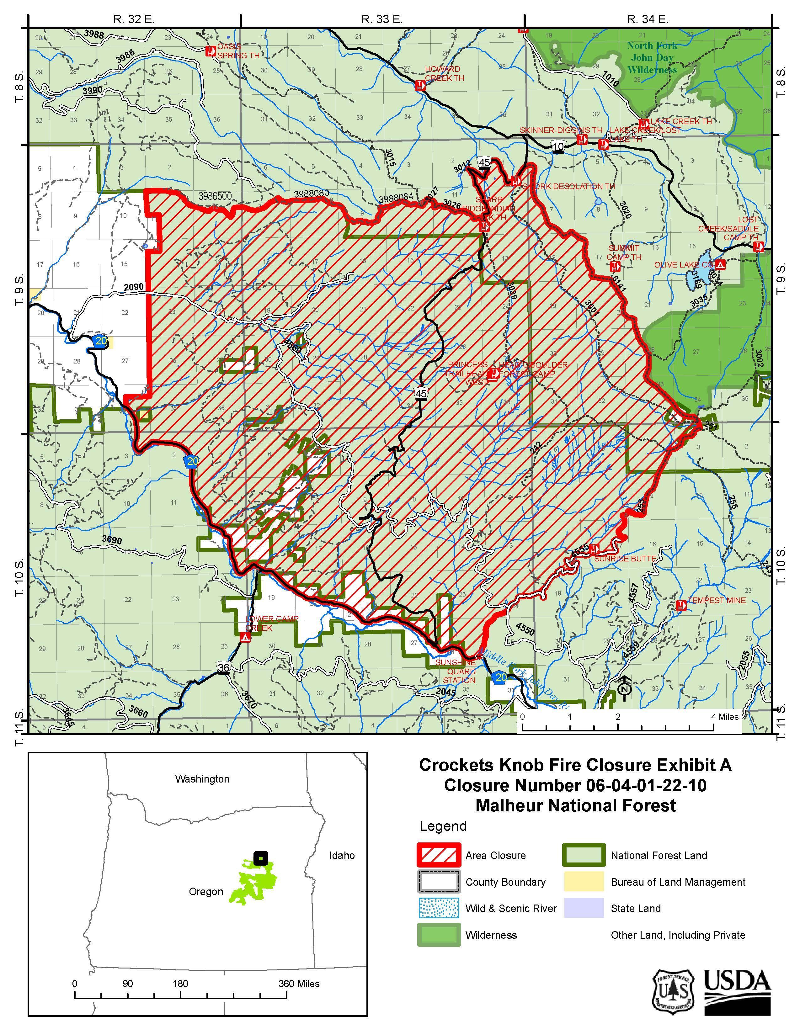
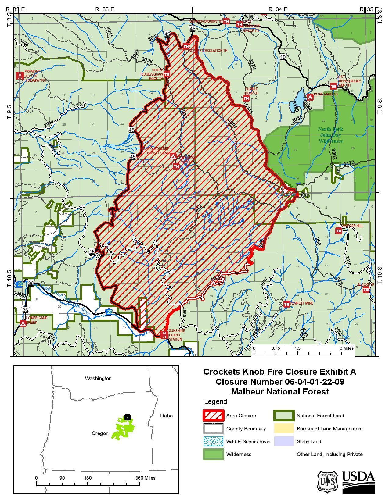
Malheur & Umatilla National Forest Closure Map

Image options: [ Full Size ] -

Grant County Emergency Manager released an Evacuation Map for Level one (Ready Status)

Image options: [ Full Size ] -

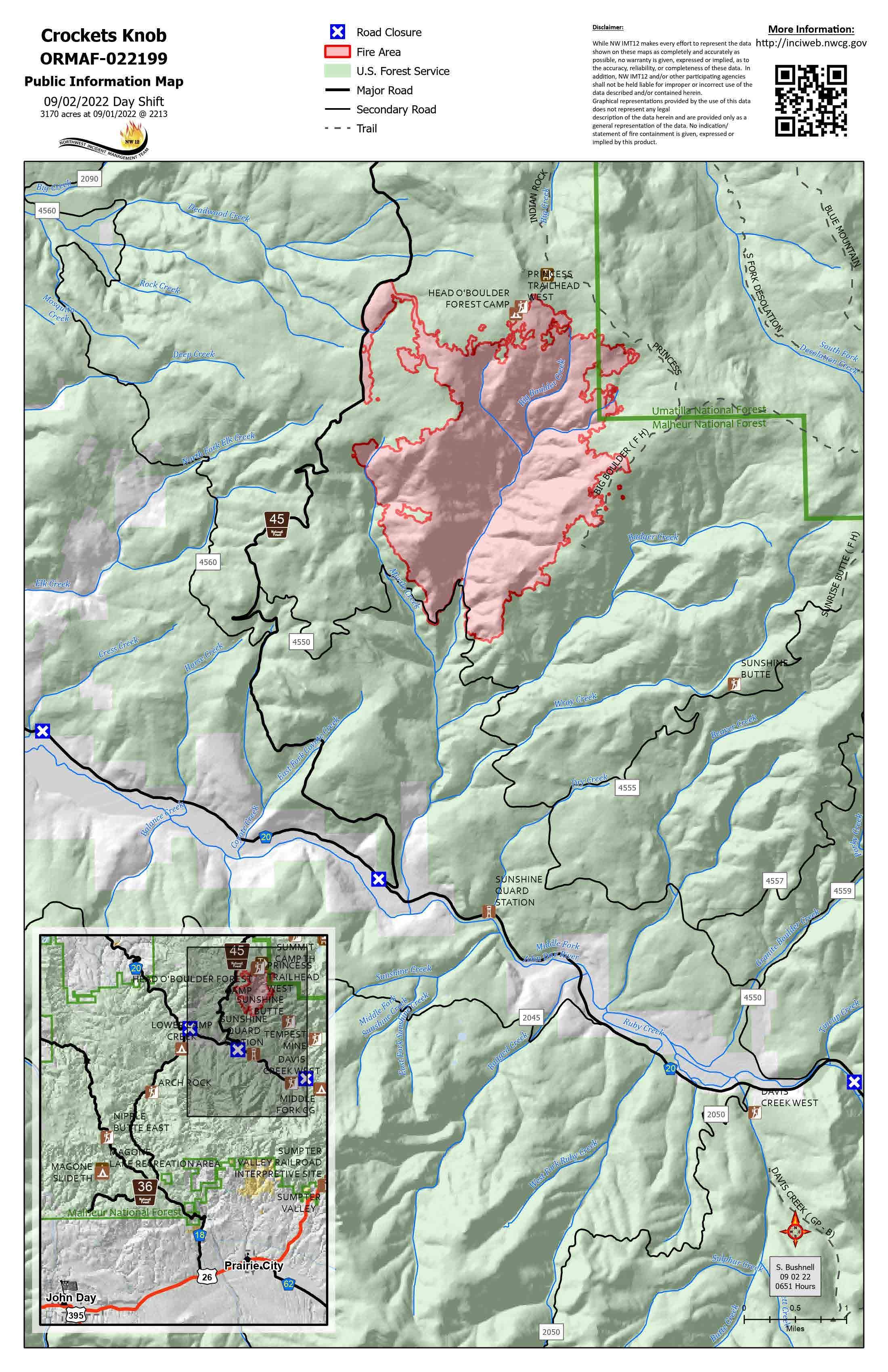
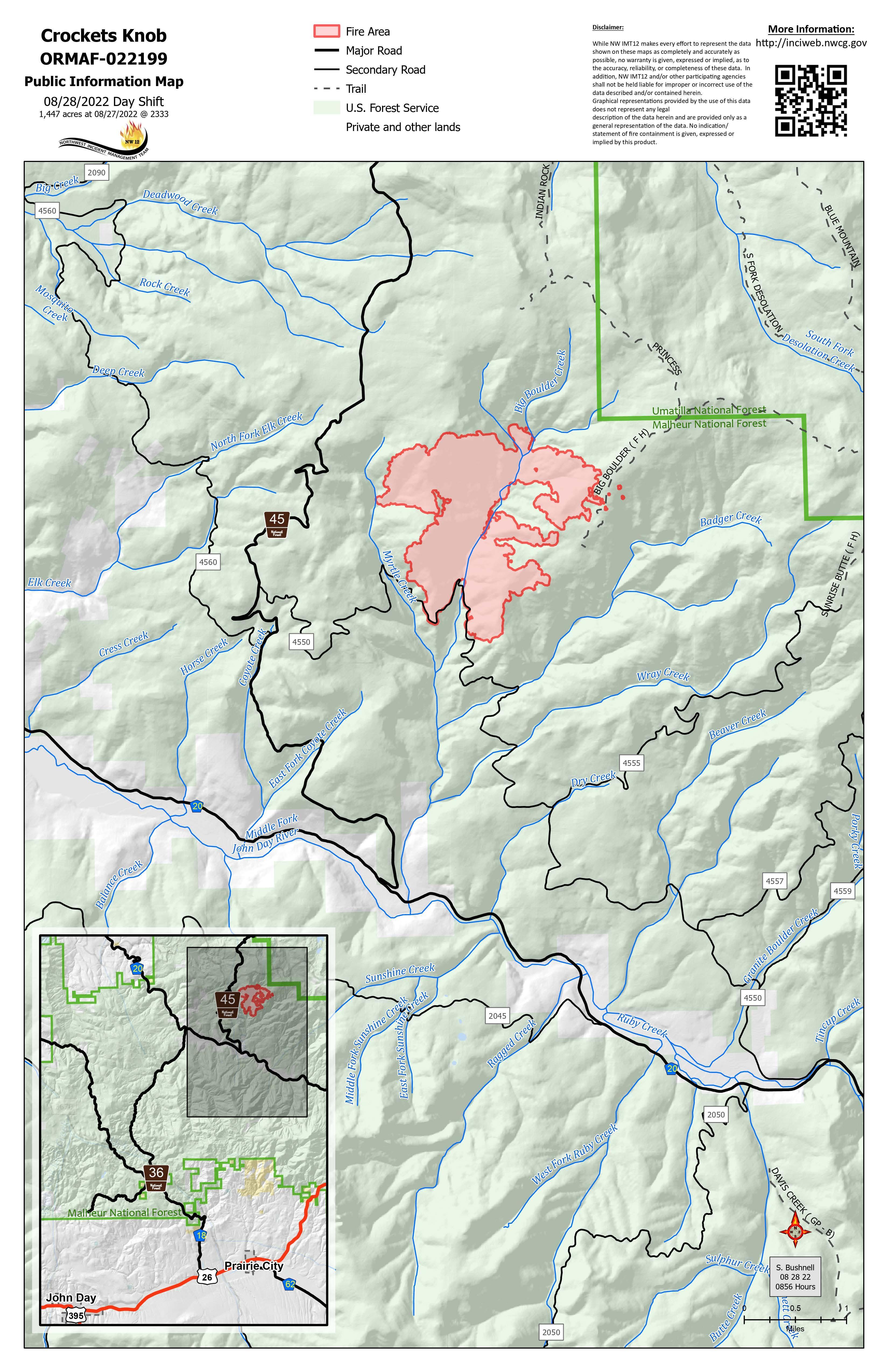
Crockets Knob Fire Map 9/2/2022

Image options: [ Full Size ] -

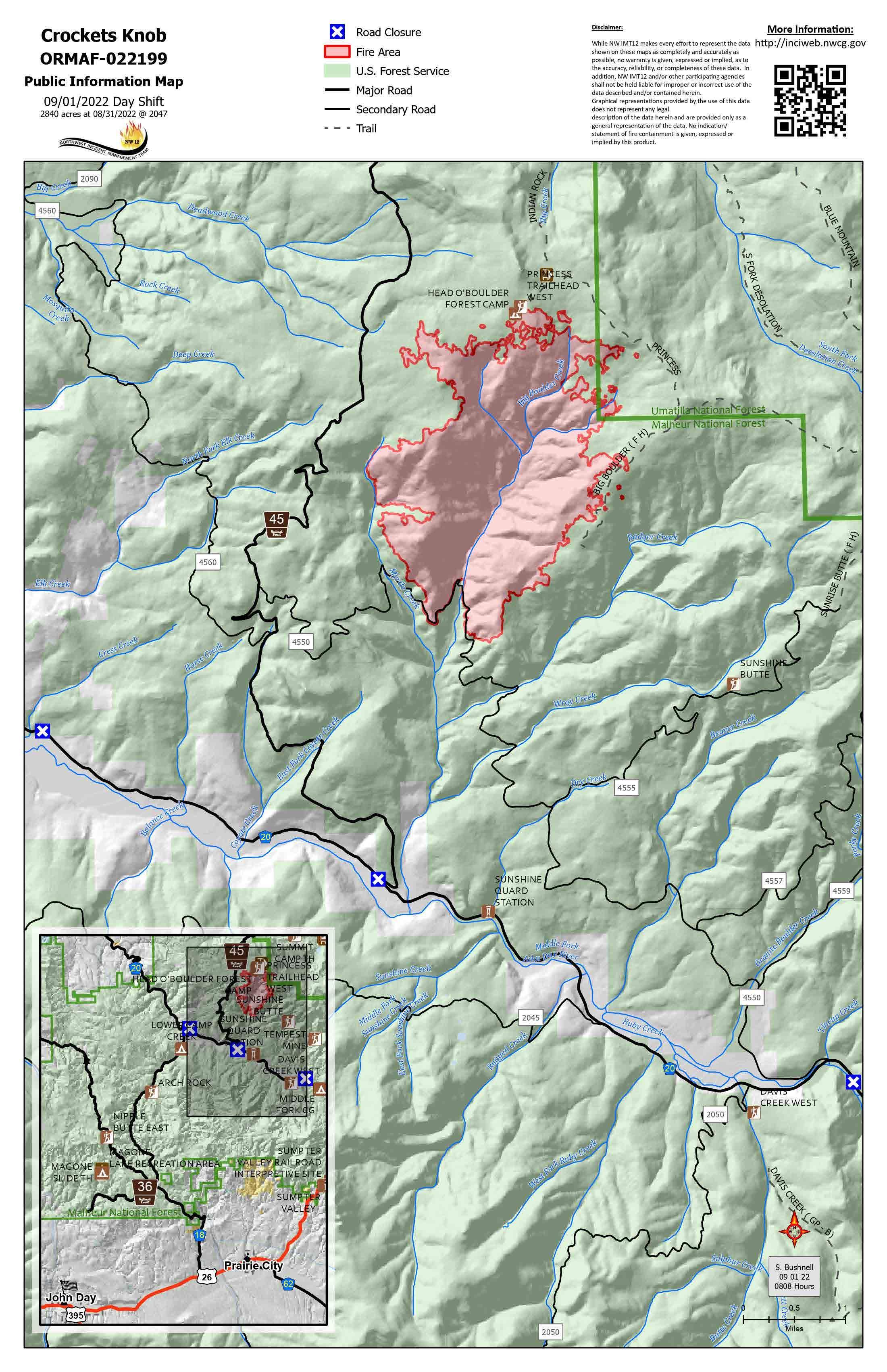
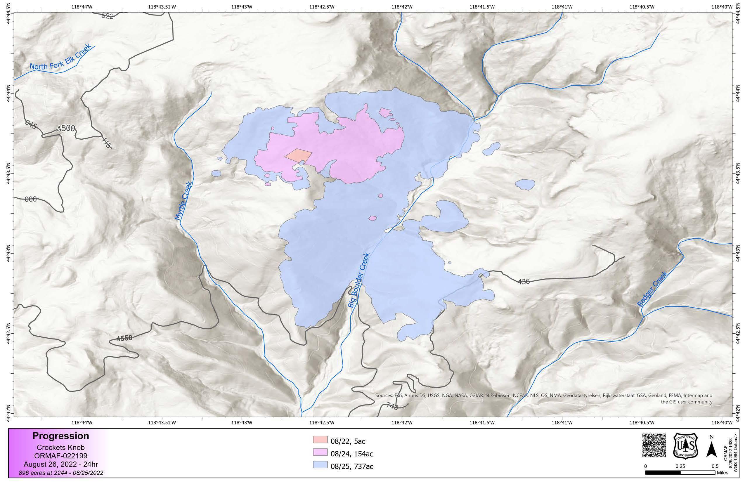
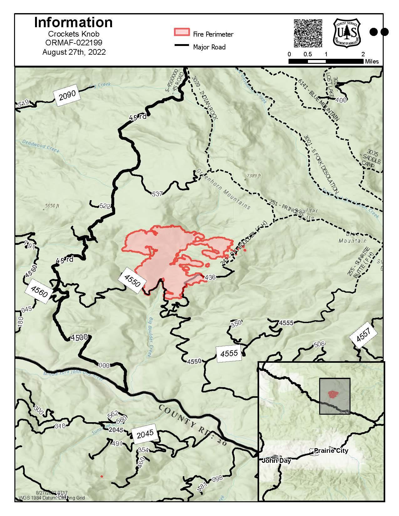
Crockets Knob Fire Map 9/1/2022

Image options: [ Full Size ] -

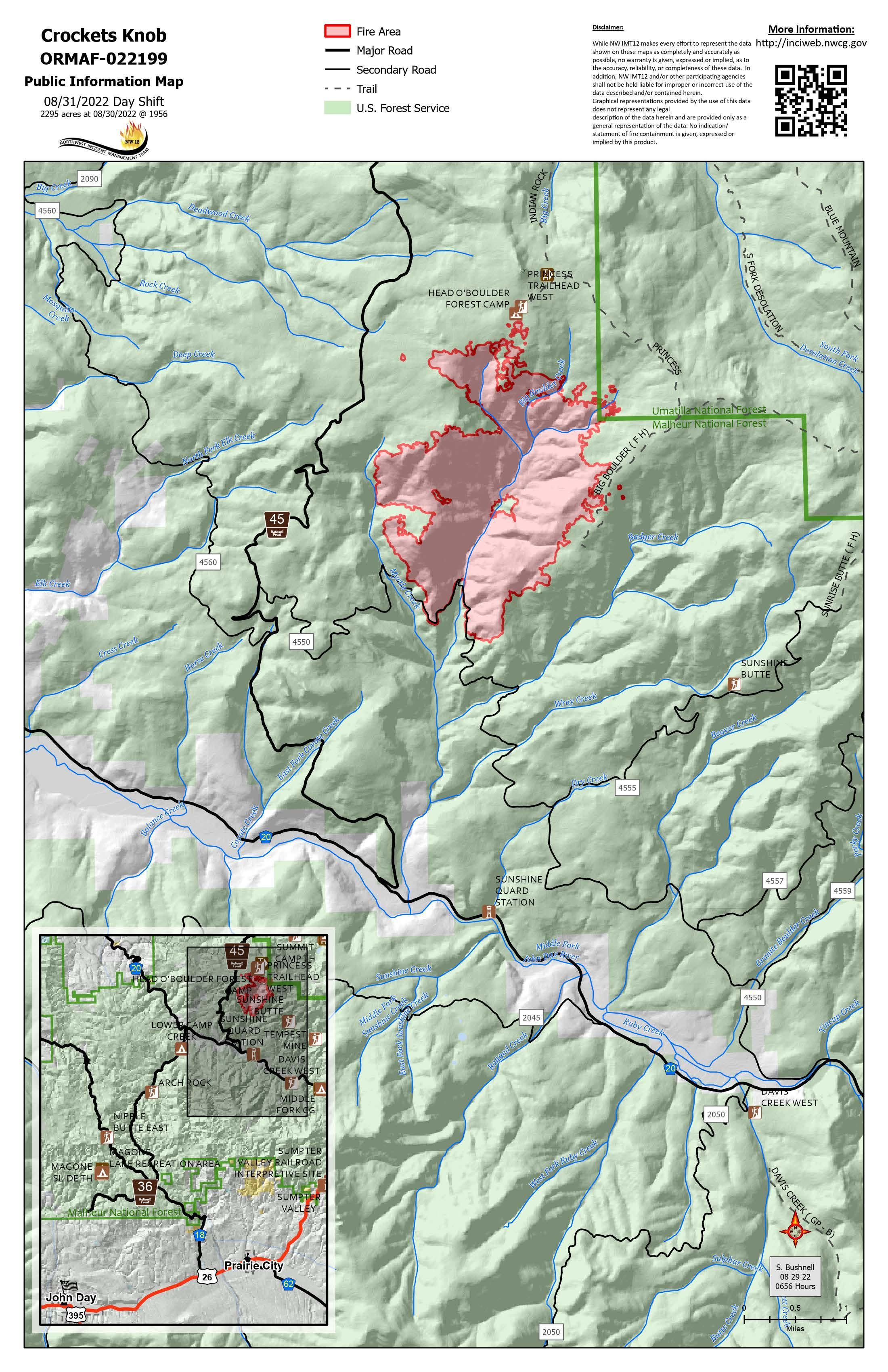
Crockets Knob Fire Map 8/31/2022

Image options: [ Full Size ] -

Image options: [ Full Size ] -

Image options: [ Full Size ] -

Image options: [ Full Size ] -

Image options: [ Full Size ] -

Image options: [ Full Size ] -