Incident Media Maps
Could not determine your location.
 Wildfire
 Prescribed Fire
 Burned Area
Response
Burned Area
Response Other
Other
Maps Gallery
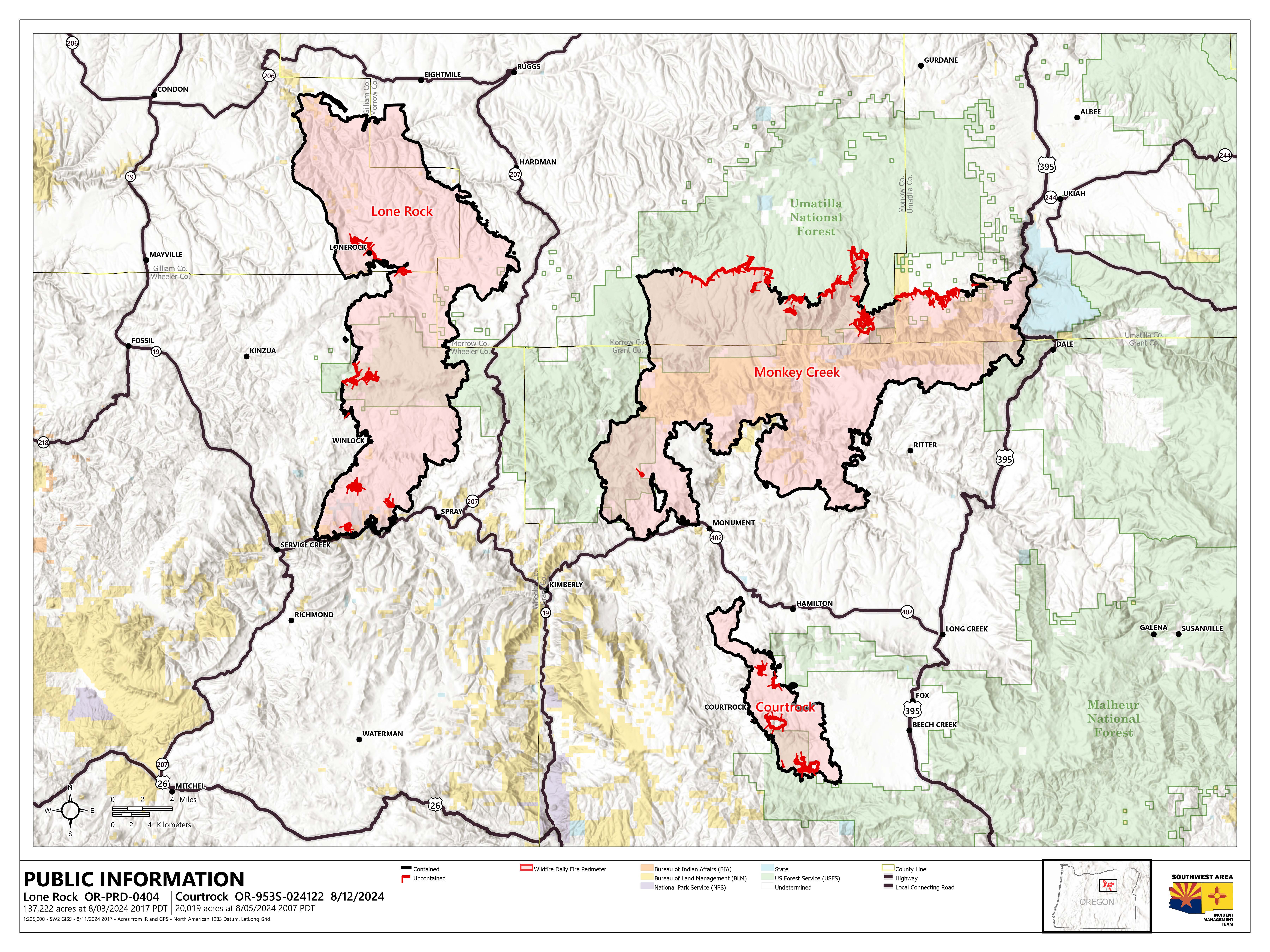
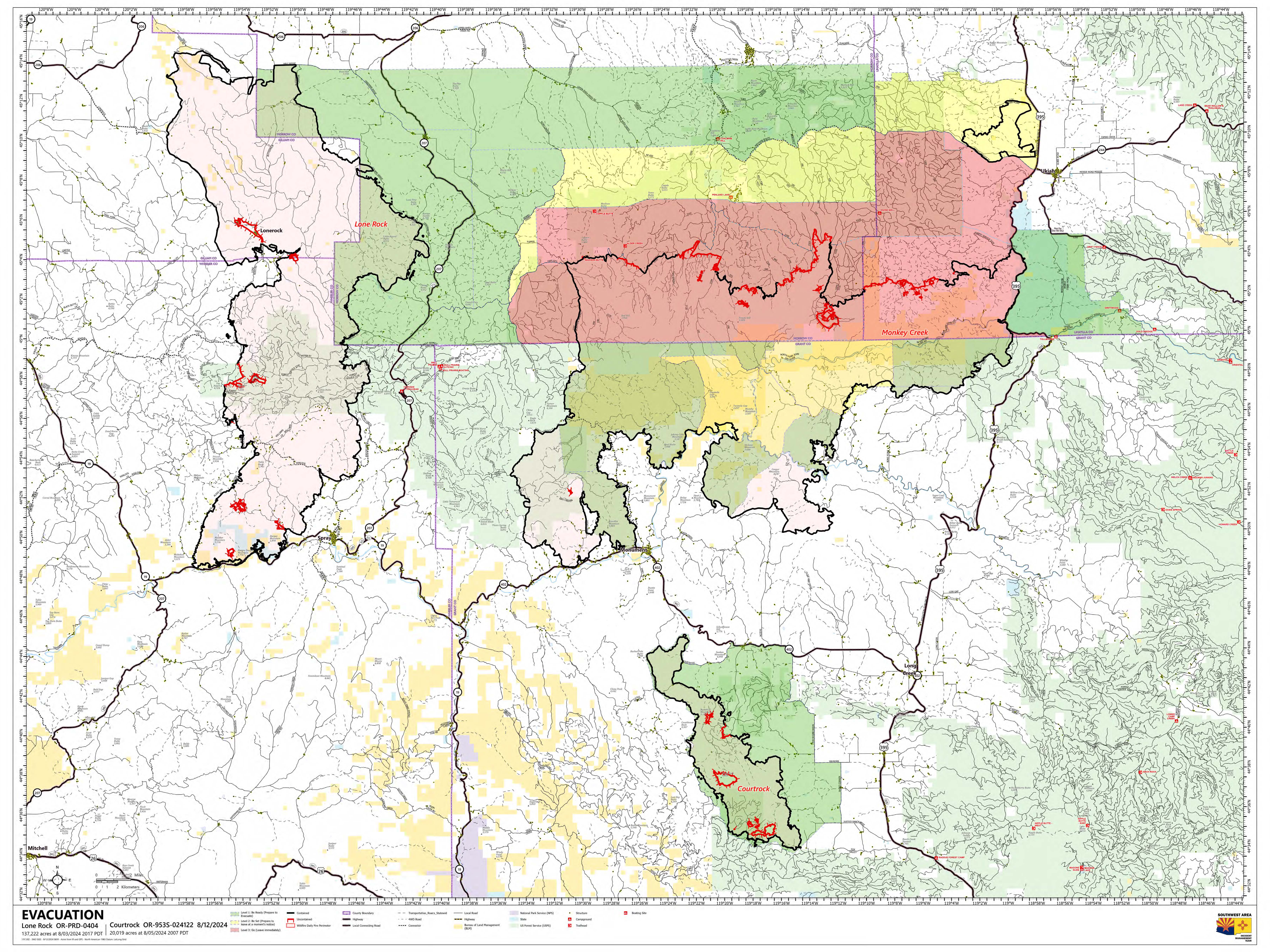

Evacuation Map for the areas surrounding and including the Courtrock Fire. All Level 3 evacuations have been removed. The majority of the fire area is at a Level 2 (Set) with a small portion in the northern area of the fire at a Level 1 (Ready) and another southern portion downgraded out of evacuations as of this publication on Sunday, August 11, 2024.
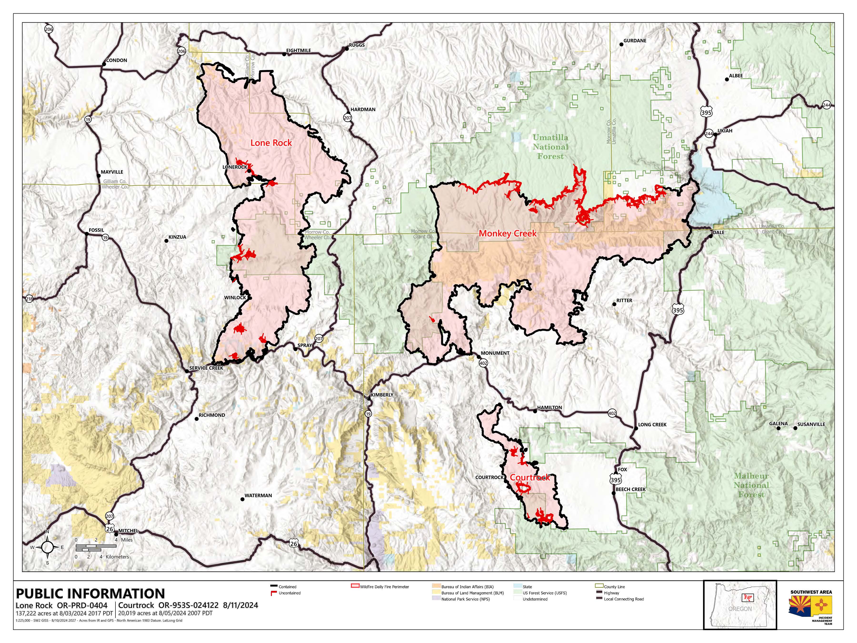
Evacuation Map for the areas surrounding and including the Courtrock Fire. All Level 3 evacuations have been removed. The majority of the fire area is now at a Level 2 (Set) with a small portion in the northern area of the fire at a Level 1 (Be Ready). A small portion of the fire has been downgraded out of evacuation. These updates are as of time of this publication on Saturday, August 10, 2024.


Evacuation Map for the areas surrounding and including the Courtrock Fire. All Level 3 evacuations have been removed. The majority of the fire area is in a Level 2 (set) and a small portion in the northern area of the fire is at a Level 1 (ready) level as of this publication on Thursday, August 8, 2024.

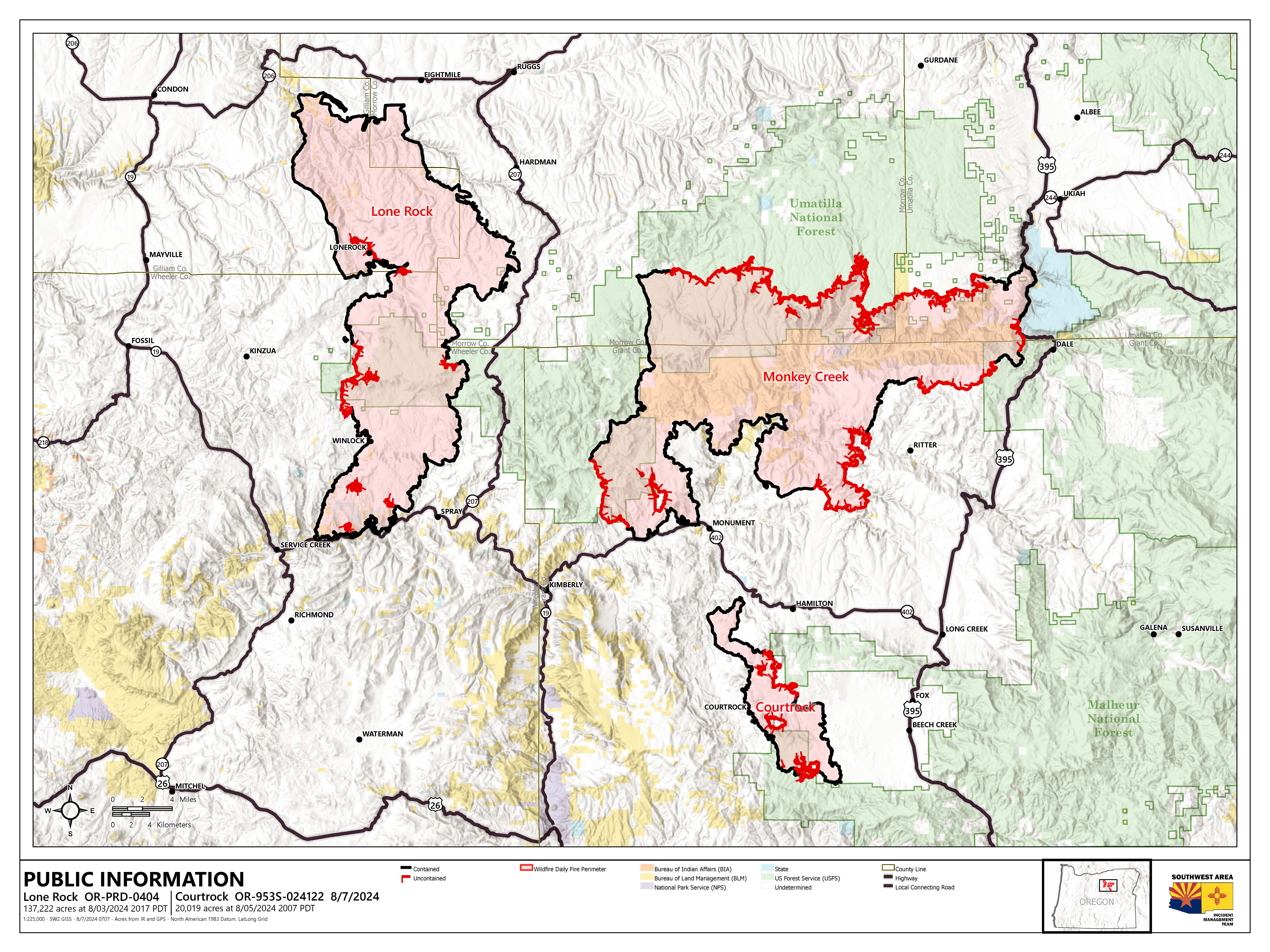
Evacuation Map for the areas surrounding and including the Courtrock Fire. The Courtrock Fire is in mostly at a Level 2 with the northern area of the fire and areas west of the fire perimeter being downgraded to a Level 1 as of this publication on Wednesday, August 7, 2024