
Incident Media Maps
Settings - change map background and toggle additional layers
Filter - control incident types displayed on map.
Zoom to your location
Reset map zoom and position
Could not determine your location.
Show Legend
 Wildfire
 Prescribed Fire
 Burned Area
Response
Burned Area
Response Other
Other
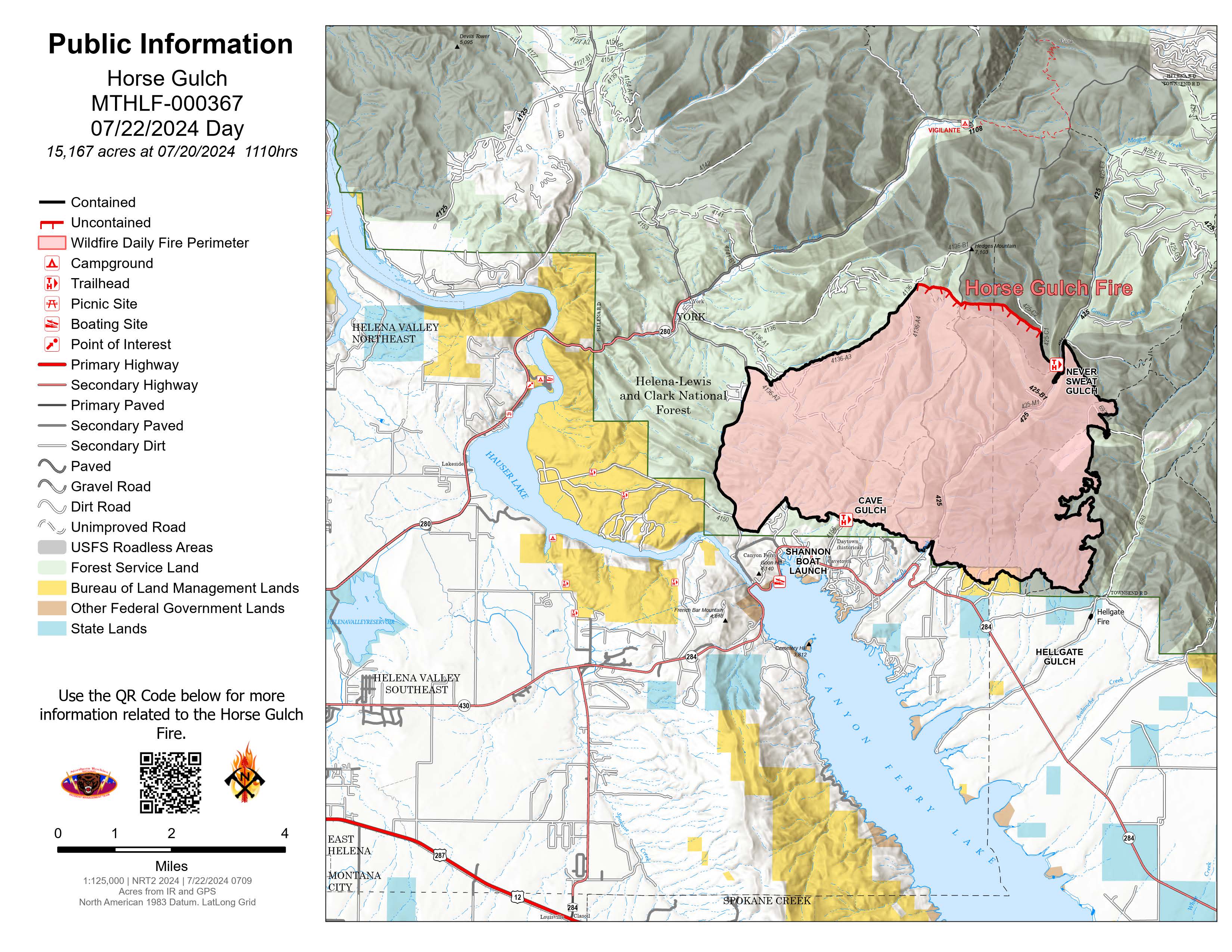
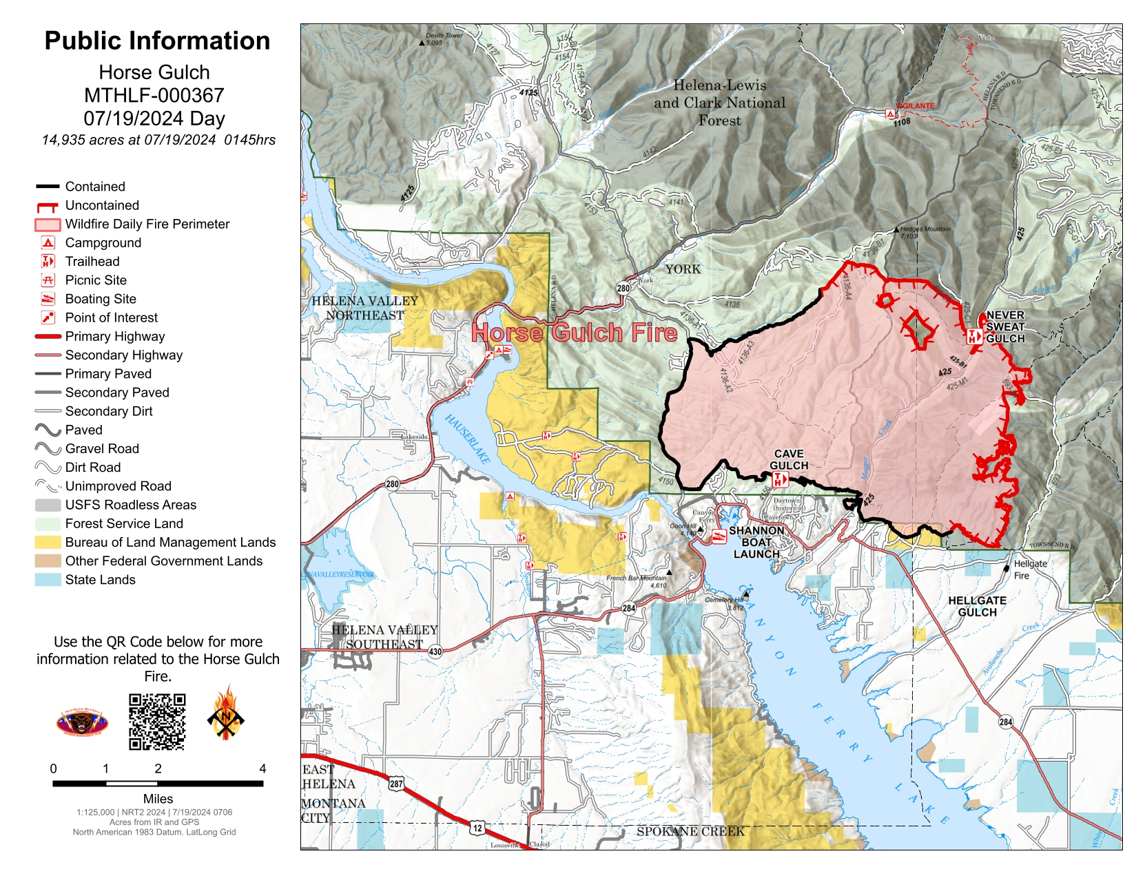
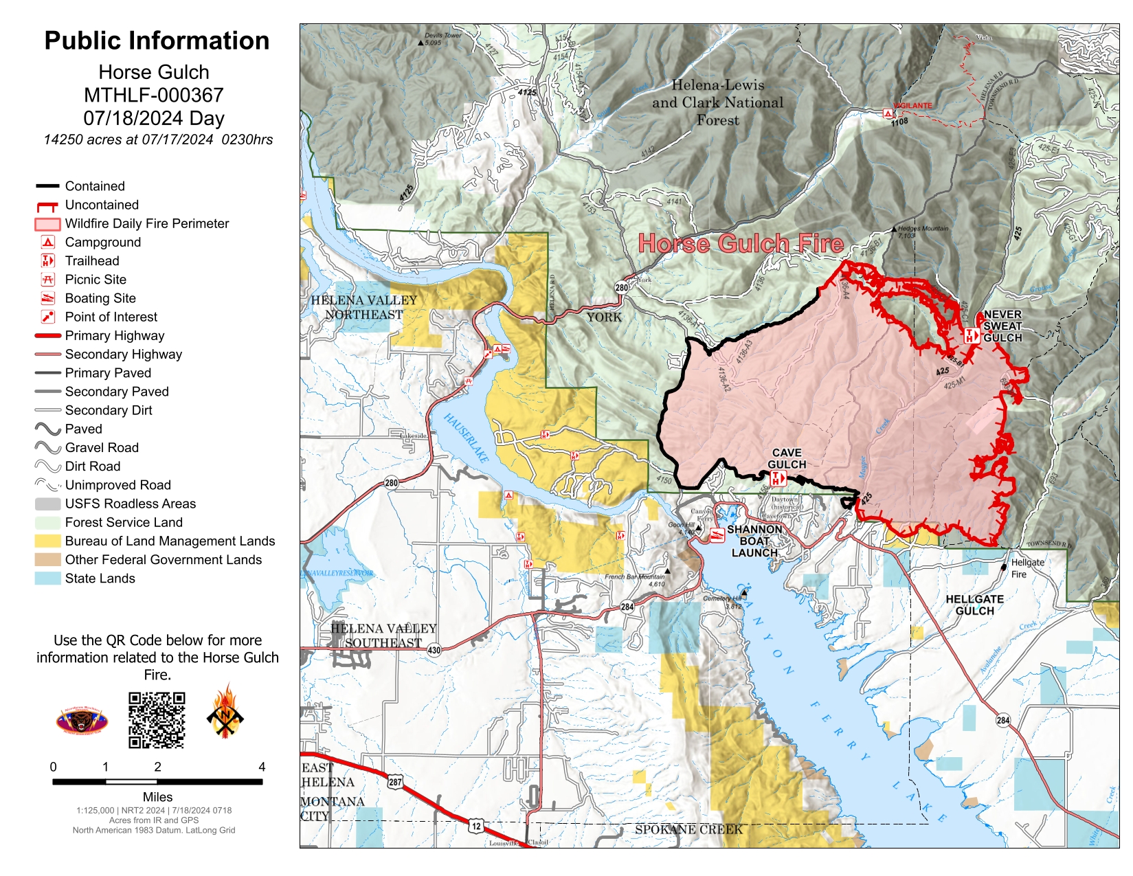
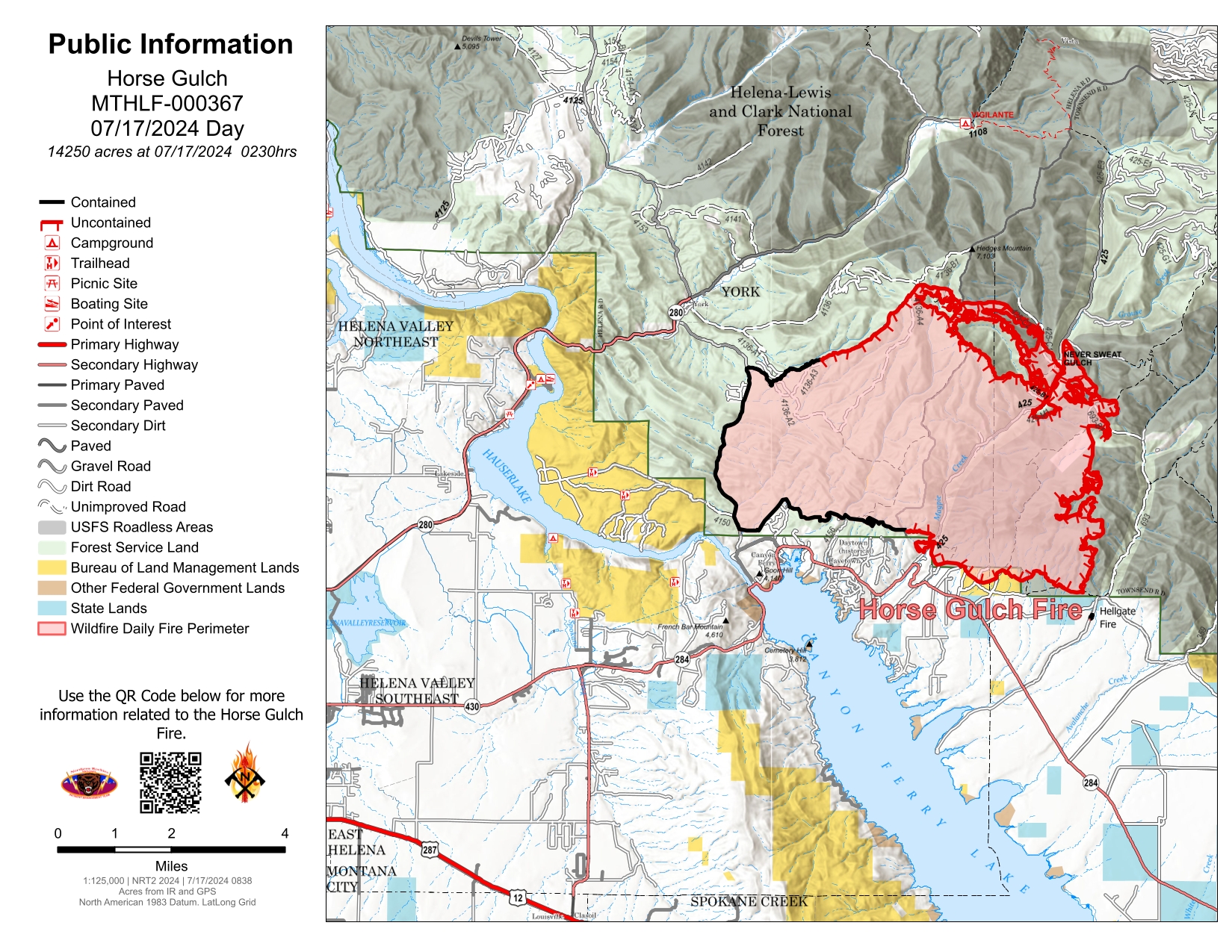
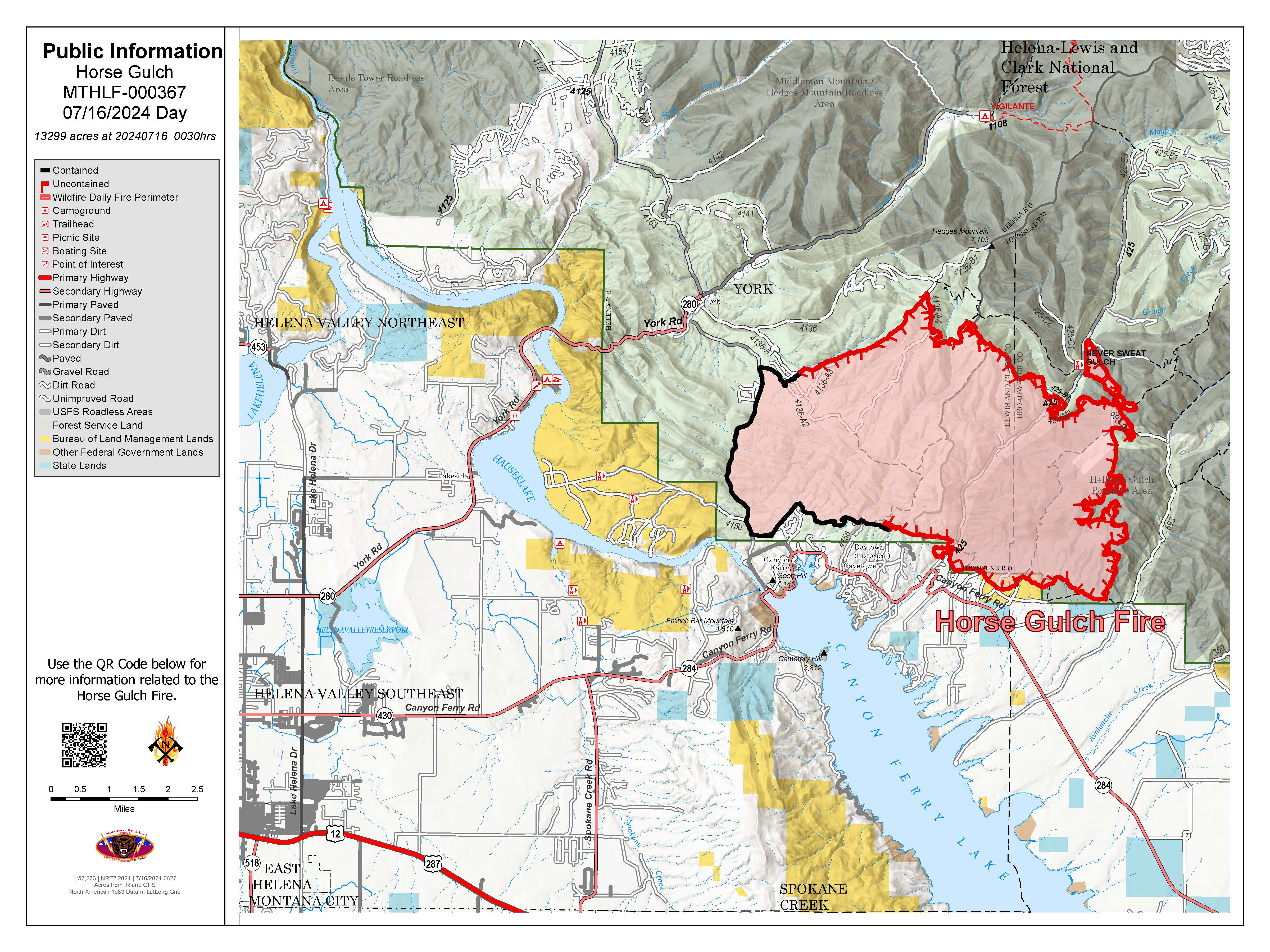
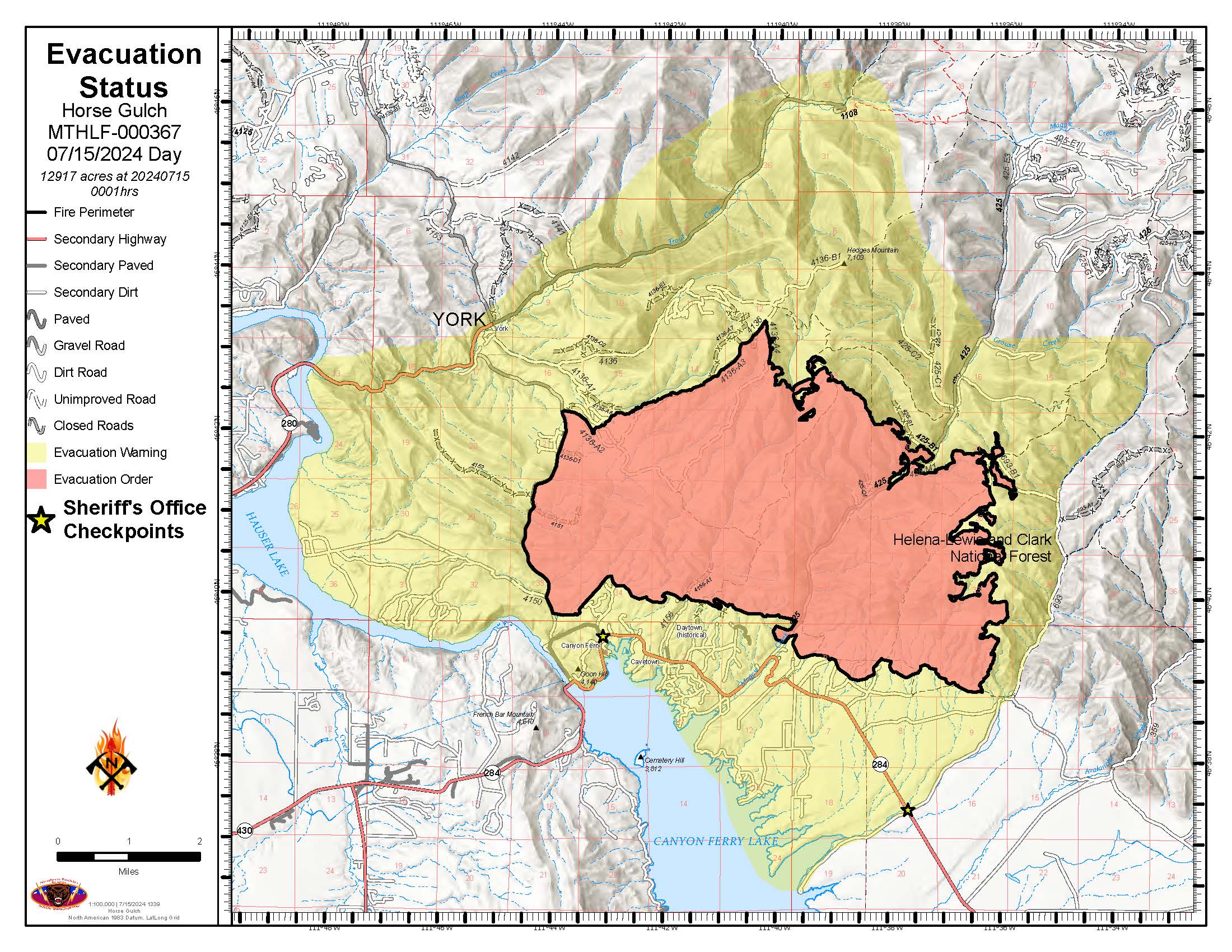
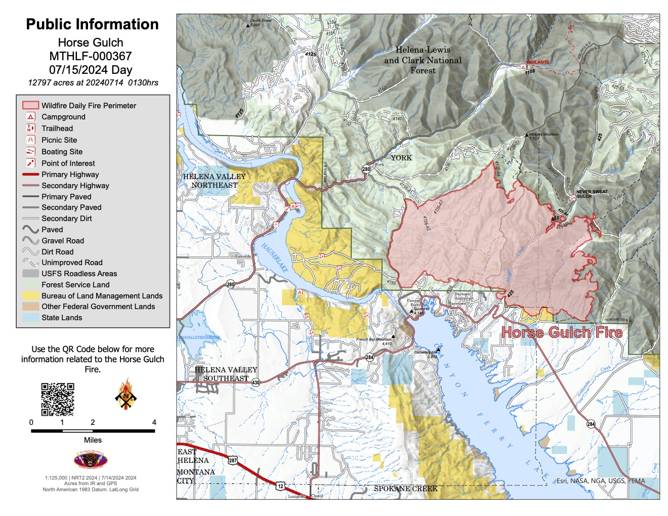
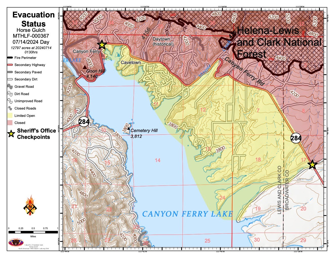
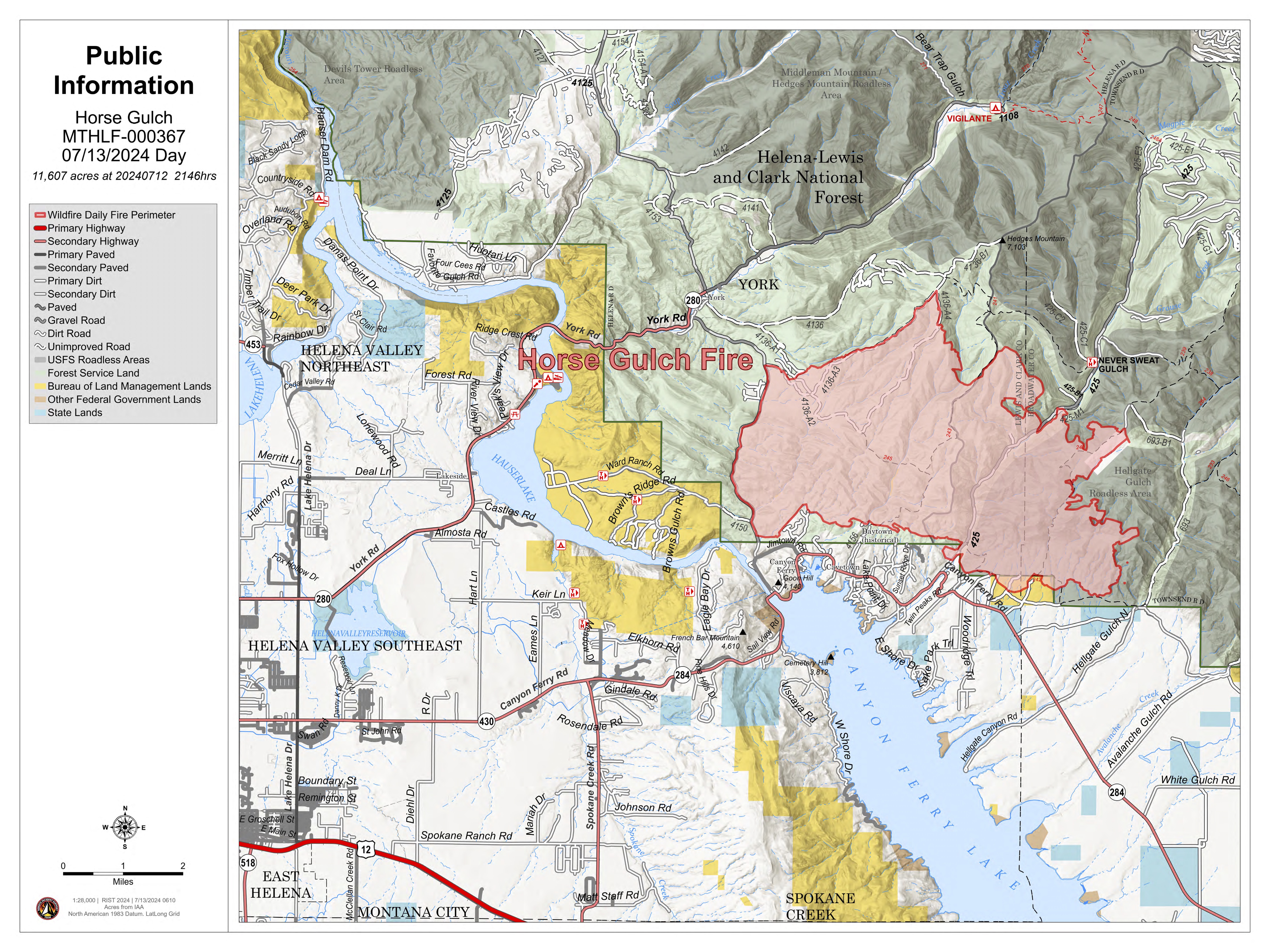
Horse Gulch Fire
Unit Information
Incident Contacts
- Fire InformationEmail:Phone:406-924-3858
- Media Phone LinePhone:406-594-6497Hours:7:00am to 7:00pm
Maps Gallery

[
PDF
]
Horse Gulch Fire July 12 Afternoon Updated Public Information Map with features and fire perimeter.