
Incident Media Maps
Could not determine your location.
 Wildfire
 Prescribed Fire
 Burned Area
Response
Burned Area
Response Other
Other
Summit Lake
Unit Information
Agency Name: U.S. Forest Service
Agency Name: U.S. Forest Service
Incident Contacts
Maps Gallery
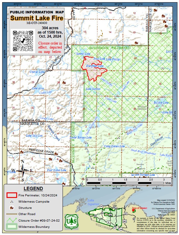
Public Information map for the Summit Lake Fire as October 24, 2024. This map provides the perimeter of the fire as well as the closure area for the McCormick Wilderness. The fire perimeter encompasses an estimated 304 acres. The fire perimeter was mapped using heat-detecting infra-red videography.
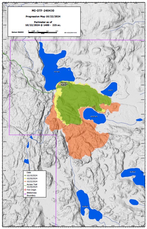
This map depicts growth of the Summit Lake Fire between October 20 and October 22, 2024. The majority of fire growth occurred during the day of October 22 which was characterized by unusually warm temperatures and gusty winds. The fire has since been moderated by intermittent rain and cooler temperatures.