U.S. flag

An official website of the United States government

Here's how you know

Incident Media Maps

Zoom to your location
Reset map zoom and position

Could not determine your location.

Lava Fire

Unit Information

1249 S. Vinnell Way 
Boise, 
Idaho 
83709 
1249 S. Vinnell Way 
Boise, 
Idaho 
83709 

Incident Contacts

  • Email:
    SM.FS.boise_inbox@usda.gov
    Phone:
    208-384-3266

Maps Gallery

Image options: [ Full Size ] - [ PDF ]

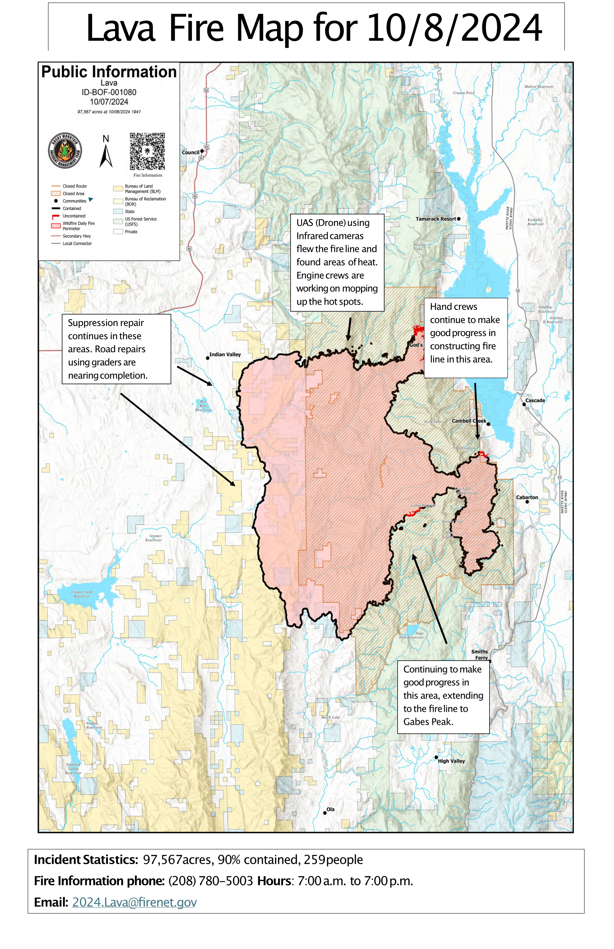
October 8 Public Information Call-Out Map

Image options: [ Full Size ] - [ PDF ]

Image options: [ Full Size ] - [ PDF ]

Image options: [ Full Size ] - [ PDF ]


[ PDF ]

Image options: [ Full Size ] -

Image options: [ Full Size ] - [ PDF ]

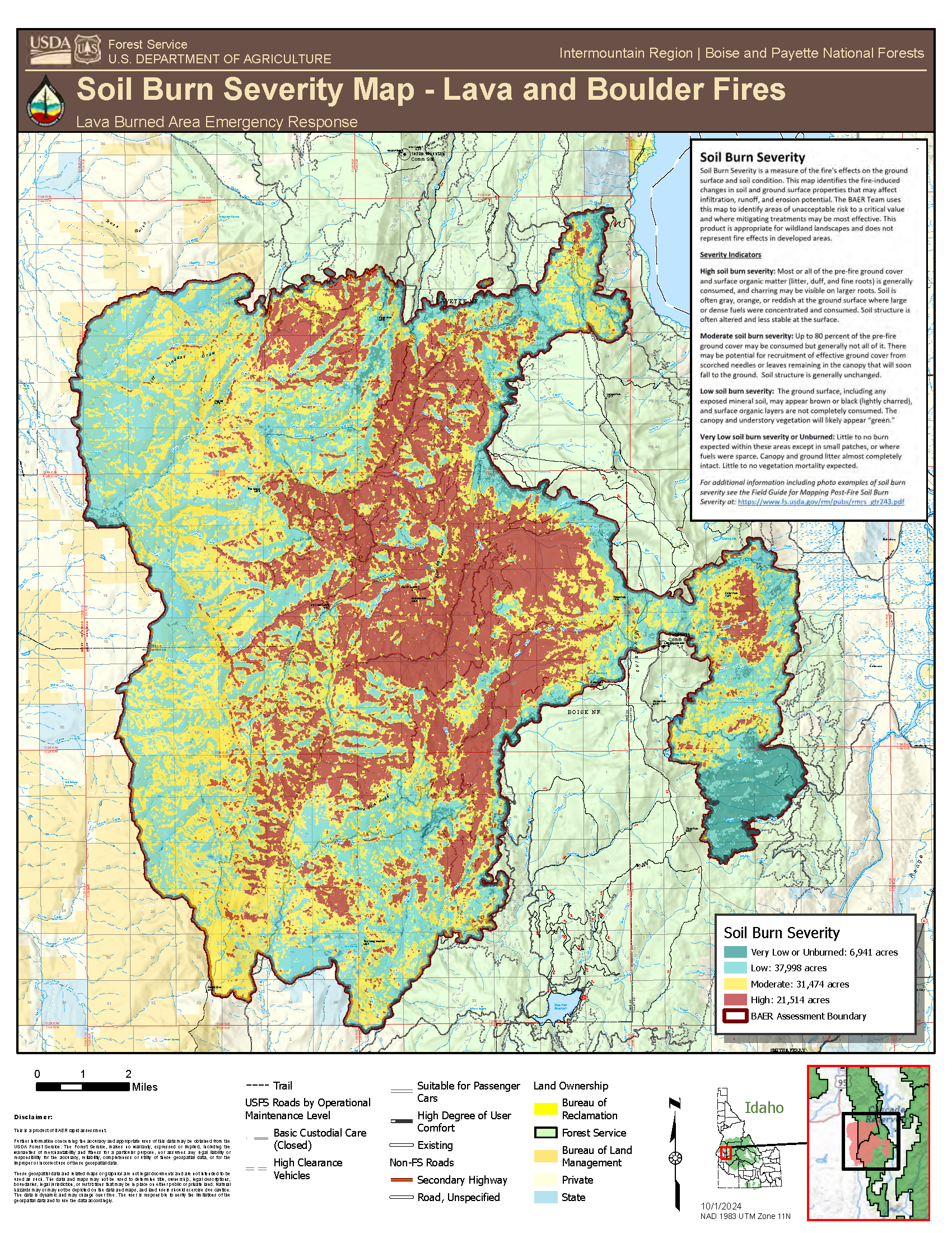
Map of lava fire displaying severity of fire impacts on soils. Red is highest severity, then orange, then yellow, then green, and lowest is blue.

Image options: [ Full Size ] -


Image options: [ Full Size ] - [ PDF ]

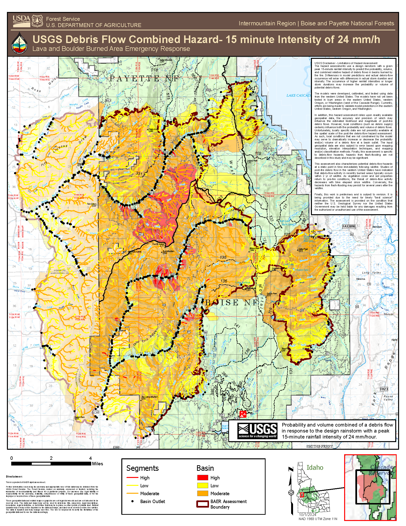
Map showing risk of debris flow under precipitation events, depending on soil burn severity, slope, and amount of precipitation.