Incident Media Maps
Settings - change map background and toggle additional layers
Filter - control incident types displayed on map.
Zoom to your location
Reset map zoom and position
Could not determine your location.
Show Legend
 Wildfire
 Prescribed Fire
 Burned Area
Response
Burned Area
Response Other
Other

Maps Gallery
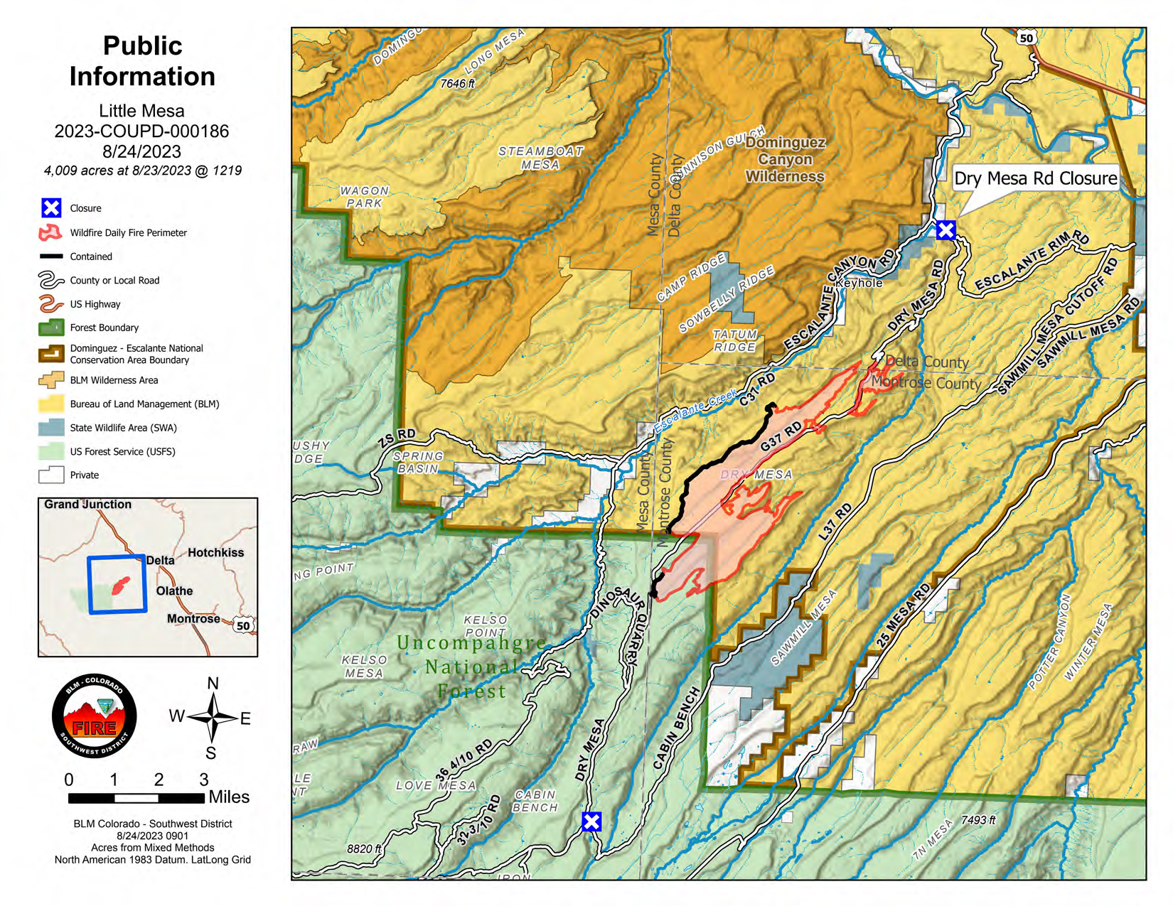


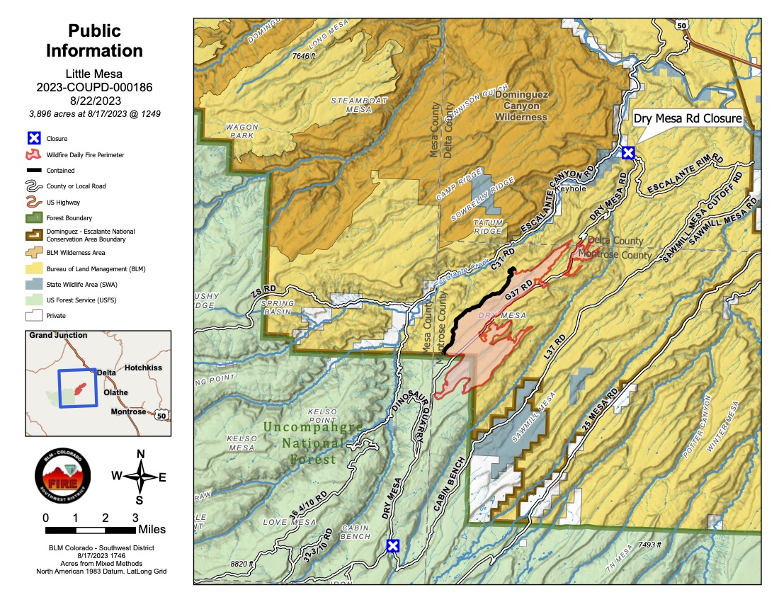
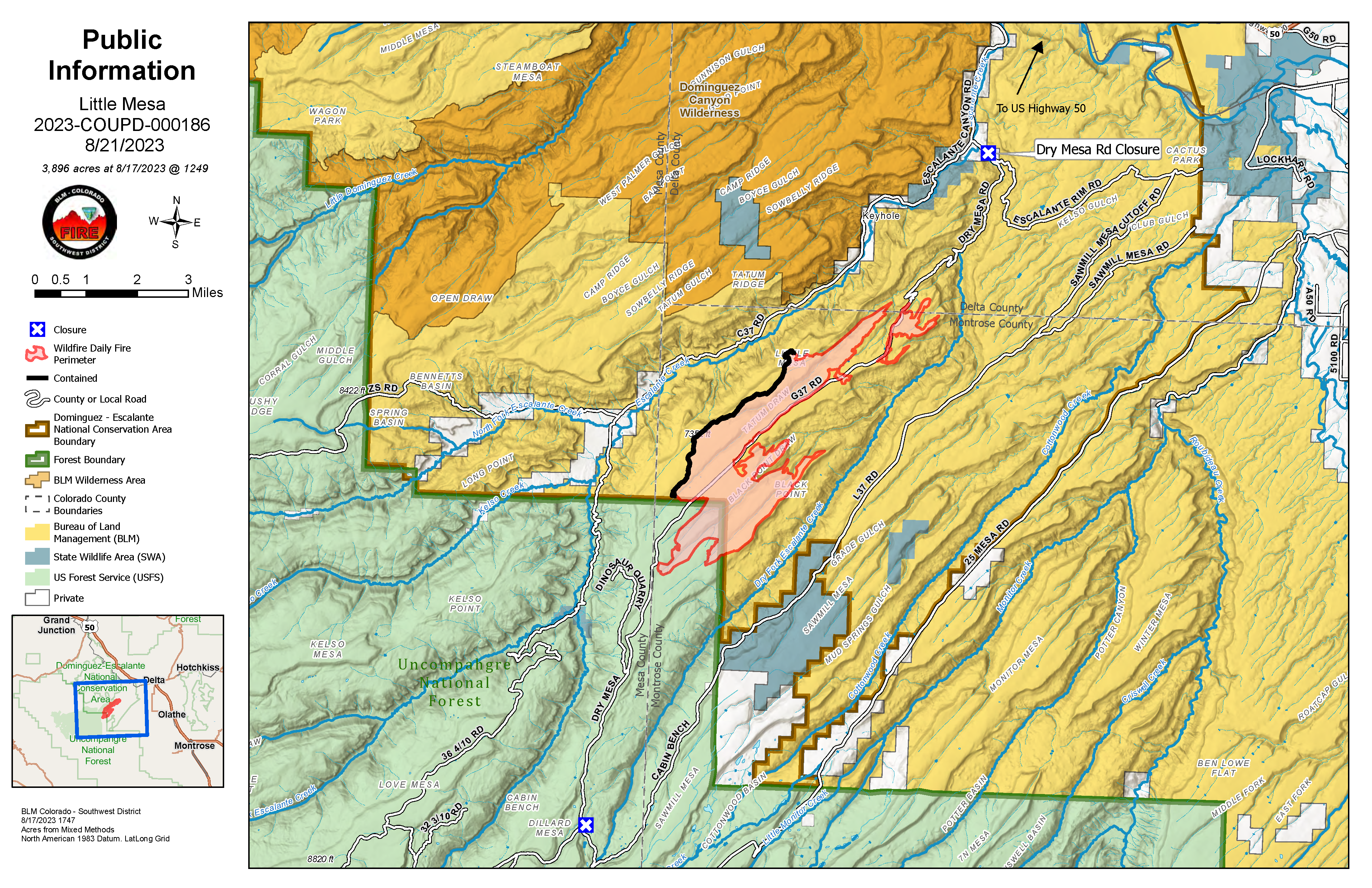


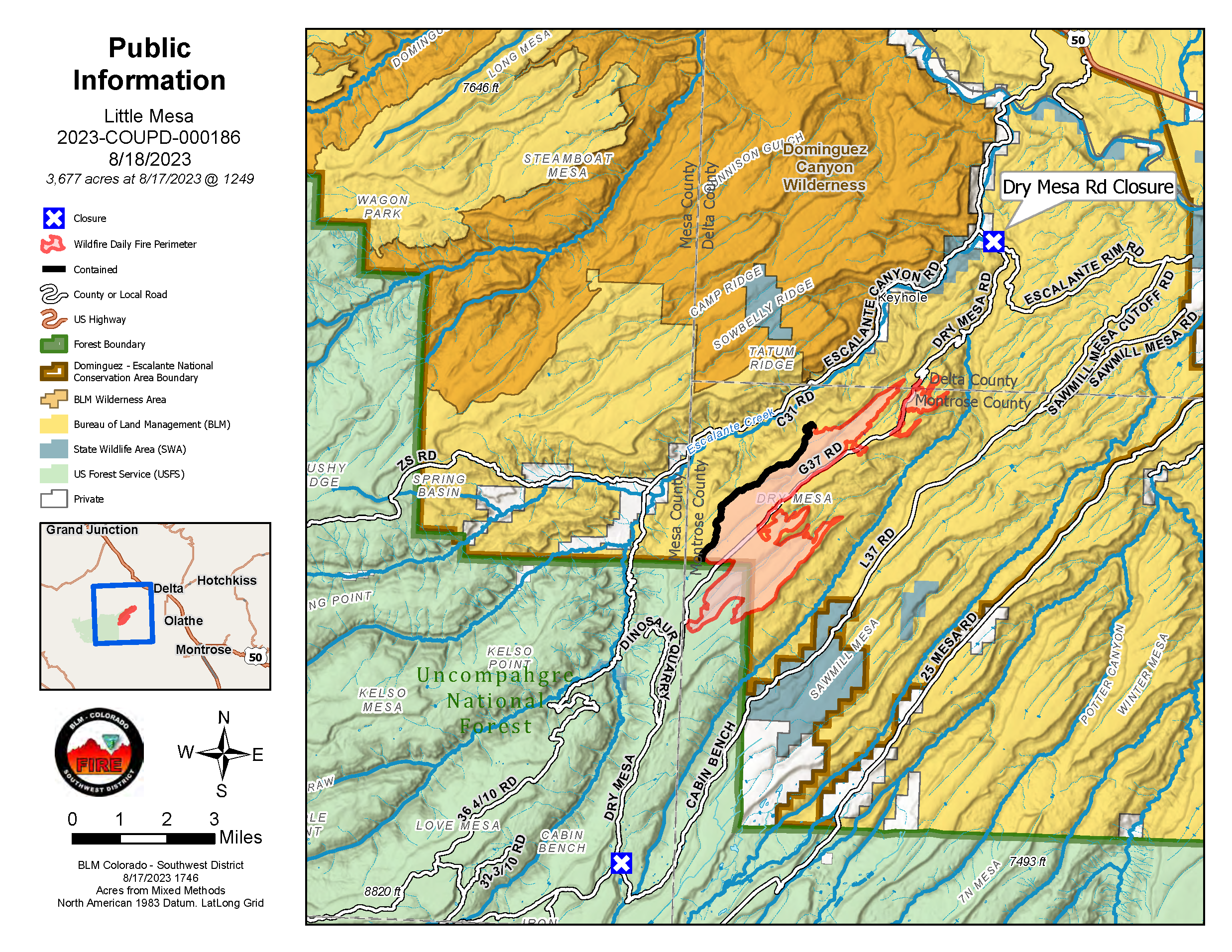

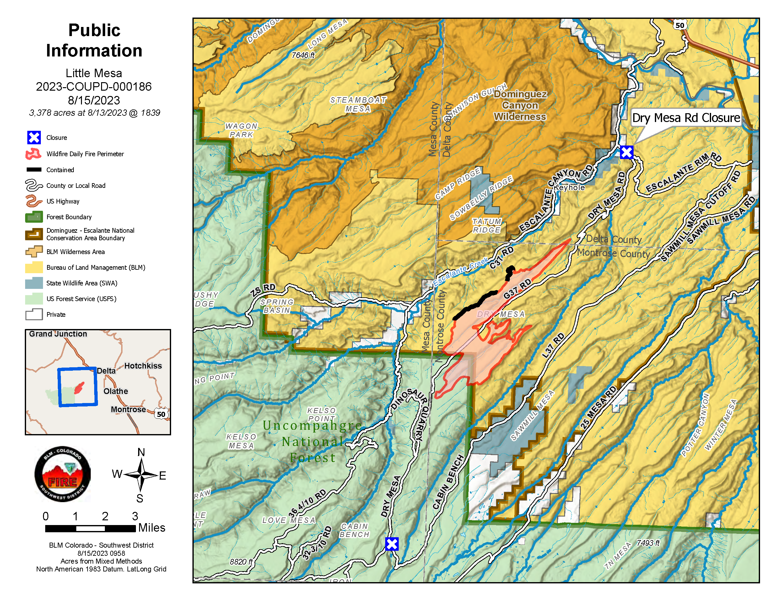
Little Mesa Fire Public Information Map showing 3,896 acres with 30% containment within the BLM Dominguez-Escalante National Conservation Area approximately 15 miles west, southwest of Delta, CO. Fire behavior was minimal after receiving precipitation earlier in the day with no growth, but due to better mapping the map shows an increase in acreage.