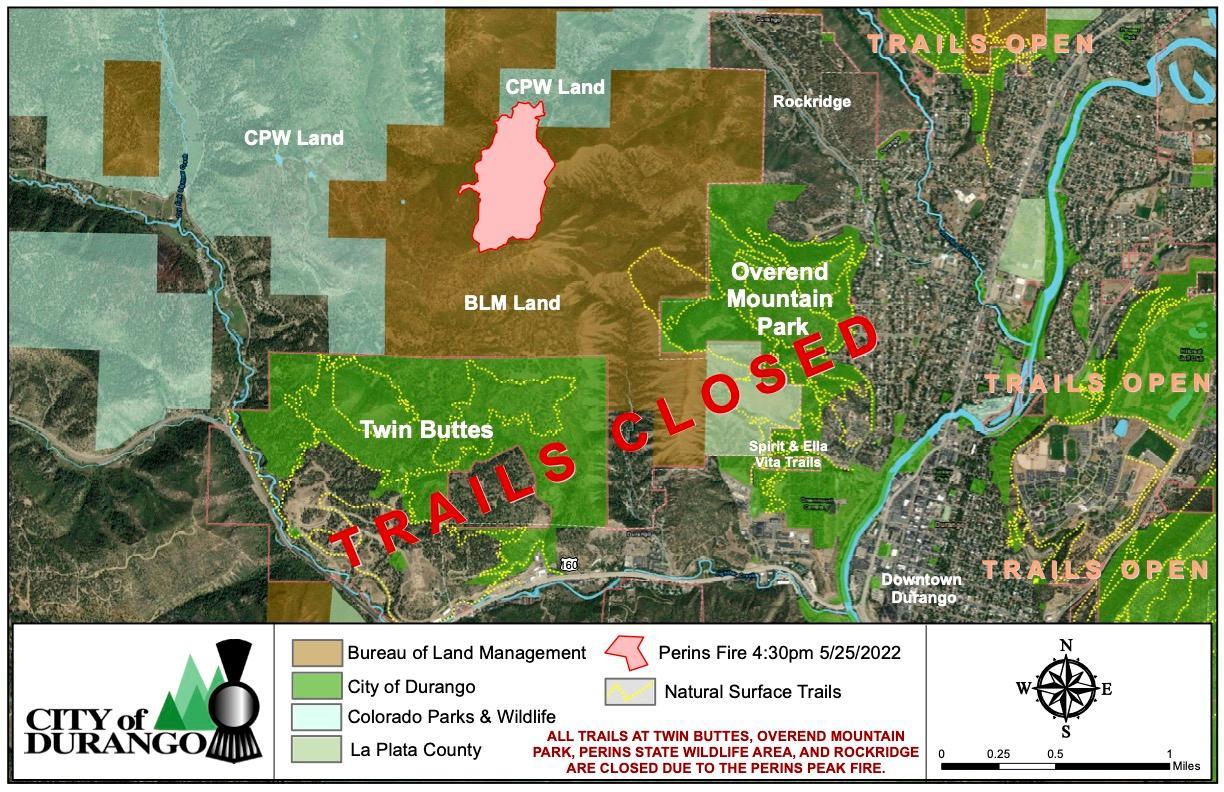
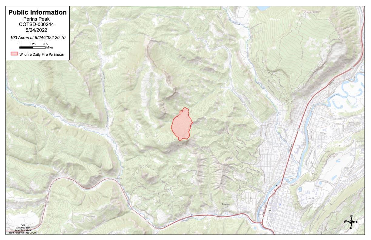
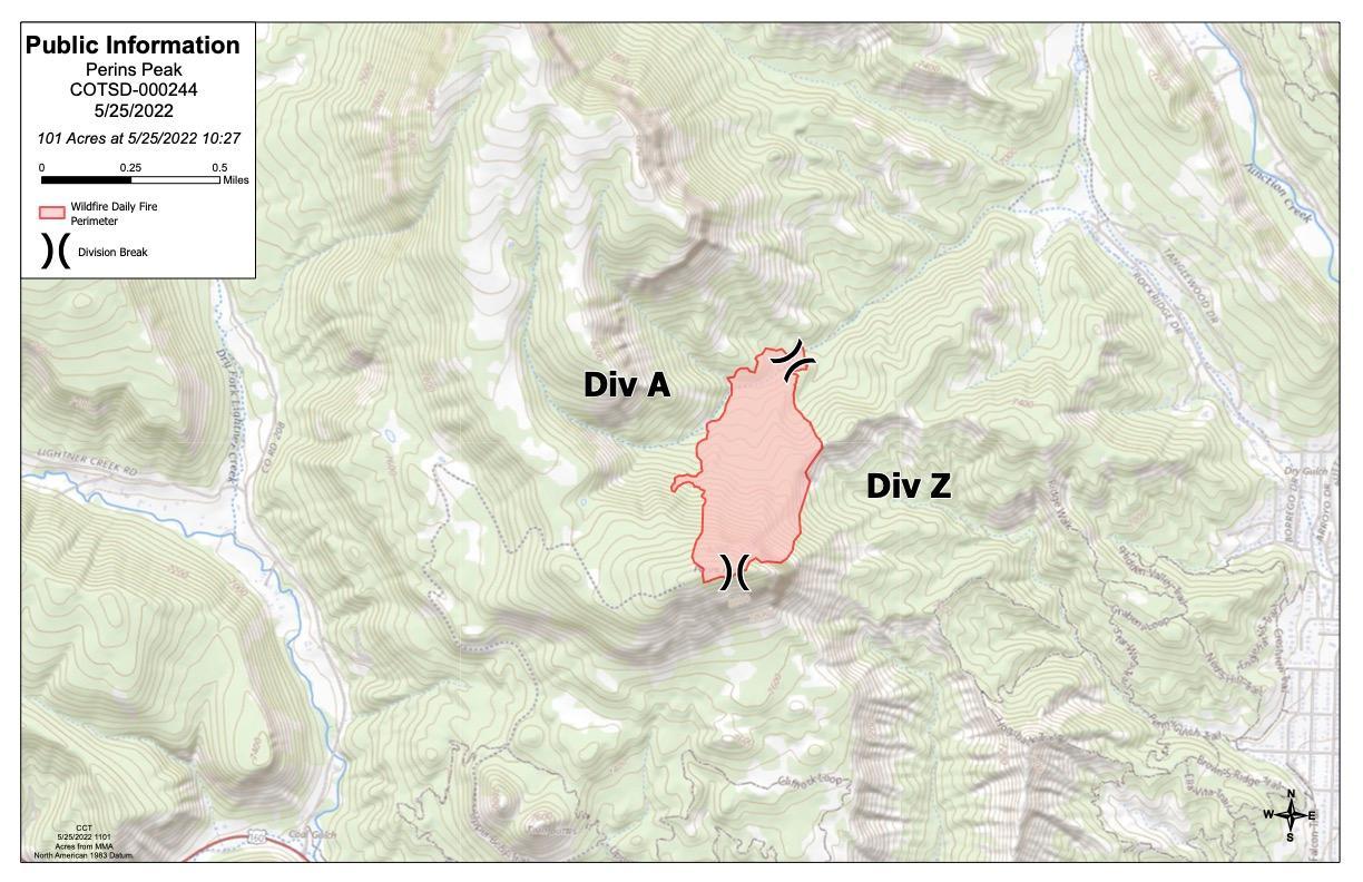
Incident Media Maps
Settings - change map background and toggle additional layers
Filter - control incident types displayed on map.
Zoom to your location
Reset map zoom and position
Could not determine your location.
Show Legend
 Wildfire
 Prescribed Fire
 Burned Area
Response
Burned Area
Response Other
Other

Maps Gallery
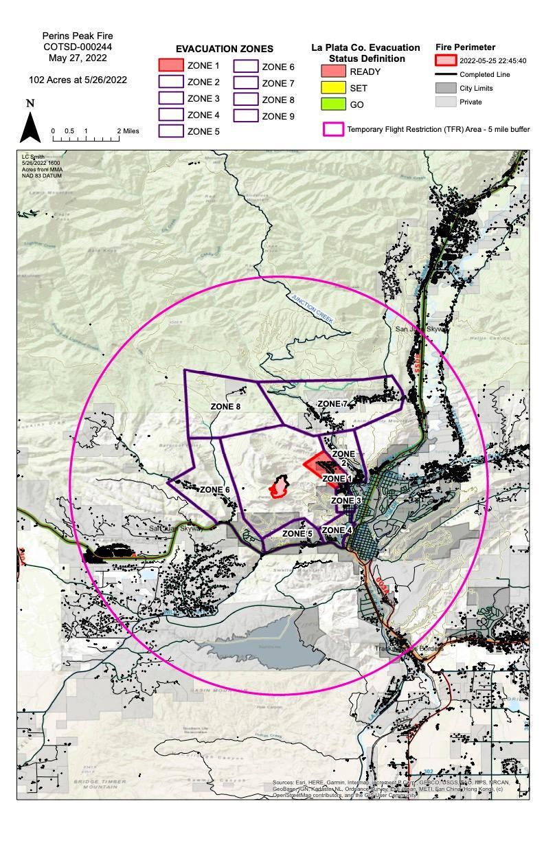
Image options: [ Full Size ] -
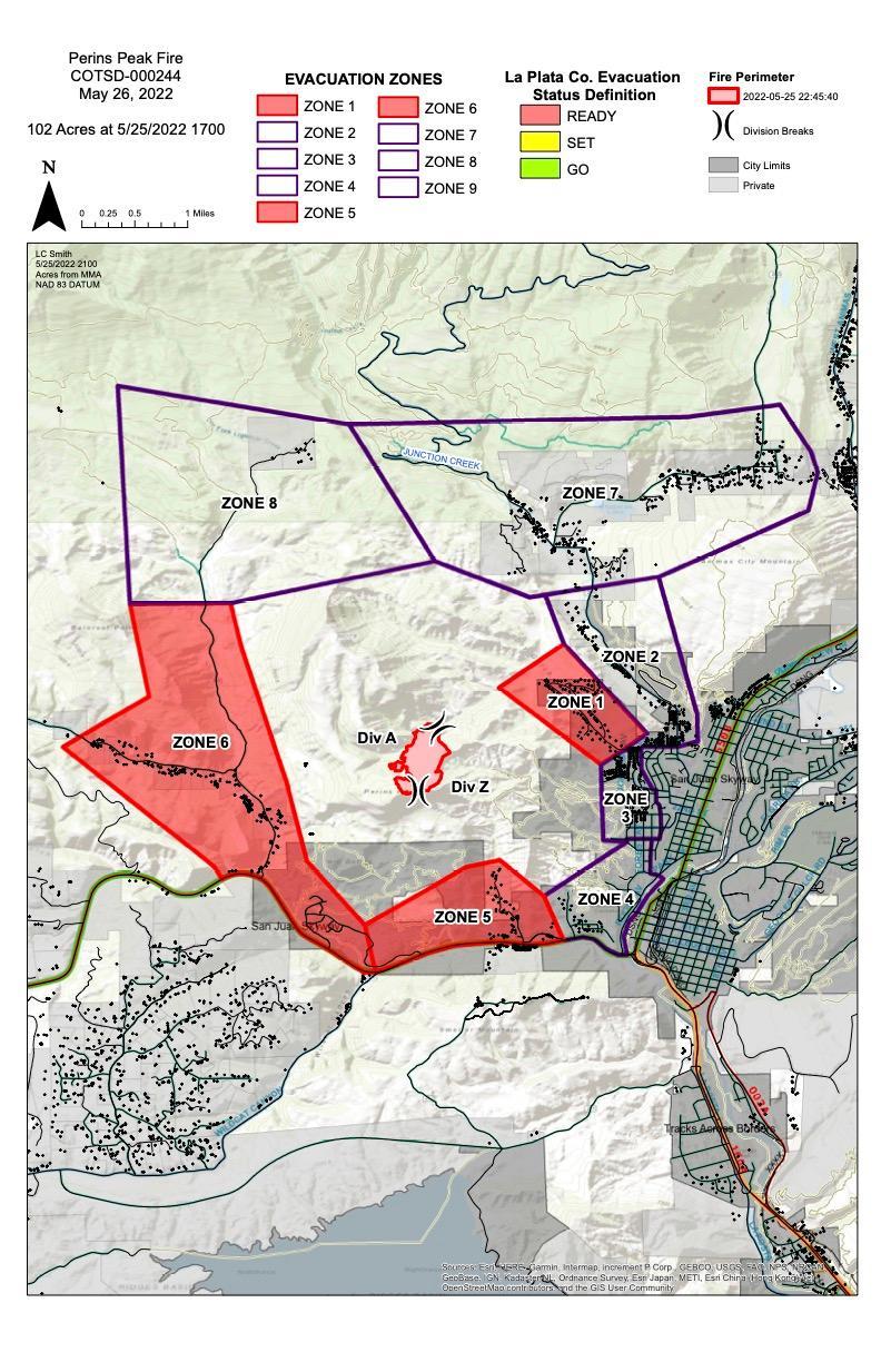
A map showing the perimeter of the Perins Peak Fire near Durango, CO May 26th, as well as evacuation zones.