
Incident Media Maps
Could not determine your location.
 Wildfire
 Prescribed Fire
 Burned Area
Response
Burned Area
Response Other
Other
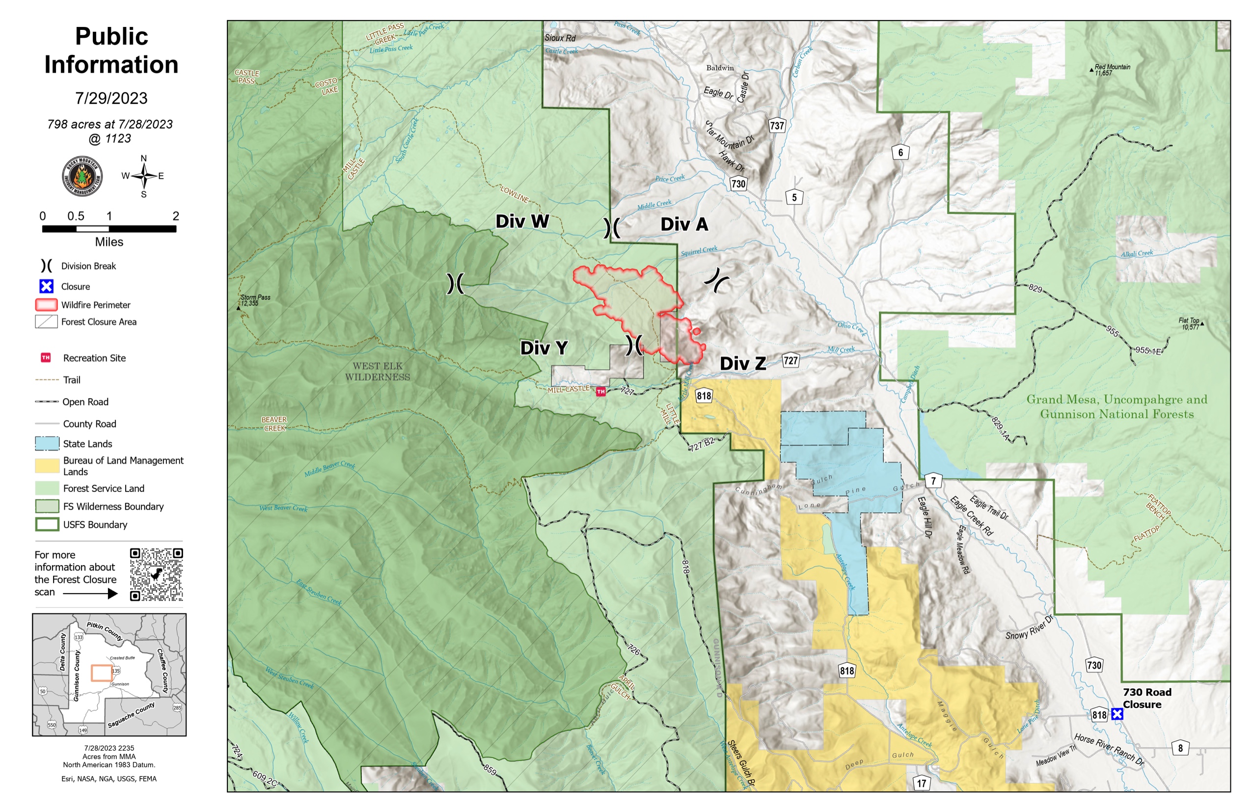
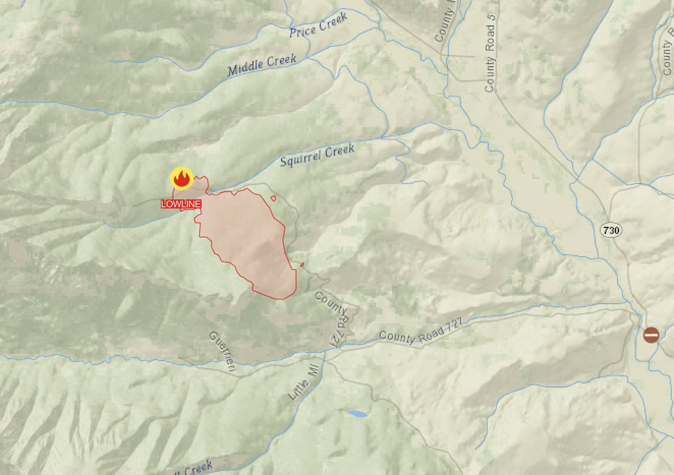
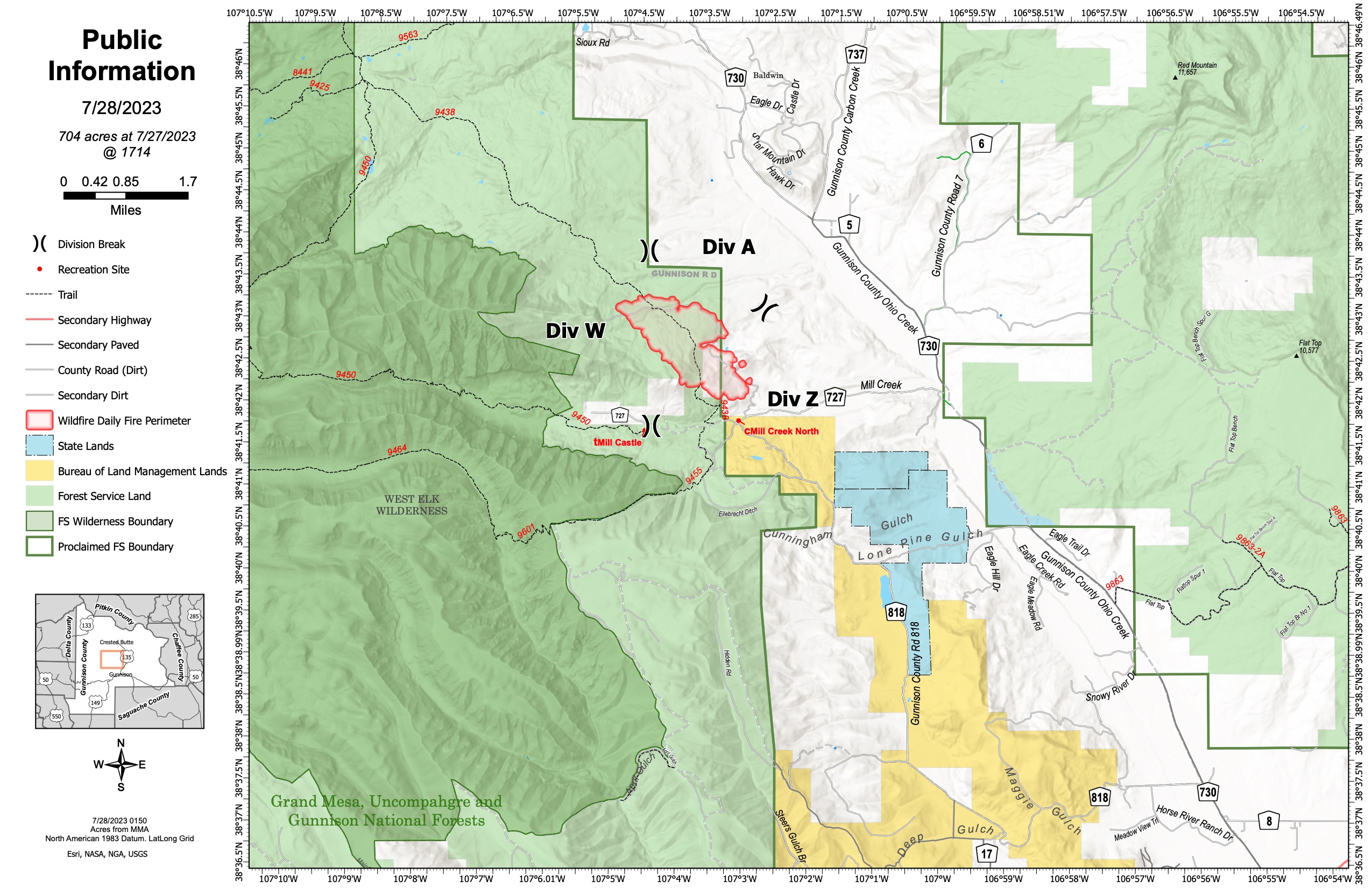
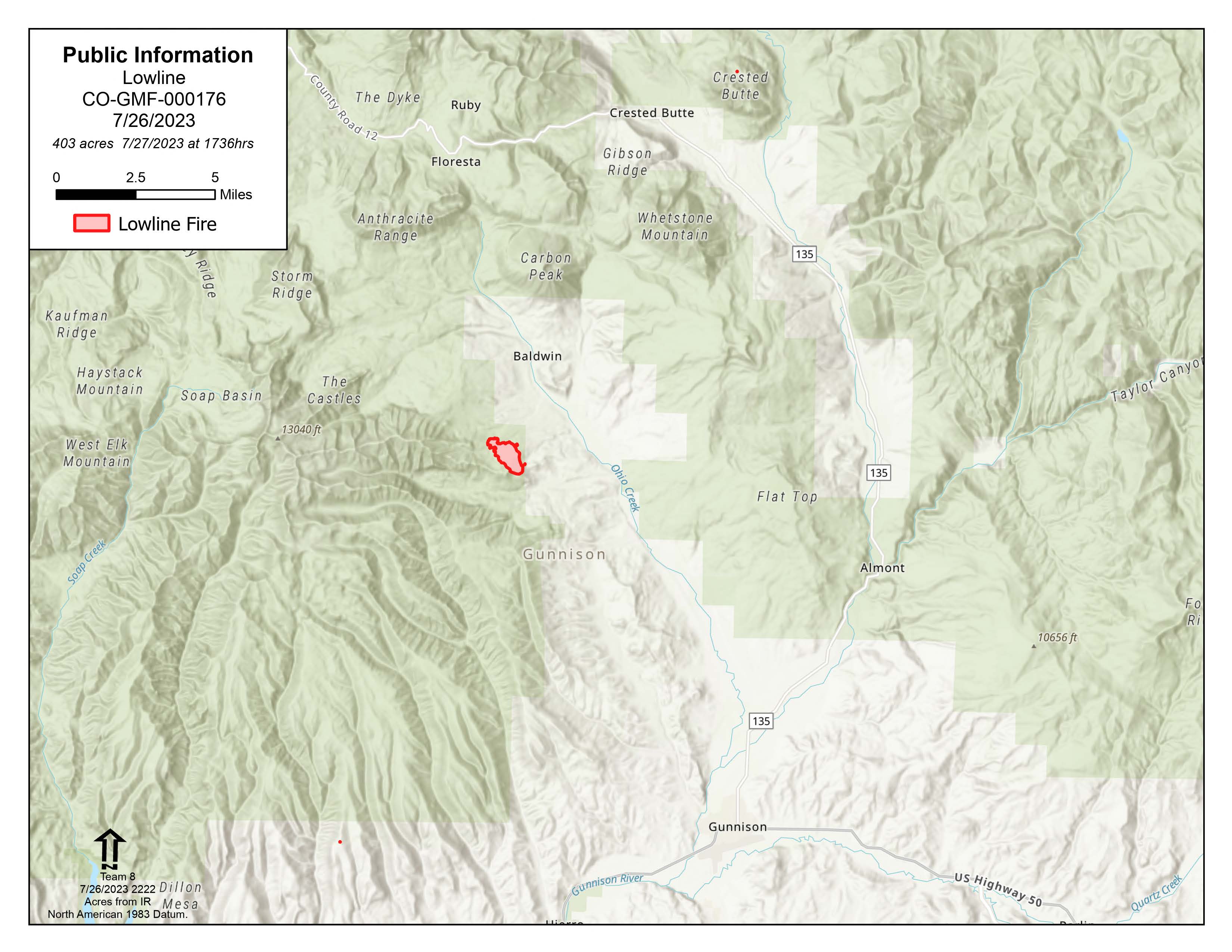
Lowline Fire
Unit Information
Incident Contacts
- Gunnison Ranger DistrictPhone:970-641-0471Hours:8am - 4pm
- GMUG Fire Info HotlinePhone:970-874-6602Hours:24/7
Maps Gallery
A screenshot from a map showing the location of the Lowline Fire, northwest of Gunnison, Colorado. The original map is at: https://arcg.is/1KKu8X
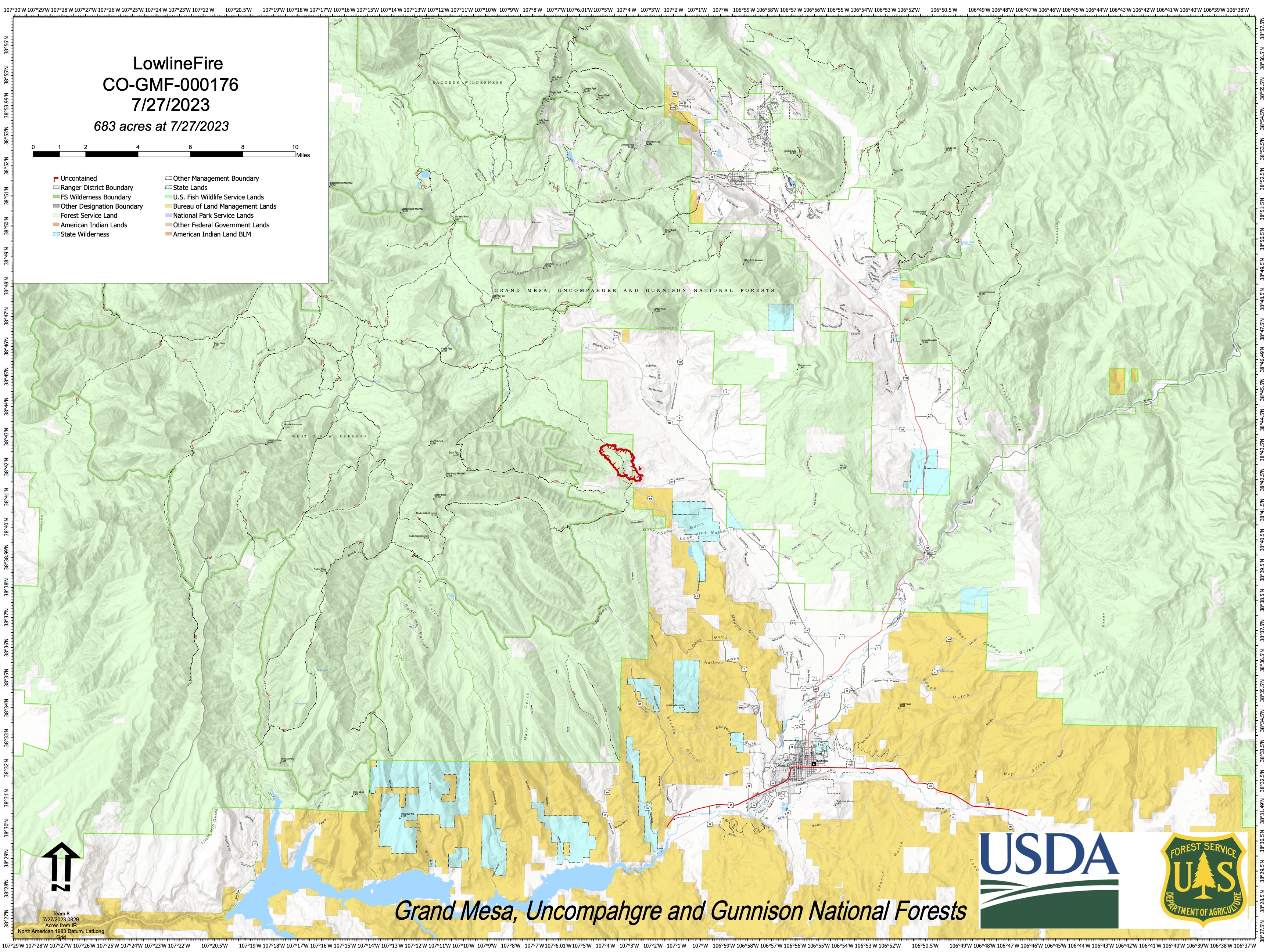
This map shows the area where the Lowline Fire is burning. Gunnison, Colorado is to the southeast of the fire area and Crested Butte is to the northeast. This perimeter is based on a flight over the fire last night (July 26) using an infrared camera to map areas of heat. Because it's a snapshot in time of a large, active fire, the actual perimeter is already larger. How much it has grown depends on many factors, including wind, overnight humidity, etc., as well as suppression activity. The possibility of thunderstorms today (July 27) could produce rapid fire growth because of the strong winds thunderstorms usually produce.
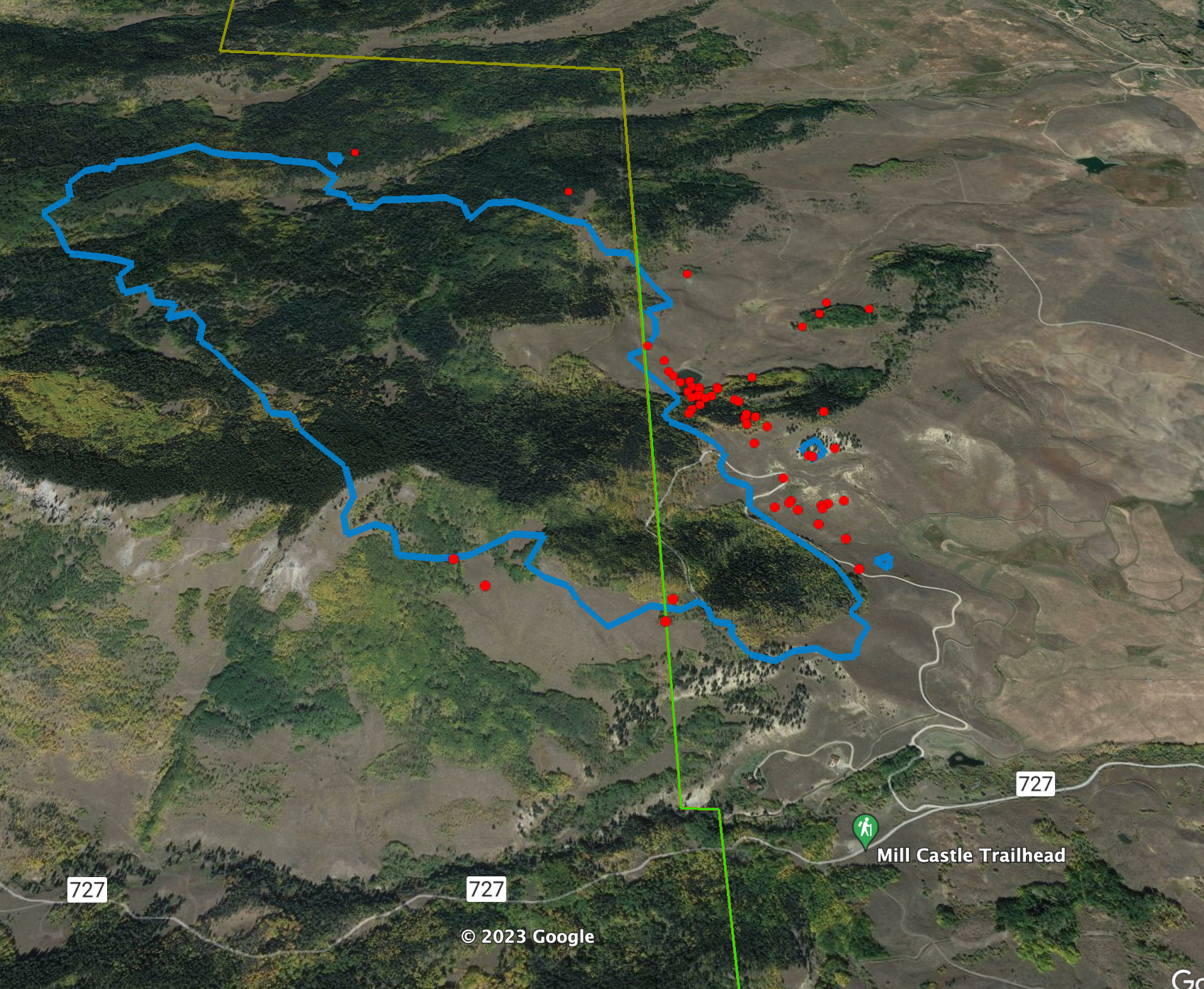
This image shows the approximate perimeter of the Lowline Fire at 9 p.m. on July 26, 2023 and plotted on a Google Earth image. The perimeter was calculated using an infrared camera on one of Colorado's Multi-Mission Aircraft (MMA). The green line through the center of the image is the boundary between public and private land, with the national forest to the left. The red dots are heat sources, usually spot fires, that are burning ahead of the main body of the fire.