Incident Media Maps
Settings - change map background and toggle additional layers
Filter - control incident types displayed on map.
Zoom to your location
Reset map zoom and position
Could not determine your location.
Show Legend
 Wildfire
 Prescribed Fire
 Burned Area
Response
Burned Area
Response Other
Other
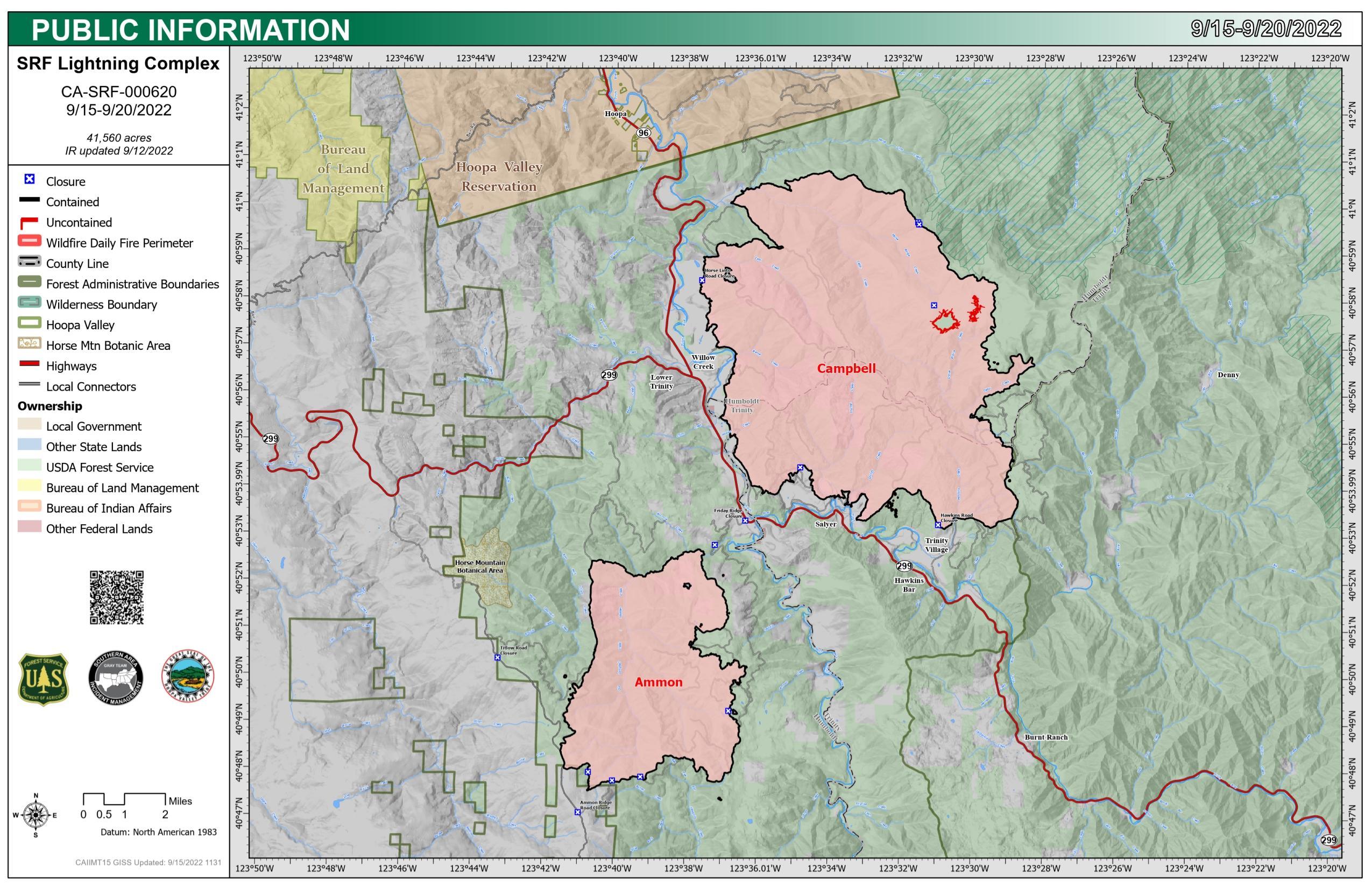
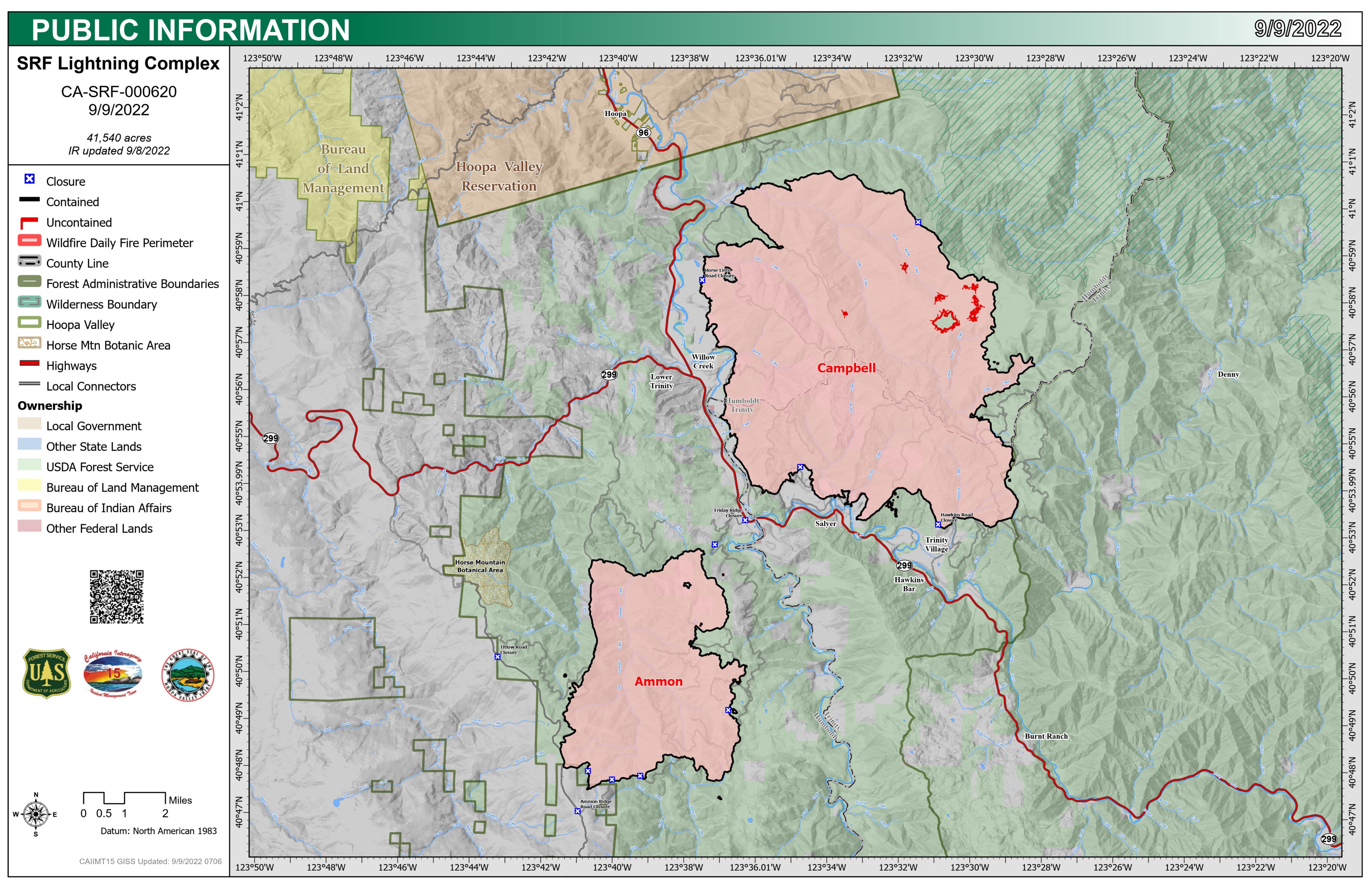
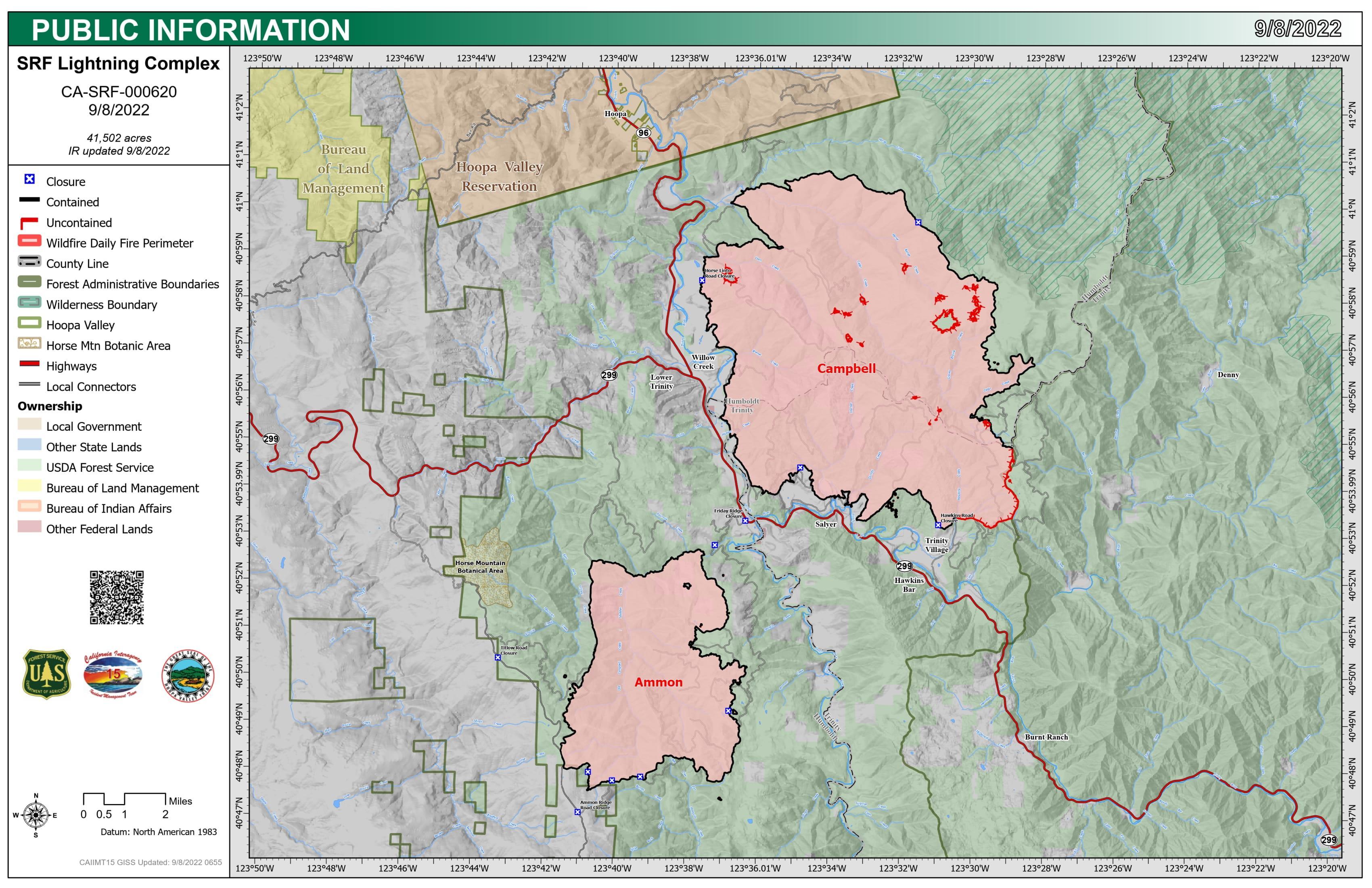
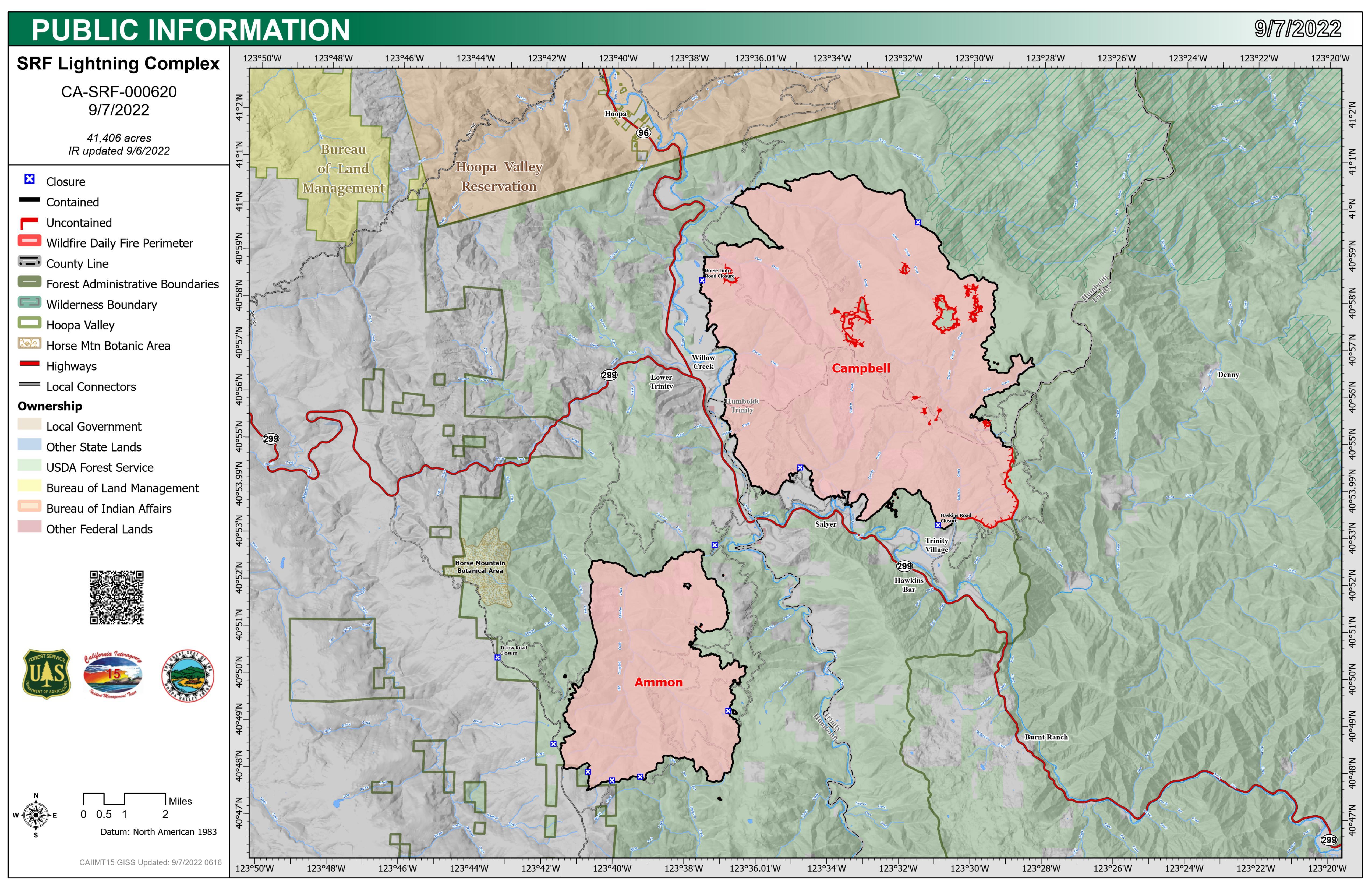
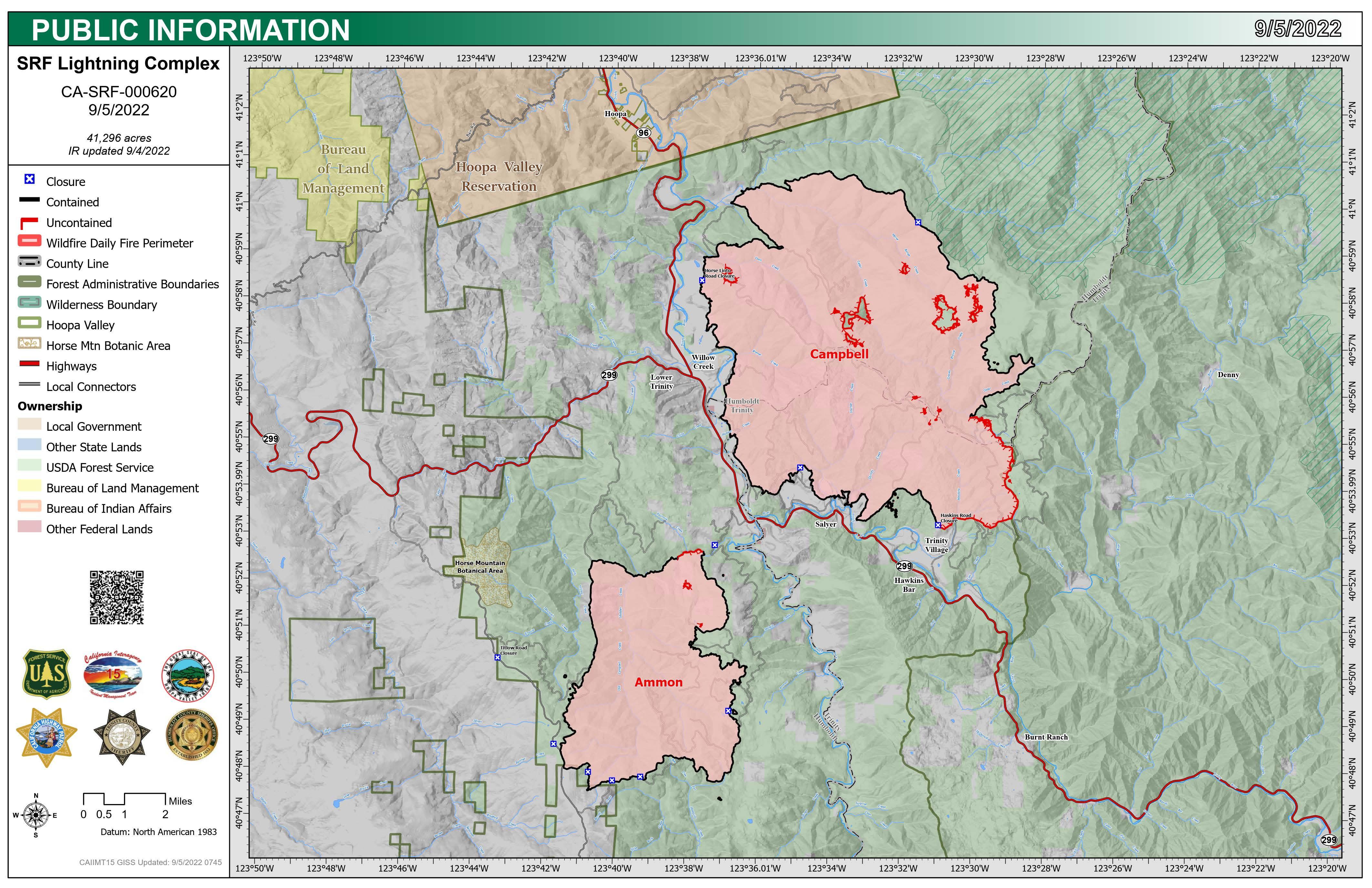
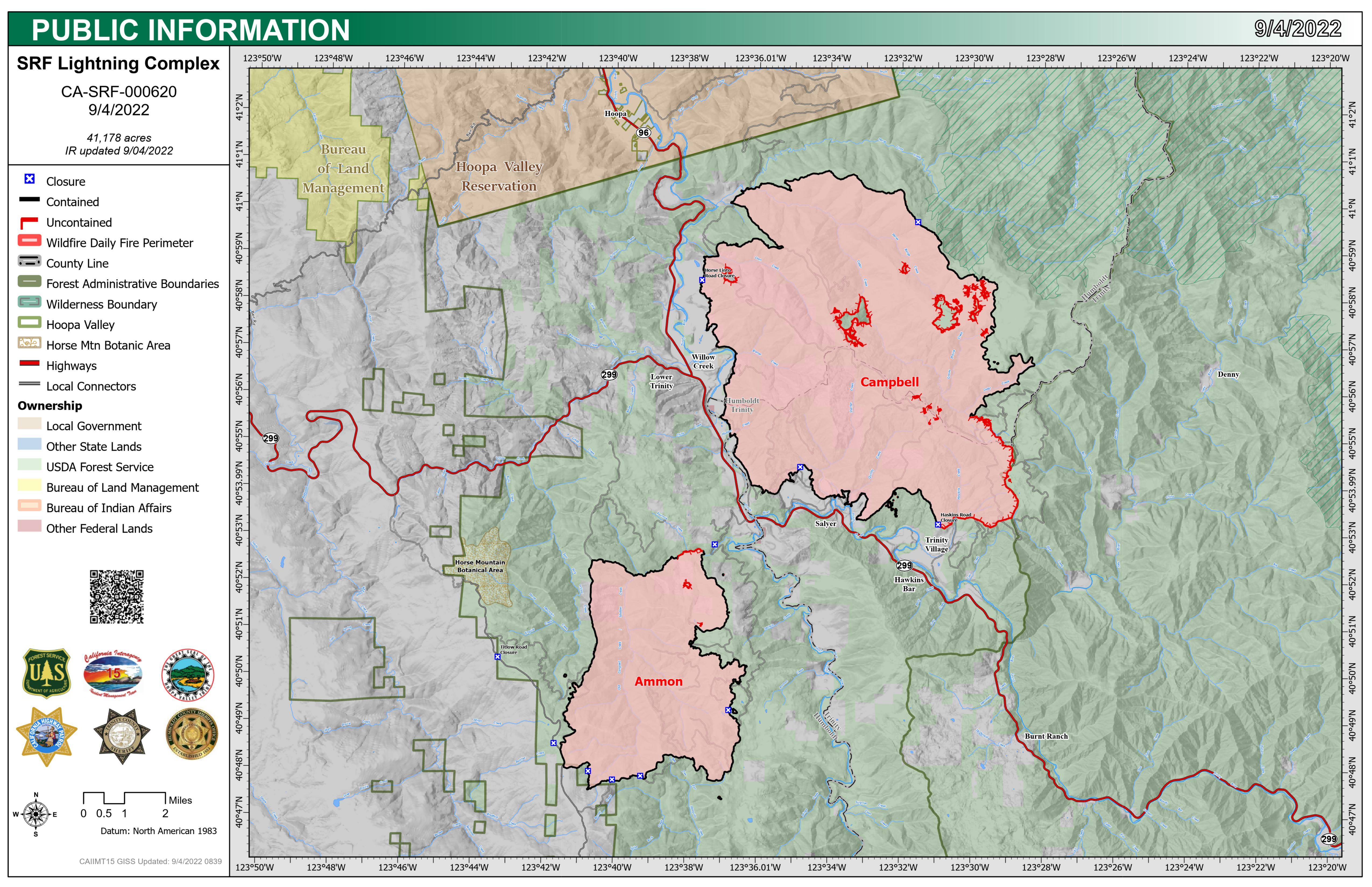
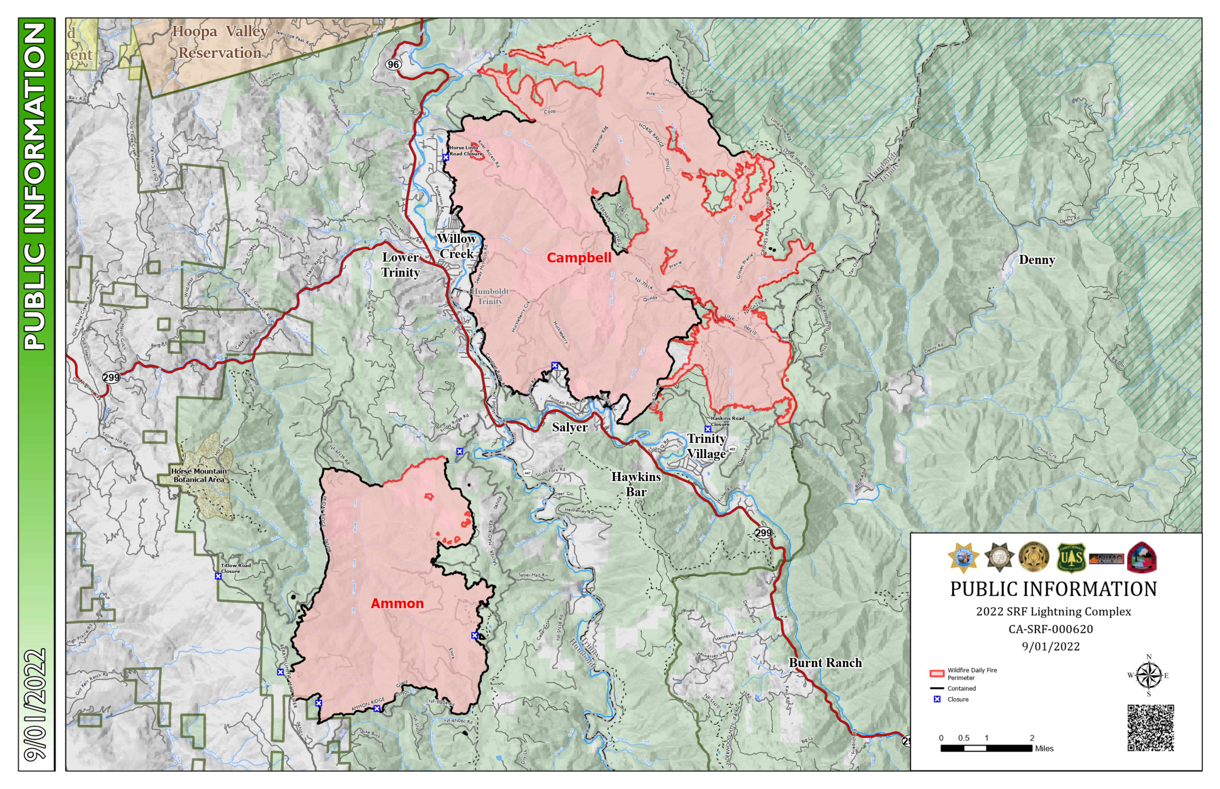
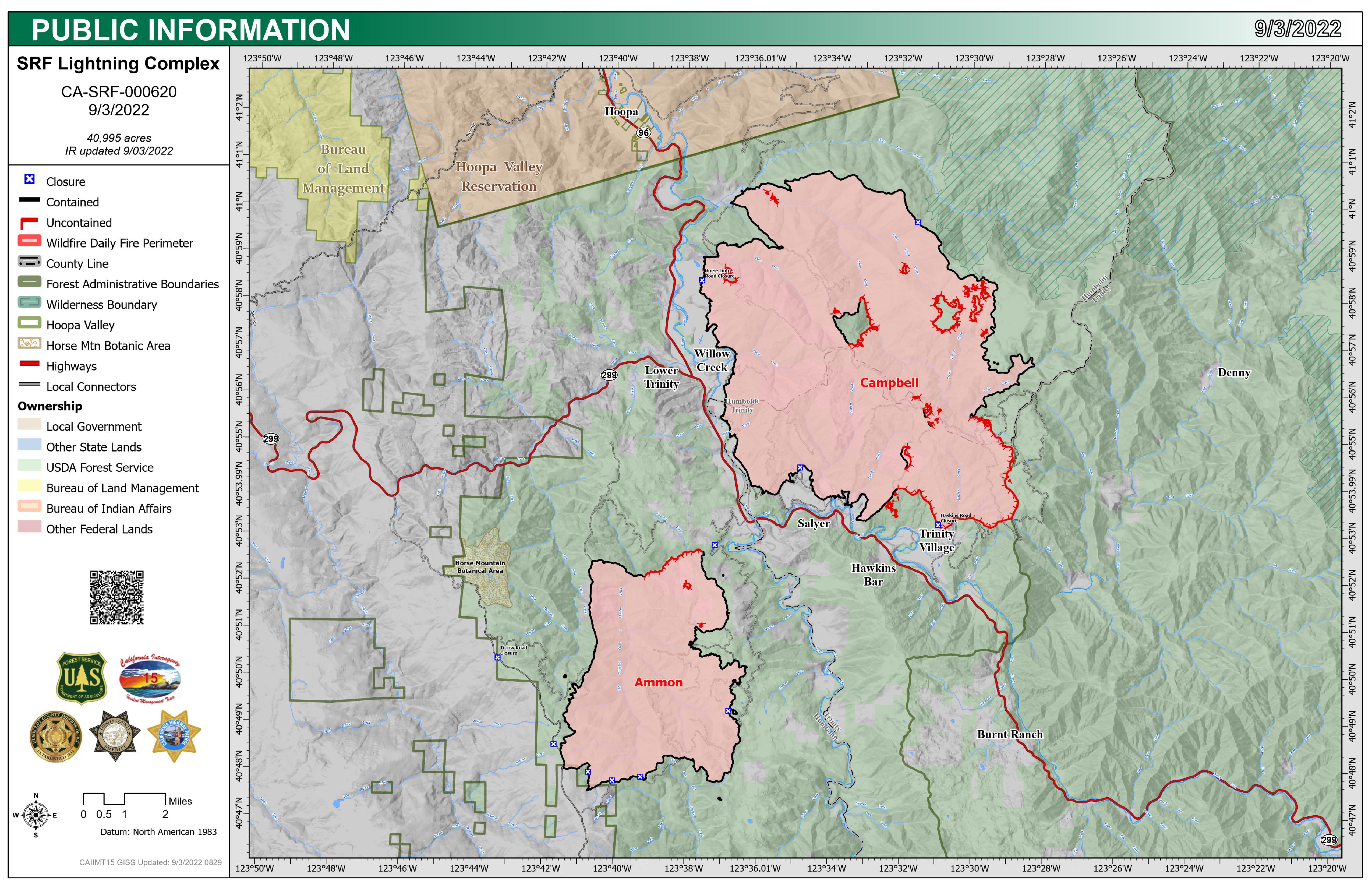
Six Rivers Lightning Complex
Unit Information
Incident Contacts
- Fire InformationPhone:707-356-9442Hours:Monday-Friday 8:00am-4:30pm
Maps Gallery
Image options: [ Full Size ] -
22-10-08 Closure area map shows Ammon and Campbell fire closure area that follows most of the fire perimeter.