Incident Media Maps
Settings - change map background and toggle additional layers
Filter - control incident types displayed on map.
Zoom to your location
Reset map zoom and position
Could not determine your location.
Show Legend
 Wildfire
 Prescribed Fire
 Burned Area
Response
Burned Area
Response Other
Other
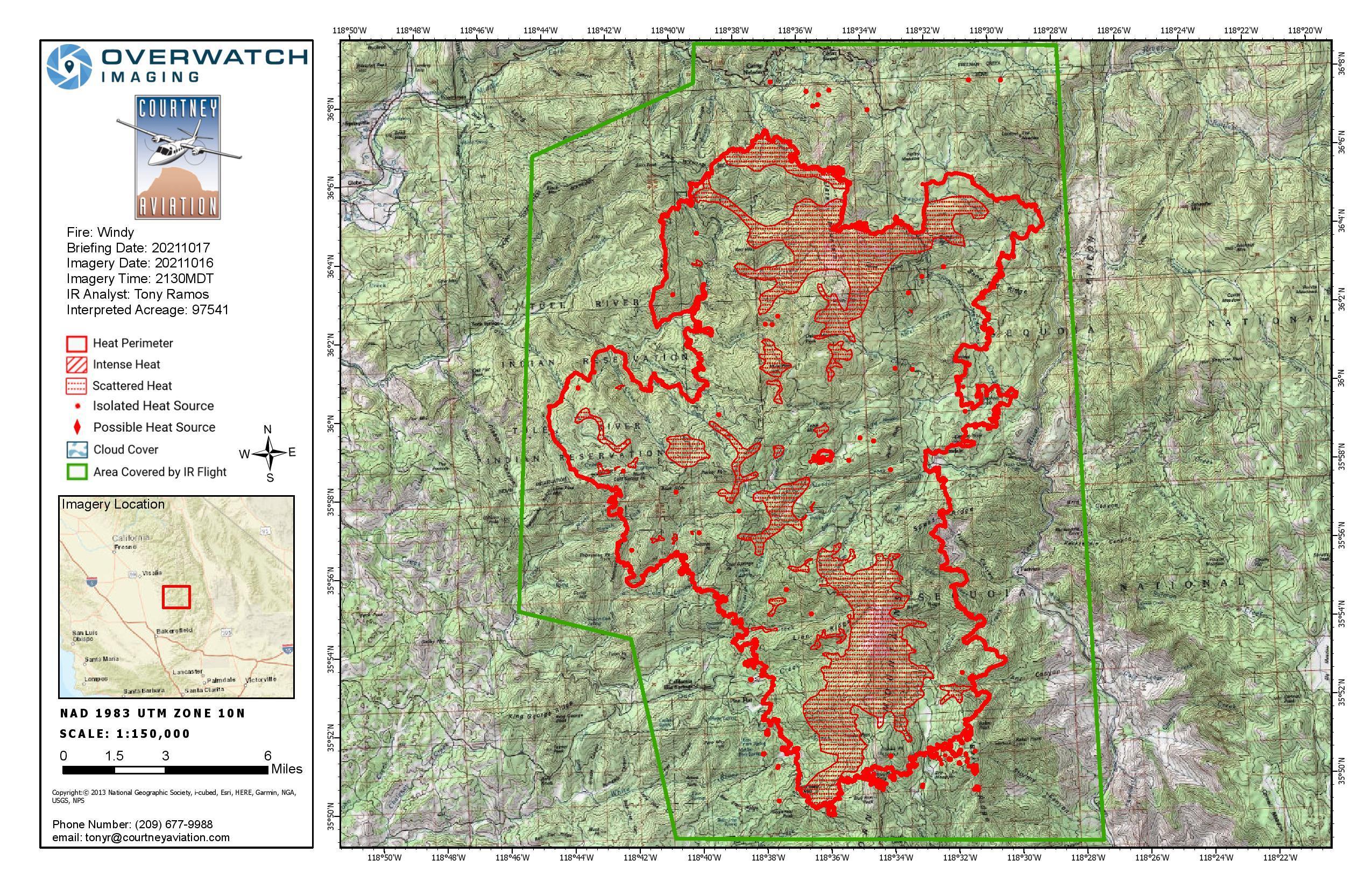
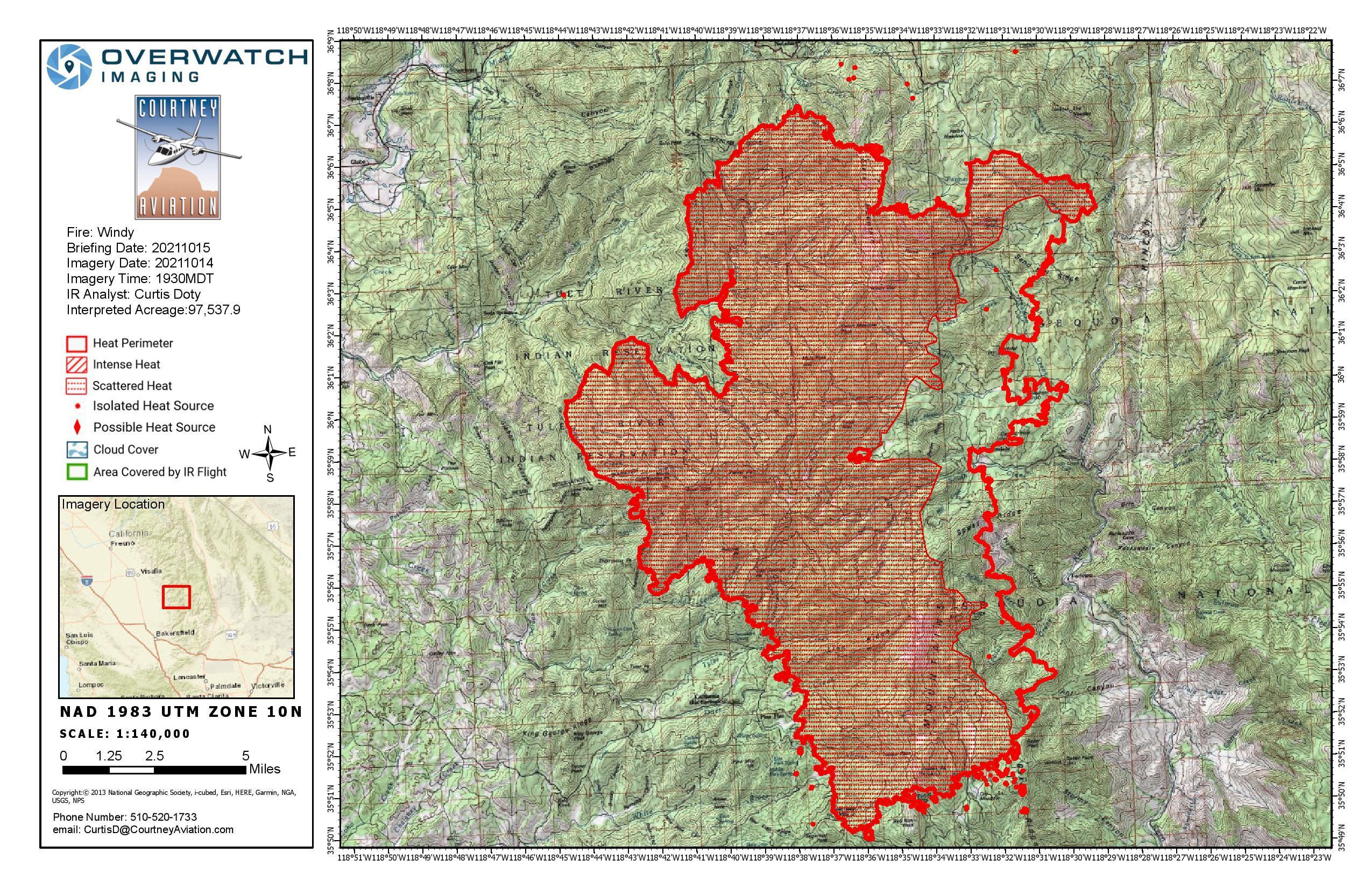
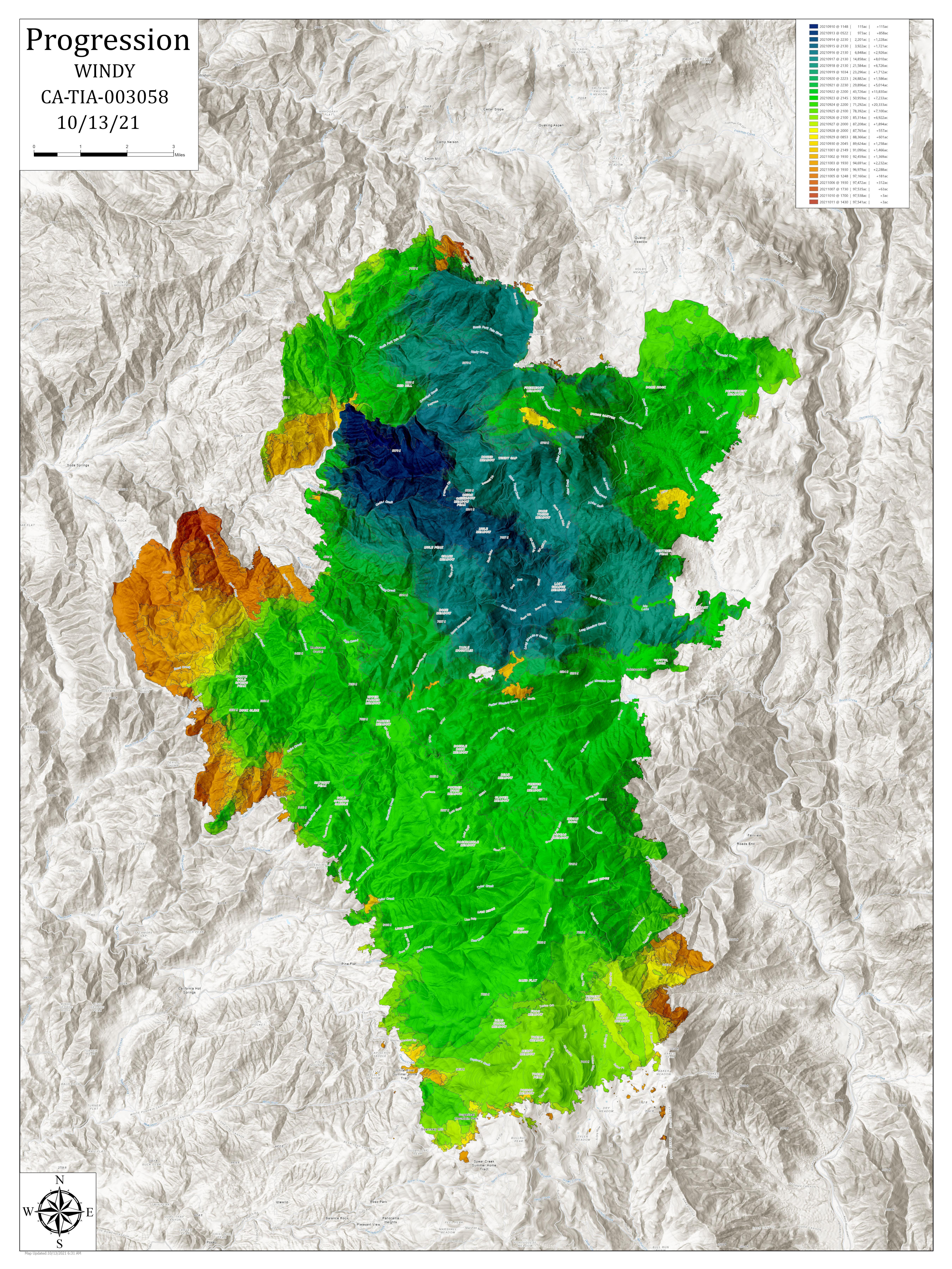
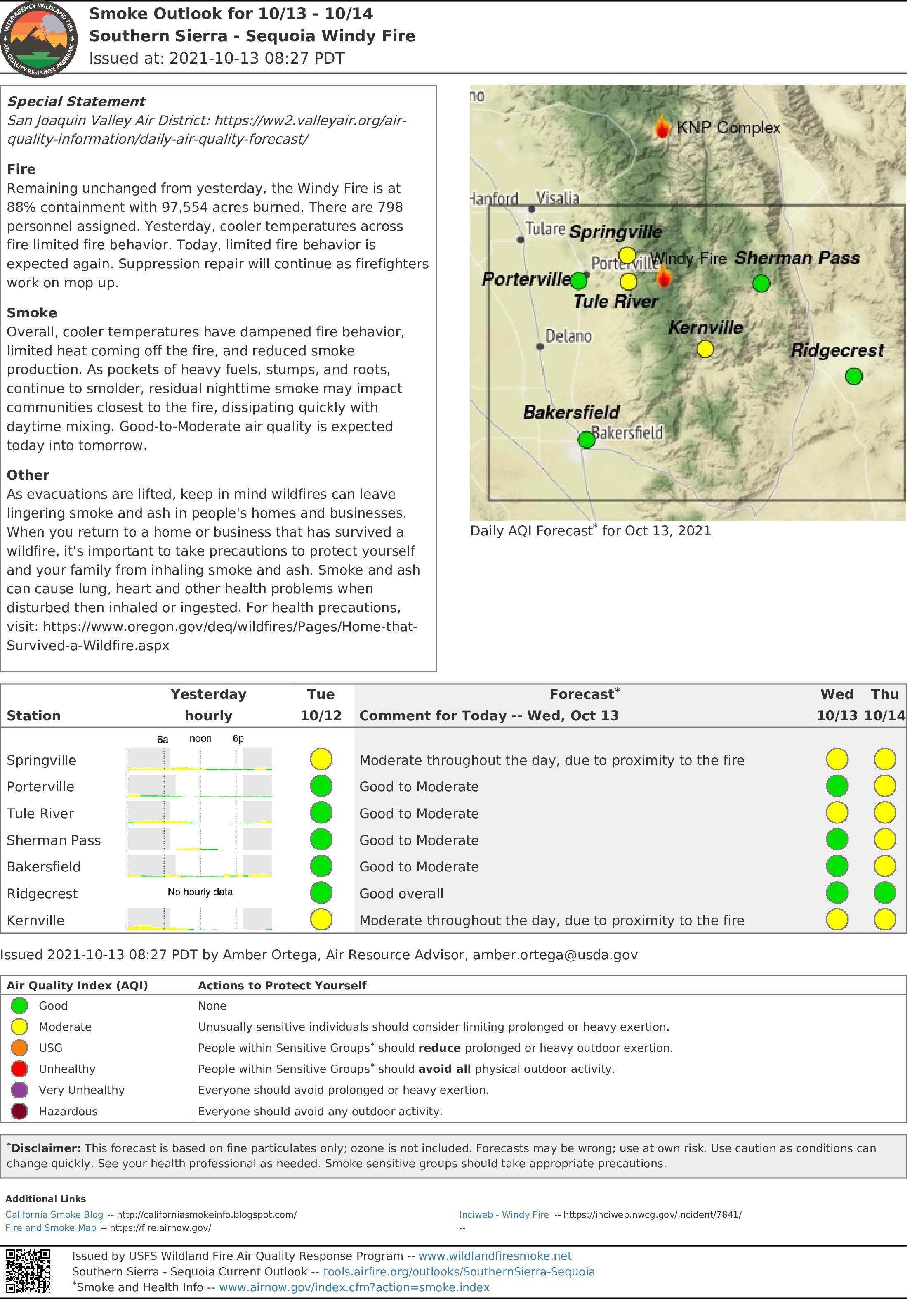
Windy Fire
Unit Information
Incident Contacts
- Sequoia National ForestEmail:Phone:559-539-2607Hours:Mon - Fri 7 a.m. to 3 p.m.
Maps Gallery
Image options: [ Full Size ] -
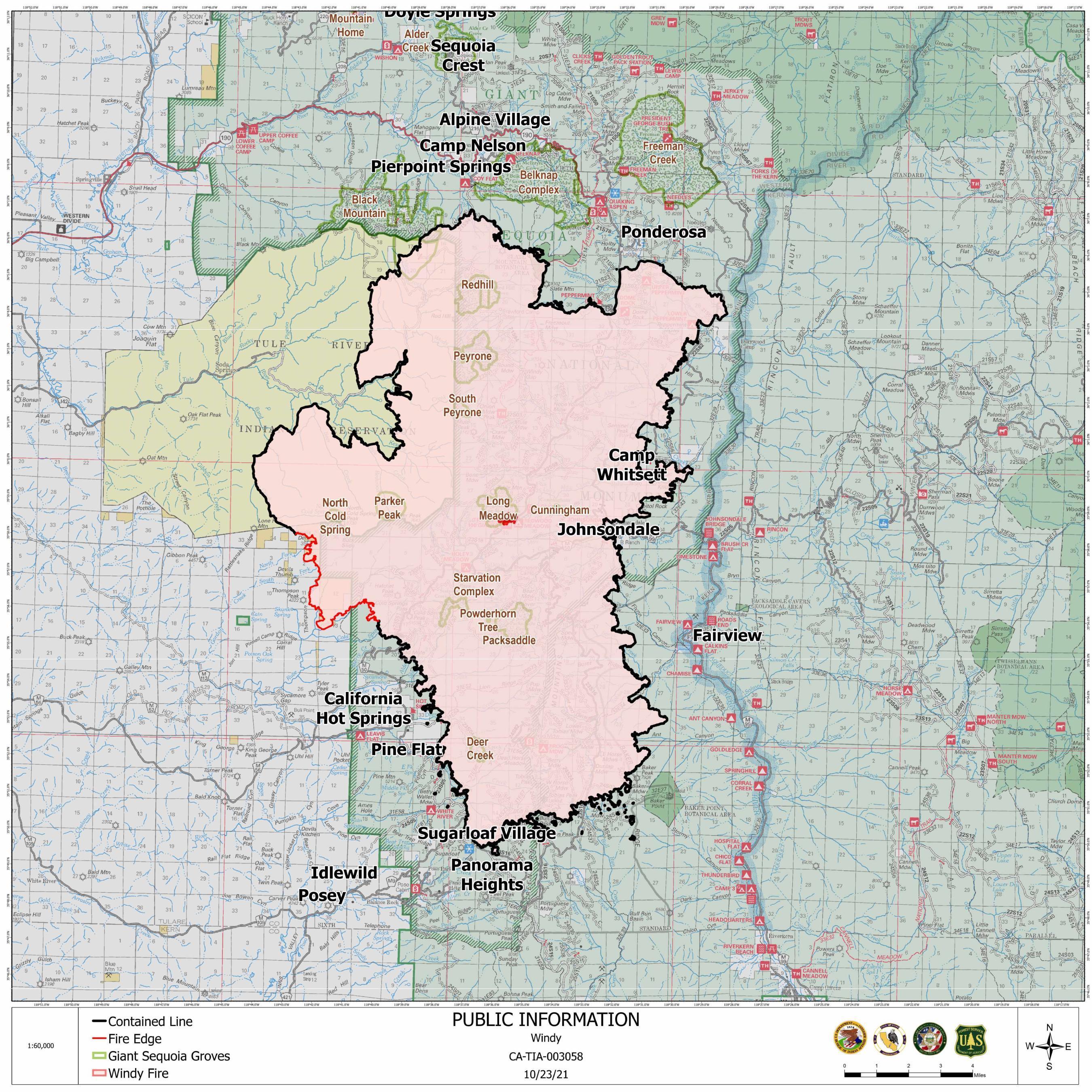
Current Public Information Map as of 10/23/21, showing the additional containment (black line) on the north edge of the fire

Image options: [ Full Size ] -
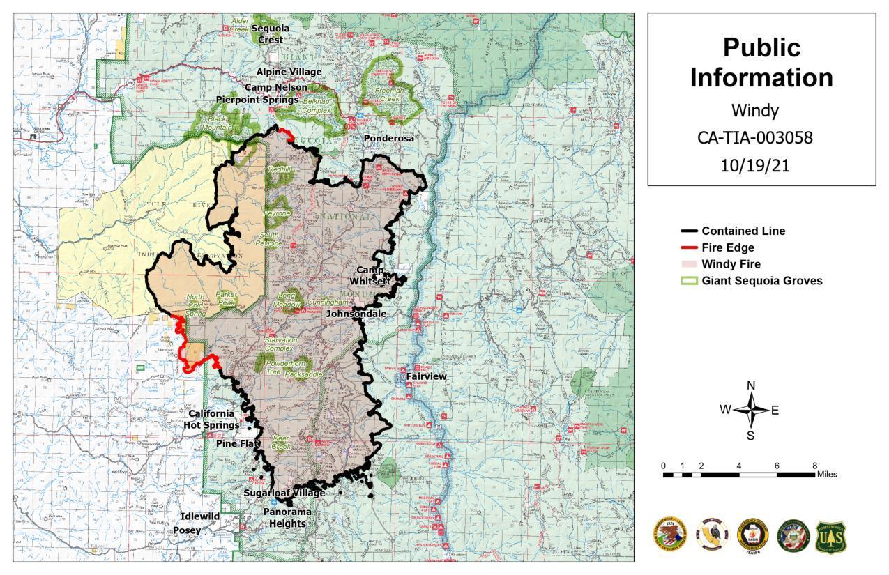
Current Public Information Map as of 10/19/21, showing the additional containment (black line) on the southeast edge of the fire
Image options: [ Full Size ] -
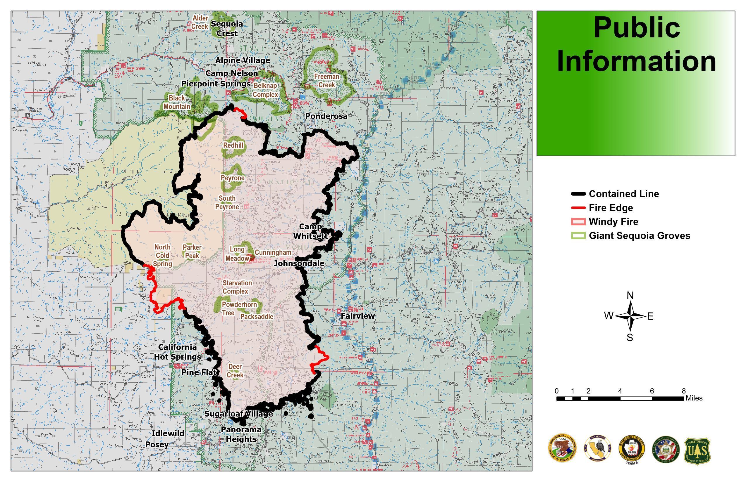
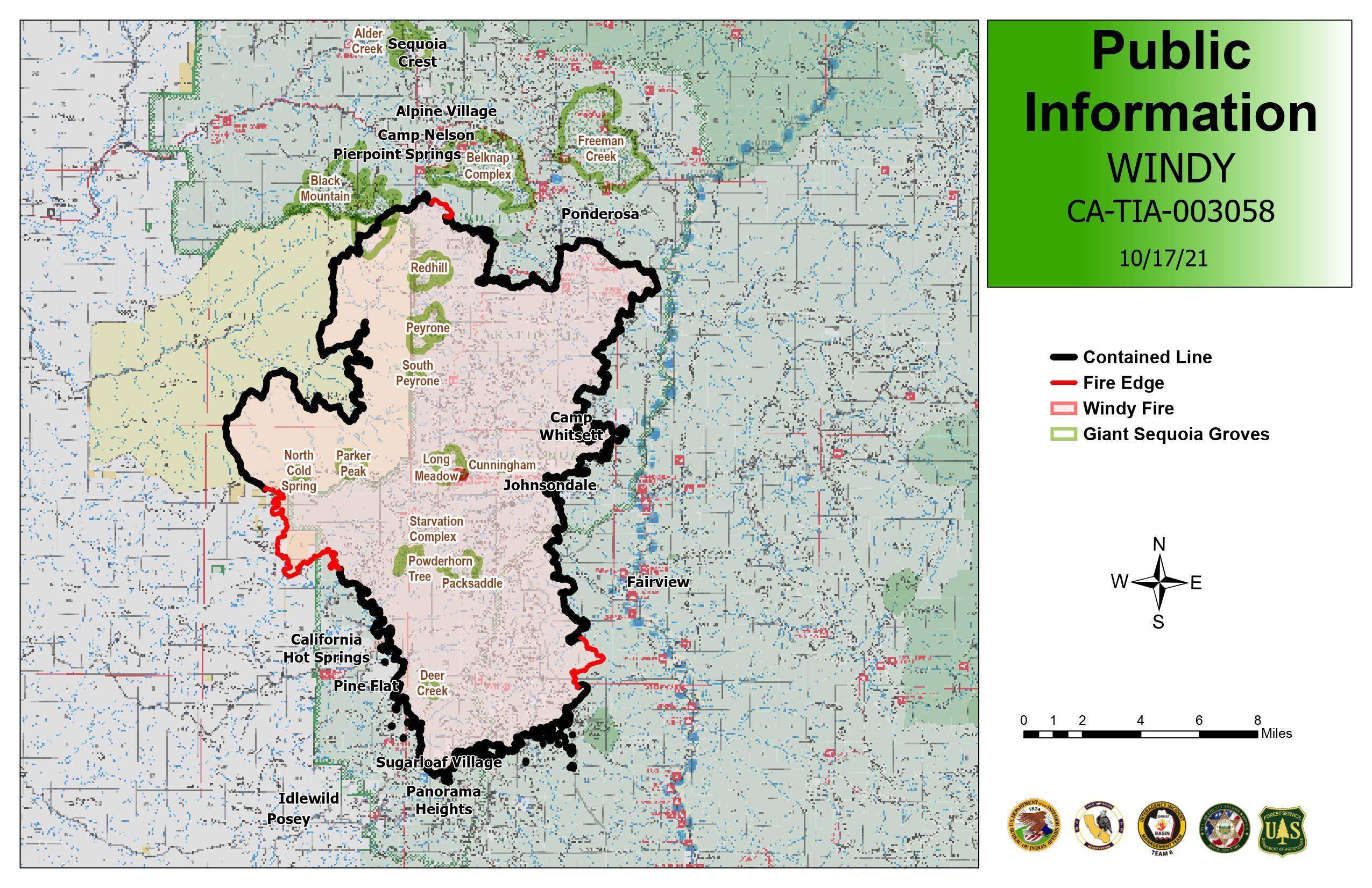
Current Public Information Map, as of October 18, 2021. This map will be updated periodically.