
FINAL 947 FIRE UPDATE, NOV 18, 5:15 p.m. -- The fire remains at 166 acres with 33 personnel. Crews monitored containment lines today. There are still some smoking logs. The cold weather tonight could cause low-lying smoke that may impact Douthart Creek Road. Drive carefully. No further spread is expected. This will be the last update for the 947 Fire unless there is a change in fire activity.
947 FIRE UPDATE, NOV 17, 5:15 pm. -- The 947 Fire is fully contained as of 5 p.m., Nov. 17, with 166 acres burned. Some smoke may still be seen in the area. There are no threats to private lands or buildings. We will provide one more update late Saturday.
947 FIRE UPDATE, NOV 17, 1:30 p.m. -- The fire line was completed and held throughout the night. Crews are reinforcing containment lines today and no further spread is anticipated. Some residual smoke may be seen in the immediate area. Fire size is unchanged at an estimated 145 acres with 38 firefighters. We will post another update this evening.
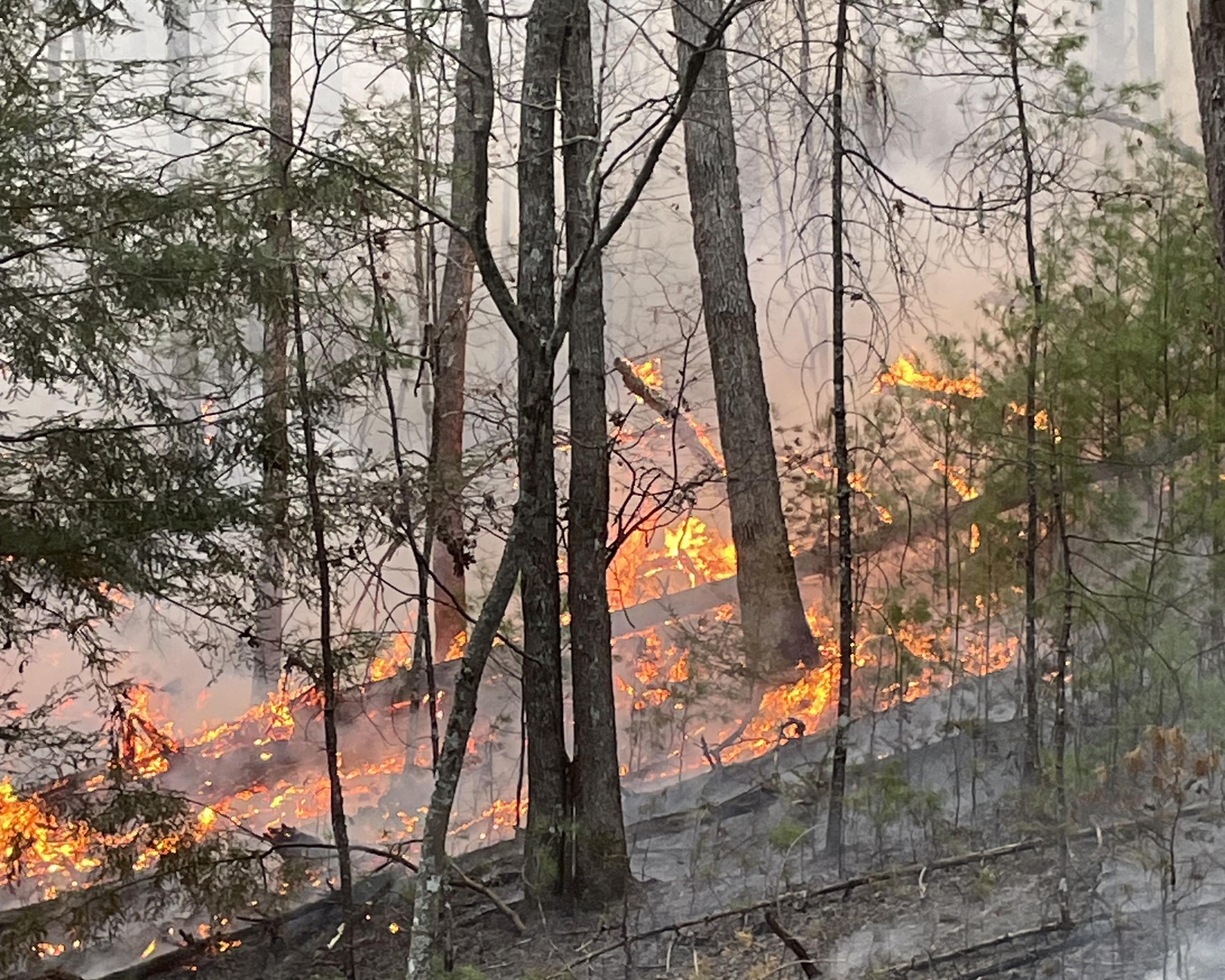
947 FIRE UPDATE, NOV 16, 430 p.m. -- The 947 Fire is now an estimated 145 acres with 38 firefighters on site. The fire is 65 percent contained with moderate fire activity in hardwood litter and some brush. Firefighters are completing burnout operations and will be patrolling the area overnight. A map has been added to InciWeb.
947 FIRE UPDATE, NOV 16, 10 a.m. -- The 947 Fire is estimated at 100 acres with 33 firefighters on site. The fire is located on Monongahela National Forest in Pocahontas County off Forest Road 947 near the intersection of Brushy Mountain Trail and Beaver Lick Road. You may see or smell smoke from this fire. Please avoid the area to allow vehicles and personnel access.
In addition to staff from Monongahela National Forest, firefighters from the Boise National Forest, Tonto National Forest, Modoc National Forest, Klamath National Forest, Nevada Bureau of Land Management, and Job Corps are working the fire.
Local fire departments first responded to the fire Monday evening. By Tuesday the fire was an estimated 30 acres, and by Wednesday it was an estimated 100 acres.
The National Weather Service predicts warm weather with low humidity with heightened fire concerns today. Rain is predicted for Friday. Be sure to follow the fall fire laws and make sure all campfires are dead out before you leave them: https://wvforestry.com/fire-laws/.
FINAL 947 FIRE UPDATE, NOV 18, 5:15 p.m. -- The fire remains at 166 acres with 33 personnel. Crews monitored containment lines today. There are still some smoking logs. The cold weather tonight could cause low-lying smoke that may impact Douthart Creek Road. Drive carefully. No further spread is expected. This will be the last update for the 947 Fire unless there is a change in fire activity.
947 FIRE UPDATE, NOV 17, 5:15 pm. -- The 947 Fire is fully contained as of 5 p.m., Nov. 17, with 166 acres burned. Some smoke may still be seen in the area. There are no threats to private lands or buildings. We will provide one more update late Saturday.
947 FIRE UPDATE, NOV 17, 1:30 p.m. -- The fire line was completed and held throughout the night. Crews are reinforcing containment lines today and no further spread is anticipated. Some residual smoke may be seen in the immediate area. Fire size is unchanged at an estimated 145 acres with 38 firefighters. We will post another update this evening.
947 FIRE UPDATE, NOV 16, 430 p.m. -- The 947 Fire is now an estimated 145 acres with 38 firefighters on site. The fire is 65 percent contained with moderate fire activity in hardwood litter and some brush. Firefighters are completing burnout operations and will be patrolling the area overnight. A map has been added to InciWeb.
947 FIRE UPDATE, NOV 16, 10 a.m. -- The 947 Fire is estimated at 100 acres with 33 firefighters on site. The fire is located on Monongahela National Forest in Pocahontas County off Forest Road 947 near the intersection of Brushy Mountain Trail and Beaver Lick Road. You may see or smell smoke from this fire. Please avoid the area to allow vehicles and personnel access.
In addition to staff from Monongahela National Forest, firefighters from the Boise National Forest, Tonto National Forest, Modoc National Forest, Klamath National Forest, Nevada Bureau of Land Management, and Job Corps are working the fire.
Local fire departments first responded to the fire Monday evening. By Tuesday the fire was an estimated 30 acres, and by Wednesday it was an estimated 100 acres.
The National Weather Service predicts warm weather with low humidity with heightened fire concerns today. Rain is predicted for Friday. Be sure to follow the fall fire laws and make sure all campfires are dead out before you leave them: https://wvforestry.com/fire-laws/.
| Current as of | Sat, 11/18/2023 - 20:37 |
|---|---|
| Incident Type | Wildfire |
| Date of Origin | |
| Location | Four miles south of Minnehaha Springs, Pocahontas County |
| Incident Commander | Jeremy Plain, Incident Commander, U.S. Forest Service Will Balcom, Incident Commander Trainee, U.S. Forest Service |
| Coordinates |
38° 07' 48.4'' Latitude
-80° 01' 41.2
'' Longitude
|
| Total Personnel: | 33 |
|---|---|
| Size | 166 Acres |
| Percent of Perimeter Contained | 100% |