
Highlighted Media
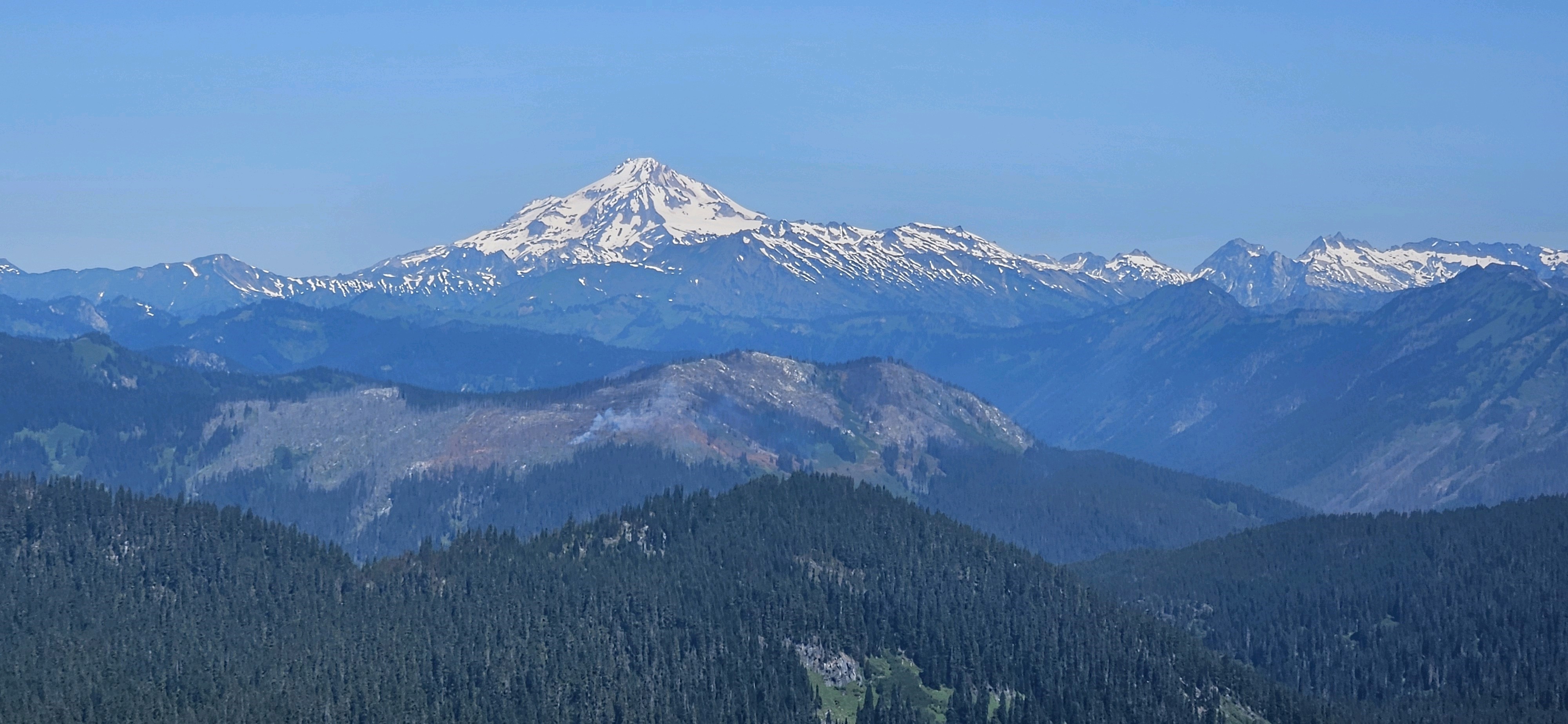
Footprint of Shoofly Fire as seen from Mount McCausland on July 14th, 2024. Looking north from the summit with Glacier Peak as the backdrop.
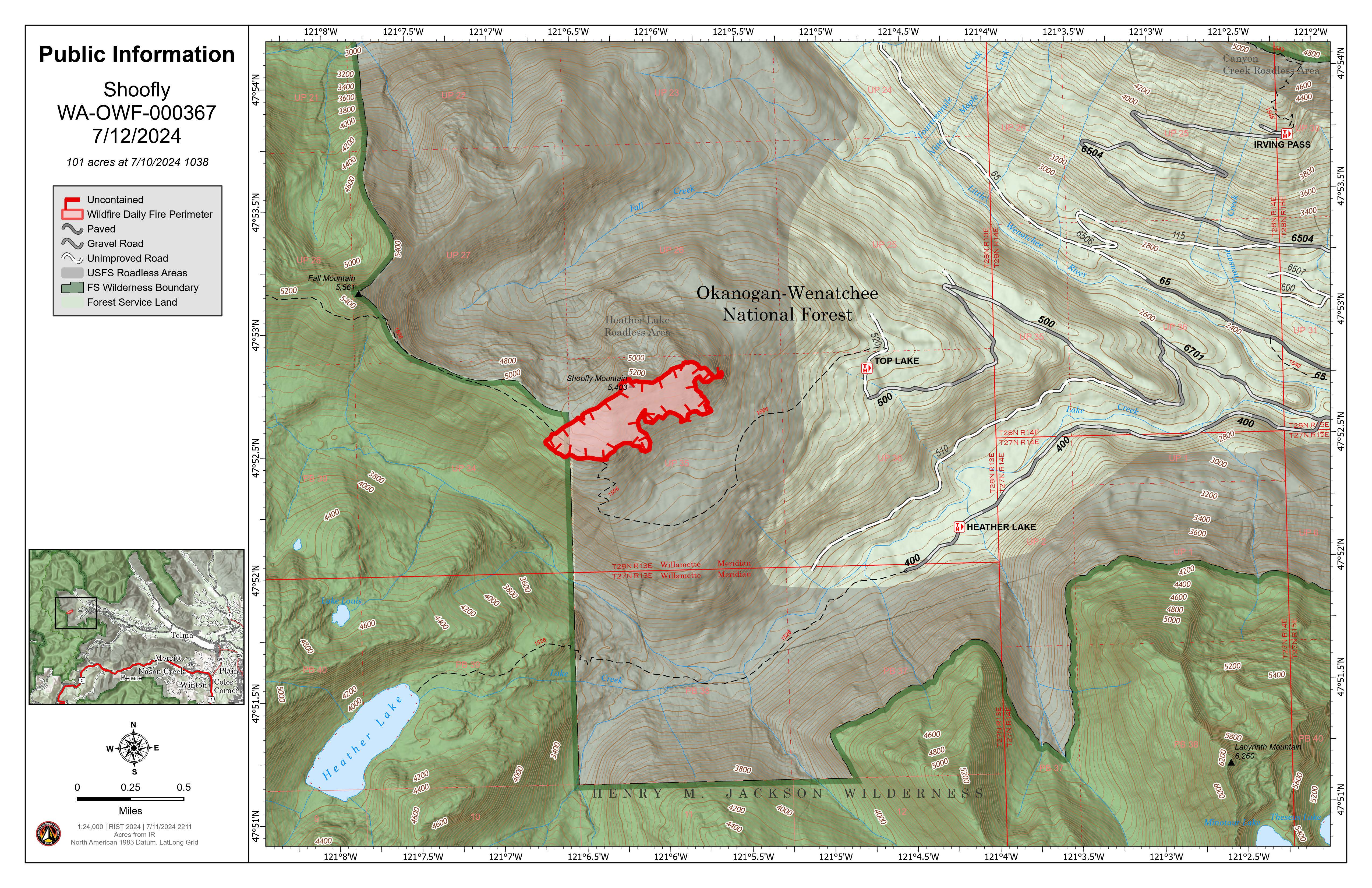
Shoofly Map
The Shoofly Fire, located on the Wenatchee River Ranger District of the Okanogan-Wenatchee National Forest, roughly 25 miles west of Lake Wenatchee, WA, is on the southeast slope of Shoofly Mountain in steep terrain. The Shoofly Fire is in sub-alpine fir and an older burn scar along the western flank of the fire.
Air and ground firefighting resources are implementing a full suppression strategy to control the fire as efficiently and safely as possible.
Campground, road and trail closures are listed on the Okanogan-Wenatchee National Forest website at https://www.fs.usda.gov/okawen.
| Current as of | Fri, 08/02/2024 - 16:10 |
|---|---|
| Incident Time Zone | America/Los_Angeles |
| Incident Type | Wildfire |
| Cause | Undetermined |
| Date of Origin | |
| Location | Southeast face of Shoofly Mountain, approximately 9 miles north of Stevens Pass |
| Incident Commander | Andrew Mendiguren, ICT4 Okanogan-Wenatchee National Forest, U.S. Forest Service |
| Coordinates |
47° 52' 36'' Latitude
--121° 6' 20
'' Longitude
|
| Total Personnel: | 0 |
|---|---|
| Size | 104 Acres |
| Percent of Perimeter Contained | 63% |
| Estimated Containment Date | 10/31/2024 |
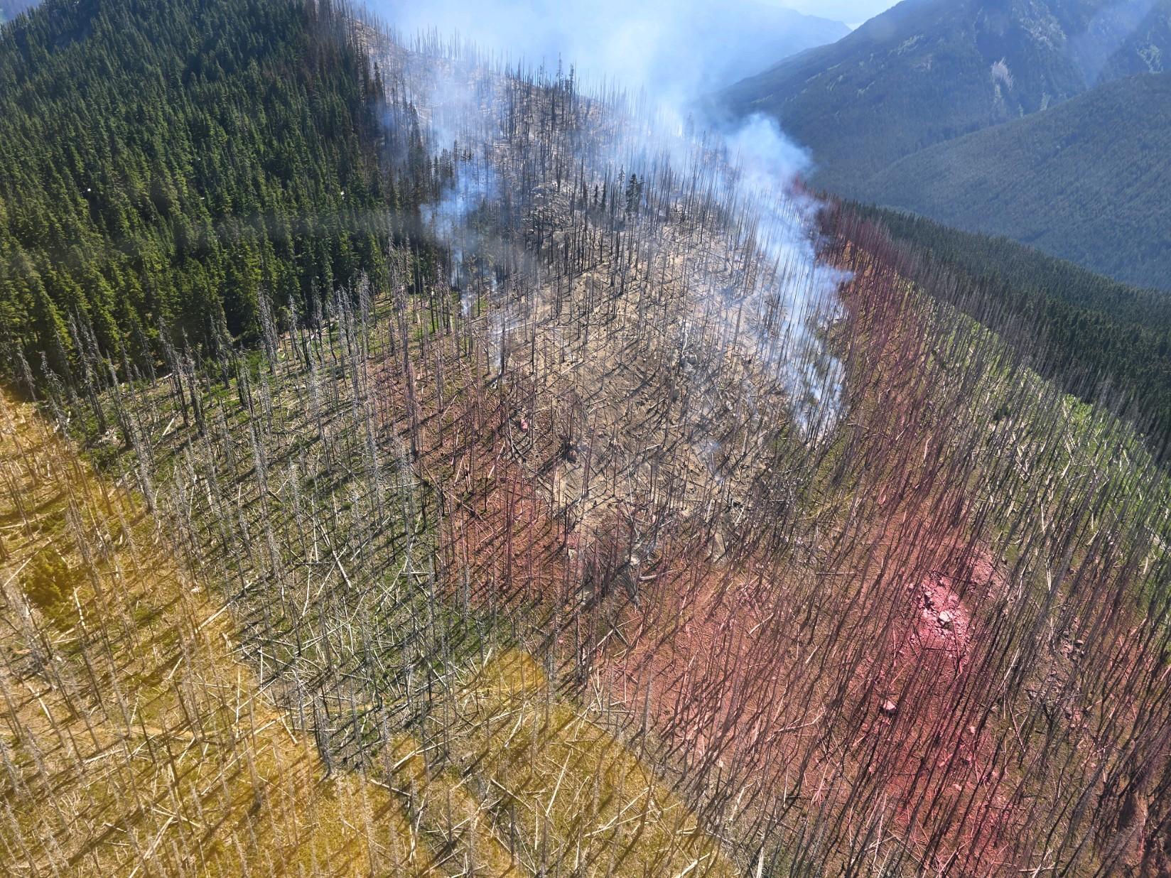
| Fuels Involved | Timber (litter and understory); Brush (2 feet) Abundant snags from 2014 burn scar, the southern edge of the fire is checked with handline and natural features. |
| Significant Events | Minimal fire activity observed. The fire is smoldering in dead and down fuels, not moving much beyond that. |
| Planned Actions |
Continue to monitor remotely and as needed with local district personnel. |
|---|---|
| Projected Incident Activity |
12 hours: Monitor and patrol control lines. 24 hours: Monitor and patrol control lines. 48 hours: Monitor and patrol control lines. 72: hours: Monitor and patrol control lines. |
| Weather Concerns | Warm high pressure will build over Shoofly Tuesday, pushing temperatures in the 80's with low humidity and moderate instability. Starting Wednesday morning, 10% chance of wetting rain and 10% chance of lightening. Winds will consistently be 10 mph through the week. |
|---|