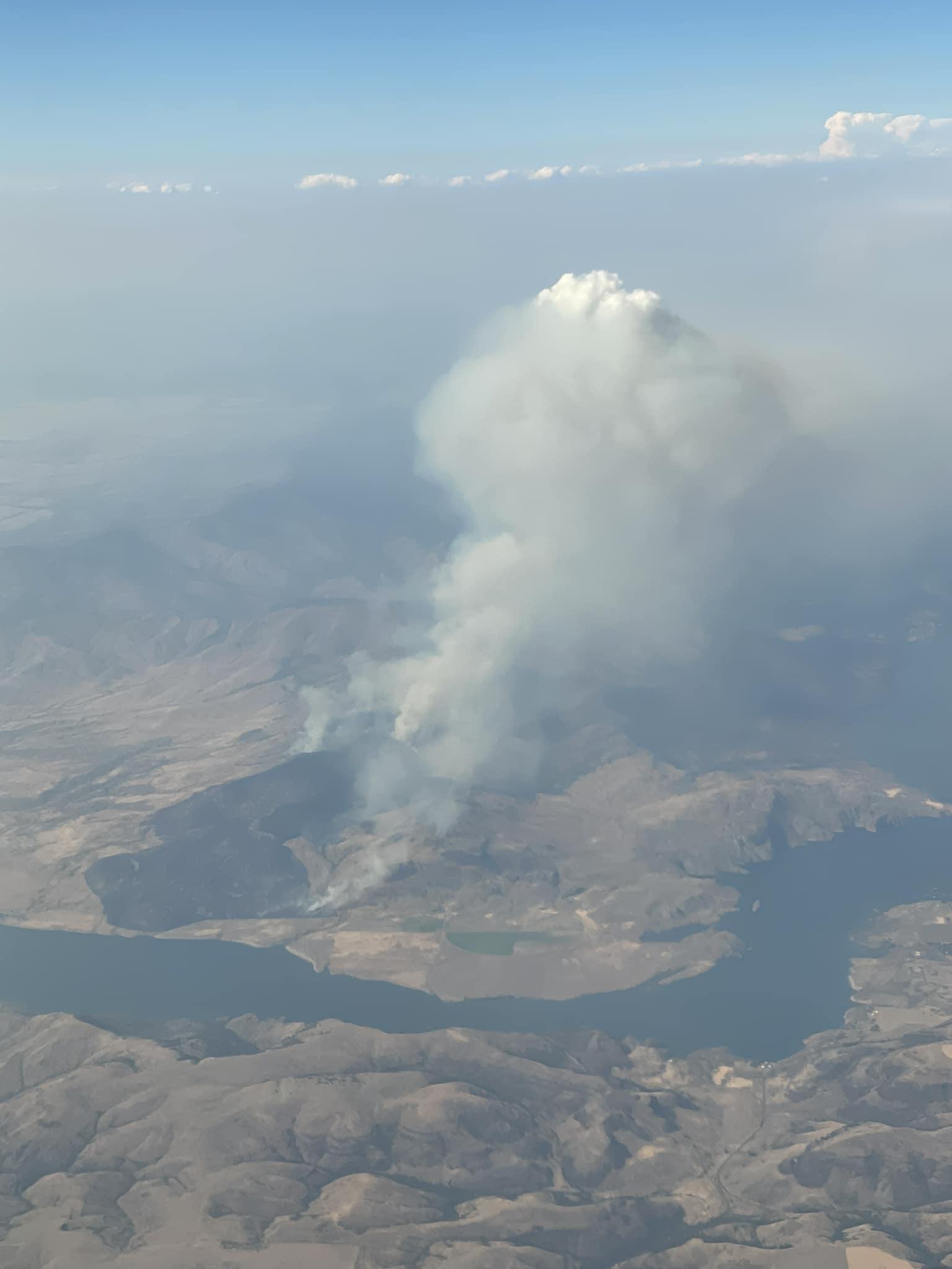
Highlighted Media

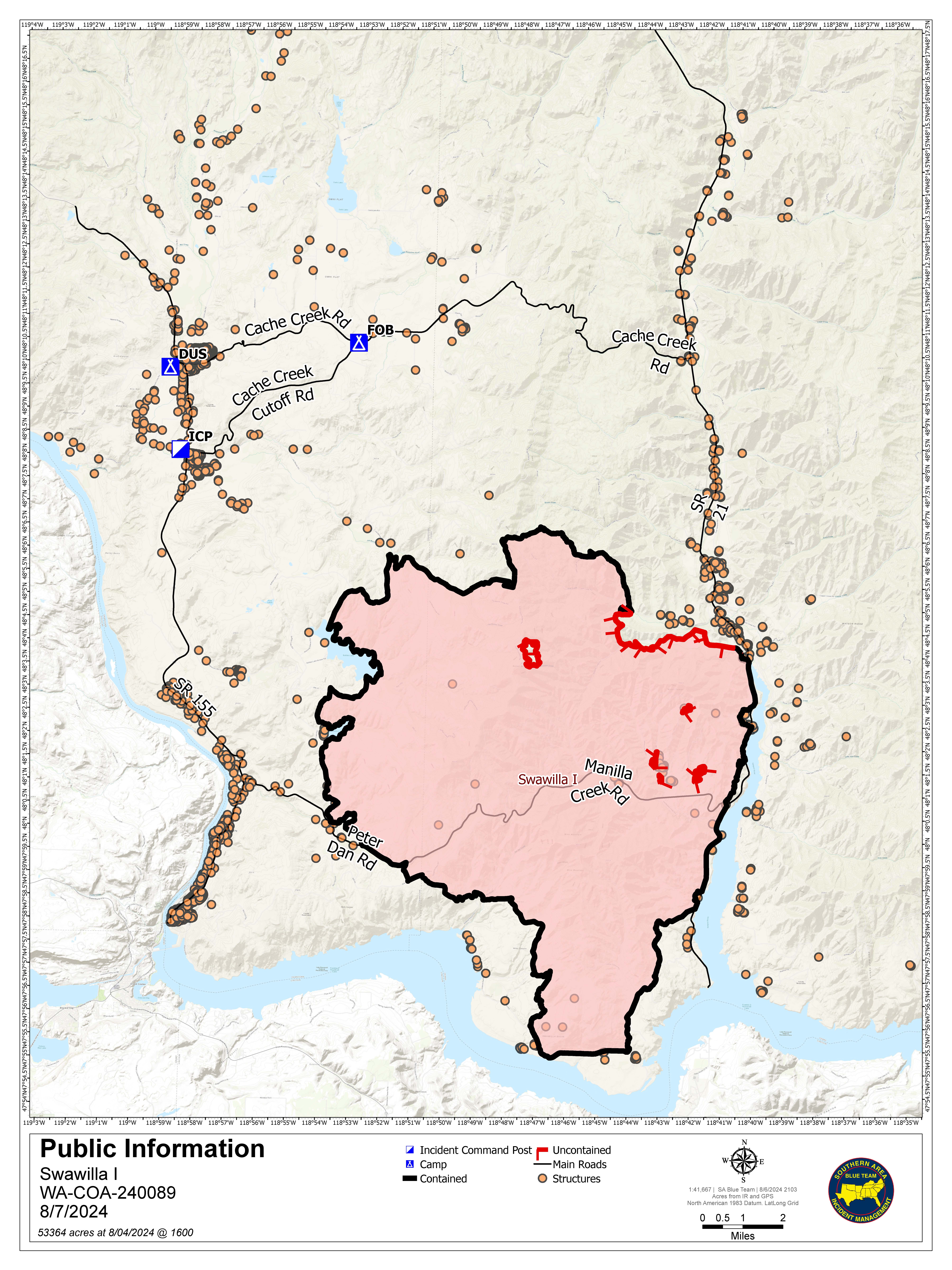
The Swawilla Fire was initiated by lightning on July 17th, 2024. It is located 9 miles south of Keller and roughly estimated at 53,462 acres. Level 3 evacuations were lowered to Level 2 for the town of Keller along the Hwy. 21 corridor north to Cache Creek. All major traveled roadways surrounding the fire are now open.
The Swawilla Fire was initiated by lightning on July 17th, 2024. It is located 9 miles south of Keller and roughly estimated at 53,462 acres. Level 3 evacuations were lowered to Level 2 for the town of Keller along the Hwy. 21 corridor north to Cache Creek. All major traveled roadways surrounding the fire are now open.
| Current as of | Fri, 08/16/2024 - 10:56 |
|---|---|
| Incident Time Zone | America/Los_Angeles |
| Incident Type | Wildfire |
| Cause | Lightning/Natural |
| Date of Origin | |
| Location | North of Columbia River, East of Swawilla Basin, West of Hwy 21 |
| Incident Commander | Charlie Patterson, IC Andy Baker, Deputy IC Jon Wallace, IC Trainee Southern Area Blue Complex Incident Management Team |
| Coordinates |
47° 56' 45'' Latitude
-118° 46' 42
'' Longitude
|
| Total Personnel: | 401 |
|---|---|
| Size | 53,462 Acres |
| Percent of Perimeter Contained | 98% |
| Estimated Containment Date | 8/22/2024 |
| Fuels Involved | Tall Grass (2.5 feet) Fuels in the fire area are composed of a mosaic of grass/shrub (GR2/SH2) and mixed conifer/shrub/litter understory (TU5/TL8). All age and size classes of conifer fuels are represented. Low to moderate amount of dead surface fuels within plantations and harvest units. Herbaceous and live woody fuels are partially to fully cured on the exposed, south aspects and will contribute to surface fire spread. The fire perimeter is encountering past burn scars and fuel treatment areas. Fuel loading is much lighter in these areas. |
| Significant Events | Minimal Mostly surface fire consuming interior pockets of fuel. |
| Planned Actions |
In all Divisions resources will patrol and take any action necessary to keep fire within containment lines. Continued suppression repair and backhaul of required equipment and supplies. |
|---|---|
| Projected Incident Activity |
12 hours: Active surface fire in the interior of northern portions of the fire. 24 Hours: Fire should remain within containment lines as it continues to burn and clean up interior pockets of fuels. 48 Hours: Fire should remain within containment lines as it continues to burn and clean up interior pockets of fuels. 72 hours: Fire should remain within containment lines as it continues to burn and clean up interior pockets of fuels. Anticipated after 72 hours: Fire should remain within containment lines as it continues to burn and clean up interior pockets of fuels. |
| Remarks |
The Southern Area CIMT 2 (Blue Team) will transfer command of the fire at 0600 PDT to a Type 3 IMT on August 8, 2024. |
| Weather Concerns | Some moderation in the immediate forecast but continued warm and dry conditions with a slight chance of thunderstorm activity with erratic, gusting outflow winds. |
|---|

 InciWeb
