


After a major wind event early afternoon March 20, 2024, a fire was reported on private land in the Rocky Branch area of Luray, Virginia, just north of Shenandoah National Park Headquarters. Initial responders included Luray Fire Department and National Park Service (NPS) firefighters. The fire progressed into the Park, and NPS firefighters assembled a crew to contain it. On March 23, the Southern Area Incident Management Team assumed command of the fire. At the end of the day on March 27, fire management was returned to Shenandoah National Park. The cause of the fire is undetermined.
After a major wind event early afternoon March 20, 2024, a fire was reported on private land in the Rocky Branch area of Luray, Virginia, just north of Shenandoah National Park Headquarters. Initial responders included Luray Fire Department and National Park Service (NPS) firefighters. The fire progressed into the Park, and NPS firefighters assembled a crew to contain it. On March 23, the Southern Area Incident Management Team assumed command of the fire. At the end of the day on March 27, fire management was returned to Shenandoah National Park. The cause of the fire is undetermined.
| Current as of | Thu, 03/28/2024 - 08:06 |
|---|---|
| Incident Time Zone | America/New_York |
| Incident Type | Wildfire |
| Cause | Undetermined |
| Date of Origin | |
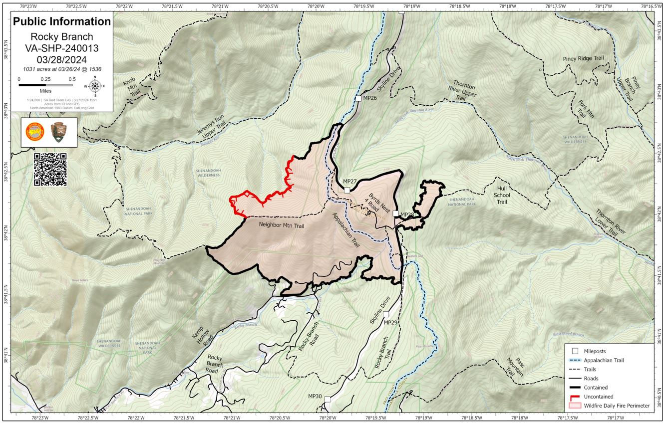
| Location | 5 miles northeast of Luray, Virginia |
| Incident Commander | Steven Parrish, Incident Commander Bart Kicklighter, Incident Commander Michael Davis, Incident Commander Trainee |
| Coordinates |
38° 41' 44'' Latitude
-78° 20' 11
'' Longitude
|
| Total Personnel: | 40 |
|---|---|
| Size | 1,031 Acres |
| Percent of Perimeter Contained | 80% |
| Estimated Containment Date | 04/04/2024 |
| Fuels Involved | Hardwood litter and timber (grass and understory) |
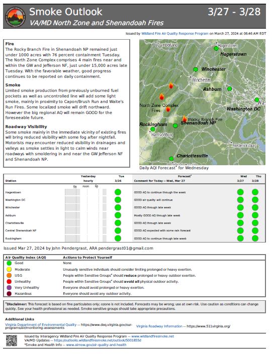
| Significant Events | Minimal, smoldering Narrative: Limited small pockets of smoldering remain, mostly in stump holes and dead/down snags. |
| Planned Actions |
Monitor and map the fire edge in Div W. Monitor and patrol in Divs. A, G, and W. |
|---|---|
| Projected Incident Activity |
12 hours: Limited fire movement expected, with some smoldering in 1,000-hour fuels expected. 48 hours: Predicted rainfall should moderate fire behavior, with limited movement expected while some smoldering in stump holes and heavy fuels may continue. 72 hours: Minimal fire behavior expected. |
| Remarks |
Trail and road closures are in effect and include the following. |
| Weather Concerns | Tuesday 3/26: Partly to mostly sunny today with increasing high clouds later in the day. Temperatures near normal with afternoon humidity dropping to around 35%. Light terrain driven winds at lower elevations with southerly winds around 10 mph across the ridgetops. Lows in the upper 30s to lower 40s tonight with a slight chance of rain after midnight. Excellent humidity recovery. |
|---|