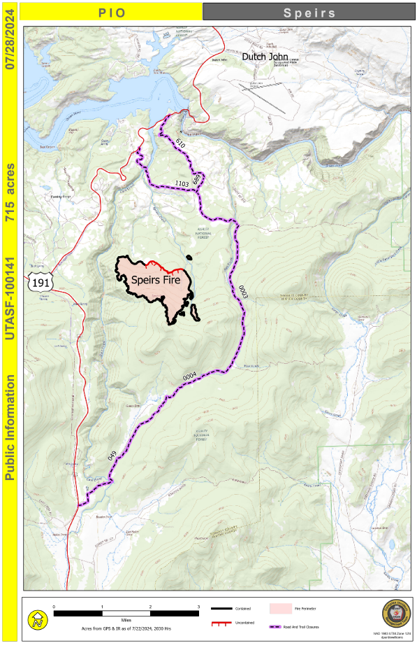
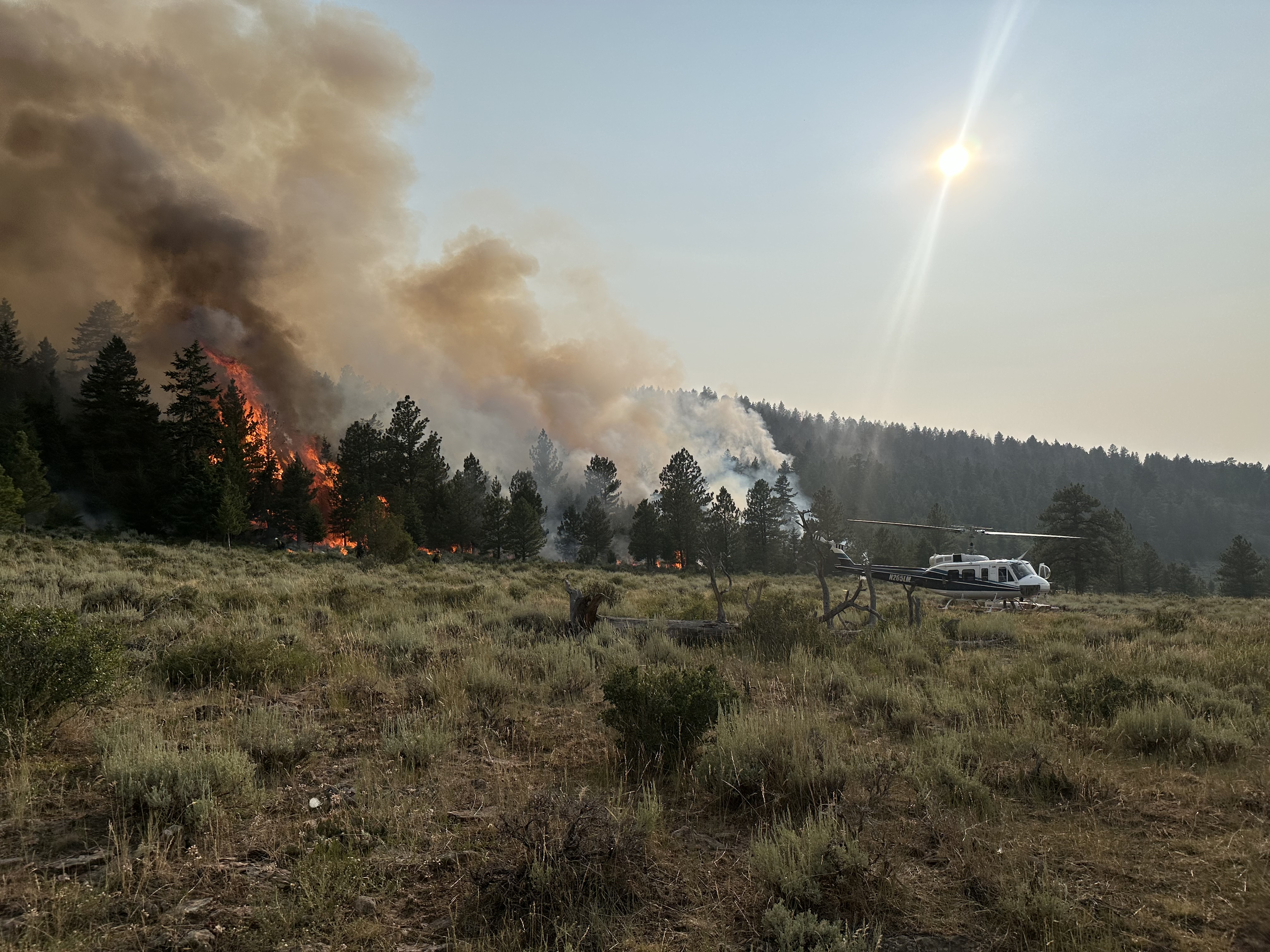
U.S. flag

An official website of the United States government

Here's how you know

Single Incident Information

Zoom to your location
Reset map zoom and position

Could not determine your location.

Speirs Fire

Unit Information

Utah 
Vernal, 
Utah 
84078 
Utah 
Vernal, 
Utah 
84078 

Incident Contacts

Speirs Fire Information
Phone: (435) 709-8209
Hours: 6:00 AM to 10:00 PM Mountain Time

Highlighted Activity

Firefighters Memorial Campground and part of Greendale Group Campground have reopened after being temporarily closed due to the Speirs Fire.The following forest service roads and trails remain closed:• Forest Service Road (FSR) 610, FSR 689, Greens Draw Road (FSR 049)• Lowline trail, Forest Service trail (FST) 103, its junction with the Pipe Creek Trail,FST 003• Forest Service trail 003 from… Read more
Publication Type: Closures -
The Speirs Fire daily fact sheet will be moving to an every other day posting (next one will be shared tomorrow morning) but here are some quick facts for today:715 acres, 68% contained, 399 personnel & please watch the operational update video that has been posted on the Ashley National Forest FB page.If you have specific questions, please contact the Speirs Fire information line at (435)… Read more
Publication Type: News -

Highlighted Media

Pioneer Day parade_thank you firefighters

The Speirs Fire was caused by lightning and first reported on Saturday, July 13 at approximately 1:00 pm. The fire is located approximately three miles south of the town of Dutch John, Utah and south of Flaming Gorge Reservoir. It is burning in heavy timber and downed timber and grass understory in steep and rugged terrain. The fire is currently being managed by Great Basin Complex Incident Management Team 3.

Basic Information
Current as of Fri, 07/26/2024 - 10:47
Incident Time Zone America/Denver
Incident Type Wildfire
Cause Lightning
Date of Origin
Location 30 miles north of Vernal, Utah
Incident Commander Brett Waters, Incident Commander, Great Basin Complex Incident Management Team 3
Coordinates 40° 52' 40'' Latitude
-109° 26'
12
'' Longitude
Current Situation
Total Personnel: 399
Size 715 Acres
Percent of Perimeter Contained 68%
Fuels Involved

Timber (Grass and Understory)

Short grass (1 foot) 

Medium logging slash

Significant Events

Minimal - Flanking, Backing, Creeping

Fire behavior was generally low to moderate spread rates and flame lengths occurring on portions of the uncontrolled edge and interior pockets. Some jackpot burning was observed.

Outlook
Planned Actions

In Division A, crews will continue to hold and mop-up firing operations that occurred along the northern flank of the fire on Monday.  Division F and Z will continue to mop interior of the main edge of the fire. Spots East of division F will continue to be worked and evaluated. Helicopters will continue to be utilized to perform bucket operations on interior islands. Crews are beginning to de-mobilize from the fire as they time out. Replacement needs will be evaluated into the 24, 48, and 72-hour timeframes. Construction will continue on the contingency line south of the fire in the Green's Draw corridor.

Projected Incident Activity

12 hours: Continued limited burning in heavy fuels in the interior and on the uncontrolled edge, occasional jackpot burning. There may be spotting related to rollout in steep terrain, otherwise we expect few challenges to containment lines. Precipitation on the fire is possible tonight.


24 hours: The RH is forecast to rise once again (+ 15%), precipitation chances remain the same, cloud cover will slightly diminish, and the temperature will decrease about 5 degrees. Winds will move to come from the west. General fire behavior is expected to diminish to low levels. We are still concerned with the possibility of thunderstorms-associated outflow winds away from any precipitation. The fire area is likely to receive at least some precipitation Friday.

Current Weather
Weather Concerns

Monsoonal moisture began pushing back across Utah, arriving across NE Utah midmorning Thursday. Humidity levels remained steady in the upper 20s and lower 30s through the day. Increased moisture brought showers and thunderstorms to the area during the afternoon, but did not impact the incident. This pattern is expected to continue Friday and Saturday, with showers and thunderstorms each afternoon.