
Highlighted Media
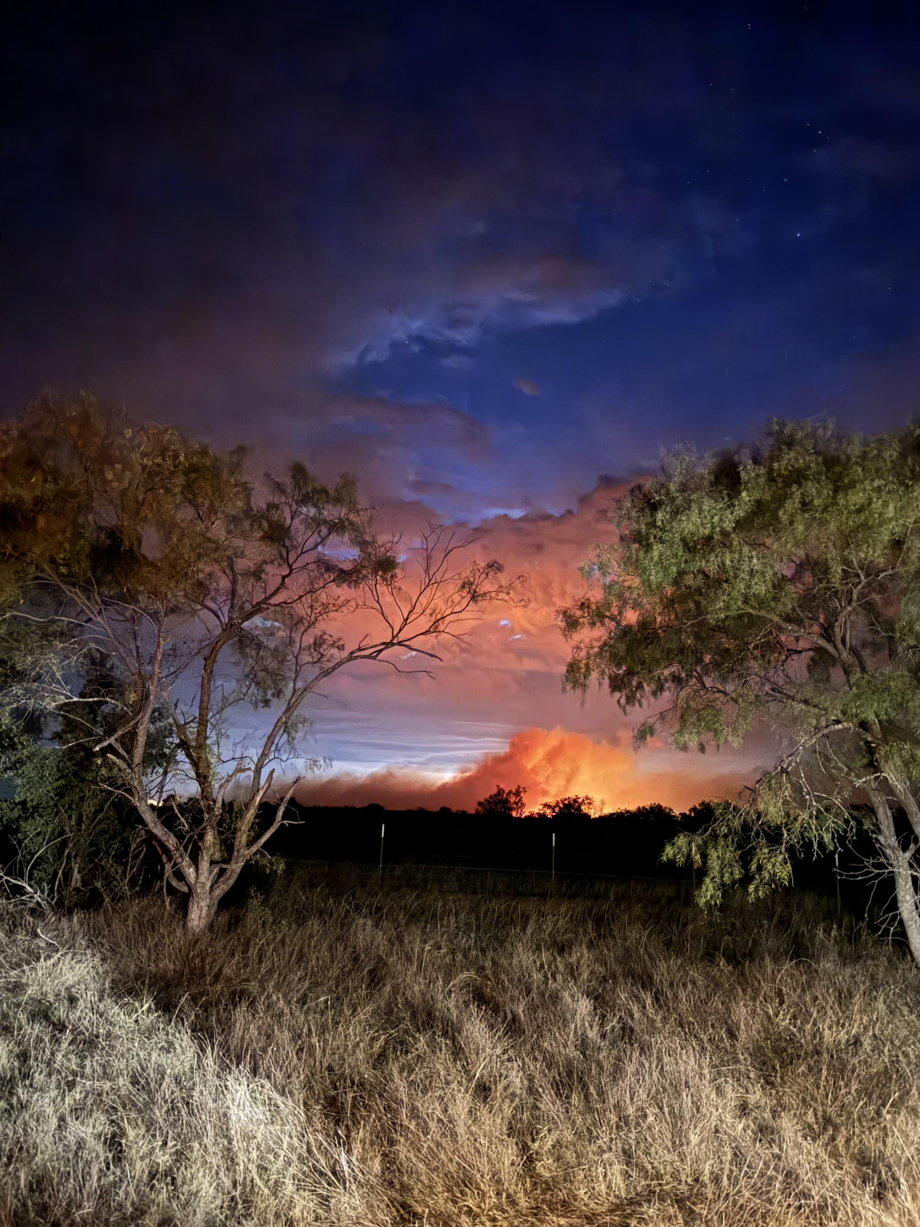
Nighttime photo of fire activity in the distance on the North Art Fire Complex.
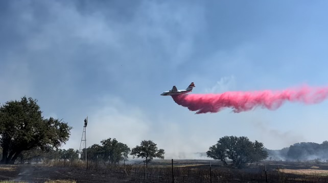
Large airtanker dropping fire retardant on the North Art Complex Fire
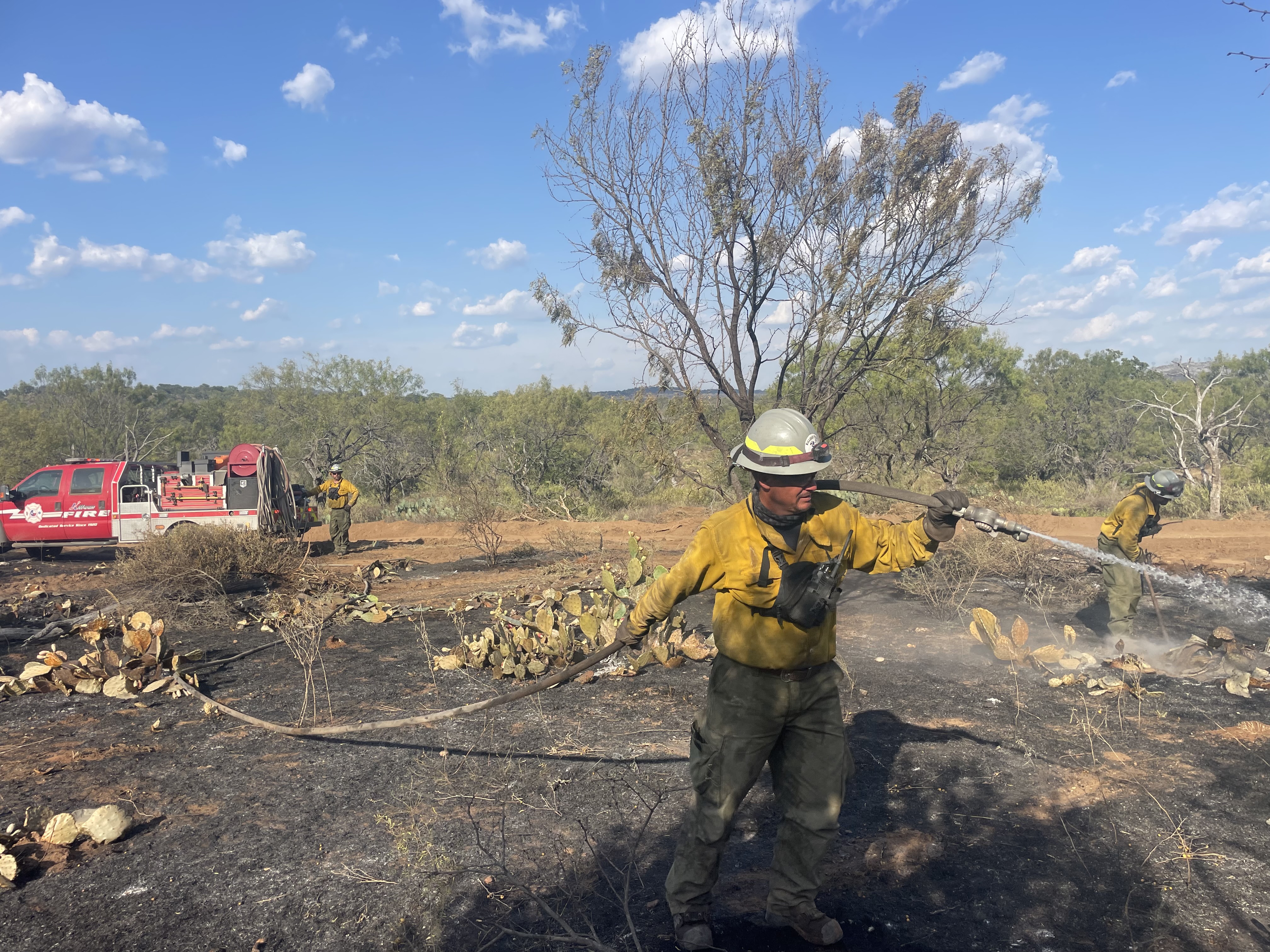
Texas Intrastate Fire Mutual Aid System (TIFMAS) engine out of Killeen mopping up along a dozer line on the northwest side of the fire.
Final Update, 6:00 PM, 8/25/24: The North Ark Complex reached 100% containment today and was returned to local officials. Crews completed patrol and mop up this afternoon.
-Original-
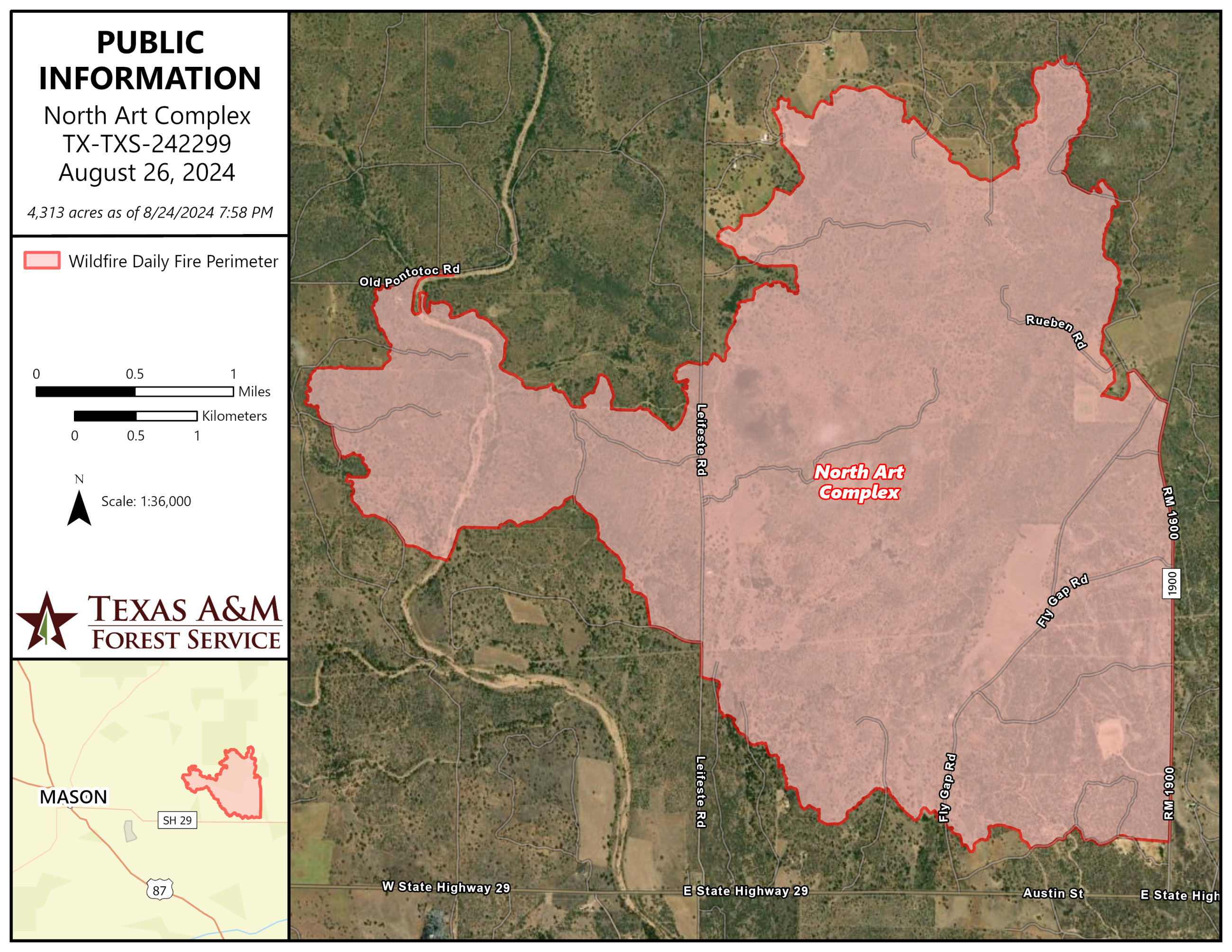
The North Art Complex started on August 22, 2024 approximately 7 miles east of Mason, Texas and 1 mile north of Art, Texas. Local fire departments initially responded to this fire and requested assistance from Texas A&M Forest Service to provide additional resources on August 22, 2024.
Texas A&M Forest Service is working in unified command with Mason County officials to suppress the North Art Complex.
Crews responded with heavy equipment to construct containment lines, areas cleared of any kind of combustible materials, around the perimeter of the fire, stopping further spread. Engines worked along these lines, putting out any active flames and identifying any heat to ensure that fire can not cross back over the containment lines. Aviation resources assisted on the first and second days of the first to extinguish hot areas of the fire and monitor fire spread.
Final Update, 6:00 PM, 8/25/24: The North Ark Complex reached 100% containment today and was returned to local officials. Crews completed patrol and mop up this afternoon.
-Original-
The North Art Complex started on August 22, 2024 approximately 7 miles east of Mason, Texas and 1 mile north of Art, Texas. Local fire departments initially responded to this fire and requested assistance from Texas A&M Forest Service to provide additional resources on August 22, 2024.
Texas A&M Forest Service is working in unified command with Mason County officials to suppress the North Art Complex.
Crews responded with heavy equipment to construct containment lines, areas cleared of any kind of combustible materials, around the perimeter of the fire, stopping further spread. Engines worked along these lines, putting out any active flames and identifying any heat to ensure that fire can not cross back over the containment lines. Aviation resources assisted on the first and second days of the first to extinguish hot areas of the fire and monitor fire spread.
| Current as of | Thu, 08/29/2024 - 15:36 |
|---|---|
| Incident Time Zone | America/Chicago |
| Incident Type | Wildfire |
| Cause | Lightning |
| Date of Origin | |
| Location | 7 miles east of Mason, Texas |
| Incident Commander | Shane Crimm, Texas A&M Forest Service |
| Incident Description | Wildfire burning in oak, juniper, and mesquite with grass understory. |
| Coordinates |
30° 44' 18.2640'' Latitude
-99° 6' 41.2980
'' Longitude
|
| Size | 4,313 Acres |
|---|---|
| Percent of Perimeter Contained | 100% |
| Fuels Involved | Grass, Oak, Juniper, Mesquite |
| Significant Events | Minimal fire behavior was observed yesterday, including creeping and smoldering. |
| Planned Actions |
Continued containment line creation. Patrolling and mop up along fire perimeter |
|---|---|
| Projected Incident Activity |
Mitigation of hazard trees near containment lines, patrolling and mop up. |
| Weather Concerns | Expect light and variable winds this morning to become southeast at 5 to 10 mph by mid to late morning and continue into the afternoon hours. Winds will return to light and variable this evening. Expect RH values to drop to around 67 percent by 10 AM, near 50 percent by noon, and reach a minimum of 33 percent by midafternoon. RH values will then slowly begin to increase this evening, reaching 40 percent by 8 PM. Expect a high temperature around 96 this afternoon. |
|---|