
Highlighted Media
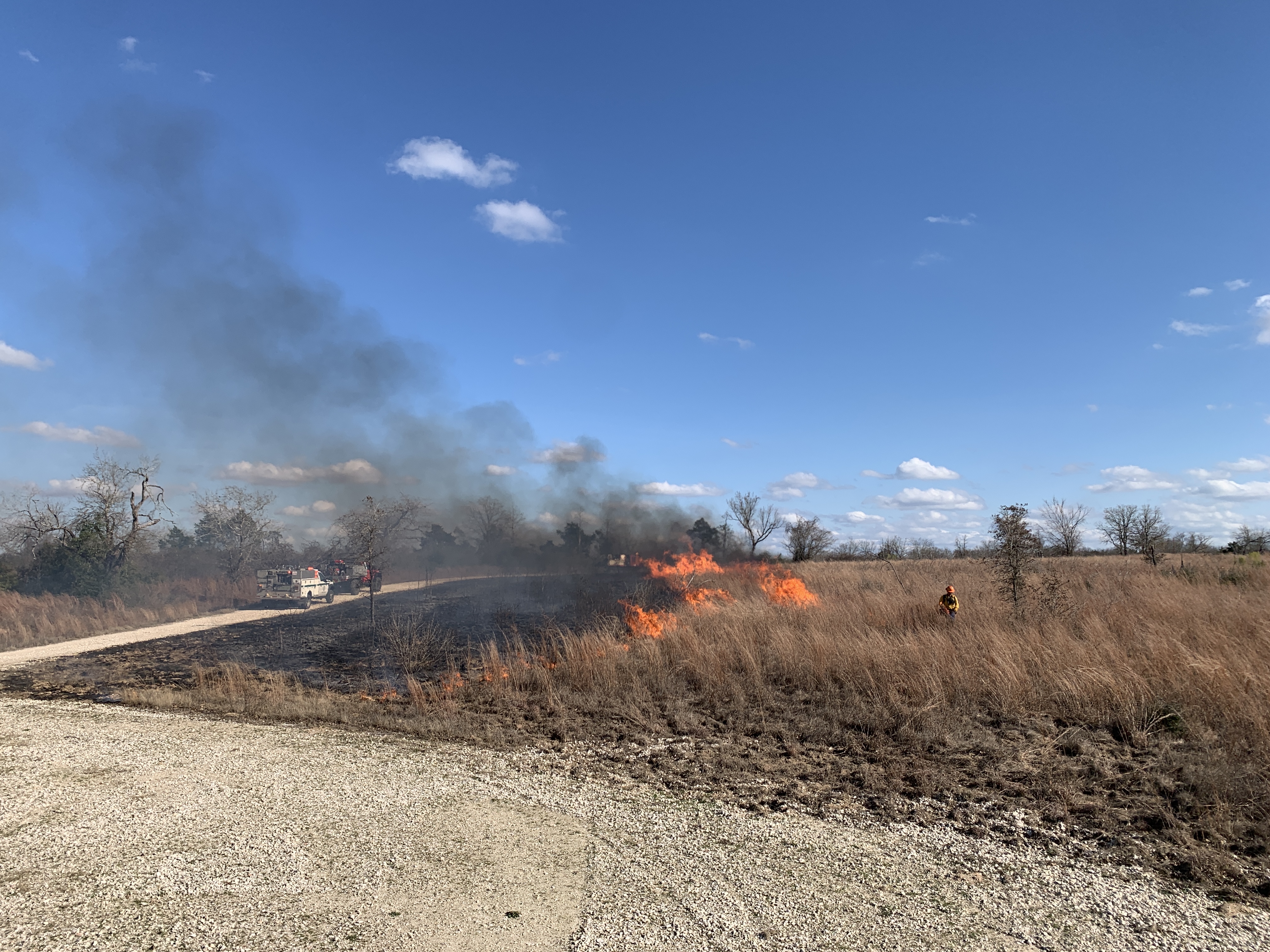
Unit 9, a predominately grass unit with native tree species encroaching in meadow, last underwent a prescribed fire two year ago, in January 2023. Without regular maintenance, grasslands can become overrun with vines, shrubs and trees, along with "thatchy" dead grasses, restricting new grasses from growing. A wildland firefighter uses a drip torch to slowly light the unit to revitalize native grass growth.
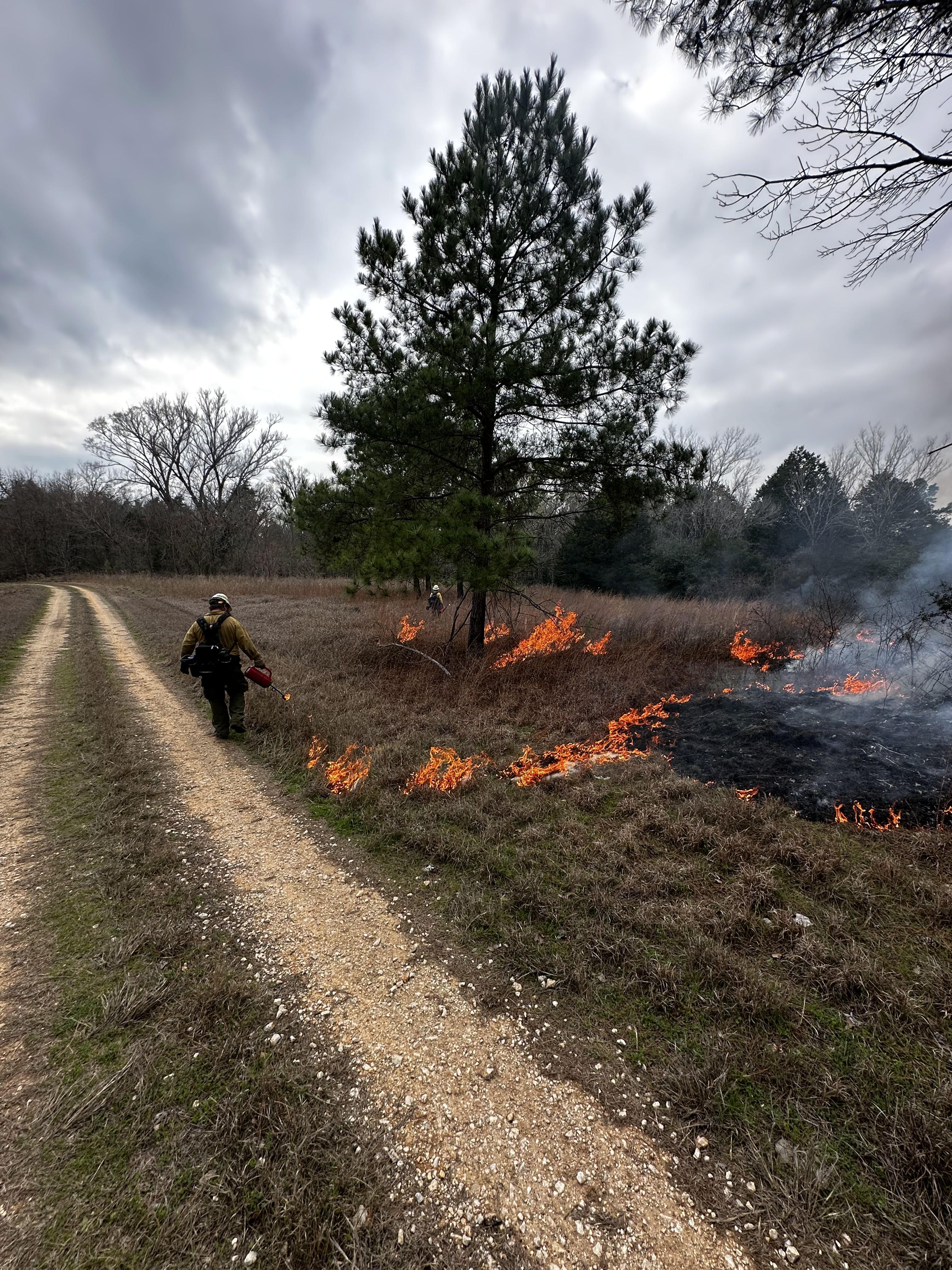
Objectives for many of the prescribed fires at Camp Swift include burning the grassy meadows to reduce the amount of woody hardwoods, such as sand plum, various oaks and youpon holly, which encroach into these openings. Here, the ignitors use a technique to put a small amount of fire under the pine trees first, before the main head of the fire moves through, in order to protect the mature pine trees.
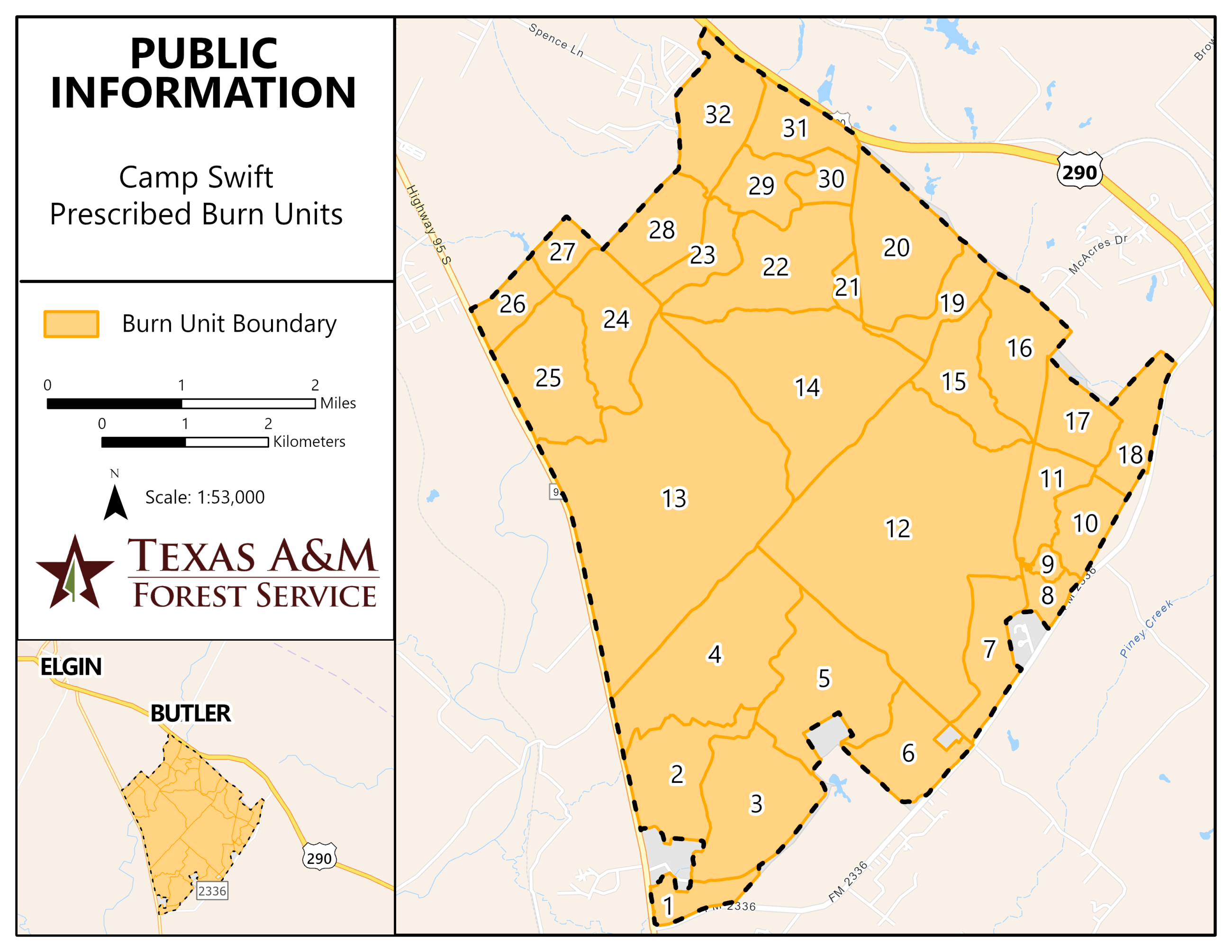
Texas A&M Forest Service is planning for several prescribed burns to take place on Camp Swift Army National Guard land during late winter to early spring 2025. Burn units identified as Units 6, 7, 9, 11, 15, 17, 19, 25, 28, 30 and 31 may be burned for a total of 2,182 acres.
Units with Proposed Burning Dates in Mid-February
- Unit 17 - 188 acres
Units with Proposed Burning Dates February to May
- Unit 7 - 234 acres
- Unit 25 - 380 acres
- Unit 28 - 236 acres
- Unit 30 - 100 acres
- Unit 31 - 188 acres
Units Completed
- Unit 9 – 28 acres - Completed Feb. 3, 2025
- Unit 11- 160 acres - Completed Feb. 3, 2025
- Unit 6 - 252 acres - Completed Feb. 17, 2025
- Unit 15 - 260 acres - Completed Feb. 17, 2025
- Unit 19 - 156 acres - Completed Feb. 17, 2025
These burns are designed to meet multiple land management objectives including reducing the accumulation of hazardous fuels by targeting invasive and native aggressive species, manage understory growth, improve access and visibility for land management and Texas Military Department training activities and improve wildlife habitat.
Each prescribed burn unit has defined weather parameters and firing patterns to ensure the objectives for each unit have a high potential for success. Texas A&M Forest Service personnel will monitor all prescribed burns to evaluate achievement of goals and help guide future prescriptions.
Nearby residents can expect some lingering smoke effects overnight after the burns and may see some moderate to heavy smoke impacts for short periods during ignition operations. These effects will be mitigated by burning on days with good ventilation so that smoke will be dispersed away from communities.
More information will be published as weather conditions allow for safe burning operations.
| Current as of | Tue, 02/18/2025 - 14:29 |
|---|---|
| Incident Time Zone | America/Chicago |
| Incident Type | Prescribed Fire |
| Date of Origin | |
| Location | Bastrop County, Texas |
| Incident Commander | Texas A&M Forest Service |
| Coordinates |
30° 15' 20.4552'' Latitude
--98° 43' 23.2674
'' Longitude
|