
On March 10, 2025, at approximately 1015 hours, two fires were reported along BIA Route 13 on Cheyenne River Indian Reservation. These fires merged becoming the Route 13 Fire. A third fire, Northside Fire, was reported at 1049 hours. Overnight the fires merged into one Fire, Route 13 Fire. The fire behavior, conditions, and winds prompted the evacuation of Takini School and Community on March 10, 2025.
Final
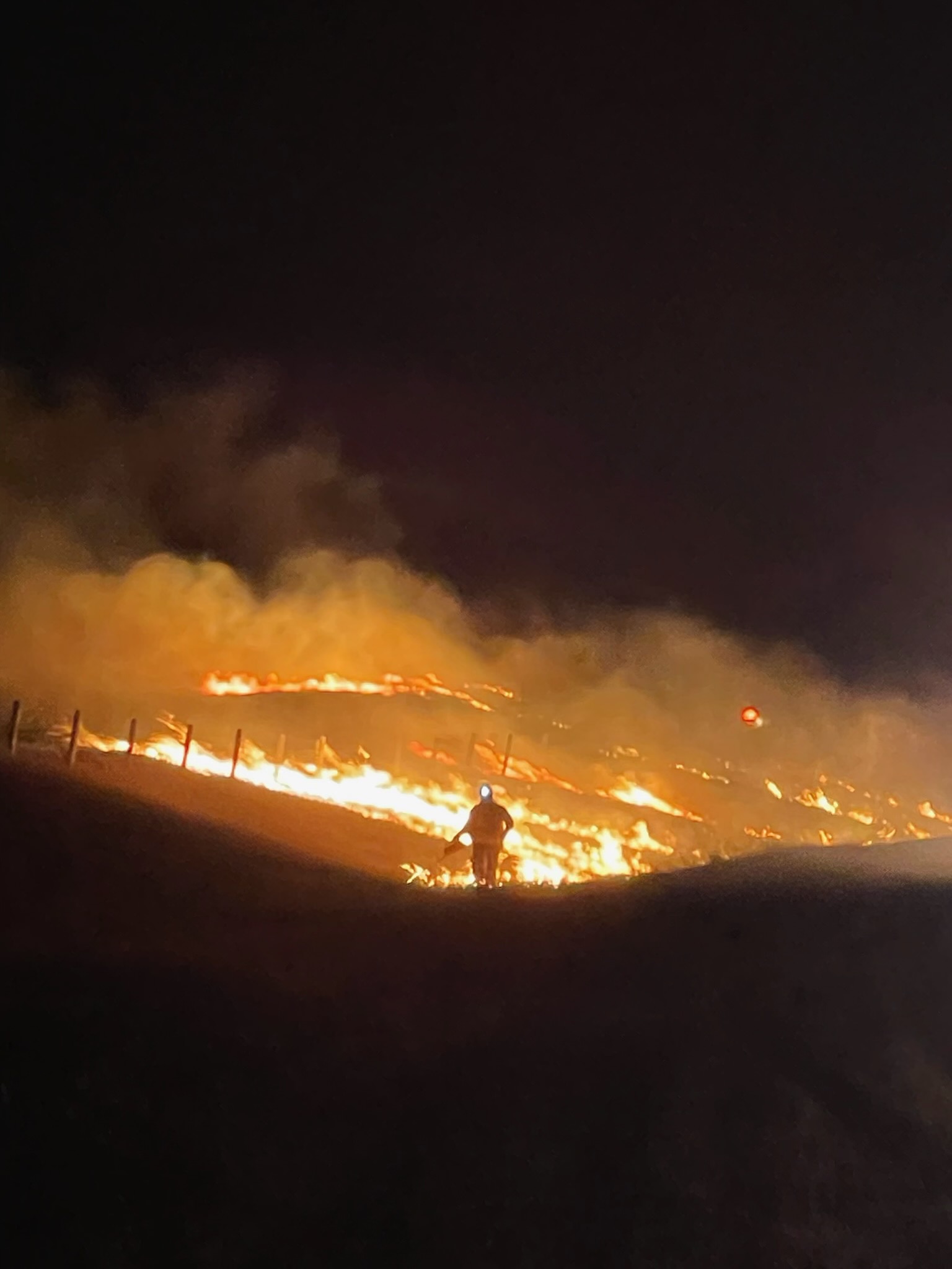
Incident Command reported 100% containment on March 20, 2025. The fire suppression was complicated by dry heavy fuels (trees, logs, and shrubs) from moderate drought conditions and fire weather conditions with critical and near severe along with frequent wind shifts. The shifting wind directions kept rekindling heavy fuels. There were periods of high winds reducing visibility and testing the fireline throughout the ten days.
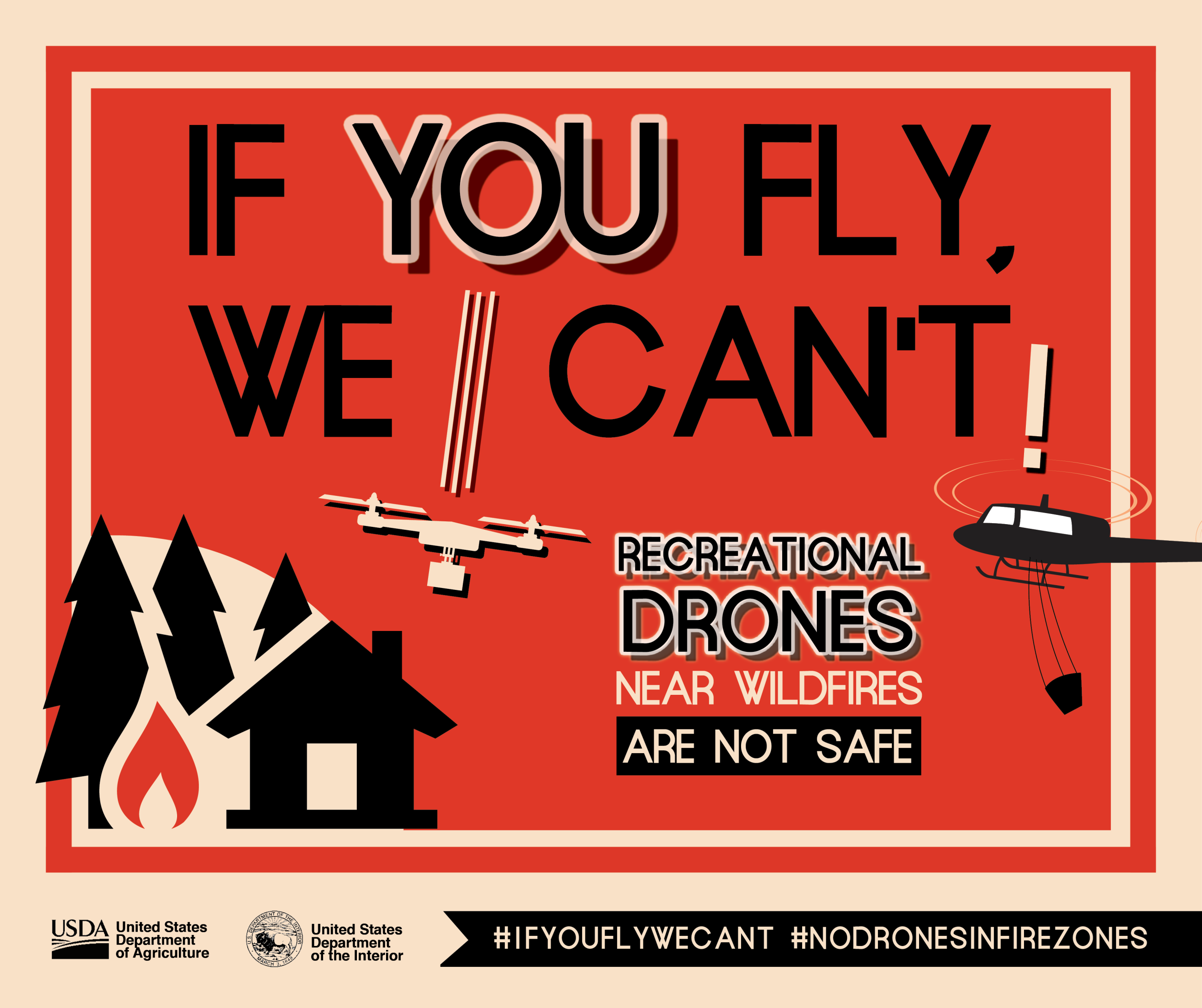
A Type 3 Helicopter and the South Dakota National Guard (SDNG) Type 1 Blackhawk Helicopters were available to address hot spots and map the fire perimeter. The SDNG Type 1 helicopters dropped 20 buckets of water on the fire on Thursday, March 13, 2025. At 660 gallons a bucket, this was approximately 26,000 gallons of water used to address the slop over. The Type 3 helicopter used was more agile and carries a 140-gallon bucket. It was able to Remember to keep drones grounded during wildland fire event because IF YOU ARE FLYING THEY CANNOT!
The Incident Command would like to thank the Takini and surrounding Communities for their support.
A Burned Area Emergency Response assessment is being done, working with other Agencies and personnel to determine future needs.
Enning Volunteer Fire Department provided initial response joined by BIA Wildland Fire resources along with Dupree, Faith, Isabel, Timber Lake, and Eagle Butte Volunteer Fire Departments. Additional resources were ordered by High Plains Zone Fire Management Officer at the request of the Incident Commander to assist in the Type 3 Incident Command.
Numerous other Volunteer Fire Departments assisted Cheyenne River on Monday and Tuesday. The fire had at least 135 personnel documented at one point. Thank you to all.
On March 10, 2025, at approximately 1015 hours, two fires were reported along BIA Route 13 on Cheyenne River Indian Reservation. These fires merged becoming the Route 13 Fire. A third fire, Northside Fire, was reported at 1049 hours. Overnight the fires merged into one Fire, Route 13 Fire. The fire behavior, conditions, and winds prompted the evacuation of Takini School and Community on March 10, 2025.
Final
Incident Command reported 100% containment on March 20, 2025. The fire suppression was complicated by dry heavy fuels (trees, logs, and shrubs) from moderate drought conditions and fire weather conditions with critical and near severe along with frequent wind shifts. The shifting wind directions kept rekindling heavy fuels. There were periods of high winds reducing visibility and testing the fireline throughout the ten days.
A Type 3 Helicopter and the South Dakota National Guard (SDNG) Type 1 Blackhawk Helicopters were available to address hot spots and map the fire perimeter. The SDNG Type 1 helicopters dropped 20 buckets of water on the fire on Thursday, March 13, 2025. At 660 gallons a bucket, this was approximately 26,000 gallons of water used to address the slop over. The Type 3 helicopter used was more agile and carries a 140-gallon bucket. It was able to Remember to keep drones grounded during wildland fire event because IF YOU ARE FLYING THEY CANNOT!
The Incident Command would like to thank the Takini and surrounding Communities for their support.
A Burned Area Emergency Response assessment is being done, working with other Agencies and personnel to determine future needs.
Enning Volunteer Fire Department provided initial response joined by BIA Wildland Fire resources along with Dupree, Faith, Isabel, Timber Lake, and Eagle Butte Volunteer Fire Departments. Additional resources were ordered by High Plains Zone Fire Management Officer at the request of the Incident Commander to assist in the Type 3 Incident Command.
Numerous other Volunteer Fire Departments assisted Cheyenne River on Monday and Tuesday. The fire had at least 135 personnel documented at one point. Thank you to all.
| Current as of | Sun, 04/13/2025 - 20:32 |
|---|---|
| Incident Time Zone | America/Denver |
| Incident Type | Wildfire |
| Cause | Under Investigation |
| Date of Origin | |
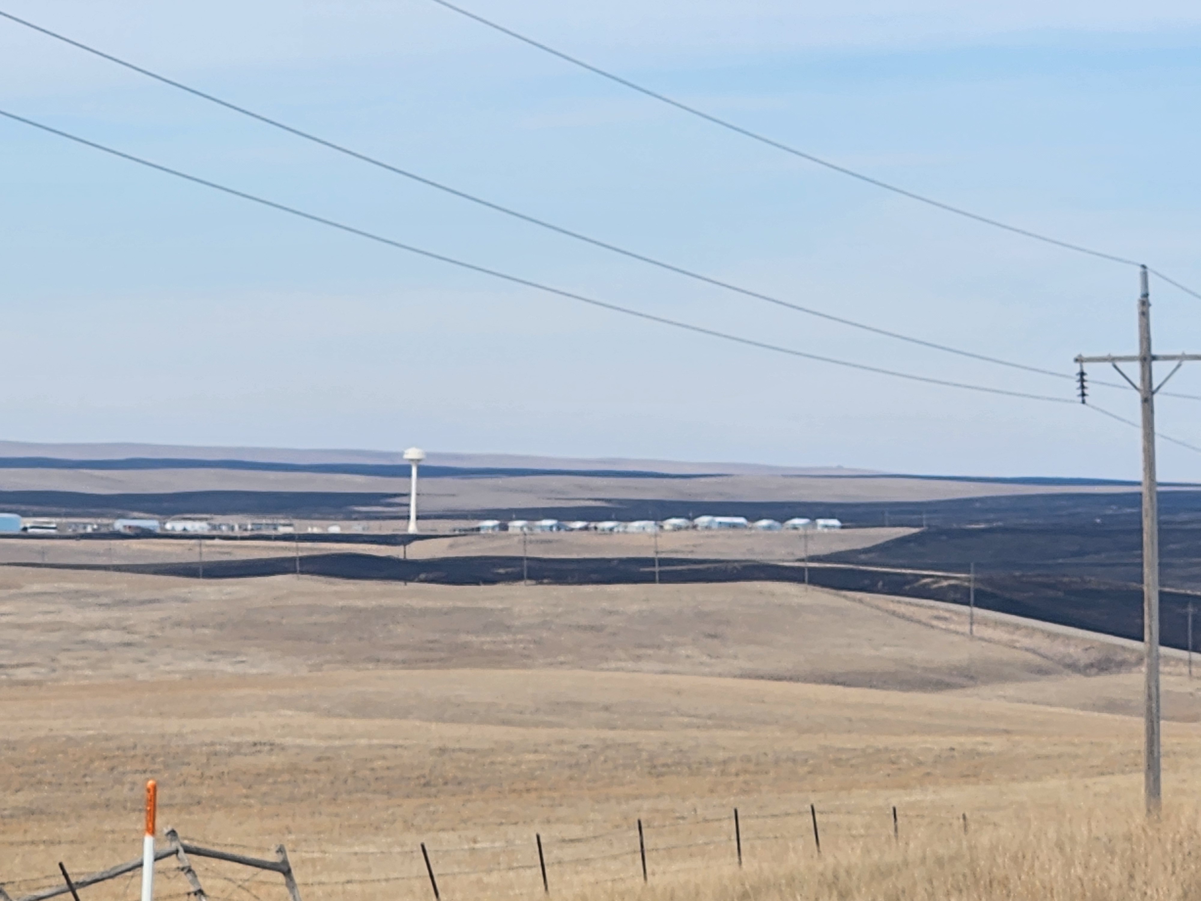
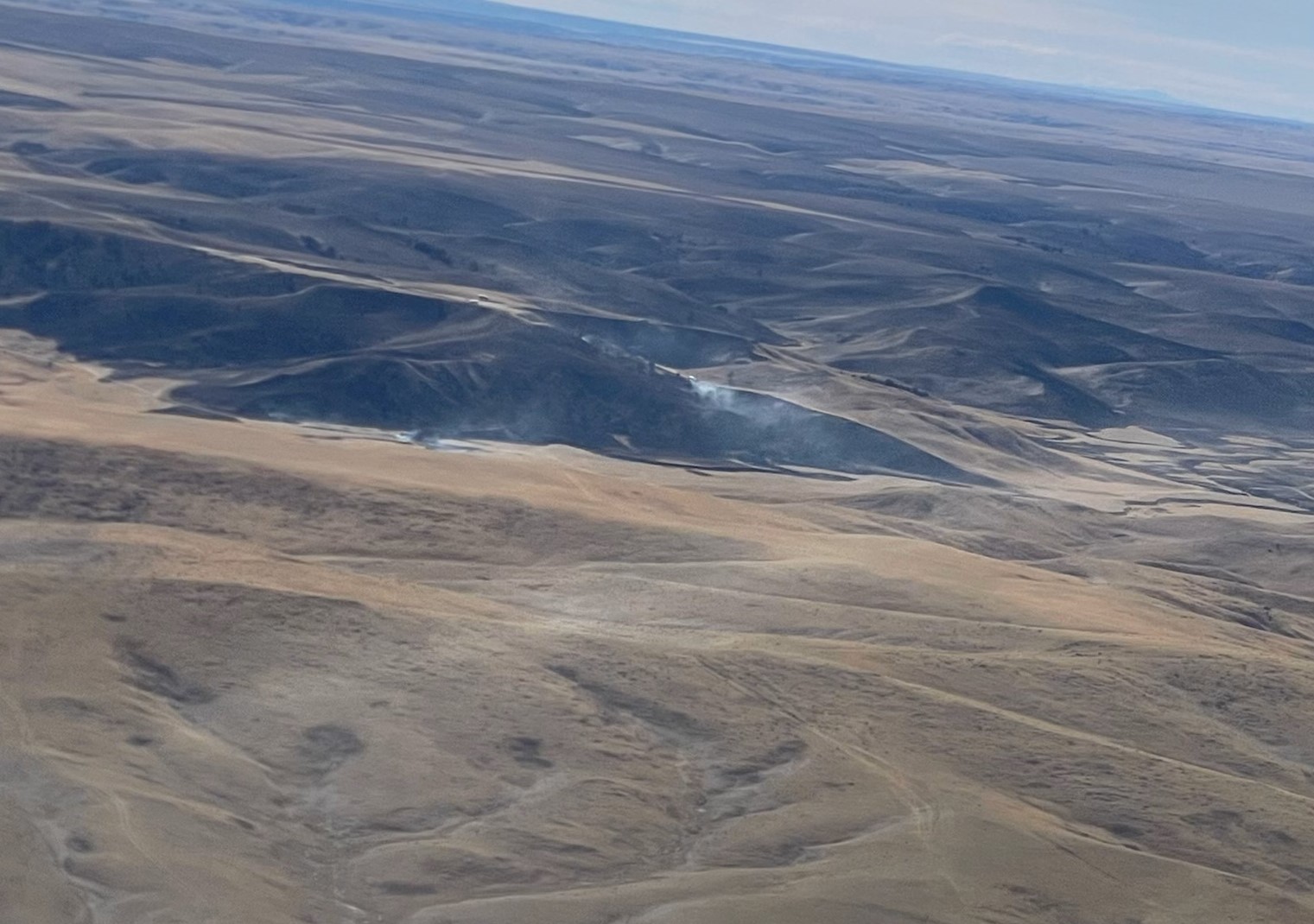
| Location | 28 miles south of Faith, SD, 8 miles east on BIA Route 11 |
| Incident Commander | Type 3 Incident Command Cheyenne River Agency Bureau of Indian Affairs |
| Incident Description | Grassland wildland fire in a rough river break area along Cherry Creek on the Cheyenne River Indian Reservation. |
| Coordinates |
44° 39' 15'' Latitude
-101° 59' 02
'' Longitude
|
| Total Personnel: | 56 on last ICS-209 |
|---|---|
| Size | 33,928 Acres |
| Percent of Perimeter Contained | 100% |
| Fuels Involved | There were heavy logs, trees, and shrubs burning in the draws. Some were rekindling with wind shifts and intensity. |
| Significant Events | Three fires in this area. All merged into one large fire. The fire is 17 miles in length. Block burns done overnight on March 11th successfully stopped forward progress of the fire. Terrain features prevented total burn out. No structures were involved. Patrolling and monitoring may continue to ensure hot spots do not spare new fires until the fire is completely out.
|
| Weather Concerns | It was warm and windy with frequent shifts in wind direction along with critical to near severe fire weather conditions on top of moderate drought conditions. |
|---|