Highlighted Media


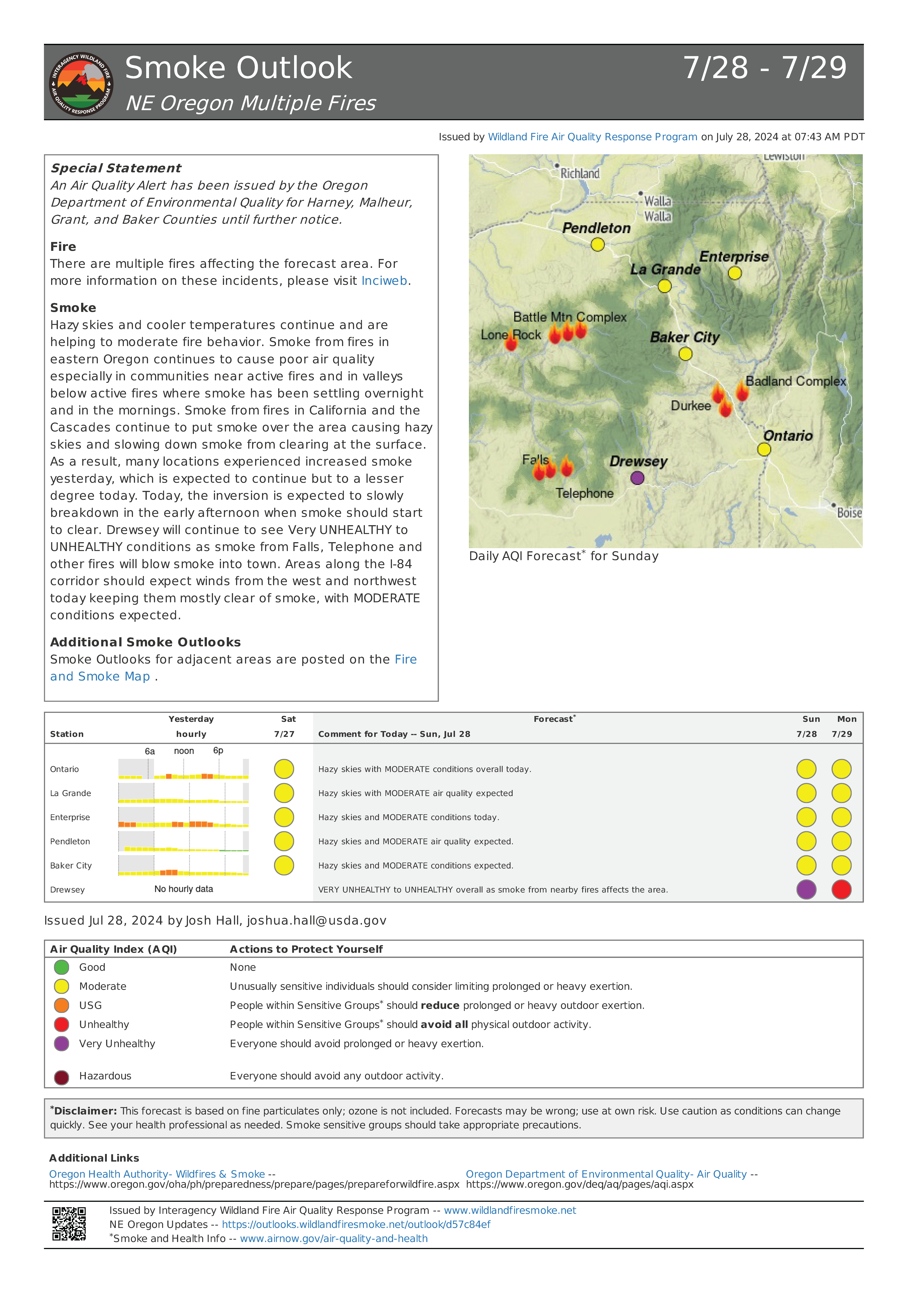
Hazy skies and cooler temperatures continue and are helping to moderate fire behavior. Smoke from fires in eastern Oregon continues to cause poor air quality especially in communities near active fires and in valleys below active fires where smoke has been settling overnight and in the mornings. Smoke from fires in California and the Cascades continue to put smoke over the area causing hazy skies and slowing down smoke from clearing at the surface. As a result, many locations experienced increased smoke yesterday, which is expected to continue but to a lesser degree today. Today, the inversion is expected to slowly breakdown in the early afternoon when smoke should start to clear. Drewsey will continue to see Very UNHEALTHY to UNHEALTHY conditions as smoke from Falls, Telephone and other fires will blow smoke into town. Areas along the I-84 corridor should expect winds from the west and northwest today keeping them mostly clear of smoke, with MODERATE conditions expected.
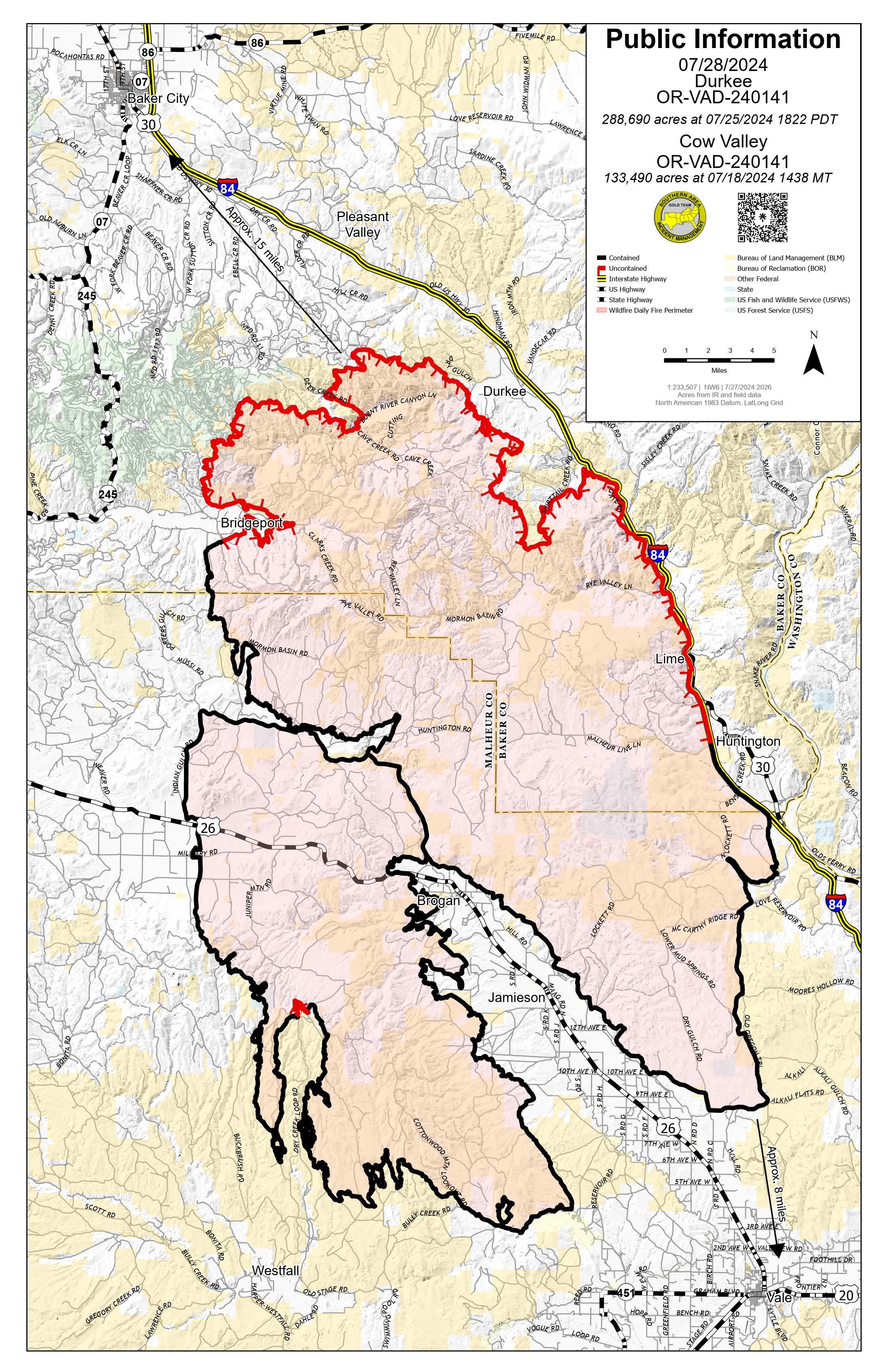
The human-caused Cow Valley Fire on private and public lands 9 miles east of Ironside, Ore., on both sides of Hwy. 26, is 99% contained.
There will be no further updates to this page.
| Current as of | Wed, 07/31/2024 - 13:17 |
|---|---|
| Incident Time Zone | America/Boise |
| Incident Type | Wildfire |
| Cause | Human - Under Investigation |
| Date of Origin | |
| Location | West of Brogan and Northwest of Vale |
| Incident Commander | |
| Coordinates |
44° 21' 24'' Latitude
-117° 45' 22
'' Longitude
|
| Total Personnel: | 0 |
|---|---|
| Size | 133,490 Acres |
| Percent of Perimeter Contained | 99% |
| Estimated Containment Date | 08/03/2024 |
| Fuels Involved | Brush (2 feet) Narrative: |
| Significant Events | Minimal
|
| Planned Actions |
Continue to patrol and begin suppression repair where needed. |
|---|---|
| Projected Incident Activity |
12 hours: Expect no fire behavior across the fire perimeter. |
| Remarks |
Origin has been determined and ownership falls on private land in Malheur County, Oregon. Inital Attack suppression responsibility falls to Vale Fire and Ambulance Department (OR-VALN). |
| Weather Concerns | Today, a weak weather disturbance is moving through the area and Over the next few days, temperatures are likely to be a few |
|---|

 InciWeb
