
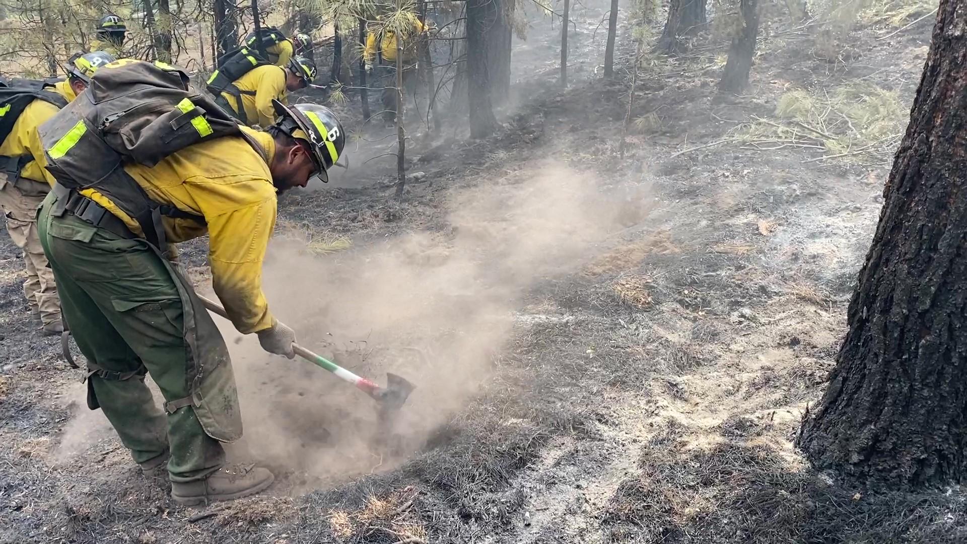
Highlighted Media
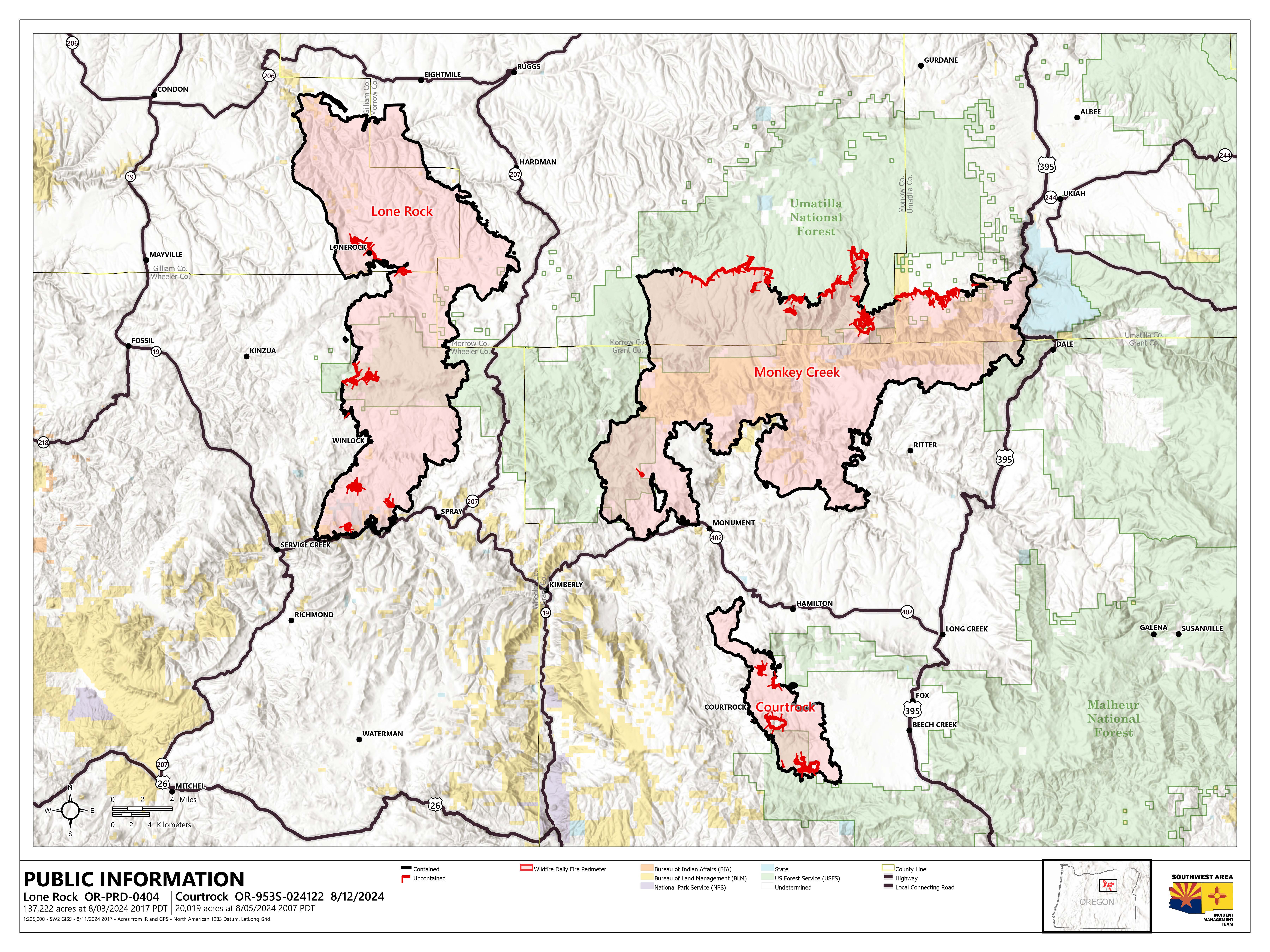
Public information map for the Courtrock Fire, Monday, August 12, 2024
Size: 20,019
Containment: 97%

Thank you to everyone over at Long Creek Schools for this lovely handmade sign.
All areas within the Courtrock Fire perimeter and surrounding areas have been downgraded to a Level 1 (Be Ready) level as of this publication on Monday, August 12, 2024.
The Courtrock Fire started Sunday, July 21, 2024, from a lightning strike during an afternoon thunderstorm event that moved through the area. The fire is located south of Monument and directly west of Long Creek.
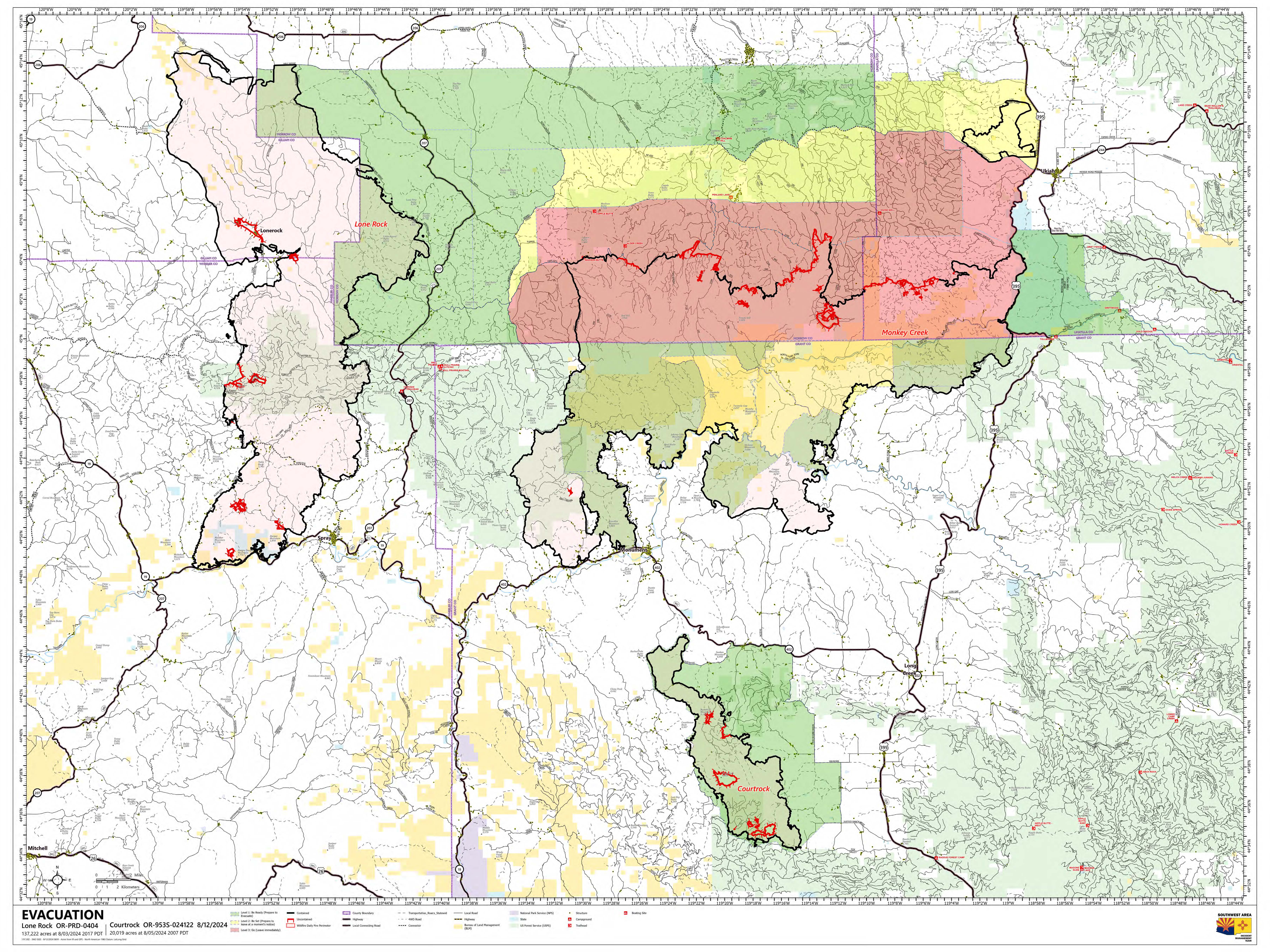
Evacuation Information:
Evacuations for the Courtrock Fire have been lifted.
Closures:
The Malheur National Forest has an area closure for the Courtrock Fire on the Blue Mountain Ranger District. To protect public health and safety, fire managers have closed the area around the fire due to fire activity and fire suppression operations. A detailed map of the closure is included and available on the Malheur National Forest website and offices.
Please be responsible and help prevent wildfires firefighters by adhering to Oregon Department of Forestry Public Fire Restrictions. Additional fire prevention tips are available at keeporegongreen.org
| Current as of | Sat, 08/17/2024 - 18:15 |
|---|---|
| Incident Time Zone | America/Los_Angeles |
| Incident Type | Wildfire |
| Cause | Lightning |
| Date of Origin | |
| Location | 7.1 Miles south of Monument, OR |
| Incident Commander | Effective Sunday, August 18, 2024 at 7 a.m., The High Desert Type 3 Team will transfer command back to the local Oregon Department of Forestry with Incident Commander Brandon Vos. |
| Incident Description | Lightning caused wildfire. Full suppression tactics are being utilized. |
| Coordinates |
44° 43' 37'' Latitude
-119° 22' 52
'' Longitude
|
| Total Personnel: | 100 |
|---|---|
| Size | 20,019 Acres |
| Percent of Perimeter Contained | 100% |
| Estimated Containment Date | 08/17/2024 |
| Fuels Involved | Mixed conifer fuels exist at the northeastern and southwestern perimeters of the fire area along with ponderosa pine and Western larch. The conifer fuels provide a ready source of embers under moderate to elevated winds when torching due to copious ladder fuels and dead/downed fuels in the understory. The continuous grass crop east of the fire area is cured and readily available for rapid ignition and will exhibit elevated rates of spread with an ignition source and even moderate wind. Brush fuels are primarily juniper savannas which transition to pure juniper stands with minimal herbaceous understory on the western flank
|
| Projected Incident Activity |
FINAL UPDATE: The High Desert Type 3 team will close out at 7 a.m. on Sunday, August 18, 2024 transferring command of the Courtrock fire back to the local ODF agency with Brandon Vos as the Incident Commander. With the transition to a Type 4 incident and complexity level minimizing, the amount of fire personnel will also decrease. Visiting resources will start to demobilize, and local resources will take over, continuing with mop-up and suppression repairs with the help of some contracted heavy equipment and overhead personnel. The evacuation preparedness levels that were in place near the fire have been lifted. This is the final Courtrock fire update. The incident Facebook page and email will no longer be active. For future fire information, please contact the following agencies: Oregon Department of Forestry, Prineville Unit (Central Oregon District Office) https://www.oregon.gov/odf/aboutodf/pages/mapoffices.aspx 541-447-5658
Malheur National Forest Supervisor’s Office/Blue Mountain Ranger District https://www.fs.usda.gov/malheur 541-575-3000
Grant County Sheriff’s Office https://grantcountyoregon.net/262/Sheriffs-Office 541-573-1131 |
|---|---|
| Remarks |
The High Desert Type 3 team will close out at 7 a.m. on Sunday, August 18, 2024 transferring command of the Courtrock fire back to the local ODF agency with Brandon Vos as the Incident Commander. |
| Weather Concerns | A Red Flag warning is in effect from 1 pm this afternoon to 8 pm this evening for wind and low relative humidity for Oregon Fire Zone 642. Saturday temperatures will be in the mid to upper 80 degrees. Winds will begin to increase and shift east 5 to 8 miles per hour (MPH) in the morning before shifting to the southeast around noon. Daytime relative humidity will be poor, ranging 6-11% with moderate overnight recoveries. Winds will continue to be a bit breezy Saturday night with winds from the south 5 to 10 MPH then shifting multiple times. |
|---|