
Highlighted Activity
Highlighted Media
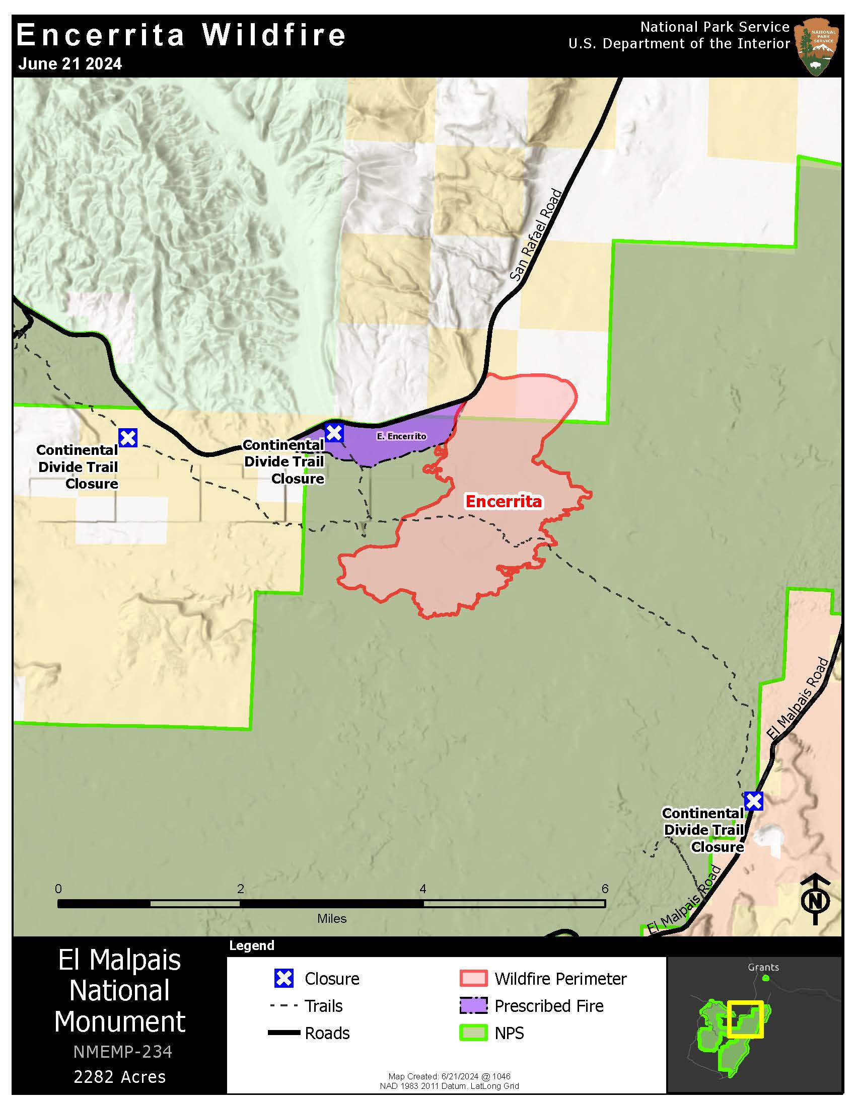
June 21 Encerrita Fire Map
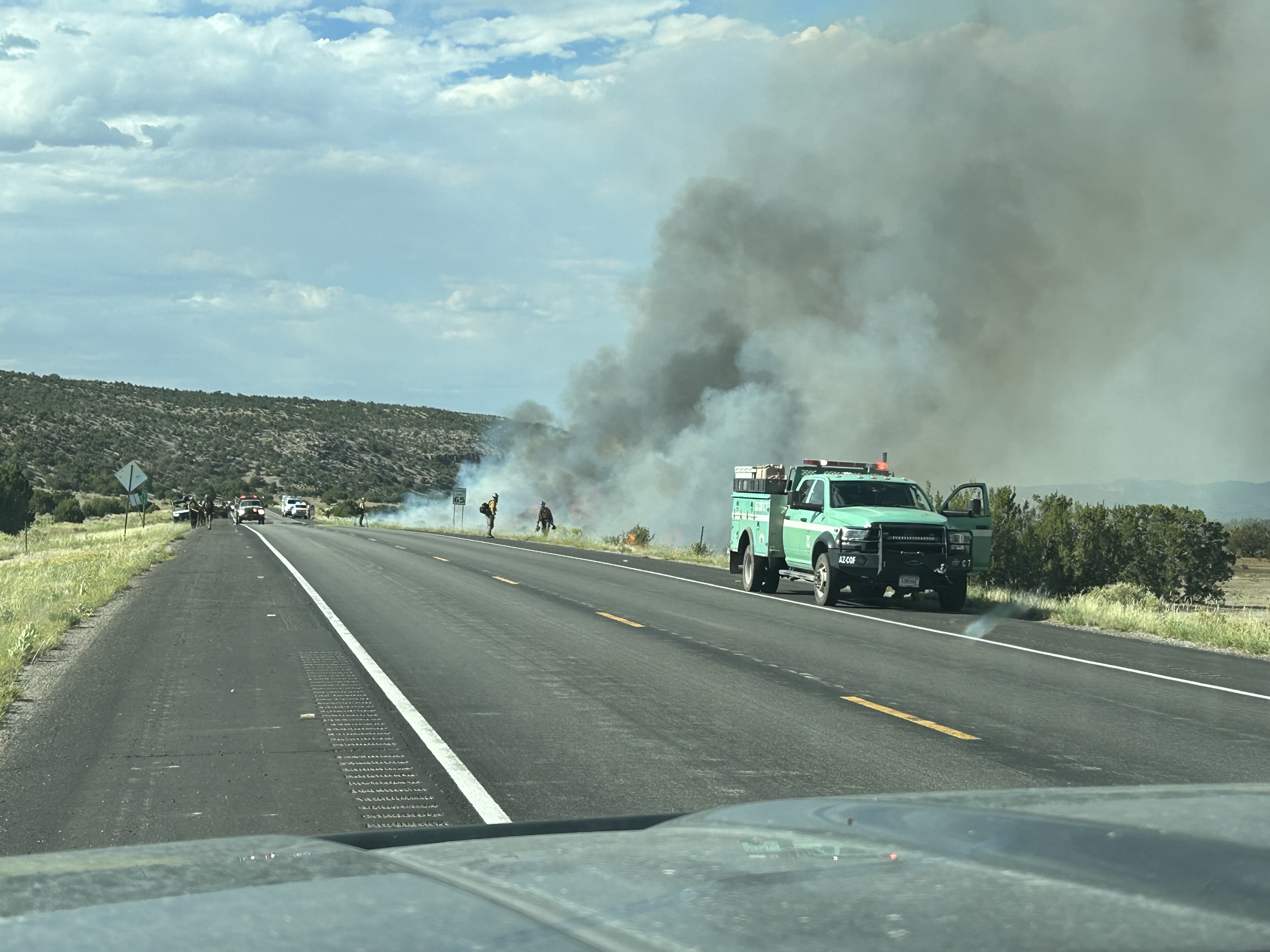
Firefighters work along Highway 53 while the Encerrita Fire burns alongside the roadway.
National Park Service staff discovered a lightning-caused fire burning on El Malpais National Monument lands on the afternoon of Saturday, June 15. The Encerrita Fire is located approximately 15 miles south-southwest of Grants, NM.
The final formal update for this incident was published on June 25 unless significant fire activity occurs. Further updates on the Encerrita Fire can be found by visiting the El Malpais Facebook page (@ElMalpaisNPS) or webpage (www.nps.gov/elma), or by calling the El Malpais Visitor Center at (505) 876-2783.
| Current as of | Tue, 06/25/2024 - 11:45 |
|---|---|
| Incident Time Zone | America/Denver |
| Incident Type | Wildfire |
| Cause | Lightning |
| Date of Origin | |
| Location | 15 miles SSW of Grants, NM |
| Incident Commander | L. Sackett, Type 4 Incident Commander A. Ledesma, Type 4 Incident Commander (Trainee) |
| Coordinates |
34° 56' 07'' Latitude
-107° 56' 08
'' Longitude
|
| Total Personnel: | 107 |
|---|---|
| Size | 2,496 Acres |
| Fuels Involved | The fire is burning in Ponderosa pine forest with a grass and timber litter understory with some medium logging slash from logging operations that were conducted pre-WWII. |
| Planned Actions |
Firefighters will limit fire growth on private jurisdiction and prevent the fire from crossing Highway 53. Crews will utilize direct and indirect tactics that provide highest probability of success while limiting exposure to firefighters. |
|---|---|
| Projected Incident Activity |
The southwest corner of the fire perimeter will have single tree torching and some fire growth to the west and south. Backing and smoldering with some movement to the southeast. Some smoke impact to Highway 53 is possible. |
| Weather Concerns | Excellent Rh recoveries and a chance for rain and thunderstorms exists for the next few days. Light to moderate precipitation received over the fire area. |
|---|