
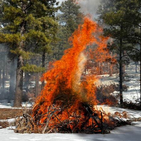
Fire managers are preparing to potentially begin ignitions as early as Jan. 31.
Fire crews are planning to continue with prescribed fire treatment on this multi-year project to reduce the threat of wildfire to surrounding communities. For the 2024/2025 season, fire managers have identified piles created from 219 acres of thinning. Piles are all located west of Highway 76:
- South of Chamisal
- Between Trampas and Ojo Sarco
Take Action
Project Background
The Rio Trampas project aims to restore forest health and resiliency next to communities while providing fuelwood and other wood product opportunities to residents and visitors. Some areas have been thinned by local leñeros, or woodcutters, who adopt one-acre blocks of the forest.
The project is part of the national Wildfire Crisis Strategy. As an area with some of the most at-risk firesheds in the nation, the strategy identified a 1.5-million-acre area in and around the Carson National Forest as the Enchanted Circle Landscape. Forest Service staff and partners across the region are working to protect communities and natural resources by restoring healthy, resilient, fire-adapted forests using mechanical thinning and returning beneficial fire in these landscapes.
| Current as of | Wed, 02/19/2025 - 15:20 |
|---|---|
| Incident Time Zone | America/Denver |
| Incident Type | Prescribed Fire |
| Location | West of Highway 76 near Chamisal, Ojo Sarco and Trampas |
| Coordinates |
36° 08' 46'' Latitude
-105° 44' 57
'' Longitude
|
| Fuels Involved | Piles created from forest thinning. |
|---|