
Fire managers are preparing to potentially begin pile burning in early February.
Fire crews are planning to continue with prescribed fire treatment on this multi-year project to reduce the threat of wildfire to surrounding communities. For the 2024/2025 season, fire managers have identified over 1,700 acres for different kinds of treatment:
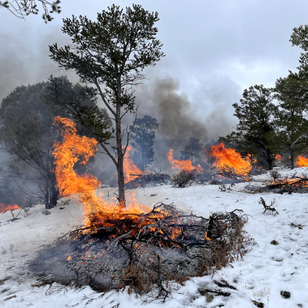
- Pile Burning: Over 400 acres of piles are ready for treatment near Arroyo Hondo and Turley Mill.
- Jackpot Burning: Over 1,300 acres are ready for treatment east of Highway 522 and south of D.H. Lawrence Ranch Road.
Take Action
- Get Smoke Ready
- Sign up for email updates
- Learn about the differences between pile and jackpot burning
Project Background
The Kiowa-San Cristobal Wildland Urban Interface Project aims to reduce hazardous fuels on Forest Service land by thinning and safely reintroducing fire, all while opening areas for personal fuelwood and forest products collection. 183 acres of the area were thinned by local community members as part of the Mayordomo Program, in which one-acre blocks are adopted out for green fuelwood collection.
The approximately 9,000-acre project was approved in 2017, with work beginning shortly after. Because fire knows no boundaries, partner groups are conducting work on private lands in the area.
The project is part of the Wildfire Crisis Strategy, a national initiative to reduce the threat of wildfire to communities, infrastructure and natural resources. The Enchanted Circle Landscape is one of the strategy’s priorities.
| Current as of | Thu, 01/30/2025 - 12:57 |
|---|---|
| Incident Time Zone | America/Denver |
| Incident Type | Prescribed Fire |
| Location | Forest Service land bound by Arroyo Seco, Deer Mesa, Highway 522, San Cristobal and Turley Mill |
| Coordinates |
36° 33' 45'' Latitude
-105° 38' 33
'' Longitude
|
| Fuels Involved | Brush piles and lopped/scattered debris from thinning. |
|---|