
Highlighted Media
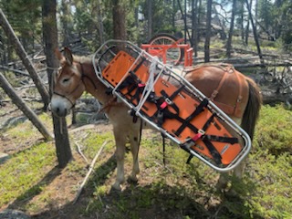
Wisdom Ranger District mule string packing out medical equipment from the Blacktail Canyon helipots.
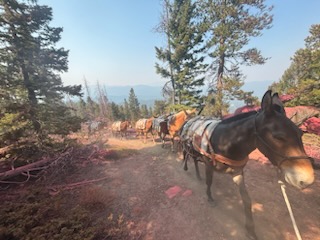
Wisdom Ranger District mule string packing out medical equipment from the Blacktail Canyon helipots.
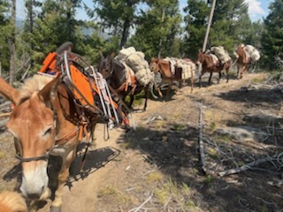
Wisdom Ranger District mule string packing out medical equipment from the Blacktail Canyon helipots.
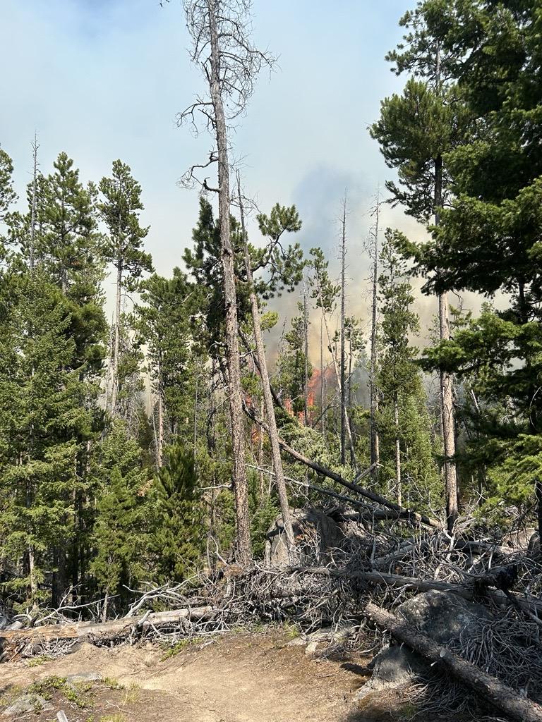
The Blacktail Canyon fire was reported on the afternoon of July 19th. The fire is located 4 miles southeast of Butte, MT in timber with a heavy dead and down fuel component. On the first afternoon, several large air tankers and a very large air tanker (VLAT) dropped retardant as helicopters assisted with water bucket drops.
Working in cooperation with the Butte-Silver Bow officials, fire managers have identified and prioritized critical values at risk, focusing available resources and current efforts on the protection of the private structures in the Blacktail Canyon, Homestake Road, and Passmore Canyon areas. Local Fire Department engines provided structure assessments in these areas. Crews will continue to assess critical values at risk in the adjacent areas.
| Current as of | Sat, 08/31/2024 - 13:13 |
|---|---|
| Incident Type | Wildfire |
| Cause | Undetermined |
| Date of Origin | |
| Location | 4 miles southeast of Butte, MT |
| Incident Commander | C. Enriquez |
| Coordinates |
45° 53' 7'' Latitude
-112° 25' 41
'' Longitude
|
| Total Personnel: | 12 |
|---|---|
| Size | 80 Acres |
| Percent of Perimeter Contained | 100% |
| Fuels Involved | Timber, timber litter, and grass. Heavy dead and down component. |
| Significant Events | The evacuation warning issued by Butte-Silver Bow Law Enforcement Department has been rescinded. Previously constructed firelines held, despite the gusty winds over the last several days. The acreage remains at 80. Firefighting efforts resulted in securing sections of the fire edges, 3 chains (198 feet) into the interior. Containment of a fire implies there are secure firelines around the perimeter, directly next to the edge where the fire burned. As the crews progress around the entire fire perimeter with “mop-up” and extinguish all residual heat interior to the fire edge, the containment percentage will increase. Crews will continue with “mop-up” operations, as allowed by weather conditions and subsequent impacts of the gusty winds. Crews and helicopters will be available for initial attack of new fires, given the recent lightning and several smoke reports in the area.
|
| Planned Actions |
Crews will continue with “mop-up” operations, as allowed by weather conditions and subsequent impacts of the gusty winds. Crews and helicopters will be available for initial attack of new fires, given the recent lightning and several smoke reports in the area.
|
|---|---|
| Projected Incident Activity |
Fire behavior was minimal. Little to no smoke was visible. |
| Remarks |
Fire managers are calling the fire 95% contained. Containment of a fire implies there are secure firelines around the perimeter, directly next to the edge where the fire burned. As the crews progress around the entire fire perimeter with “mop-up” and extinguish all residual heat interior to the fire edge, the containment percentage will increase. Winds associated with passing thunderstorms have tested the efficacy of constructed firelines. Gusty winds pose a major safety hazard due to the high density of “snags” and falling trees. Additionally, the proximity of the fire location to recreation sites such as the Continental Divide Trail and the Silver Bow Archery Range in Thompson Park presents a further need for public awareness. The public is advised to stay out of these areas, as crews and helicopters continue their work. Ensuring firefighter safety and protecting life and property are of the utmost importance during any incident. |
| Weather Concerns | There is a chance of showers and thunderstorms throughout the day, with associated precipitation. Rain activity will increase late overnight Tuesday and into Wednesday morning. Thunderstorms are possible in the afternoon hours. Winds will be light with relative humidity at higher levels Tuesday afternoon.
|
|---|