
As of June 4, 2025 - No Prescribed Fire operations are scheduled at this time
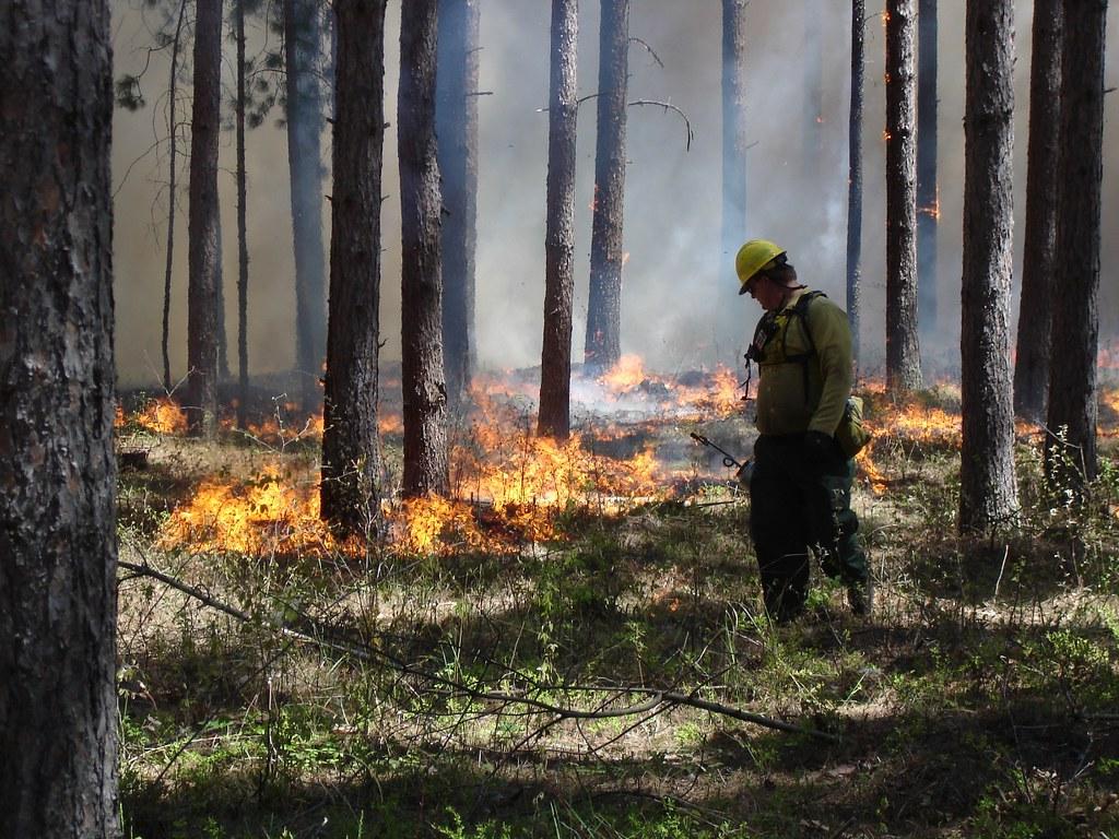
The Forest uses prescribed fires to help reduce overgrown vegetation to help protect local communities, infrastructure, and natural resources from wildfires. Residents may experience smoke during prescribed burns.
We estimate this work to continue through the spring as weather conditions allow.
Stay informed about the scheduled prescribed fires through the forest website, social media channels, and here on InciWeb, the interagency incident information system.
As of June 4, 2025 - No Prescribed Fire operations are scheduled at this time
The Forest uses prescribed fires to help reduce overgrown vegetation to help protect local communities, infrastructure, and natural resources from wildfires. Residents may experience smoke during prescribed burns.
We estimate this work to continue through the spring as weather conditions allow.
Stay informed about the scheduled prescribed fires through the forest website, social media channels, and here on InciWeb, the interagency incident information system.
| Current as of | Wed, 06/04/2025 - 12:39 |
|---|---|
| Incident Time Zone | Central Standard Time |
| Incident Type | Prescribed Fire |
| Date of Origin | |
| Incident Time Zone | Central Standard Time |
| Location | Chippewa National Forest |
| Incident Commander | Chippewa National Forest Fire Staff |
| Incident Description | The Forest uses prescribed fires to help reduce overgrown vegetation to help protect local communities, infrastructure, and natural resources from wildfires. |
| Coordinates |
47° 04' 5'' Latitude
-94° 15' 9
'' Longitude
|
| Size | 0 Acres |
|---|
| Weather Concerns | The Forest will evaluate weather conditions in the hours before a burn begins. If conditions warrant, scheduled prescribed fire activities may be canceled. |
|---|