

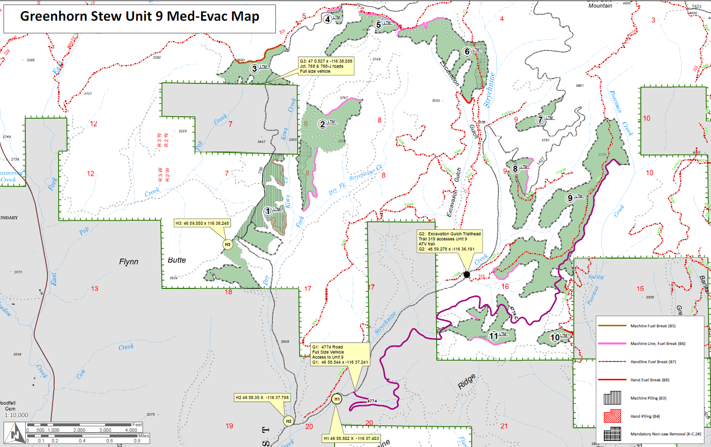


This project is located one and a half miles west of Horse Camp Trailhead and about one and a half miles east of Highway 6.
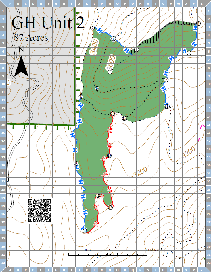
The objective of burning this slash is to remove fuel accumulations and create areas for planting new trees.
This project is located one and a half miles west of Horse Camp Trailhead and about one and a half miles east of Highway 6.
The objective of burning this slash is to remove fuel accumulations and create areas for planting new trees.
| Current as of | Fri, 04/18/2025 - 13:38 |
|---|---|
| Incident Type | Prescribed Fire |
| Location | This project is located approximately one and a half miles west of Horse Camp Trailhead and about one and a half miles east of Highway 6 |
| Incident Commander | Palouse Ranger District Fire and Fuels Staff |
| Coordinates |
46° 58' 55.27'' Latitude
-116° 36' 6.20
'' Longitude
|