

The primary purpose of this project is to reduce hazardous fuels within designated Rural Wildland Urban Interface lands adjacent to Elk City, ID. Activities are to reduce fuels created from logging operations and create planting sights for new trees post harvest. Like the Landscape burning it also helps reduce the potential for, and intensity of, subsequent wildfire and increase the chance for fire suppression strategies and tactics to be successful. There is a need to enhance wildfire suppression capability and provide for public and firefighter safety by reducing the amount of available fuel and implementing strategic treatments to provide safety zones and escape routes.
The primary purpose of this project is to reduce hazardous fuels within designated Rural Wildland Urban Interface lands adjacent to Elk City, ID. Activities are to reduce fuels created from logging operations and create planting sights for new trees post harvest. Like the Landscape burning it also helps reduce the potential for, and intensity of, subsequent wildfire and increase the chance for fire suppression strategies and tactics to be successful. There is a need to enhance wildfire suppression capability and provide for public and firefighter safety by reducing the amount of available fuel and implementing strategic treatments to provide safety zones and escape routes.
| Current as of | Fri, 04/18/2025 - 16:04 |
|---|---|
| Incident Type | Prescribed Fire |
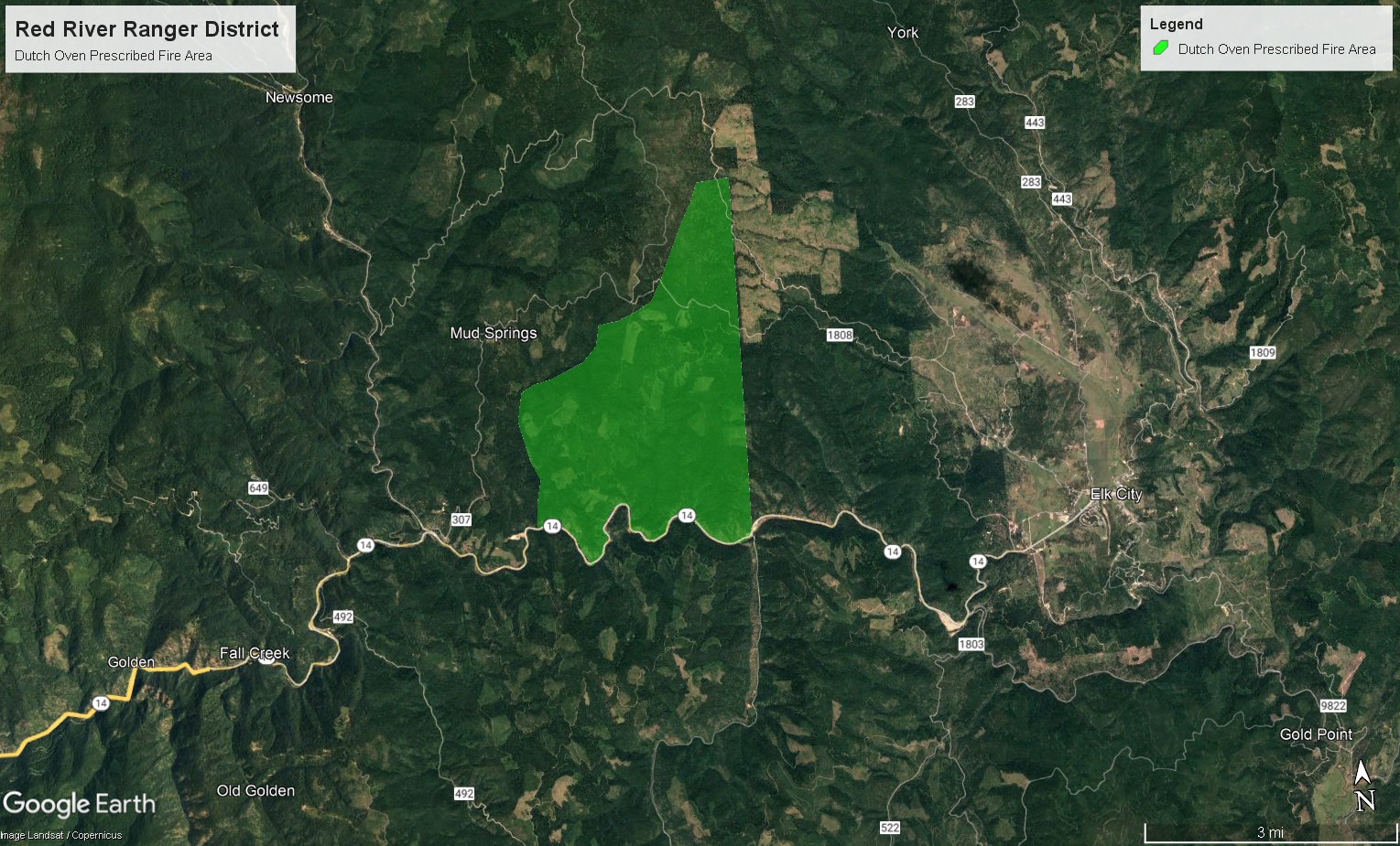
| Location | Two miles south of Elk Summit Lookout and off the National Forest Service Road #1808 (Wagon Road), on the NFSR #9852 |
| Incident Commander | Red River Ranger District Fire and Fuels staff |
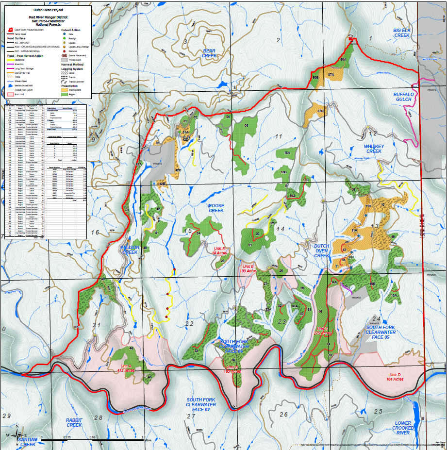
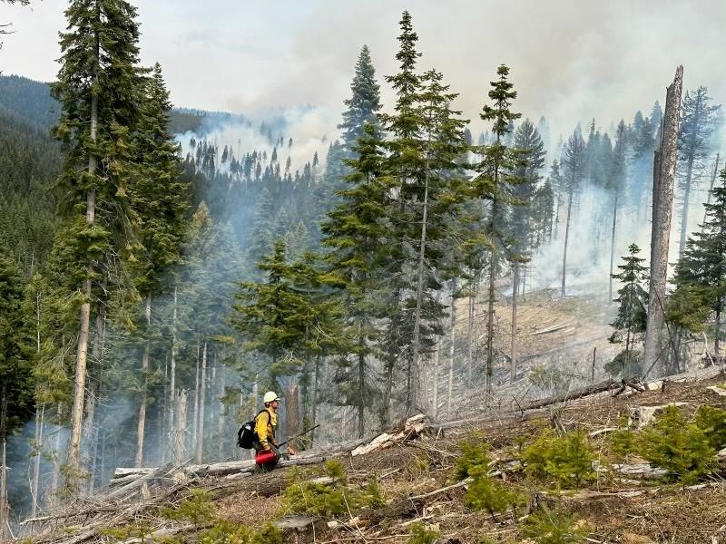
| Incident Description | Landscape: Burn natural fuels to create wildlife habitat, reduce fuel loadings, and improve options during wildfire suppression efforts to protect the Elk City Township BD Activity: Burn activity fuels generated from timber harvest, create quality planning sights, reduce fuel loadings, and improve options during wildfire suppression efforts to protect the Elk City Township. |
| Coordinates |
45° 49' 32.16'' Latitude
-115° 31' 55.44
'' Longitude
|
| Projected Incident Activity |
Ignitions will possibly start on April 20th depending on weather and could go as far out as May 30th depending on weather and burning conditions. |
|---|---|
| Remarks |
Potential short-duration smoke impacts will be Hwy 14, the Elk City Township, and the Red River valley. Smoke will be dispersed by transport winds impact should be low. Smoke impacts during the day will be minimal, but at night and in the mornings residual smoke may impact the valleys and State Highway 14 near the project area. |