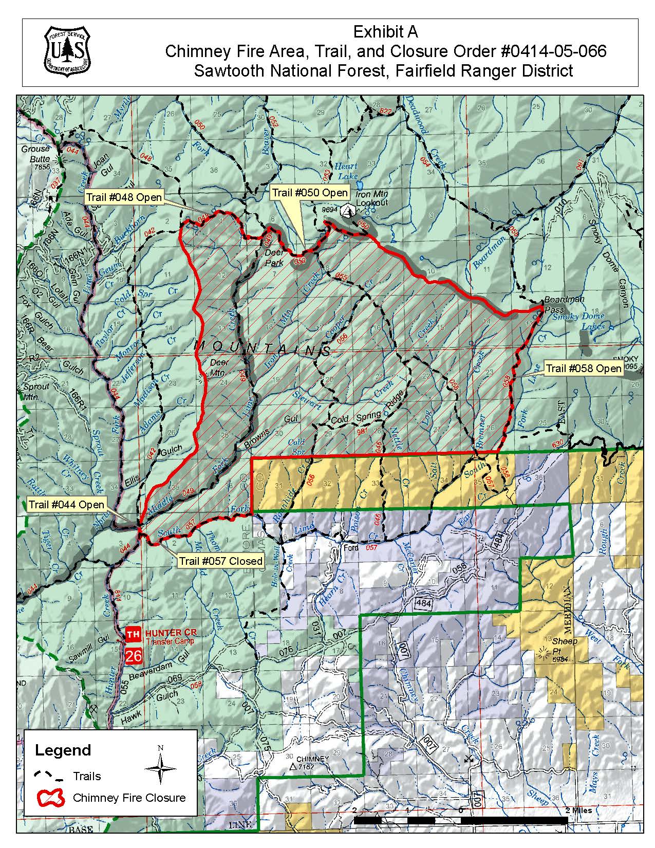
The Chimney Fire is not currently threatening any structures and is a safe distance away from communities. Most of the fire growth occurred in the early days of the fire.
The terrain is remote and rugged. It is possible that the fire could impact grazing allotments, sage grouse habitat and recreation trails in the coming days. Objectives include holding the fire north of Lime Creek Road and providing point protection of infrastructure and values at risk. Warmer and drier conditions with gusty winds will increase spread potential.
A local Type 3 incident management team assumed command of the fires from Southwest Area Complex Incident Management Team 4 5 p.m. Sep. 19, 2024.
| Current as of | Wed, 09/25/2024 - 12:33 |
|---|---|
| Incident Time Zone | America/Boise |
| Incident Type | Wildfire |
| Cause | Lightning/Natural |
| Date of Origin | |
| Location | 9 miles northwest of Fairfield, ID |
| Incident Commander | Matt Ganguet, ICT3 Rob MacDonald, ICT3(T) |
| Coordinates |
43° 27' 13'' Latitude
-115° 3' 24
'' Longitude
|
| Total Personnel: | 22 |
|---|---|
| Size | 6,521 Acres |
| Percent of Perimeter Contained | 80% |
| Estimated Containment Date | 10/15/2024 |
| Fuels Involved | Brush (2 feet), Timber (Grass and Understory), Timber (Litter and Understory)
|
| Significant Events | Minimal, Creeping, Smoldering |
| Planned Actions |
Complete rehab and begin walking out the excavator. On track to transition to a T4 incident on Thursday, 9/26, at 0700. |
|---|---|
| Projected Incident Activity |
12 hours: Minimal to no growth anticipated. With increased temperatures and drying, we anticipate increased interior smoke visible from Fairfield & HWY 20. 24 hours: Minimal to no growth anticipated. With increased temperatures and drying, we anticipate increased interior smoke visible from Fairfield & HWY 20. 48 hours: Minimal to no growth anticipated. 72 hours: Minimal to no activity anticipated. Anticipated after 72 hours: Minimal to no activity anticipated. |
| Weather Concerns | With increased temperatures and drying, we anticipate increased nterior smoke visible from Fairfield & HWY 20. |
|---|

 InciWeb
