
Highlighted Activity
Highlighted Media
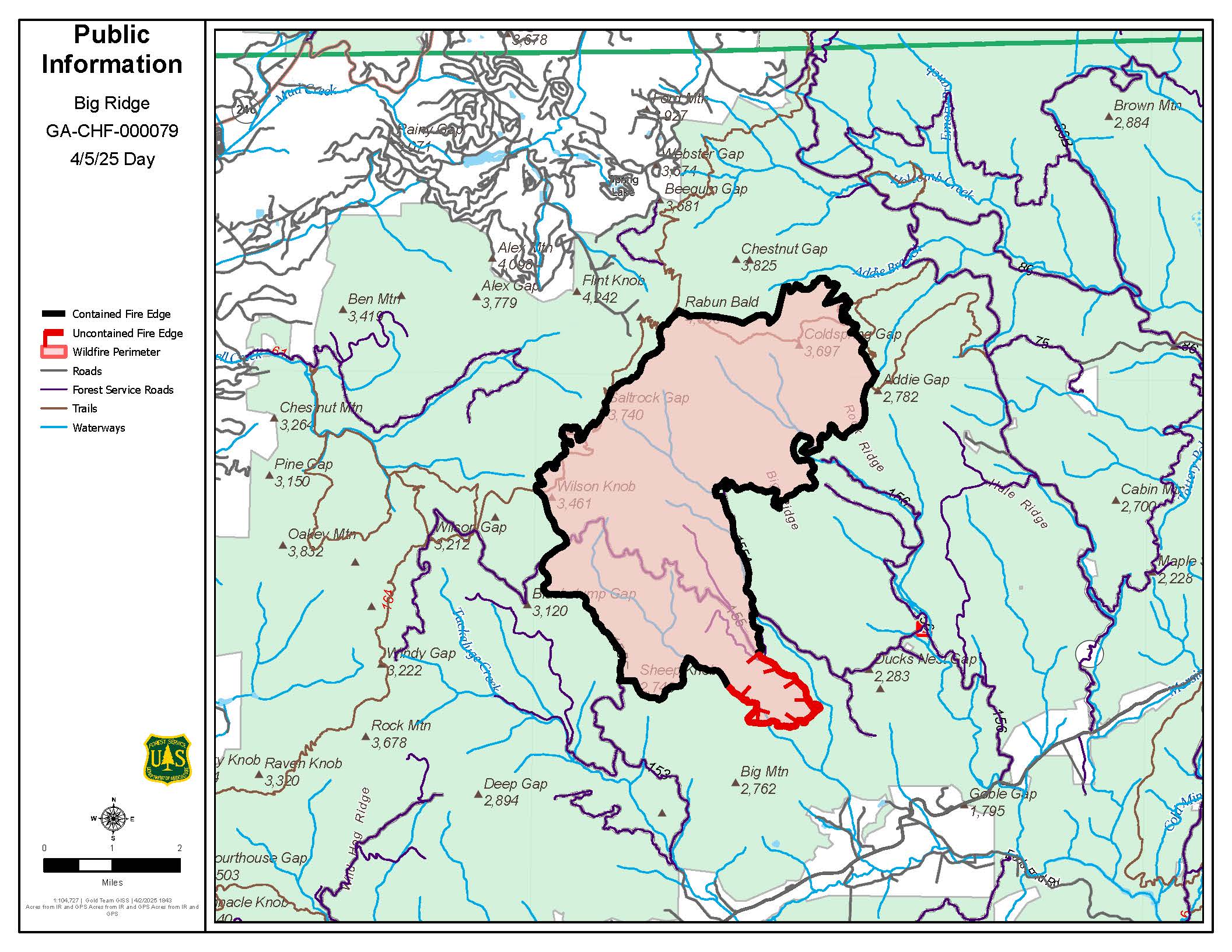
Big Ridge Fire Map April 5
The Big Ridge Fire started on March 22nd, 2025 in the Sarah's Creek area of the Warwoman Wildlife Management Area in Clayton, Georgia.
This fire is currently 88% contained and has received rain.
No further updates will be made to this page.
The Big Ridge Fire started on March 22nd, 2025 in the Sarah's Creek area of the Warwoman Wildlife Management Area in Clayton, Georgia.
This fire is currently 88% contained and has received rain.
No further updates will be made to this page.
| Current as of | Mon, 04/07/2025 - 15:21 |
|---|---|
| Incident Time Zone | America/New_York |
| Incident Type | Wildfire |
| Cause | Under Investigation |
| Date of Origin | |
| Location | 8 Miles from Clayton GA |
| Incident Commander | Willie Almand, Amy McClave (t) |
| Coordinates |
34° 57' 10'' Latitude
-83° 17' 39
'' Longitude
|
| Total Personnel: | 115 |
|---|---|
| Size | 3,434 Acres |
| Percent of Perimeter Contained | 88% |
| Estimated Containment Date | 04/30/2025 |
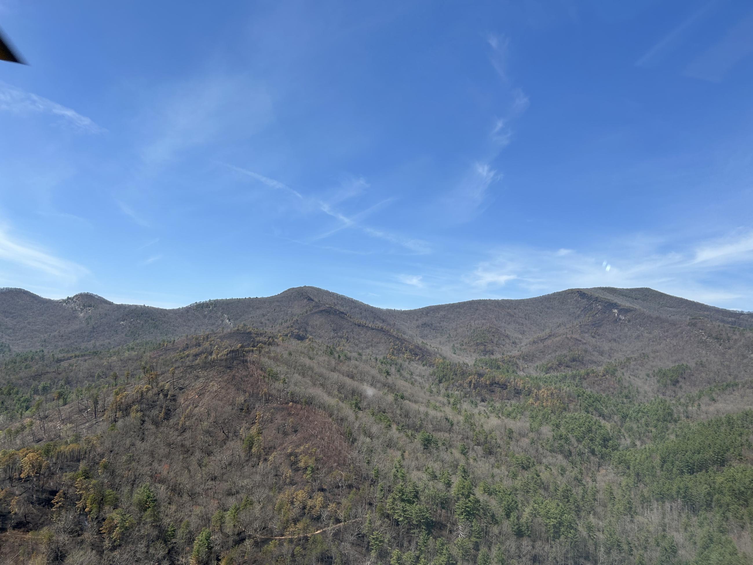
| Fuels Involved | Hardwood Litter Hardwood Litter Fuel types across the fire are primarily timber litter. Hurricane damaged fuels are minimal in the fire area, but where encountered expect the potential for more intense burning. |
| Significant Events | Minimal Creeping Smoldering
|
| Planned Actions |
Continue patrol and monitoring of the direct fire edge. Continue to conduct line and trail repair in |
|---|---|
| Projected Incident Activity |
Stump holes and heavy fuels and likely the only source of heat and potential for smoldering. |
| Weather Concerns | The front is expected to begin impacting the incident area with widespread showers and some thunderstorms by late Sunday 3fternoon. A few strong-to-severe thunderstorms are expected across the region. The chance of wetting rainfall over the Big Ridge incident is 90% Sunday night. |
|---|