


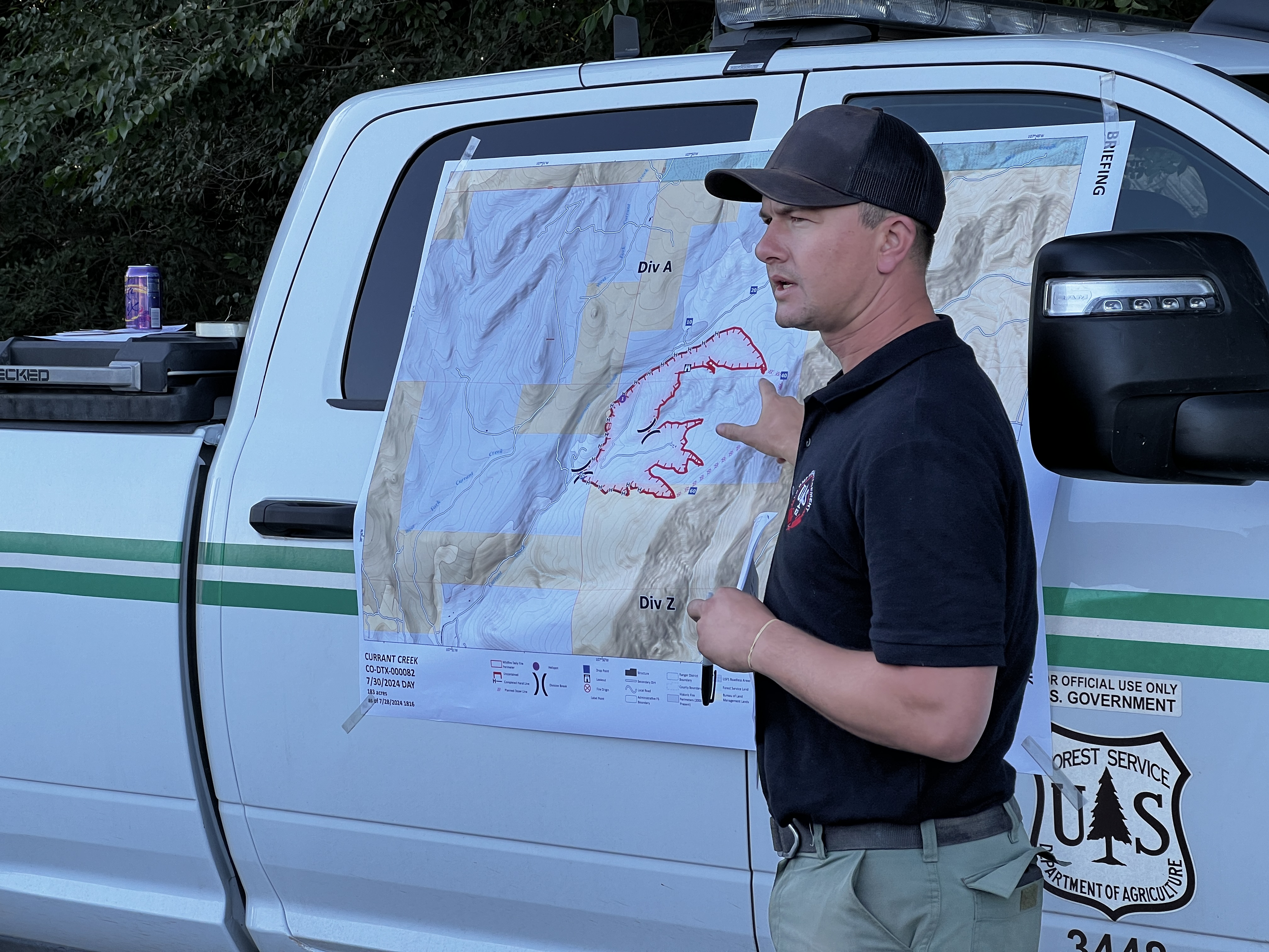
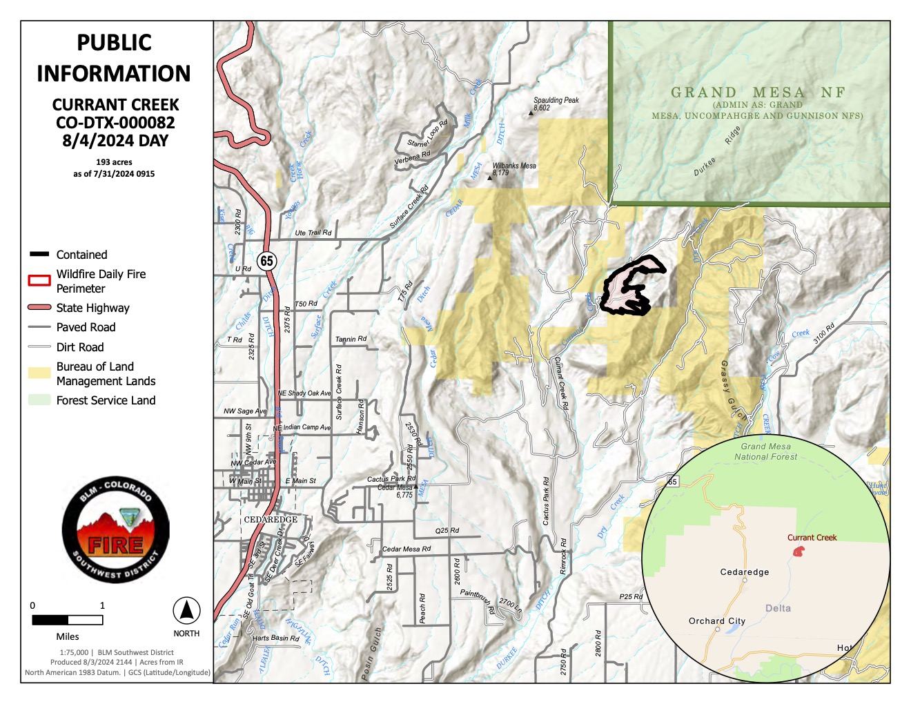

The Currant Creek Fire is located approximately 5 miles east/northeast of Cedaredge, CO near Redlands Mesa in the upper Currant Creek drainage. It was first reported on July 27th at 2 PM, at which time it was growing rapidly and aggressively. By the time local VFD resources arrived on scene, it was approximately 80 acres in size, consuming juniper, sage, oak brush, and grasses. Shortly after resources arrived, a localized thunderstorm dropped heavy rain and hail over the fire area. The precipitation reduced fire behavior and allowed firefighters to engage the fire more directly. Aerial resources arrived on scene by 4:30 PM, dropping water and retardant. The CO MMA estimated the size of the fire at 182 acres at around 7:30 PM.
This fire was declared contained by fire managers on Saturday, Aug 3, 2024 at approximately 5:00 p.m. Command was transferred to Type 4 local agency personnel for continued monitoring and suppression repair. There will be no further updates to this incident unless a change in conditions warrants the release of additional information.
| Current as of | Sun, 08/04/2024 - 18:32 |
|---|---|
| Incident Time Zone | America/Denver |
| Incident Type | Wildfire |
| Cause | Undetermined |
| Date of Origin | |
| Location | Approximately 5 miles east/northeast of Cedaredge, CO |
| Incident Commander | Local agency personnel |
| Incident Description | Wildfire |
| Coordinates |
38° 56' 24'' Latitude
-107° 50' 9
'' Longitude
|
| Total Personnel: | 9 |
|---|---|
| Size | 193 Acres |
| Percent of Perimeter Contained | 100% |
| Estimated Containment Date | 8/3/24 |
| Fuels Involved | Pinion/Juniper, Oak Brush |