
Highlighted Activity
Highlighted Media
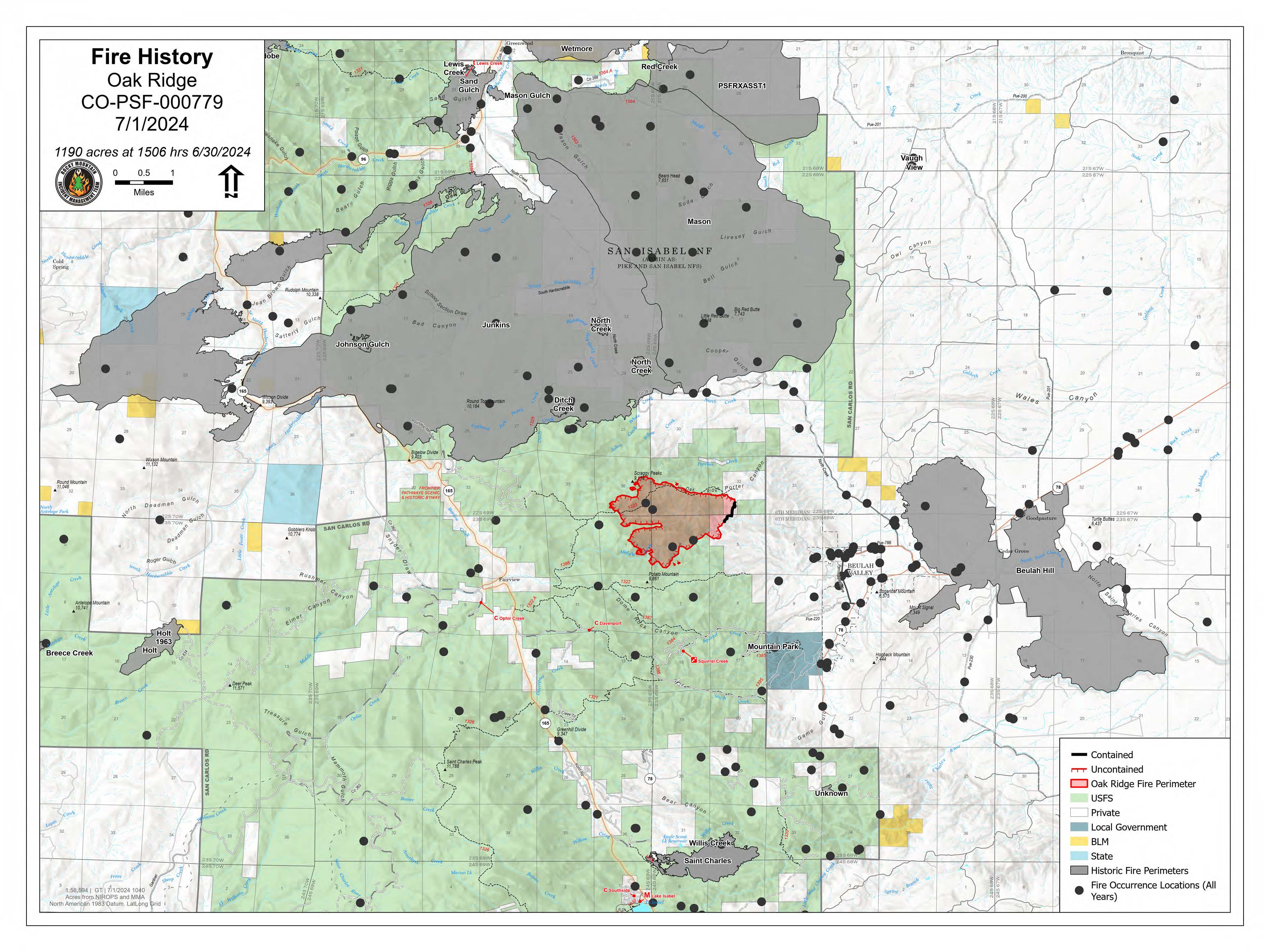
Oak Ridge Fire History Map shows the perimeter of the Oak Ridge Fire and the perimeters and locations of other, older fires.
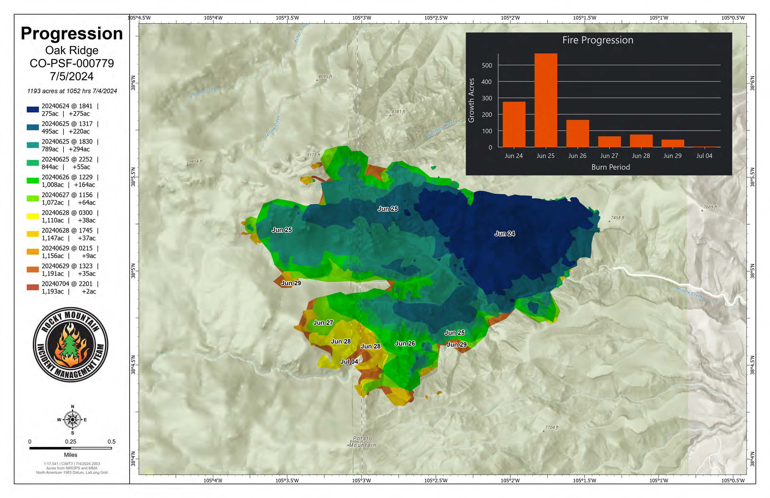
Oak Ridge Fire Progression Map - July 5, 2024
Type 3 Incident Management Organization transitioned to a Type 4 Incident Commander with various fire resources on Sunday evening, July 14, 2024.
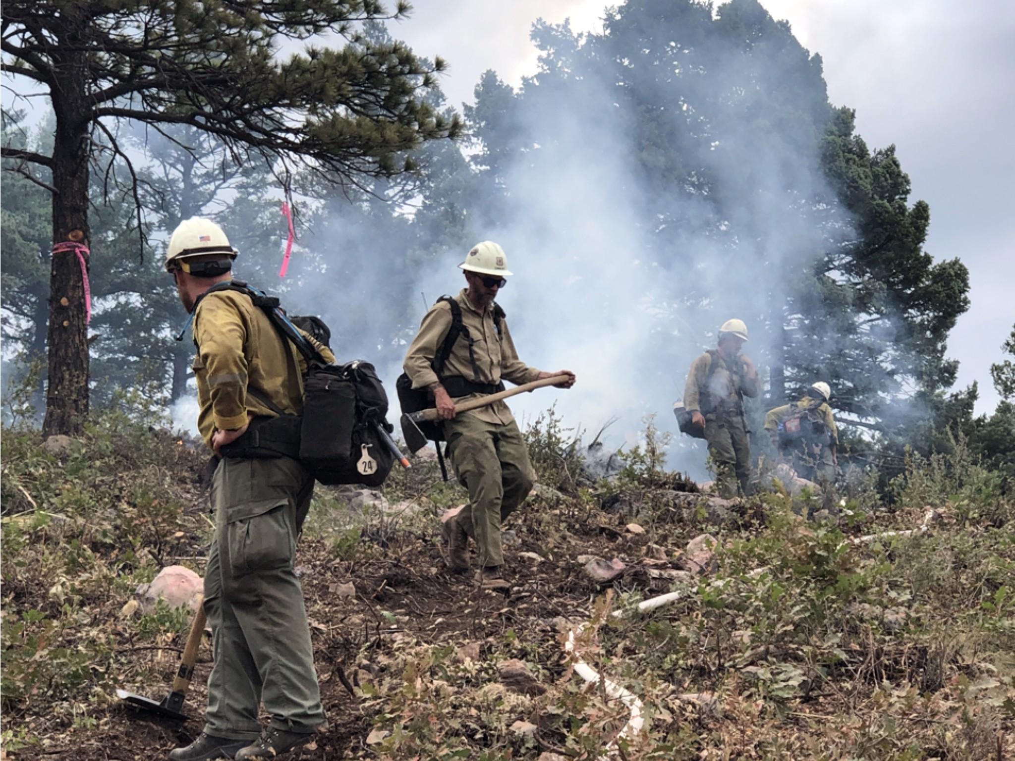
The Oak Ridge fire was detected on Saturday, June 22, 2024. Forest Service resources responded and began scouting locations where firefighters could safely access the fire. Air resources aggressively worked to slow down the fire’s progression until they could get resources on the ground. The number one priority is always and continues to be firefighter and public safety.
Evacuations: There are currently no evacuations due to the Oak Ridge Fire.
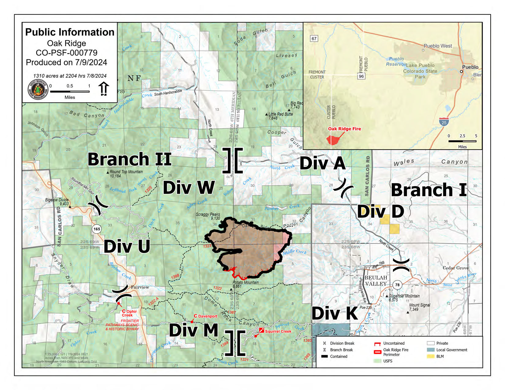
Closures: There is an area and road closure for the Pike-San Isabel National Forests
Cause: Lightning
| Current as of | Mon, 07/15/2024 - 16:01 |
|---|---|
| Incident Time Zone | America/Denver |
| Incident Type | Wildfire |
| Cause | Lightning |
| Date of Origin | |
| Location | 3 miles northwest of Beulah, Colorado |
| Incident Commander | Type 4 Incident Commander |
| Incident Description | Oak Ridge Fire was reported 6/22/2024 at 8:59 am |
| Coordinates |
38° 5' 21.9012'' Latitude
-105° 2' 19.3812
'' Longitude
|
| Total Personnel: | 54 |
|---|---|
| Size | 1,310 Acres |
| Percent of Perimeter Contained | 89% |
| Estimated Containment Date | 07/24/2024 |
| Fuels Involved | Timber (Litter & Understory) Brush (2 Feet) Timber (Grass & Understory) Ponderosa pine with oak brush understory. Mixed conifer on the north aspect slopes. |
| Significant Events | The fire is exhibiting minimal behavior with creeping and smoldering.
|
| Planned Actions |
Continue Suppression Repair in Divisions A/D/K, W/U/M with both hand and mechanized equipment.
|
|---|---|
| Projected Incident Activity |
In the next 24 hours and 48 hours, there will be minimal fire movement - transitioning weather pattern with clouds and moisture increasing throughout the day.
|
| Remarks |
Type 4 Incident Management organization assumed command of the fire on evening of July 14, 2024. TFR was rescinded on July 13, 2024. |
| Weather Concerns | Early Sunday, relative humidity recoveries were again very poor - 0 to 35 percent - with daytime humidity dropping to 15 to 20 percent. Cloud cover increased in the late morning and dry thunderstorms developed within a 20 mile vicinity of the fire starting around 1130 and continued through the afternoon causing Monday will be a transition day with above normal temperatures and dry conditions to start out the day. As Monday progresses, moisture will begin to increase, allowing for more organized showers and thunderstorms by late afternoon and evening. As high pressure over the region breaks down overnight Monday into Tuesday, monsoonal moisture will wrap into the Front Range, initiating a major weather change to cooler and wetter conditions. A cold front dropping down from the northeast late on Tuesday into Wednesday will produce wetting rain and potentially strong storms over the fire both late Tuesday and again on Wednesday afternoon. |
|---|