
Highlighted Activity
Highlighted Media
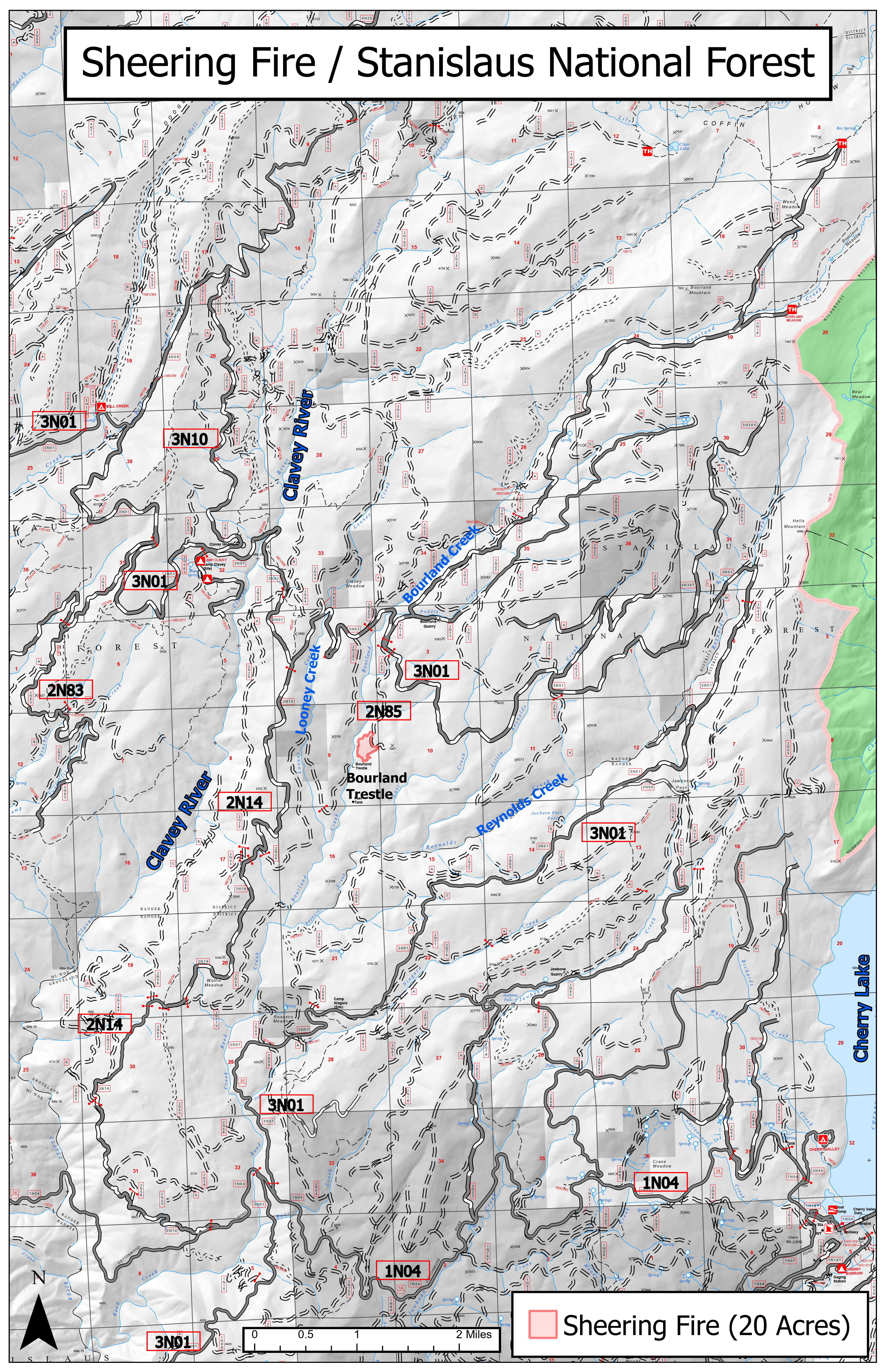
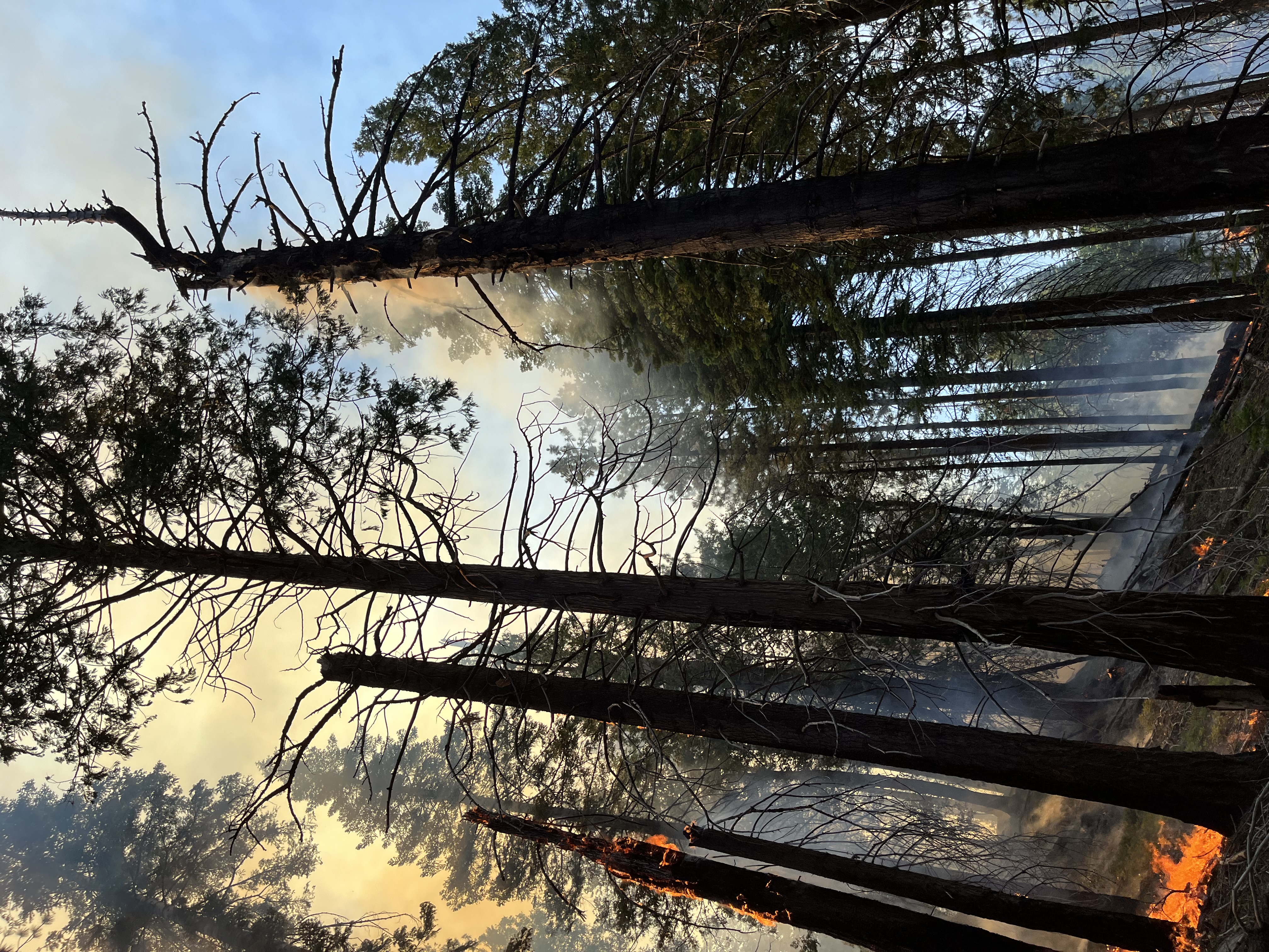
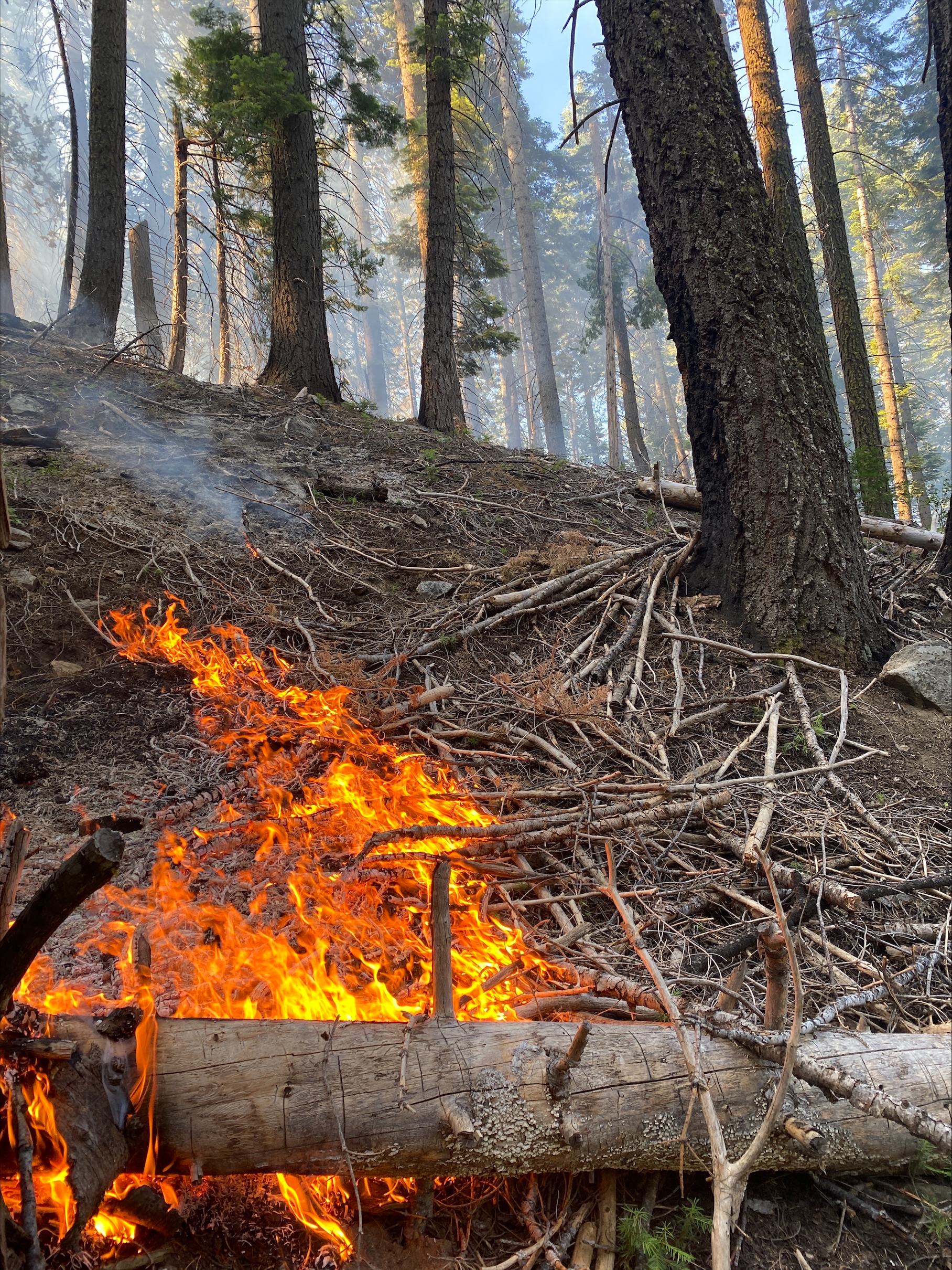
The Sheering Fire is burning in an area with excessive snags, hazard trees, and dead and down fuel within the 2013 Rim Fire footprint. Firefighters with the Stanislaus National Forest’s Mi-Wok/Summit Ranger District have implemented indirect attack tactics on the Sheering Fire while maintaining a full suppression strategy.
Sandwiched between Duckwall and Bell Mountain near Cherry Lake, the lightning caused fire has been burning since June 25 with resources currently on scene. Burn scars from the Quarry Fire (2023), Bone Fire (2023), and Rosasco Fire (2019) provide secondary barriers to East, West, and South.
| Current as of | Tue, 07/02/2024 - 19:45 |
|---|---|
| Incident Time Zone | America/Los_Angeles |
| Incident Type | Wildfire |
| Cause | Lightning |
| Date of Origin | |
| Location | Stanislaus National Forest, Tuolumne County |
| Incident Commander | Stanislaus National Forest Type 4 Team currently transitioning to Type 3 team. Shaun Craig, Incident Commander Andy Bellar-Mariscal, Incident Commander Trainee |
| Incident Description | 07/02/24 -- Initial Release -The Sheering Fire is burning in an area with excessive snags, hazard trees, and dead and down fuel within the 2013 Rim Fire footprint. Firefighters with the Stanislaus National Forest’s Mi-Wok/Summit Ranger District have implemented indirect attack tactics on the Sheering Fire while maintaining a full suppression strategy. Sandwiched between Duckwall and Bell Mountain near Cherry Lake, the lightning caused fire has been burning since June 25 with resources currently on scene. Burn scars from the Quarry Fire (2023), Bone Fire (2023), and Rosasco Fire (2019) provide secondary barriers to East, West, and South. |
| Coordinates |
38° 2' 40'' Latitude
-119° 59' 47
'' Longitude
|
| Total Personnel: | 24 |
|---|---|
| Size | 256 Acres |
| Percent of Perimeter Contained | 0% |
| Estimated Containment Date | 07/31/2024 |
| Fuels Involved | Timber (Litter and Understory), excessive snags and hazard trees |
| Planned Actions |
Hold fire within planning area or smaller utilizing natural barriers and previous fire scars. Full |
|---|---|
| Projected Incident Activity |
12 hours: Backing fire away from 3N01 |
| Weather Concerns | Excessive heat warning in effect until Jul 9. Red Flag Warning to the north of the fire area. There is also above average temperatures at lower elevations in the next few days. |
|---|