
Highlighted Media
Links: Los Padres National Forest Facebook
Maps: Final Public Info Map (pdf) | Fire Progression Map
Update: Final Update (pdf) | Actualización diaria final (pdf)
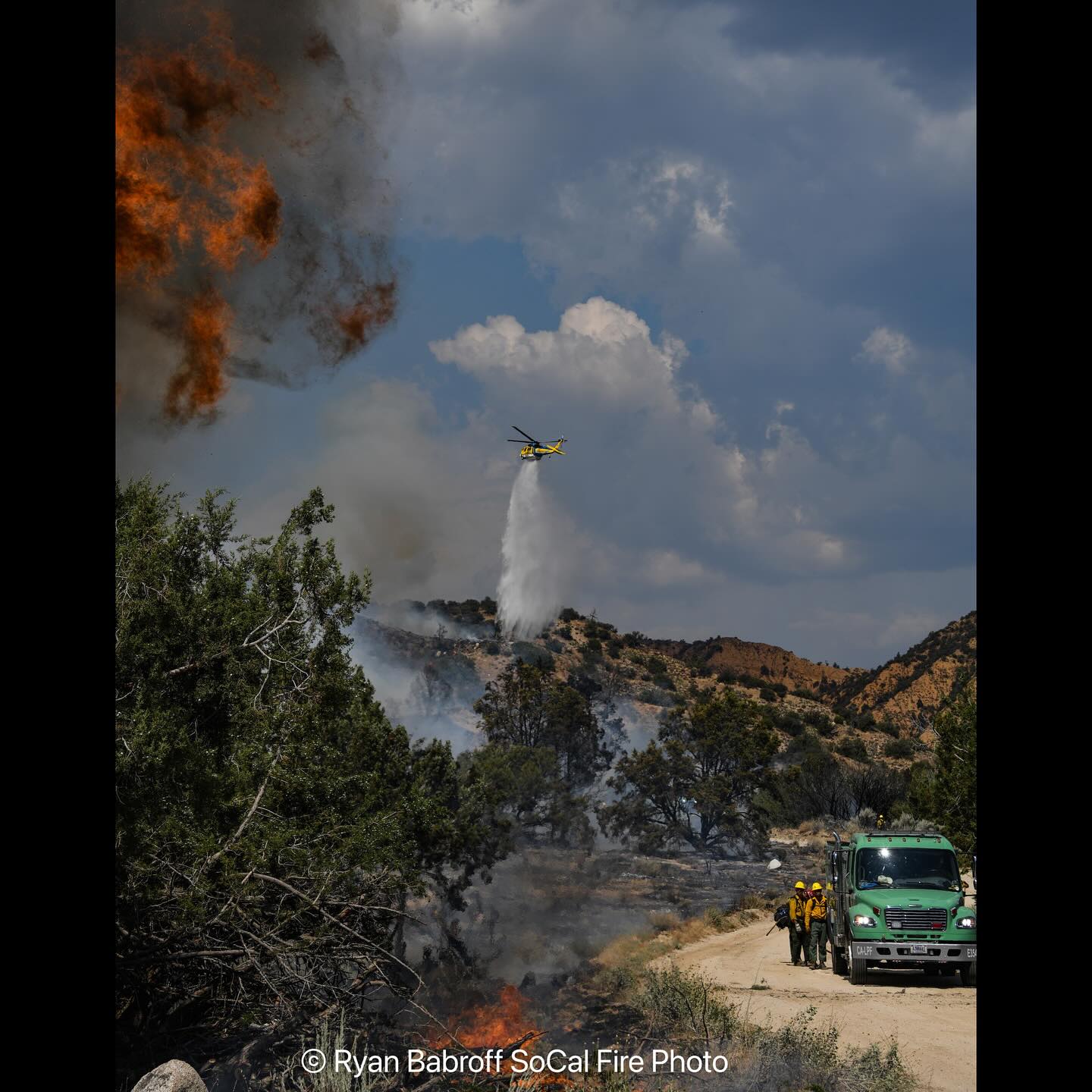
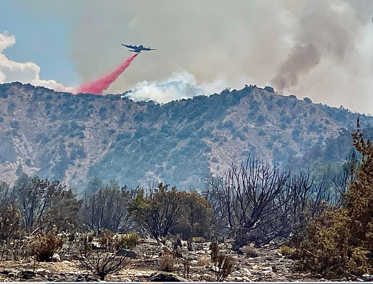
Crews on the Apache fire continue their work to complete the containment lines today. Hoselines, pumps and other equipment used in the suppression effort are being removed and rehabilitated for the next assignment. It is estimated that suppression repair work on contingency lines will be complete in 2-3 days.
Management of the Apache Fire transitioned to a Los Padres National Forest type four incident management team on July 30, 2024.
The burn area is adjacent to Maricopa Highway (CA-33). The highway is open. Motorists are encouraged to be alert for firefighters and equipment in the area. Please check Caltrans road conditions prior to driving through the area.
Forest Closure: A forest closure is in effect in the Apache Fire area, Forest Order 05-07-57-24-18. Please check the Los Padres National Forest page at https://www.fs.usda.gov/s/lpnf for additional information prior to visiting the area.
Evacuation Areas: All evacuation warnings and evacuation orders have been lifted. Info and Maps at VCemergency.com
FIRE AREA CLOSURE: Due to the Apache Fire, the Los Padres National Forest is announcing an emergency area closure for Forest Service lands surrounding the Apache Fire. This closure is in effect from 12:00 p.m. on July 27, 2024, until September 30, 2024. This order can be expanded or rescinded early based on fire behavior and risks associated with the fire and fire recovery. Fire Area Closure Order, Fire Area Closure Map
FOREST ORDERS / RESTRICTIONS: No open fires, campfires or charcoal fires will be permitted outside of developed recreation sites or designated Campfire Use Sites, even with a valid California Campfire Permit. Lanterns and portable stoves using gas, jellied petroleum or pressurized liquid fuel will be permitted, but only with a valid California Campfire Permit, which can be obtained free-of-charge at this website. Forest visitors must clear all flammable material for five feet in all directions from their camp stove, have a shovel available, and ensure that a responsible person always attends the stove during use.
ABOUT THE FOREST: Encompassing almost two million acres, Los Padres National Forest spans some of the most ruggedly beautiful landscapes to be found anywhere in California. Los Padres National Forest has ten designated wilderness areas comprising 875,000 acres.
Ecosystems in Los Padres National Forest range from semi-desert in interior areas to redwood forest on the coast. Forest vegetation is classified into two major types: chaparral (68%) and forested lands (30%). Forested land includes mixed evergreen forests, oak woodland, pinyon-juniper woodland, and conifer forest. Management of chaparral vegetation consists essentially of prescribed burning and wildfire suppression. Forested lands are managed primarily to maintain health and vigor.
Links: Los Padres National Forest Facebook
Maps: Final Public Info Map (pdf) | Fire Progression Map
Update: Final Update (pdf) | Actualización diaria final (pdf)
Crews on the Apache fire continue their work to complete the containment lines today. Hoselines, pumps and other equipment used in the suppression effort are being removed and rehabilitated for the next assignment. It is estimated that suppression repair work on contingency lines will be complete in 2-3 days.
Management of the Apache Fire transitioned to a Los Padres National Forest type four incident management team on July 30, 2024.
The burn area is adjacent to Maricopa Highway (CA-33). The highway is open. Motorists are encouraged to be alert for firefighters and equipment in the area. Please check Caltrans road conditions prior to driving through the area.
Forest Closure: A forest closure is in effect in the Apache Fire area, Forest Order 05-07-57-24-18. Please check the Los Padres National Forest page at https://www.fs.usda.gov/s/lpnf for additional information prior to visiting the area.
Evacuation Areas: All evacuation warnings and evacuation orders have been lifted. Info and Maps at VCemergency.com
FIRE AREA CLOSURE: Due to the Apache Fire, the Los Padres National Forest is announcing an emergency area closure for Forest Service lands surrounding the Apache Fire. This closure is in effect from 12:00 p.m. on July 27, 2024, until September 30, 2024. This order can be expanded or rescinded early based on fire behavior and risks associated with the fire and fire recovery. Fire Area Closure Order, Fire Area Closure Map
FOREST ORDERS / RESTRICTIONS: No open fires, campfires or charcoal fires will be permitted outside of developed recreation sites or designated Campfire Use Sites, even with a valid California Campfire Permit. Lanterns and portable stoves using gas, jellied petroleum or pressurized liquid fuel will be permitted, but only with a valid California Campfire Permit, which can be obtained free-of-charge at this website. Forest visitors must clear all flammable material for five feet in all directions from their camp stove, have a shovel available, and ensure that a responsible person always attends the stove during use.
ABOUT THE FOREST: Encompassing almost two million acres, Los Padres National Forest spans some of the most ruggedly beautiful landscapes to be found anywhere in California. Los Padres National Forest has ten designated wilderness areas comprising 875,000 acres.
Ecosystems in Los Padres National Forest range from semi-desert in interior areas to redwood forest on the coast. Forest vegetation is classified into two major types: chaparral (68%) and forested lands (30%). Forested land includes mixed evergreen forests, oak woodland, pinyon-juniper woodland, and conifer forest. Management of chaparral vegetation consists essentially of prescribed burning and wildfire suppression. Forested lands are managed primarily to maintain health and vigor.
| Current as of | Wed, 07/31/2024 - 09:42 |
|---|---|
| Incident Time Zone | America/Los_Angeles |
| Incident Type | Wildfire |
| Cause | Under Investigation / Unknown |
| Date of Origin | |
| Location | Cuyama Valley |
| Incident Commander | Los Padres National Forest. |
| Incident Description | Vegetation Fire. |
| Coordinates |
34° 45' 21'' Latitude
-119° 24' 32
'' Longitude
|
| Total Personnel: | 253 |
|---|---|
| Size | 1,538 Acres |
| Percent of Perimeter Contained | 80% |
| Fuels Involved | Precipitation and temperature alignments throughout the winter and spring of 2024 have resulted in an above average load of fuels across many grass-dominated ecosystems throughout California, allowing for rapid spread of fires when these fuels are cured. View Fire and Fuels Advisory.
|
| Projected Incident Activity |
Fire is not expected to grow. Firefighters will continue to monitor the fire daily. |
|---|