
Highlighted Media
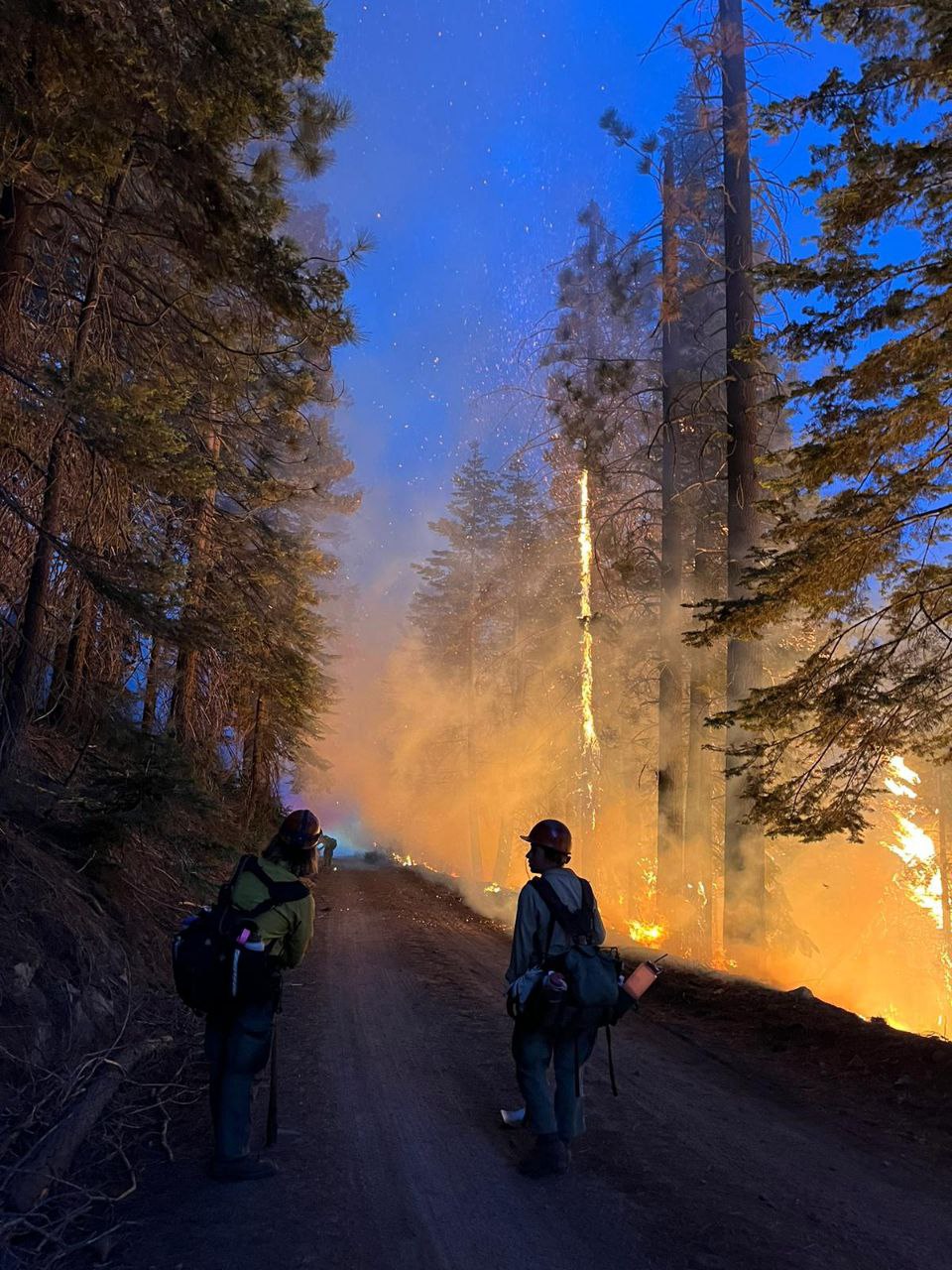
Firefighters with Whiskeytown National Recreation Area monitoring the fire. Photo by Crew Member Depue
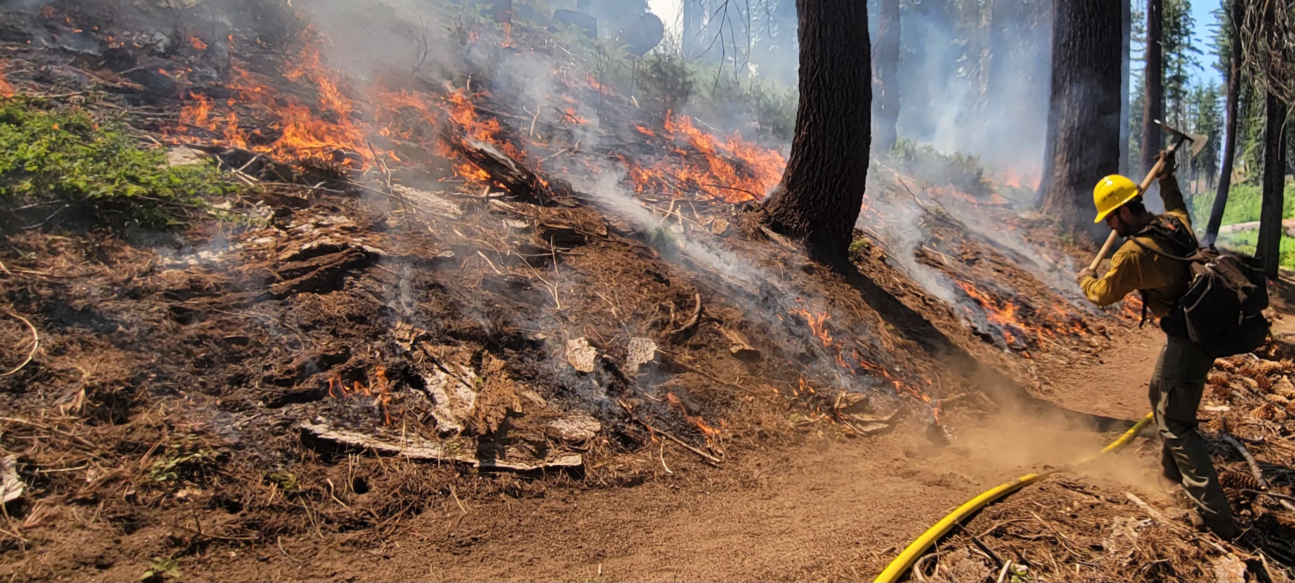
Sequoia & Kings Canyon Firefighter Meissner with Engine 72 working hard on the Park Ridge Prescribed Burn
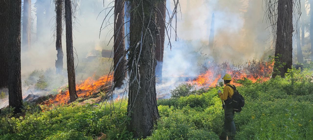
Fire Effects Technician, Ortiz observing the Park Ridge Prescribed Burn.
Sequoia & Kings Canyon National Parks will be conducting a prescribed burn, Park Ridge & Big Stump East Prescribed Burn, in the Grant Grove Area of Kings Canyon National Park beginning June 23, 2024, through June 28, 2024. Smoke will be visible from the Generals Highway and Highway 180.
Access to the General Grant Tree and parking area will not be impacted by this prescribed burn. However, trails near Panoramic Point and to Park Ridge will be closed during this time.
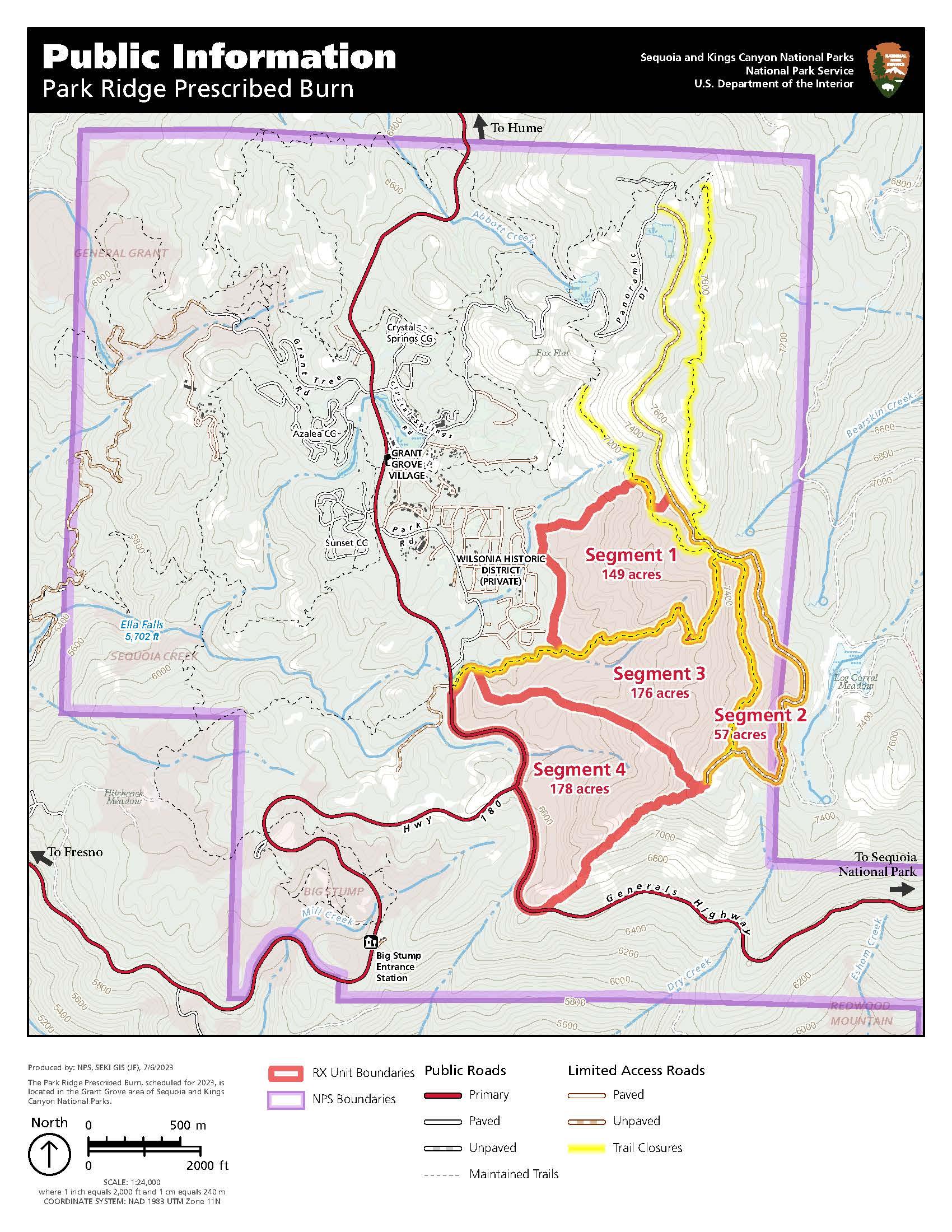
The Park Ridge Prescribed Burn is 560 acres located along the main ridge east of General Grant Grove and the Kings Canyon Visitor Center. There are four segments on the western slope of the ridge.
The Big Stump East Prescribed burn is 126 acres along the General Highway and Highway 180. There is one segment to this burn.
Please see the Maps tab for specifics.
Ignitions started on the morning of Sunday, June 23rd and will continue for approximately six days, depending on conditions. Atmospheric and air quality conditions are being monitored daily and will play a role in determining acreage to be burned each day and the number of days of ignitions.
For air quality information for your specific location or for trip planning, please visit fire.airnow.gov This website is also mobile friendly and can be accessed from your smart phone.
Sequoia & Kings Canyon National Parks will be conducting a prescribed burn, Park Ridge & Big Stump East Prescribed Burn, in the Grant Grove Area of Kings Canyon National Park beginning June 23, 2024, through June 28, 2024. Smoke will be visible from the Generals Highway and Highway 180.
Access to the General Grant Tree and parking area will not be impacted by this prescribed burn. However, trails near Panoramic Point and to Park Ridge will be closed during this time.
The Park Ridge Prescribed Burn is 560 acres located along the main ridge east of General Grant Grove and the Kings Canyon Visitor Center. There are four segments on the western slope of the ridge.
The Big Stump East Prescribed burn is 126 acres along the General Highway and Highway 180. There is one segment to this burn.
Please see the Maps tab for specifics.
Ignitions started on the morning of Sunday, June 23rd and will continue for approximately six days, depending on conditions. Atmospheric and air quality conditions are being monitored daily and will play a role in determining acreage to be burned each day and the number of days of ignitions.
For air quality information for your specific location or for trip planning, please visit fire.airnow.gov This website is also mobile friendly and can be accessed from your smart phone.
| Current as of | Sat, 07/27/2024 - 22:55 |
|---|---|
| Incident Time Zone | America/Los_Angeles |
| Incident Type | Prescribed Fire |
| Date of Origin | |
| Location | Park Ridge |
| Incident Commander | Sequoia & Kings Canyon National Parks, NPS, R. Garlapow |
| Incident Description | Ignitions on the Park Ridge Prescribed Burn began on June 23, 2024. 560 acres have been successfully completed, crews are working on mop up. |
| Coordinates |
36° 44' 8'' Latitude
-118° 57' 7
'' Longitude
|
| Total Personnel: | 79 |
|---|---|
| Size | 560 Acres |
| Fuels Involved | Mixed conifer, giant sequoias, subalpine brush, dead and down fuels. |
| Significant Events | Ignitions on the Park Ridge Prescribed Burn started on June 23, 2024. Crews have successfully completed 560 acres as of 6-27-24 on the Park Ridge Prescribed Burn.
|
| Remarks |
Firefighters will be present along both the Generals Highway and Highway 180. The public and residents are asked to drive slow, turn on headlights, and follow firefighters and park rangers instructions. |
|---|
| Weather Concerns | None at this time. |
|---|