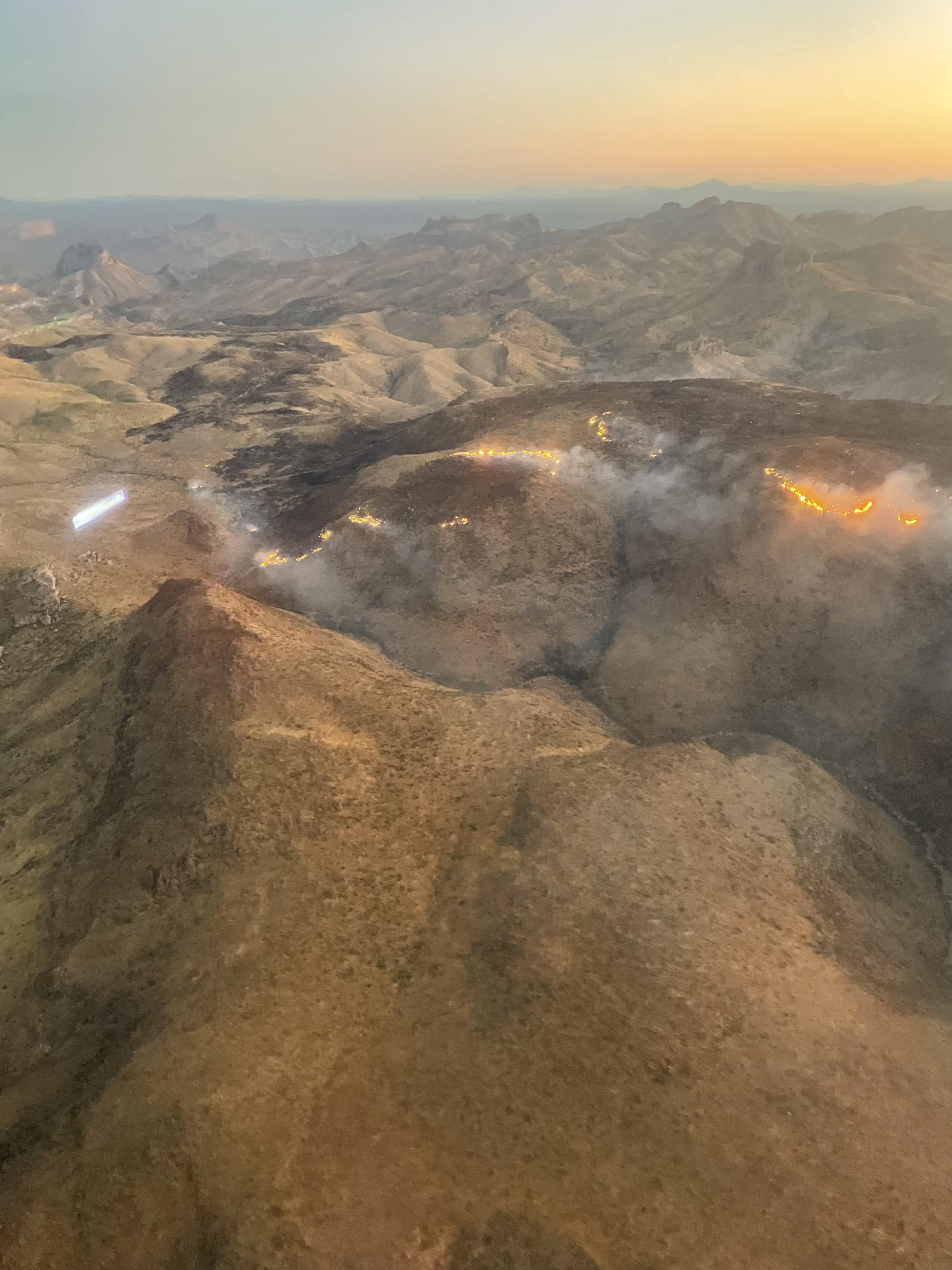
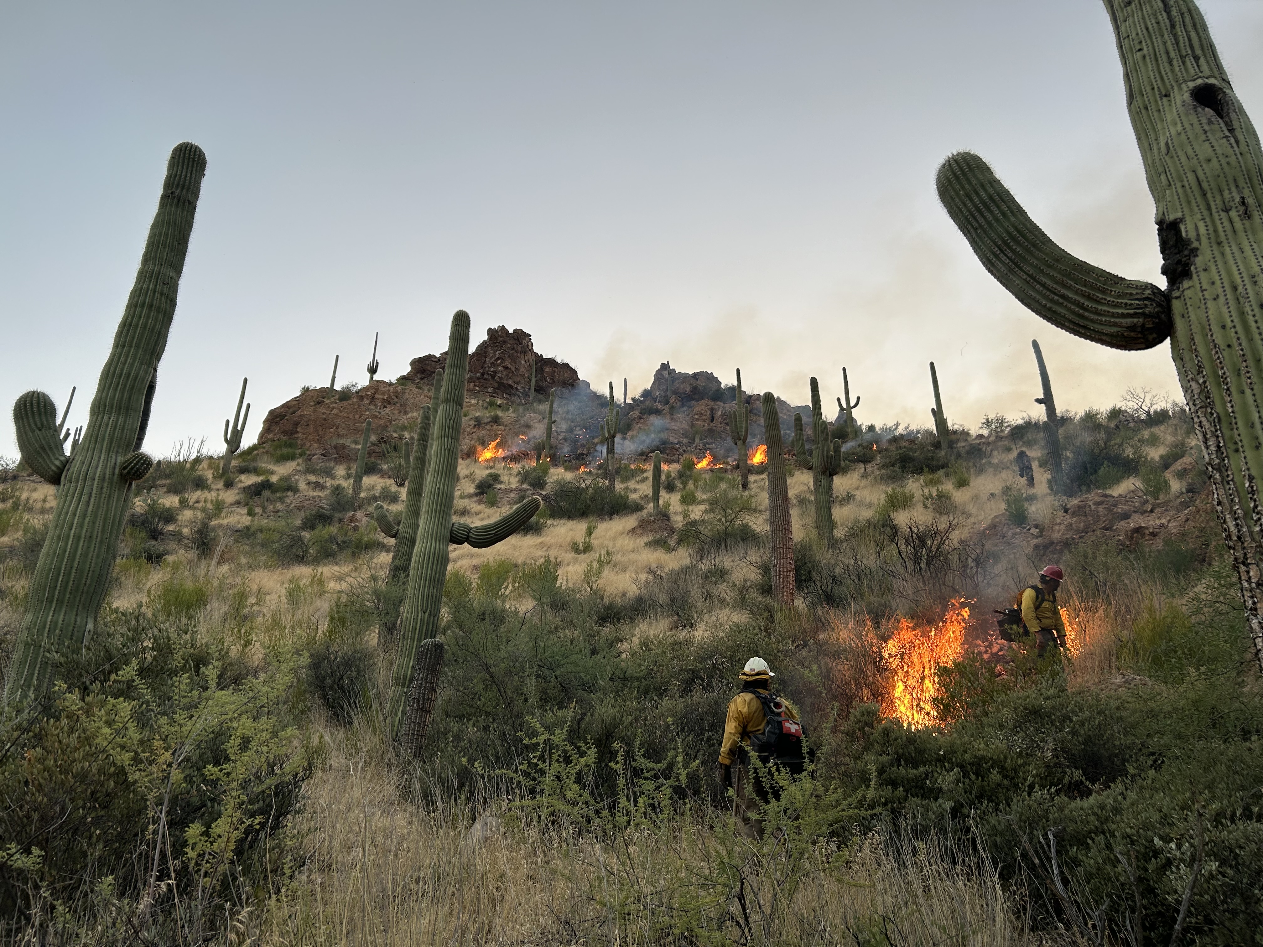
Highlighted Media

The Wood fire remains active and is primarily progressing to the east, south of Superior, Arizona on the Globe Ranger District. This fire is burning under moderate conditions in remote rugged terrain. This area was heavily impacted by the Telegraph Fire in 2021 and is now experiencing a much shorter natural fire return interval. Firefighters are working to mitigate impacts to infrastructure and other values on the landscape while this naturally caused fire burns under moderate conditions with lower temperatures, higher relative humidity, and scattered rain in the area.
Lightning-caused fires are a natural part of the ecosystem as they improve overall forest health and reduce fuel loads that have the potential to cause wildfires.
| Current as of | Sat, 09/07/2024 - 21:32 |
|---|---|
| Incident Time Zone | America/Phoenix |
| Incident Type | Wildfire |
| Cause | Lightning |
| Date of Origin | |
| Location | 5 miles south of Superior, Arizona |
| Incident Commander | The Wood Fire has transitioned to a Type 3 incident managed by the Globe Ranger District, Tonto National Forest. |
| Incident Description | The Wood and Wood 2 fires started as natural lightning-caused wildfires on the Globe Ranger District, 5 miles south of Superior, Arizona, in the Wood Canyon area. The fires merged into one fire and now are referred to as the Wood Fire for all updates. |
| Coordinates |
33° 14' 11'' Latitude
-111° 7' 61
'' Longitude
|
| Total Personnel: | 9 |
|---|---|
| Size | 7,211 Acres |
| Percent of Perimeter Contained | 45% |
| Fuels Involved | Brush (2 feet) |
| Significant Events | The Wood Fire remained inactive today despite the wind and high temperatures. Containment has increased to 45% and remains at 7,211 acres. This will be the last update for the Wood Fire unless significant activity occurs. Fire managers will continue to monitor for any new heat sources in the coming days. The Globe Ranger Districts would like to thank the public for their patience with this incident and our cooperators from Salt River Project, Southwest Gas Corporation, Town of Superior , Arizona Department of Forestry and Fire Management and Bureau of Land Management - Arizona for their assistance. Due to the rugged terrain and long medical evacuation times on large portions of the fire perimeter containment percentage may not rise for several days as firefighters will not be able to physically check for heat sources in many areas. Instead, fire managers will rely on air resources to monitor for any fire growth in remote areas. The Wood Fire has exhibited low to moderate fire behavior and is primarily burning within the 2021 Telegraph Fire footprint. It is important to note that the Telegraph Fire drastically changed the ecology of the area. Historically the Sonoran Desert rarely experienced fire. Invasive species such as red brome and buffelgrass are drivers of frequent fire. The fire returns nutrients to the soil, in turn growing more grass, which fuels fire and these areas may now burn every 1-3 years. Rural Arizonans living in a frequent fire areas are encouraged to learn more about defensible space and what you can do to help by visiting: https://www.fs.usda.gov/Internet/FSE_DOCUMENTS/stelprdb5339207.pdf The public is urged to sign up for Arizona’s Ready, Set, Go emergency notification system with their county to be informed of evacuations in their area. For information about Ready, Set, Go or to sign up for notifications visit https://ein.az.gov/ready-set-go. |
| Planned Actions |
Firefighters will continue to minimize impacts to private property, power and gas lines, State Route 177 and range infrastructure which are the primary values at risk. |
|---|
| Weather Concerns | Low to mid-90s with no rain forecasted for the next 10 days. |
|---|

 InciWeb
