
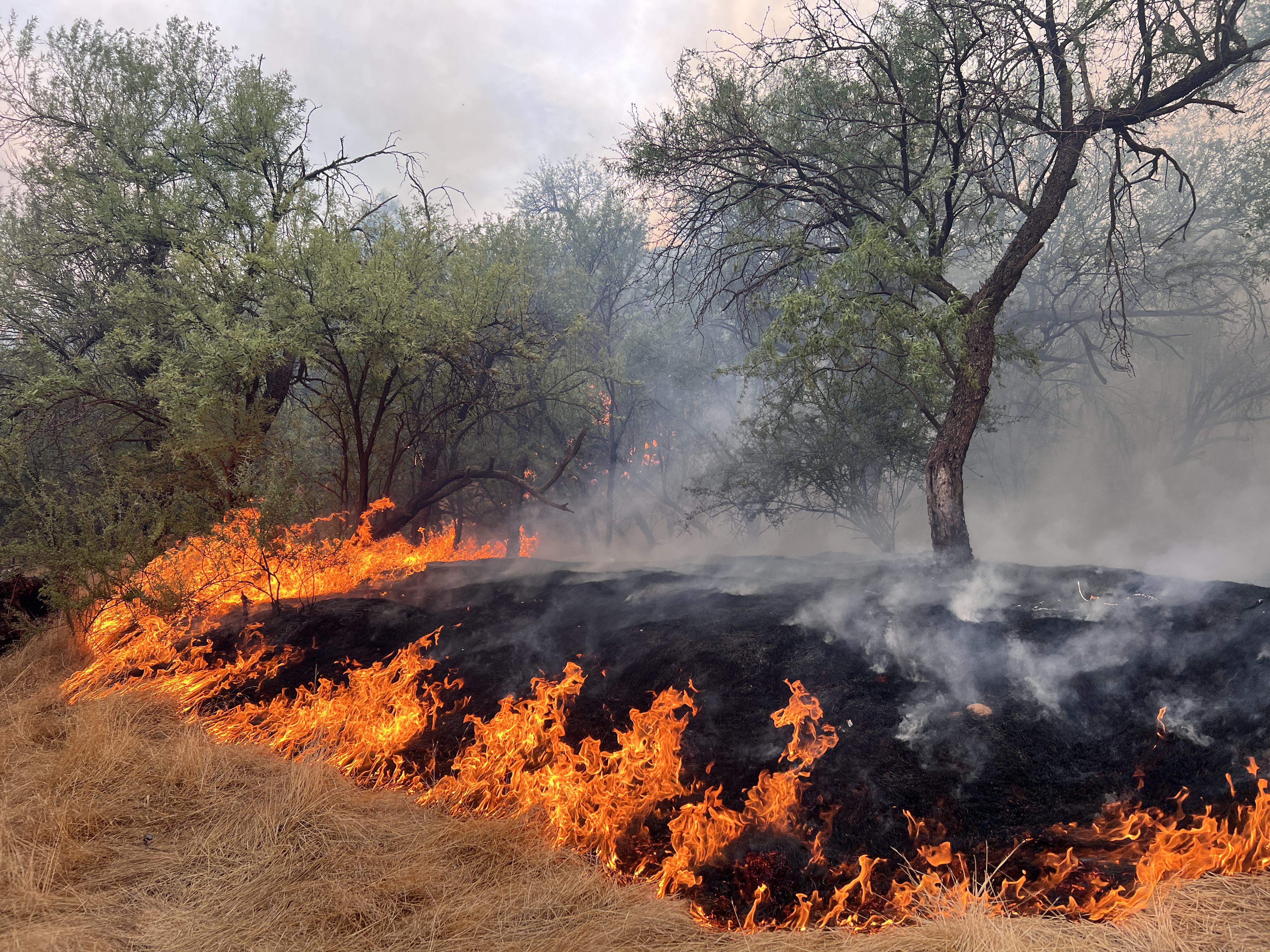
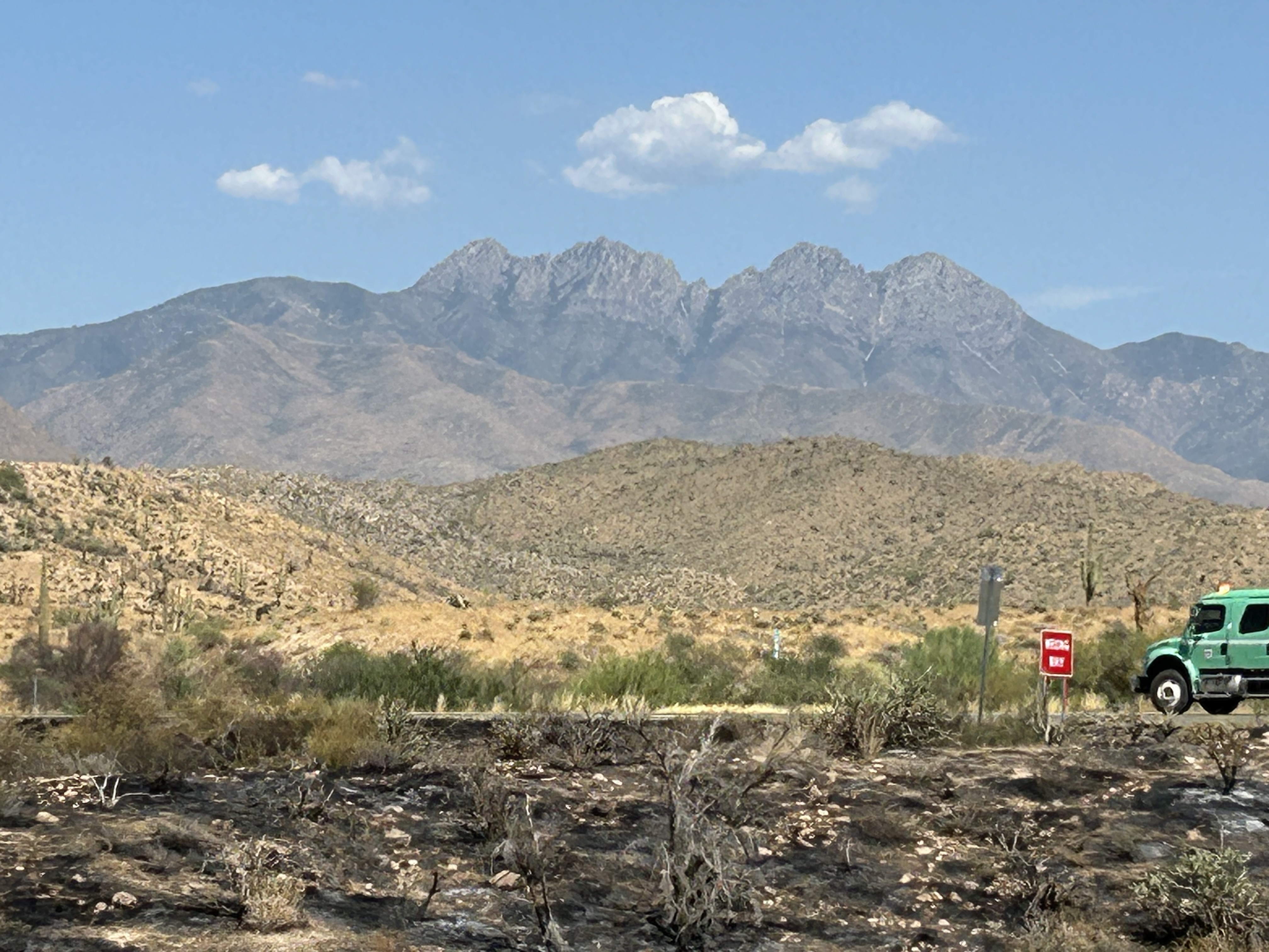
The lightning-caused Sand Stone Fire started Thursday, July 25th, 14 miles northeast of Fountain Hills, AZ between the Verde River and Hwy 87 on the Cave Creek Ranger District. The objectives for this incident include protecting values at risk, such as adjacent Tribal and private lands, power and transportation infrastructure, cultural and natural resources, threatened and endangered species, and range improvements. The fuel types for this incident include tall grass and brush. After several growing seasons of above-normal precipitation, the grass volumes are much higher than usual, and fuels are very dry, after a low-moisture monsoon season.
| Current as of | Wed, 08/21/2024 - 11:36 |
|---|---|
| Incident Time Zone | America/Phoenix |
| Incident Type | Wildfire |
| Cause | Lightning |
| Date of Origin | |
| Location | 14 miles northeast of Fountain Hills |
| Incident Commander | Type 4 incident commanders from the Cave Creek Ranger District |
| Incident Description | Wildfire in the Sonoran Desert. |
| Coordinates |
33° 45' 34'' Latitude
-111° 35' 42
'' Longitude
|
| Total Personnel: | 40 |
|---|---|
| Size | 27,390 Acres |
| Percent of Perimeter Contained | 98% |
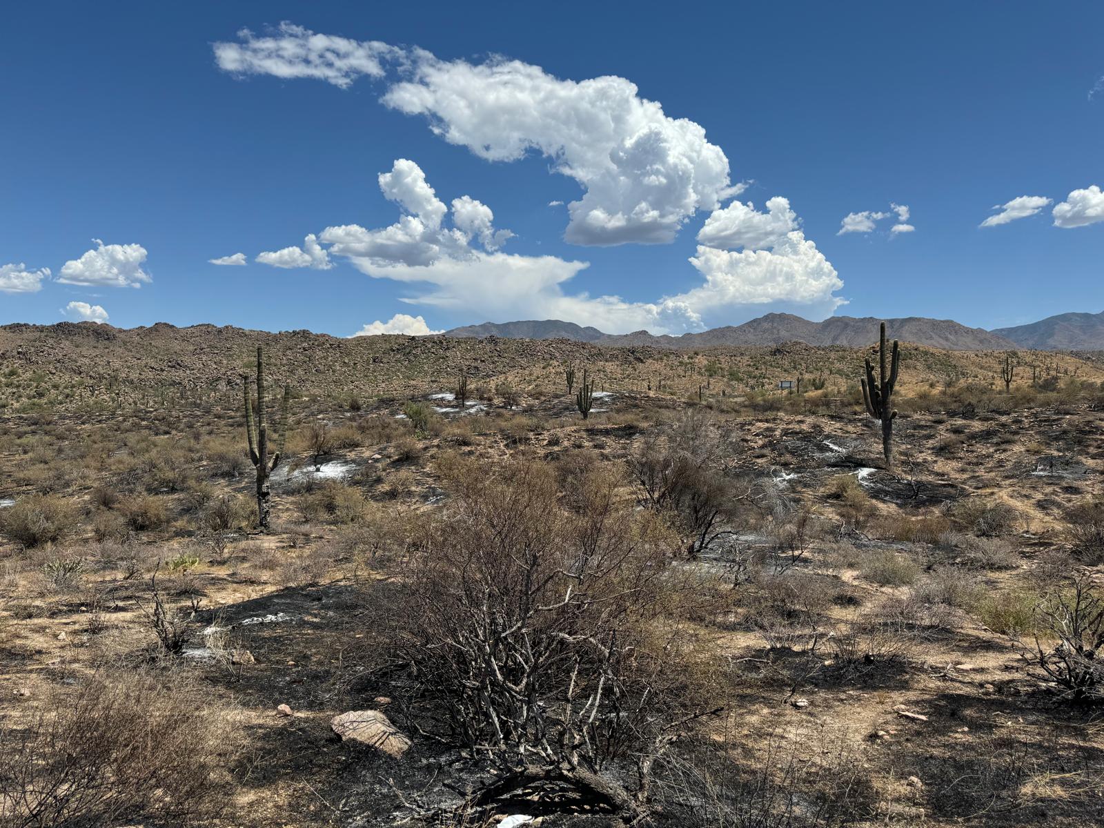
| Fuels Involved | Tall Grass (2.5 feet) Brush (2 feet) Grass volumes are elevated due to several growing seasons of above normal moisture. Recent moisture and elevated RH values have significantly reduced the availability of these fuels to carry fire. |
| Significant Events | Minimal, smoldering Only scattered heat in stump holes is present. Fire received measurable precipitation and no spread is anticipated.
|
| Planned Actions |
Continue to hold and monitor the fire, complete suppression repair, and provide for initial attack as requested. Transferred command to the Tonto NF on 1800 on 8/12/24 |
|---|---|
| Projected Incident Activity |
12 hours: No anticipated movement outside of existing footprint. 24 hours: No anticipated movement outside of existing footprint. 48 hours: No anticipated movement outside of existing footprint. 72 hours: No anticipated movement outside of existing footprint. Anticipated after 72 hours: No anticipated movement outside of existing footprint. |
| Remarks |
Closure Area: Consists of all National Forest System lands, roads, and trails within the boundary starting at the intersection of National Forest System Road (NFSR) 204 and State Route (SR) 87, then following southwest along the northwest side of SR 87 approximately 1.75 miles to the intersection with the Private Ownership also known as Goldfield Estates, then following north and west along the Private Ownership boundary approximately 4 miles to the intersection with the National Forest Boundary and Fort McDowell Reservation, then following the National Forest Boundary north and west approximately 8.25 miles to the intersection with the Verde River, then following north along the east side of the Verde River approximately 9.5 miles to the intersection with Motorized Trail (MT) 393, then following northeast along the northwest side of MT-393 approximately 4.5 miles to the intersection with NFSR 393, then following northeast along the northwest side of NFSR 393 approximately 11 miles to the intersection with MT-393, then following northeast along the northwest side of MT-393 approximately 3 miles to the intersection with NFSR 627, then following south along the east side of NFSR 627 approximately 1.75 miles to the intersection with the Private Ownership also known as the Sunflower Community, then following generally south along the Private Ownership boundary approximately 1.75 miles to the intersection with SR 87, then following generally south along the west side of SR 87 approximately 19 miles back to the point of beginning at the intersection with NFSR 204. Routes along the Described Area boundary that are closed include; NFSR 393, NFSR 627, and MT-393. SR 87 Southbound was reopened 7/31 at 21:30.
|
| Weather Concerns | Expect temperatures to be fairly stable through the next 7 days, with afternoon highs nearing 110°F |
|---|