
Highlighted Media
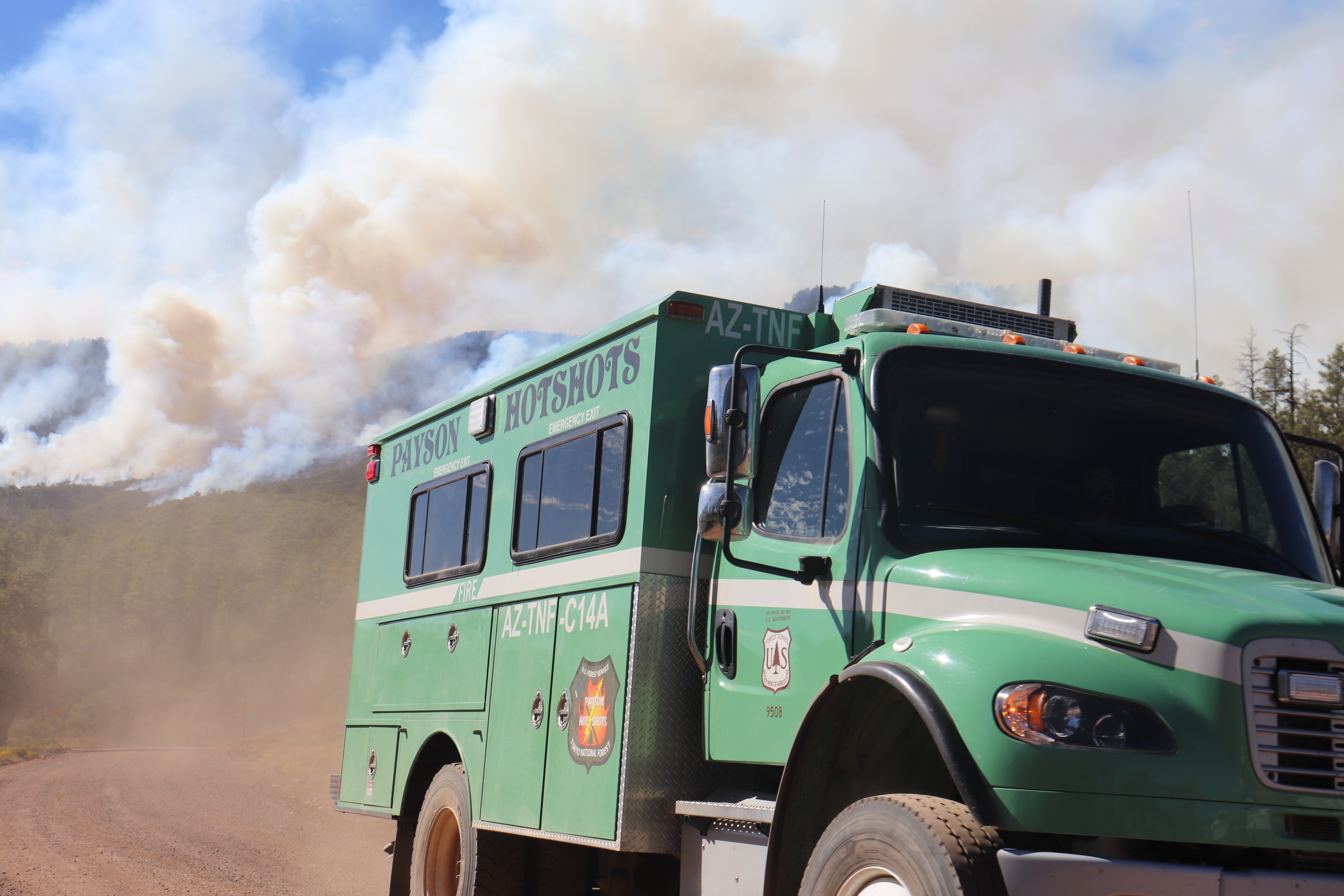
Firefighters have exercised patience with the West Fire, waiting for the right conditions to apply fire when it would be most beneficial and hold off on ignitions when conditions would get too hot. (Photo credit: T. Davila)
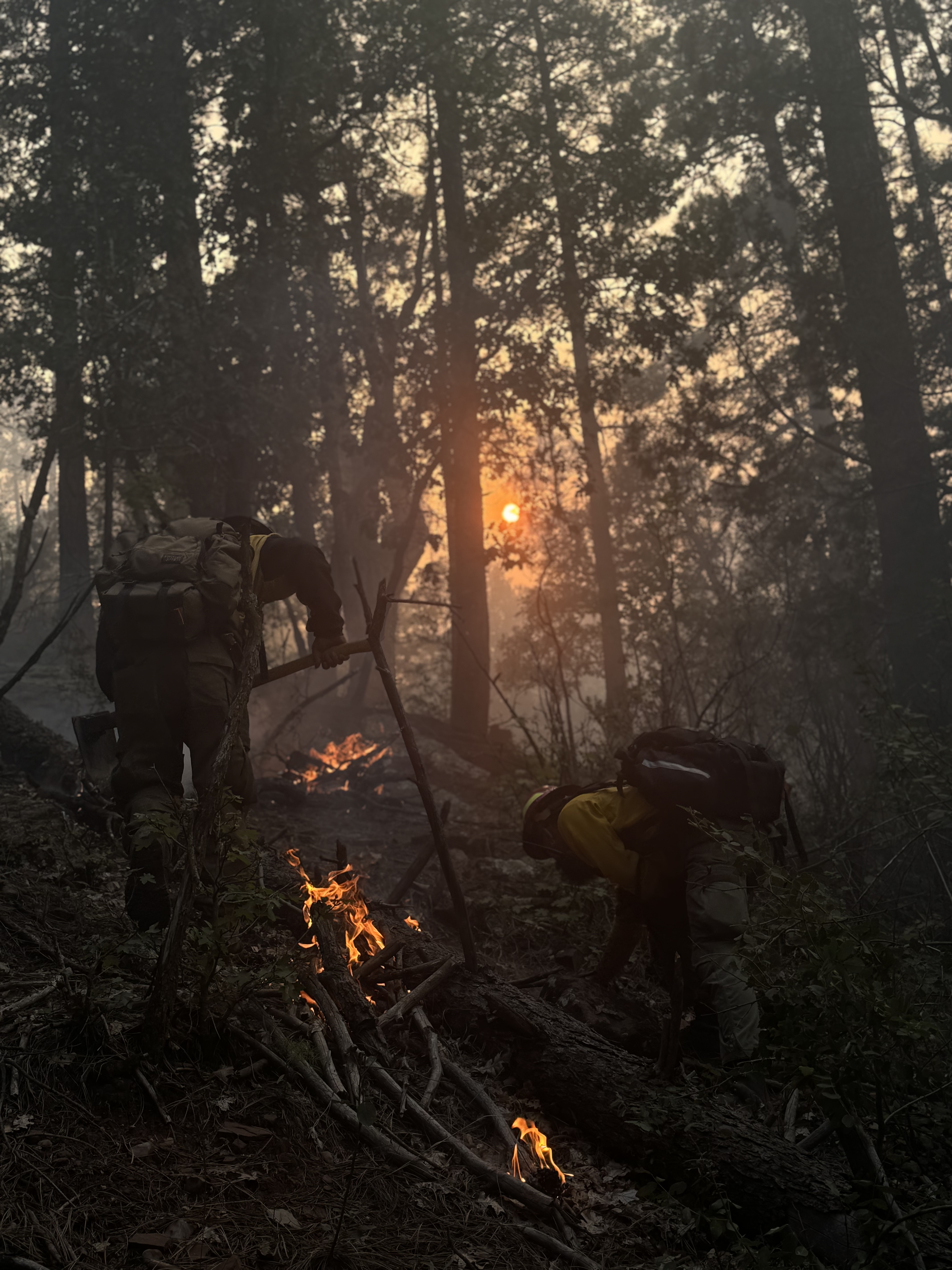
Firefighters work to create "bone piles" or small bonfires to encourage burning of the unnatural buildup of fuels. Burning these sticks and logs now makes communities safer in the future because when the next fire starts, there will be less fuel on the ground. (Photo Credit: Lauren Hill E-14)
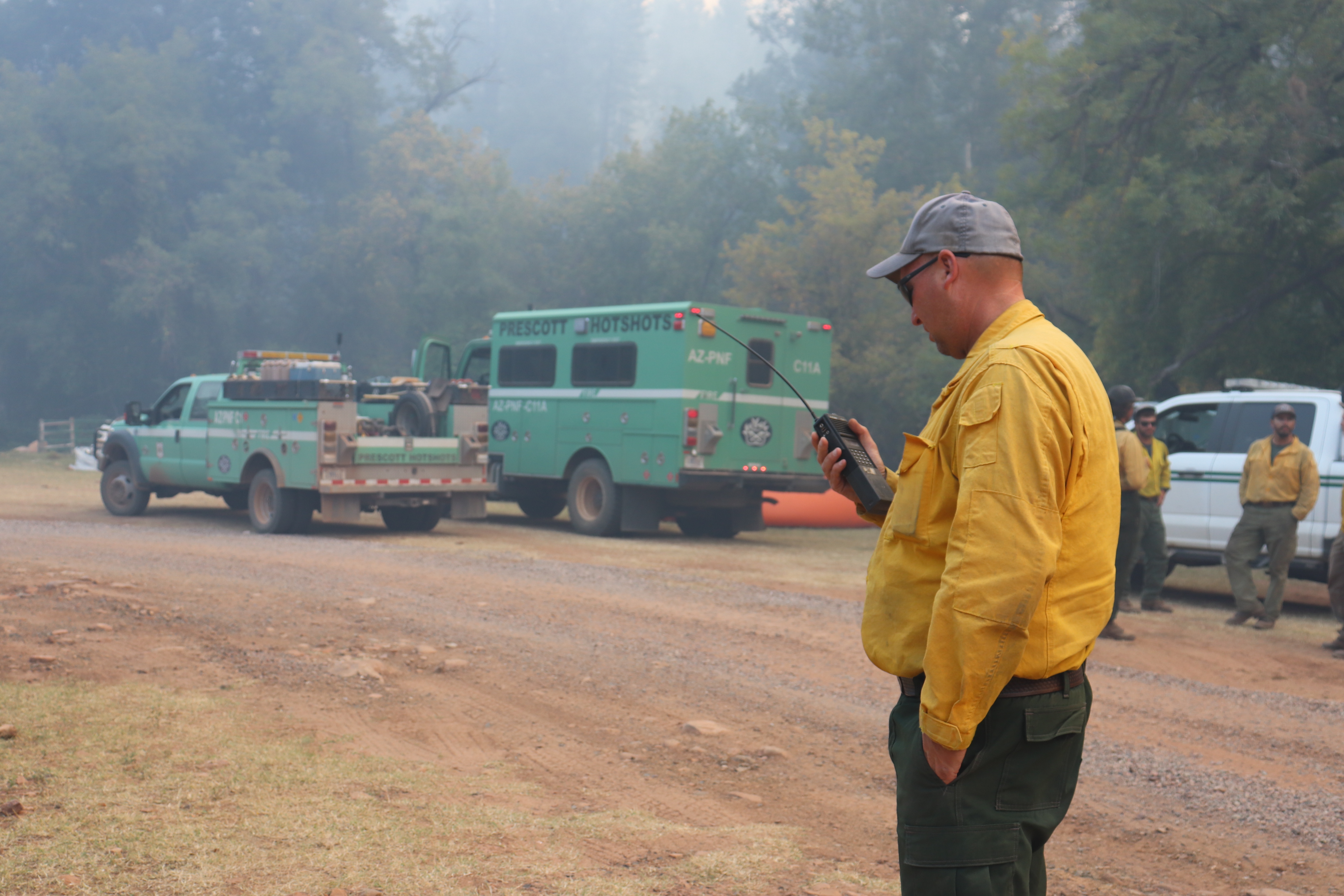
The Payson Hotshots have played an important role in containing the West Fire because they are local, know the area and are familiar with how fire behaves on the Tonto National Forest (Photo credit: T. Davila)
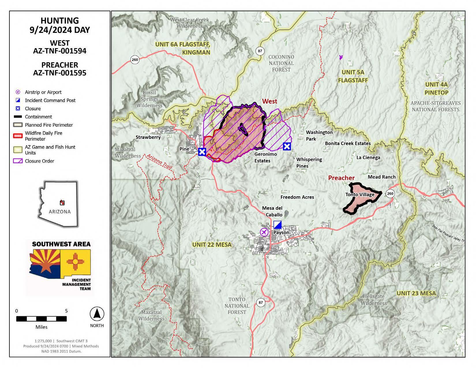
The West Fire is a lightning-caused wildfire that is burning four miles northeast of Pine, Arizona. The fire is being managed under a confine and contain strategy with the goal of protecting private lands and the communities of Camp Geronimo, Geronimo Estates, Bray Creek Ranch and Pine while reintroducing fire into a fire dependent ecosystem. The intended result is to reduce hazardous fuels, improve watershed conditions and wildlife habitat. This will decrease accumulations of fuels and the potential for future fires to burn with high severity that may be more difficult to suppress. The West Fire is being managed with the Preacher Fire under a local fire management organization led by Incident Commander Tadd Fagerud.
Final Video Update from Southwest Complex Incident Management Team 3
| Current as of | Wed, 10/09/2024 - 11:58 |
|---|---|
| Incident Time Zone | America/Phoenix |
| Incident Type | Wildfire |
| Cause | Lightning |
| Date of Origin | |
| Location | 13 miles north-northwest of Payson, Arizona |
| Incident Commander | Tonto National Forest Incident Commander, Eli Pfoutz ICT4 |
| Coordinates |
34° 25' 21'' Latitude
-111° 23' 18
'' Longitude
|
| Total Personnel: | 71 |
|---|---|
| Size | 15,074 Acres |
| Percent of Perimeter Contained | 95% |
| Fuels Involved | Chaparral (6 feet), hardwood litter, timber (litter and understory) Predominant fuels are Ponderosa pine litter and chaparral with pockets of mixed conifer. Grass is currently fully greened up and not contributing to fire spread. Discontinuous fuels broken up by rock in areas below the rim. |
| Significant Events | Moderate Flanking Backing FIre continues to burn available fuels withing perimeter as RH levels remain low. |
| Planned Actions |
Ignitions are complete. Unburned pockets in the interior may continue to produce smoke. |
|---|---|
| Projected Incident Activity |
Creeping and smoldering overnight in timber fuels. Greatly reduced smoke production compared to previous evenings. |
| Weather Concerns | Plentiful sunshine. Near record high temperatures. High 91 degrees, winds SSW at 5 to 10 mph. Tonight, clear skies, low 63 degrees. Winds light and variable. |
|---|