
Highlighted Media
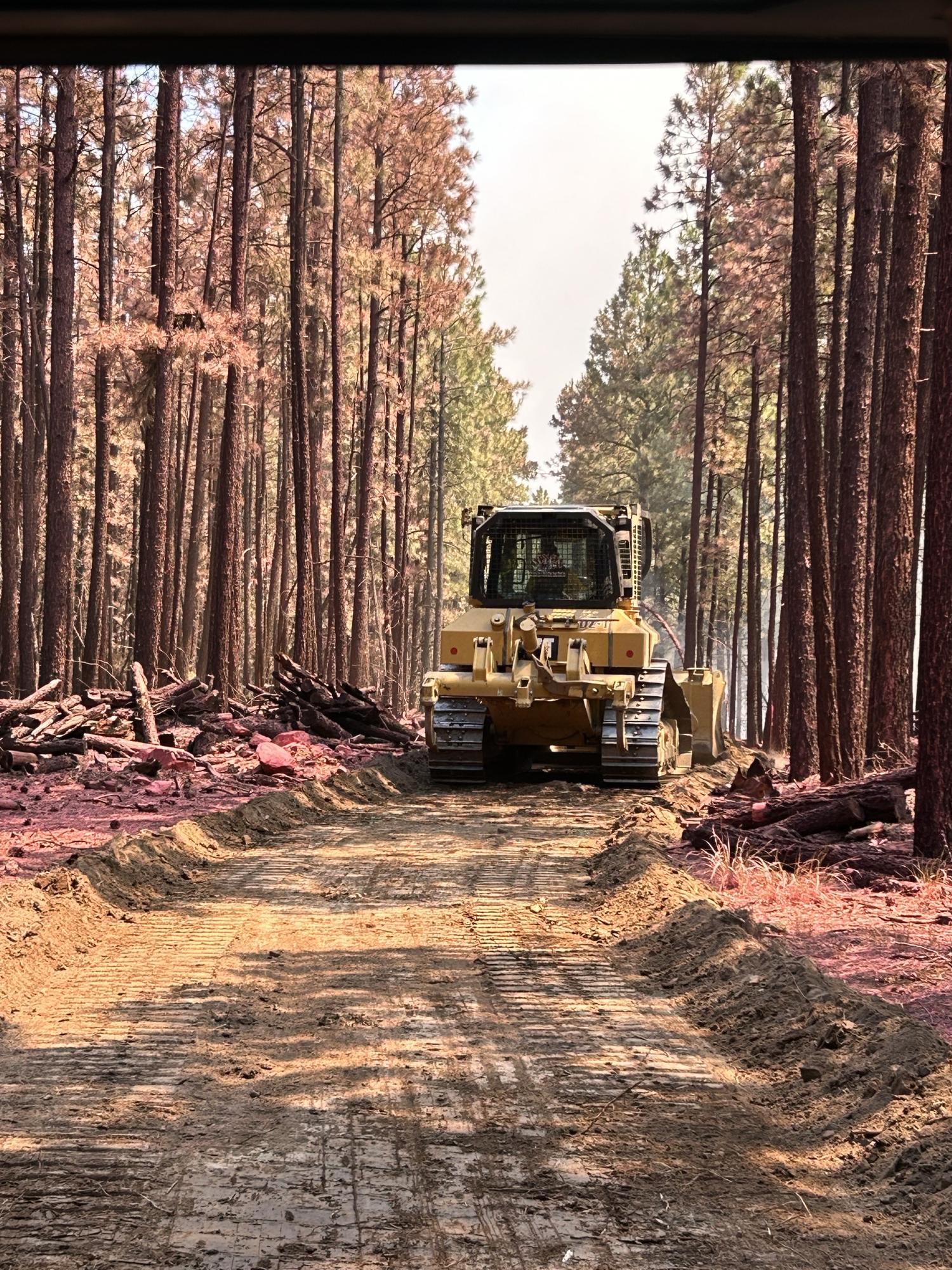
A dozer moves through retardant-coated pine trees during suppression activities on the Pius Fire, located 20 miles northeast of Payson, Ariz, on July 12, 2024.
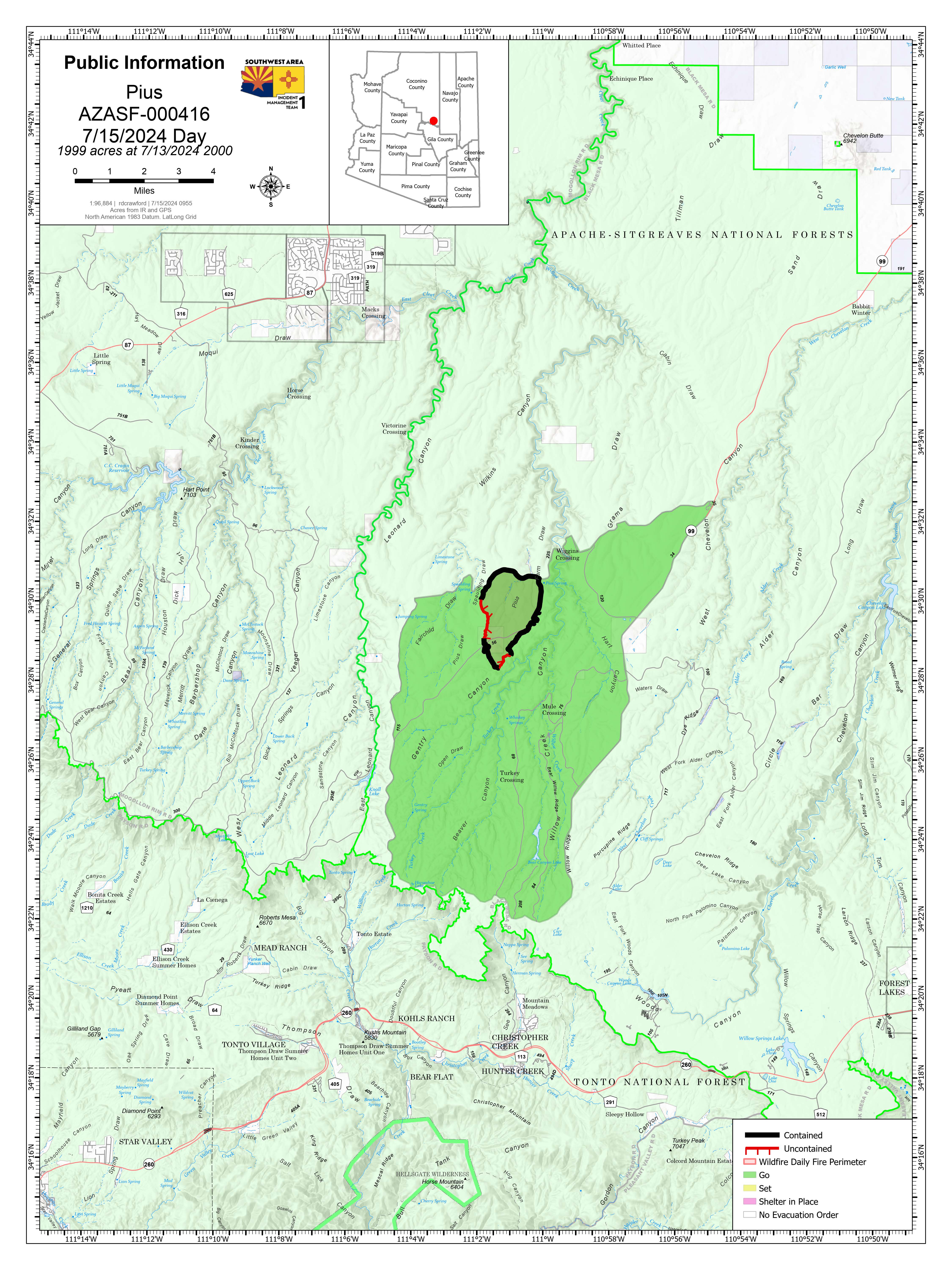
This will be the last map for the Pius Fire unless there are significant changes.
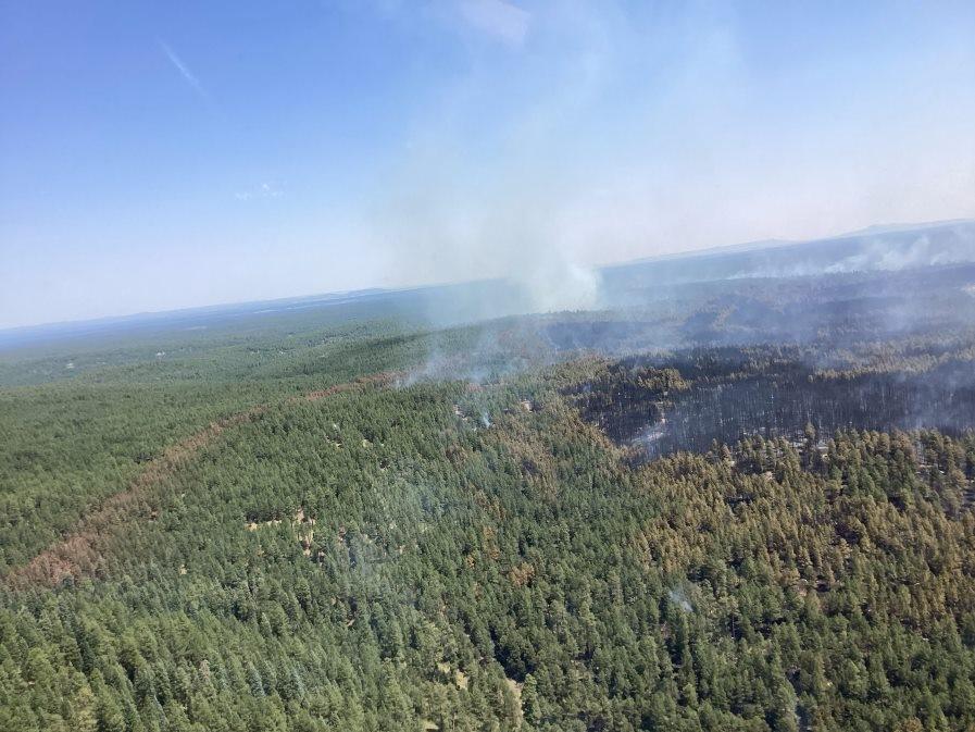
The Pius fire is located approximately 20 miles Northeast of Payson, AZ. It was detected at 12:31 p.m. on July 8, 2024. The fire is burning in ponderosa pine and mixed timber with a grass understory. Southwest Area Team 1 assumed command of the fire at 6 a.m. on July 10 and is managing the fire with a full suppression strategy. Direct and indirect tactics will be used with the objective of full perimeter control.
The Pius fire is located approximately 20 miles Northeast of Payson, AZ. It was detected at 12:31 p.m. on July 8, 2024. The fire is burning in ponderosa pine and mixed timber with a grass understory. Southwest Area Team 1 assumed command of the fire at 6 a.m. on July 10 and is managing the fire with a full suppression strategy. Direct and indirect tactics will be used with the objective of full perimeter control.
| Current as of | Mon, 07/15/2024 - 21:36 |
|---|---|
| Incident Time Zone | America/Phoenix |
| Incident Type | Wildfire |
| Cause | Undetermined |
| Date of Origin | |
| Location | 20 miles NE of Payson AZ |
| Incident Commander | Carl Schwope: Incident Commander, Southwest Complex Incident Management Team 1 Jason Clawson, Deputy Incident Commander, Southwest Complex Incident Management Team 1 |
| Coordinates |
34° 30' 19'' Latitude
-111° 1' 2
'' Longitude
|
| Total Personnel: | 196 |
|---|---|
| Size | 1,999 Acres |
| Percent of Perimeter Contained | 85% |
| Fuels Involved | Ponderosa Pine/Mixed Conifer |
| Significant Events | Fire behavior is minimal - some smoldering of interior fuels |