
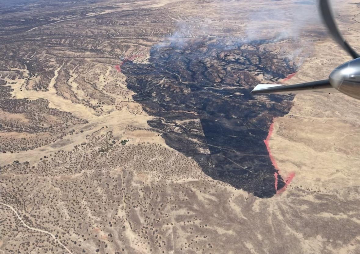
Today, crews were able to call forward progress stopped on the fire. Heavy mop up continues along the flanks of the fire and within the drainages. Significant heat still remains in the oak within the drainages. Overall, crews continue to make good progress and have the Ranch Fire 47% contained. Over the next few operational periods, resources will continue mopping up and monitoring along the fire's edge checking for any heat or interior smokes.
The Ranch Fire started approximately 10:00 am, on Tuesday, June 4. The fire was wind-driven as it pushed through heavy fuels of grass, brush, and oak. It progressed through the day to the south/southeast at a moderate rate of spread. Heavy aircraft including a Very Large Air Tanker (VLAT) and two Large Air Tankers (LATs), along with Single Engine Air Tankers (SEATs) worked the fire most of the afternoon in coordination with hand crews and engines. The aircraft use did help decrease fire activity to some degree.
The Santa Cruz County Office of Emergency Management lifted the SET status for residences north of the fire Wednesday night.
One hotshot crew, three Department of Forestry and Fire Management Type 2 crews, and 9 engines remain assigned to the incident.
The fire is located approximately 19 miles southeast of Patagonia and south/southwest of the San Rafael State Natural Area in Santa Cruz County.
Residents in Santa Cruz can sign up for emergency alerts at: https://entry.inspironlogistics.com/santacruz_az/wens.cfm
READY, SET, GO information: https://ein.az.gov/ready-set-gohttps://ein.az.gov/ready-set-go
Arizona Department of Forestry and Fire Management on Facebook: https://www.facebook.com/arizonaforestry
Arizona Department of Forestry and Fire on X (formerly Twitter): https://x.com/azstateforestry
| Current as of | Thu, 06/05/2025 - 20:04 |
|---|---|
| Incident Time Zone | Arizona Mountain Standard Time |
| Incident Type | Wildfire |
| Cause | Unknown |
| Date of Origin | |
| Incident Time Zone | Arizona Mountain Standard Time |
| Location | 19 miles southeast of Patagonia |
| Incident Commander | Josh Cabral, IC T3 - Coronado NF Michael Renovato, IC T3 (t) - Arizona Department of Forestry and Fire Management |
| Coordinates |
31° 21' 21'' Latitude
-110° 37' 44
'' Longitude
|
| Total Personnel: | 135 |
|---|---|
| Size | 2,751 Acres |
| Percent of Perimeter Contained | 47% |
| Fuels Involved | Grass and brush |
| Weather Concerns | Hot and dry conditions into the weekend |
|---|