Highlighted Activity
Highlighted Media


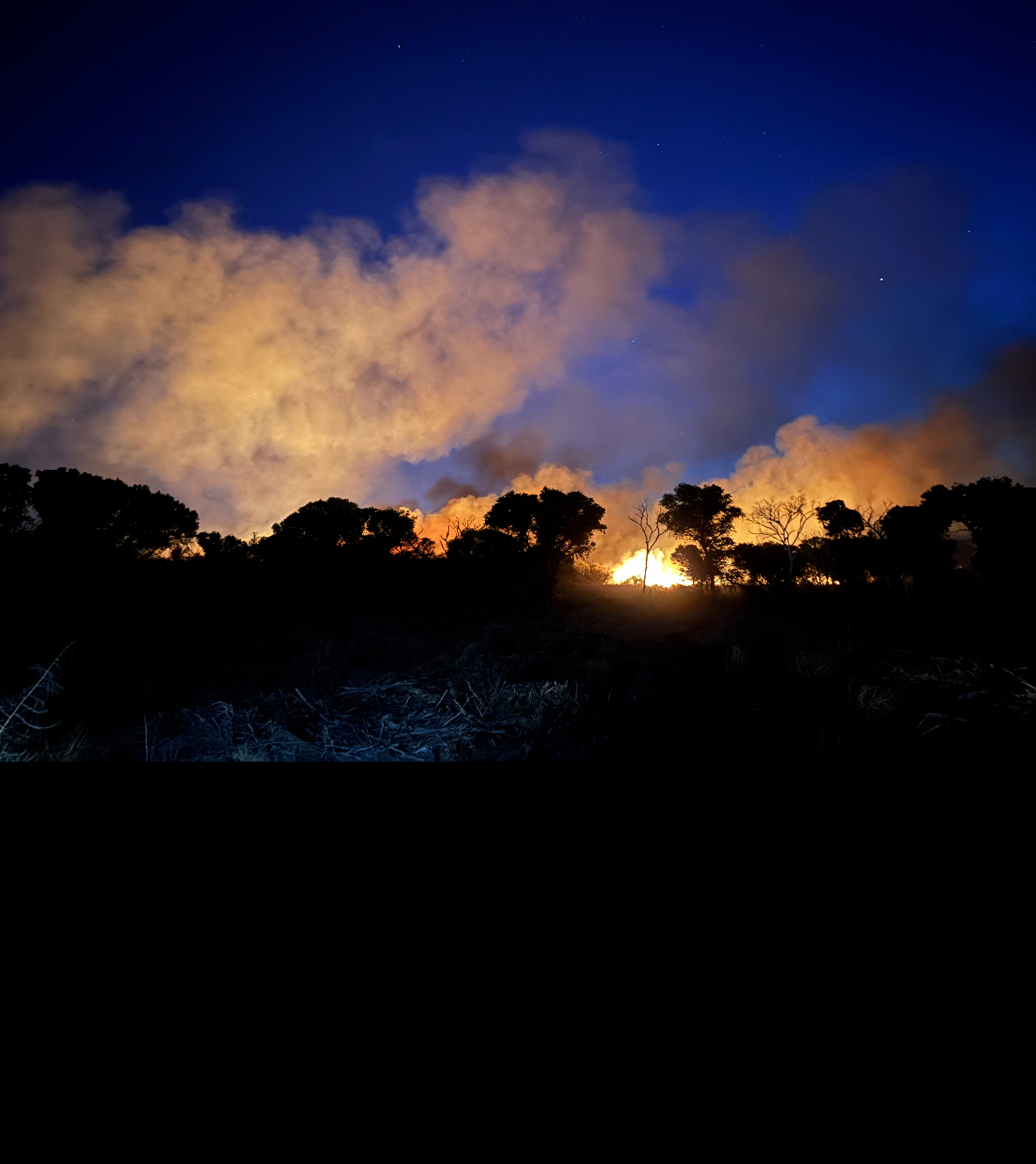
The Bryce Fire, Friday night.


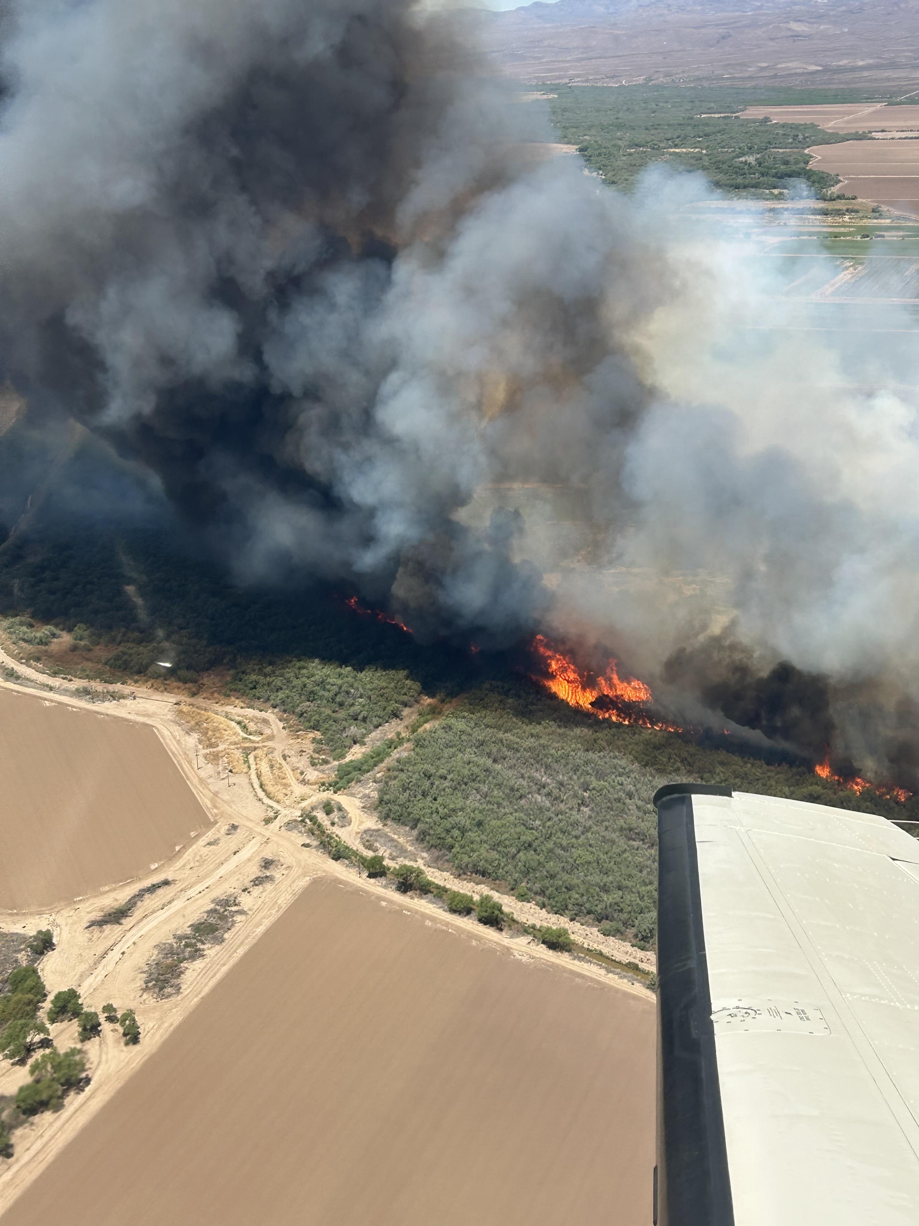
Bryce Fire aerial from Air Attack


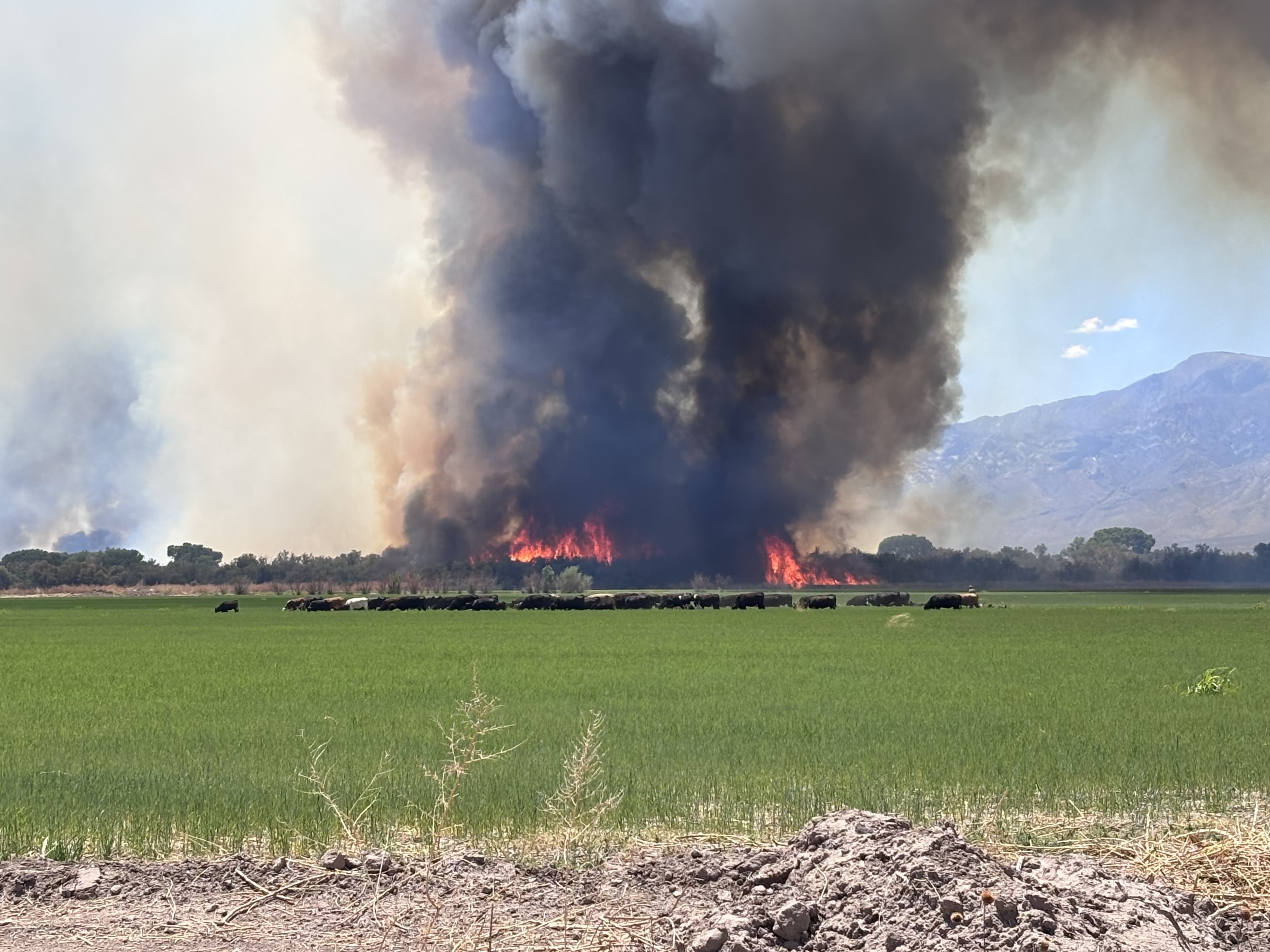
Bryce Fire burning near the communities of Pima and Eden, Arizona.
An aerial intel mission today mapped the Bryce Fire at 887 acres. It remains 25% contained. High winds fueled the fire again as it pushed through salt cedar within the Gila River bottom. Crews continued efforts toward prepping River Road which is approximately three miles ahead of the fire. They are prepping the road to use as a holding feature to keep the fire from advancing toward Fort Thomas and as part of overall suppression efforts. Hand crews and a dozer stayed engaged today on the northwest flank of the fire trying to get around the fire's head. Scoopers were ordered again, but high winds were making their work and support ineffective. Towards late afternoon a helicopter started assisting with bucket work to help the firefighters on the ground. Approximately 240 personnel are supporting the incident including Hotshot crews, hand crews, engines, water tender, medical teams, a dozer and miscellaneous overhead. Resources are trying to keep the fire north of the US 70, east of Fort Thomas, and within its current footprint in the river bed. The fire is burning within the Gila River bottom near the community of Eden in dense salt cedar stands.
Today, the Graham County Sheriff's Office initiated a SET notification for residents in the river corridor in the Fort Thomas-area. The SO advises that could go to GO if fire conditions change and threaten public safety. Bryce Fire operations established a trigger point for GO notifications. If the fire reaches that trigger point, the Sheriff's Office will elevate the SET status to GO - or evacuations. Residents should pay attention to the weather and fire conditions and be prepared to evacuate if asked. In addition, SET remains in place for residents between Eden Road and Fort Thomas on the north side of US 70. The US 70 is open, but fire conditions could restrict or delay traffic or force a closure. Drivers are urged to use caution when driving through the area between Fort Thomas and Pima as smoke continues to drift across the highway.
At noon on Saturday, the Arizona Department of Forestry and Fire Management transferred command of the fire to the Southeast Zone Type 3 Incident Management Team.
Last night, the fire stayed active throughout the night as southeast winds fueled it to the northwest through the Gila River bottom. Firefighters stayed engaged into the early morning hours working to suppress numerous spot fires and scouting locations for day shift resources to safely engage at the head of the fire. Resources reported working spot fires up to 1/2 mile away. The fire continues to produce extreme fire behavior with long-range spotting and made a six-mile push on Friday. Some infrastructure including power and gas lines were damaged in the fire. There have been no reports of any damaged or destroyed structures. On Thursday night, operations reported the fire 80% contained at 160 acres. Friday morning, high winds spotted the fire over a 25-30' wide containment line along the north side. Fueled by high winds, the fire produced extreme fire behavior throughout most of the day on Friday.
For traffic or road information: az511.com
Arizona Department of Forestry and Fire Management on Facebook: https://www.facebook.com/arizonaforestry
Arizona Department of Forestry and Fire Management on X: https://x.com/azstateforestry
Current as of | Sat, 05/10/2025 - 19:54 |
---|---|
Incident Time Zone | Arizona Mountain Standard Time |
Incident Type | Wildfire |
Cause | Human Caused |
Date of Origin | |
Incident Time Zone | Arizona Mountain Standard Time |
Location | 1.5 miles S/SE of Eden |
Incident Commander | Chad Rice, SEZ T3 IC |
Incident Description | Wildfire |
Coordinates |
32° 56' 30.8'' Latitude
-109° 53' 35.5
'' Longitude
|
Total Personnel: | 240 |
---|---|
Size | 887 Acres |
Percent of Perimeter Contained | 25% |
Fuels Involved | Salt cedar, grasses, brush |
Significant Events | SET for all homes between Eden Road and Fort Thomas on the north side of Highway 70. SET for all homes in the river corridor in the Fort Thomas area. |
Weather Concerns | Southeasterly winds will impact the fire site through the weekend, especially after Saturday and Sunday mornings. Hot and dry conditions persist over the next few days with highs in the 90s. |
---|