
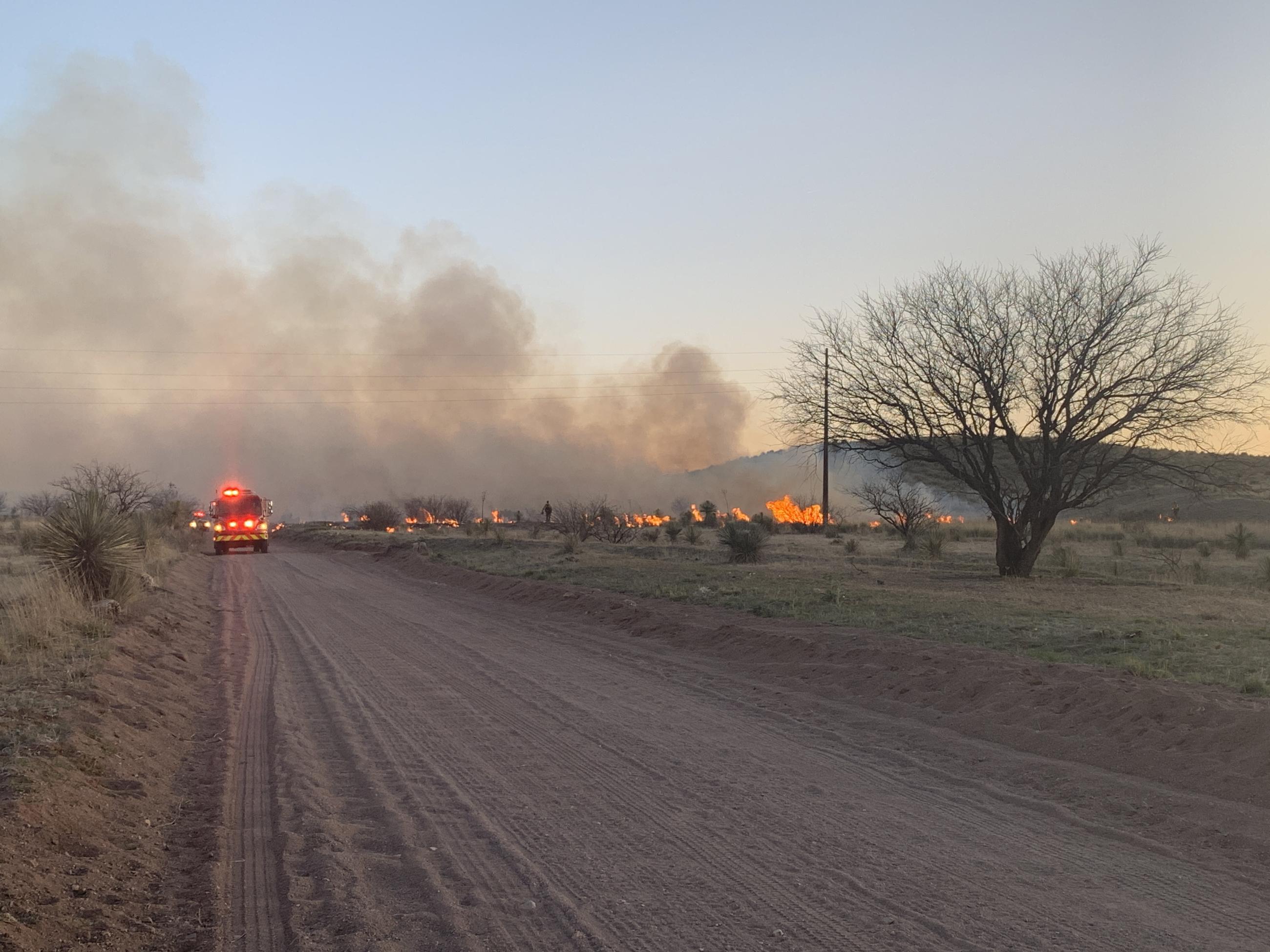
Arizona Forestry resuming ignitions on the Babacomari Ranch prescribed burn to cleanup remaining fuel within the interior of the project. Overnight humidities slowed work therefore crews working to complete the project today. Due to the fuel type, heavy smoke may be very visible to communities of Sonoita, Elgin and Fort Huachuca. Ignitions may take a few hours to complete. Over the last two days crews have successfully treated 1,500+ acres. This project is located on the Babacomari Ranch near Sonoita.
Sonoita, AZ (4/24/23) – Upcoming favorable weather allows the Arizona Department of Forestry and Fire Management to begin ignitions on a multi-day prescribed burn project nine miles southeast of Sonoita in Santa Cruz County. The Babacomari Ranch RX Burn starts Tuesday, April 25, through Thursday, April 27, and is weather dependent. Firing operations are planned daily starting in the late afternoon or evening hours. The later ignitions are due to a multitude of reasons, including predicted low relative humidities, more ideal and safer weather conditions, and better predictable winds. The project will be highly visible to the communities of Sonoita, Elgin, Huachuca City, and Sierra Vista. Burn managers expect smoke to settle into the lower elevations throughout the night. This prescribed burn is a multi-year project that started in 2019 to reduce hazardous fuels around the ranch. The primary objective of the project is to provide wildfire protection through strategically placed fire. This vegetation management tool helps reduce overloaded fuel to protect adjacent communities, key infrastructure, and other values at risk as the 2023 wildfire season unfolds. The prescribed burn also helps to reduce cat claw and mesquite brush and provide better forage for cattle and wildlife. Winter and spring moisture produced favorable burning conditions for this project by elevating soil moisture to an acceptable level. That soil moisture was inadequate over the last few years and was the main reason as to why the project was temporarily paused. Burn managers expect to target approximately 2,000 acres with 3,200 acres in total to be treated over the next few years. Prescribed fire is a multi-year, rotational management tool on the Babacomari Ranch for fire safety and vegetation management. Prescribed burns are beneficial to the ecosystem as they reduce wildfire risk to nearby communities, improve forest health, remove invasive species and pests, help re-establish soil nutrients, and safeguard watersheds. Current and expected fire weather may pause implementation of this project due to fire suppression resource commitments to existing wildfire incidents. All prescribed burns must have prior approval from the Arizona Department of Environmental Quality. At any time, DFFM can reschedule or cancel a burn if weather conditions do not provide ideal or safe burning environments.
| Current as of | Mon, 05/01/2023 - 12:18 |
|---|---|
| Incident Type | Prescribed Fire |
| Date of Origin | |
| Location | Elgin, Arizona |
| Incident Commander | Roy Hall, Arizona Department of Forestry and Fire Management |
| Incident Description | Burn managers expect to target approximately 2,000 acres with 3,200 acres in total to be treated over the next few years. Prescribed fire is a multi-year, rotational management tool on the Babacomari Ranch for fire safety and vegetation management. Prescribed burns are beneficial to the ecosystem as they reduce wildfire risk to nearby communities, improve forest health, remove invasive species and pests, help re-establish soil nutrients, and safeguard watersheds. |
| Coordinates |
31° 37' 39'' Latitude
--110 ° 27' 20
'' Longitude
|
| Size | 2,000 Acres |
|---|---|
| Estimated Containment Date | 04/27/2023 |
| Fuels Involved | Grass, Cat Claw and Mesquite brush. |
| Planned Actions |
Daily late afternoon/early evening ignitions due to a safer and more ideal burning environment. |
|---|
| Weather Concerns | Current and expected fire weather may pause implementation of this project due to fire suppression resource commitments to existing wildfire incidents. All prescribed burns must have prior approval from the Arizona Department of Environmental Quality. At any time, DFFM can reschedule or cancel a burn if weather conditions do not provide ideal or safe burning environments. |
|---|