
Single Publication
Could not determine your location.
 Wildfire
 Prescribed Fire
 Burned Area
Response
Burned Area
Response Other
Other
Wildland Fire Progression Maps – What are they and how to read them? 08-28-2024
Middle Fork Complex Fire: Bulldog, Nellie, Anderson
Publication Type: News - 08/28/2024 - 14:25
Maps are invaluable tools that guide us and tell fascinating stories. When it comes to wildland fires, Geographic Information Specialists (GIS) create a series of maps each day to assist Incident Management Teams and inform the community. These maps cover various aspects, including road closures, landscape topography, and ongoing firefighting efforts.
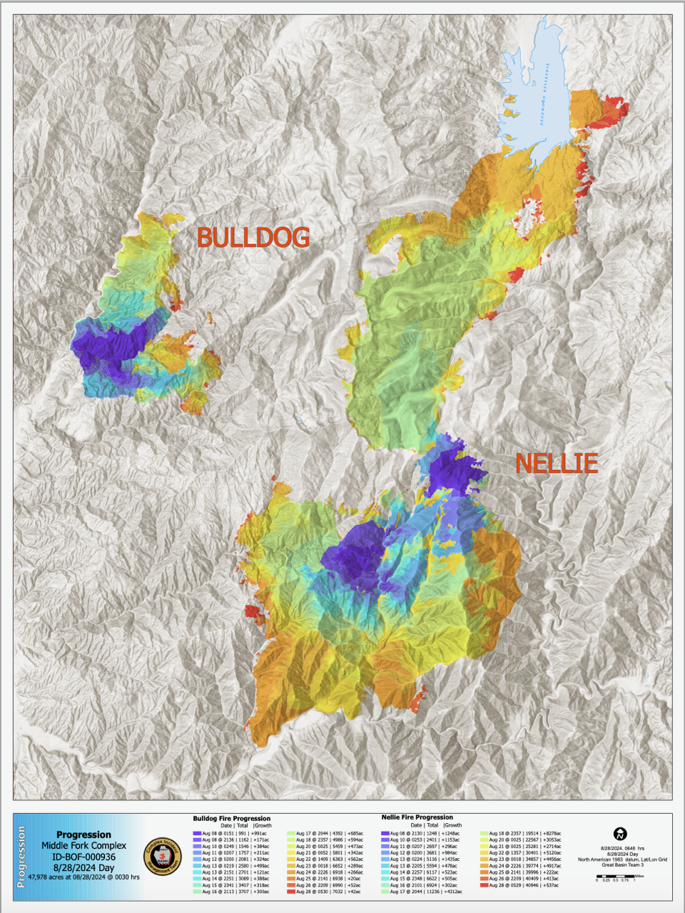
One very informative GIS product is called the Progression Map. This map visually represents how a wildfire has progressed, showing how much acreage was added each day. GIS technicians show each day's growth in a different color and provide a legend listing the amount of acreage affected. For example, on August 14th, the Bulldog Fire grew by 388 acres, while the Nellie Fire increased by 523 acres (see the map here).
By examining a Progression Map, you can gain valuable insights into daily fire activity and track trends over time. We hope this helps you better understand and interpret these important maps.