
Highlighted Activity
Highlighted Media
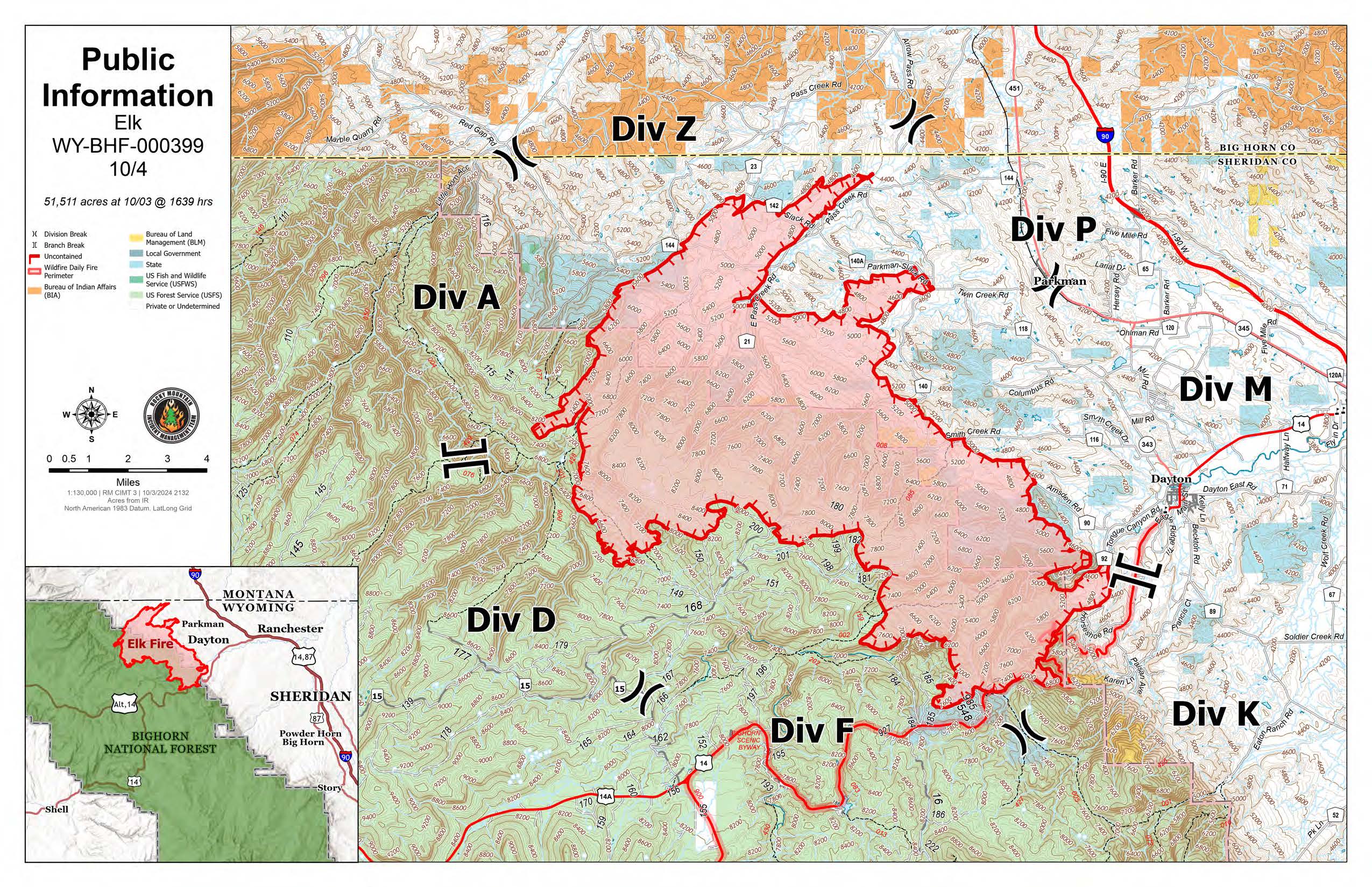
This map shows land ownership in shades of white and green, fainter lines for roads and highways, and the Elk Fire shown with a red perimeter and a pink interior.
This map shows land ownership in shades of white and green, fainter lines for roads and highways, and the Elk Fire Closure shown with a purple perimeter and lighter purple interior.
The Elk Fire burning near Riley Point and West Pass on the Bighorn National Forest. The fire was detected at 5:00 p.m. Friday, September 27, 2024. Lightning strikes were recorded in the general area within the last ten days making it the suspected cause of the fire. Air attack and ground crews initially responded, which included retardant and bucket drops from airtankers and a helicopter. Hand crews are on scene and more resources will be arriving over the next few days.
The Elk Fire is burning in heavy dead and down timber. The terrain is rough and remote making it challenging for firefighters to get in or out of the incident. There are two nearby cow camps. A closure order for the area is in place to protect the safety of firefighters and our visitors traveling Forest roads and trails. Rocky Mountain Complex Incident Management Team 3 took command of the Elk Fire on October 1st at 7:00 p.m.
| Current as of | Fri, 10/04/2024 - 12:42 |
|---|---|
| Incident Time Zone | America/Denver |
| Incident Type | Wildfire |
| Cause | Lightning |
| Date of Origin | |
| Location | Bighorn National Forest |
| Incident Commander | Casey Cheesbrough, Incident Commander Jay Miller, Deputy Incident Commander Rocky Mountain Complex Incident Management Team Three |
| Coordinates |
44° 53' 49.6'' Latitude
-107° 33' 59.51
'' Longitude
|
| Total Personnel: | 528 |
|---|---|
| Size | 51,511 Acres |
| Percent of Perimeter Contained | 0% |
| Fuels Involved | The Elk Fire is burning in heavy dead and down timber. |
| Significant Events | Due to lighter winds, cooler temperatures and higher humidity the fire was not as active as it was yesterday. Overnight, outside of the thermal belt, fire behavior was diminished but in the thermal belt fire behavior was much more active. As the day wore on, fire activity escalated to mostly surface fire spread with uphill runs and torching. Heavy down dead fuels continued to burnout. |
| Planned Actions |
Firefighters will scout for indirect and direct control lines across the fire and work to limit the forward spread of the fire. They will also be working on structure protection across the fire. |
|---|---|
| Projected Incident Activity |
12 hours: Fire spread will moderate some with lighter winds, cooler temperatures and higher humidity. 24 hours: Fire activity will increase in advance of, and after a passing cold front that will result in higher temperatures, lower relative humidity and strong shifting winds. 48 hours: Strong winds and low relative humidity. 72 hours: Fire will be active but moderate some due to decreasing wind speeds. |
| Remarks |
CLOSURES: Current Elk Fire closures can be found on the Bighorn National Forest website. |
| Weather Concerns | As of 3pm, temperatures were in the middle 50s to 60s over the Elk fire, with relative humidity values down into the 20s over the lowest elevations, and the 30s over the mid-slopes and upper elevations. Winds were southeast to upslope/upvalley, with gusts to around 20 mph. |
|---|